Category:Sotenäs Municipality
Jump to navigation
Jump to search
municipality in Västra Götaland County, Sweden  Kungshamns kyrka i centralorten   | |||||
| Upload media | |||||
| Instance of | |||||
|---|---|---|---|---|---|
| Part of | |||||
| Location |
| ||||
| Capital | |||||
| Legal form | |||||
| Inception |
| ||||
| Population |
| ||||
| Area |
| ||||
| Replaces | |||||
| official website | |||||
 | |||||
Subcategories
This category has the following 15 subcategories, out of 15 total.
Media in category "Sotenäs Municipality"
The following 55 files are in this category, out of 55 total.
-
 2007-09-04 (19) Stone, Stein.JPG 3,008 × 2,000; 2.91 MB
-
 2007-09-04 (63) Strandnelke.JPG 3,008 × 2,000; 3.02 MB
-
 Aabyfjorden sotenes IMG 0866.jpg 4,032 × 3,024; 4.55 MB
-
 Aabyfjorden sotenes IMG 0867.jpg 4,032 × 3,024; 4.1 MB
-
 Aabyfjorden sotenes IMG 0869 lundebäcken outlet.jpg 4,032 × 3,024; 3.55 MB
-
 Aabyfjorden sotenes IMG 0870 lundebäcken outlet.jpg 4,032 × 3,024; 3.91 MB
-
 Bohuslän, Sweden 2010 - panoramio - Bengt Nyman (3).jpg 5,000 × 3,121; 8.73 MB
-
 Bovallstrand - KMB - 16000300028633.jpg 768 × 512; 72 KB
-
 Bovallstrand - KMB - 16000300028634.jpg 768 × 512; 67 KB
-
 Bästa badstranden.JPG 3,888 × 2,592; 4.1 MB
-
 Chorographia Bahusiensis sida 294.png 471 × 468; 26 KB
-
 Grosshamns Fältstation.jpg 5,312 × 2,988; 3.9 MB
-
 Knutsvik på Sotenäs 2015.jpg 5,496 × 3,670; 2.44 MB
-
 Mor Lenas Stuga.jpg 2,988 × 5,312; 1.88 MB
-
 Natural port, Alvö, Hunnebostrand, Bohuslän, Sweden - panoramio.jpg 1,280 × 960; 1.85 MB
-
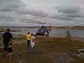 Ostermanhelicopter.jpg 1,600 × 1,200; 531 KB
-
 Risö Åbyfjorden.jpg 2,048 × 1,536; 1.77 MB
-
 Small Islands in the baltic sea near Hunnebostrand - panoramio.jpg 2,592 × 1,728; 1.78 MB
-
 Smögen (224319529).jpeg 2,048 × 1,536; 727 KB
-
 Smögen - panoramio - Helle Krog (1).jpg 739 × 519; 212 KB
-
 Smögen Blick Vom Felsen (163058285).jpeg 2,048 × 1,362; 795 KB
-
 Smögenbryggan 2016.jpg 2,215 × 1,477; 1.01 MB
-
-
 Smögens lotsutkik, trappa och uppassningshus LR 02.jpg 159 × 239; 27 KB
-
 Smögens lotsutkik, tredelat fönster i utkikstornet LR 03.jpg 159 × 239; 19 KB
-
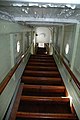
 Smögens lotsutkik, uppassningshuset LR 01.jpg 640 × 425; 109 KB
-
 Smögens lotsutkik, uppassningshusets ingång, LR 05.jpg 640 × 425; 119 KB
-
 Sotenes sote huvud granite giants kettle IMG 4074 Ramsviklandets naturreservat.jpg 2,486 × 2,933; 2.28 MB
-
 Sotenes sote huvud granite giants kettle IMG 4075 Ramsviklandets naturreservat.jpg 3,024 × 4,032; 4.28 MB
-
 Sotenes sote huvud granite giants kettle IMG 4076 Ramsviklandets naturreservat.jpg 3,024 × 4,032; 4.42 MB
-
 Sotenes sote huvud IMG 4060 geology granite Ramsviklandets naturreservat.jpg 4,032 × 3,024; 2.97 MB
-
 Sotenes sote huvud IMG 4061 geology granite Ramsviklandets naturreservat.jpg 4,032 × 3,024; 2.97 MB
-
 Sotenäs - KMB - 16000300029792.jpg 484 × 732; 91 KB
-
 Sotenäs - KMB - 16001000011913.jpg 768 × 508; 287 KB
-
 Sotenäs - KMB - 16001000011915.jpg 378 × 570; 165 KB
-
 Sotenäs Askum IMG 6999.JPG 2,849 × 2,243; 2.11 MB
-
 Sotenäs Askum IMG 7020.JPG 3,409 × 2,029; 2.5 MB
-
 Sotenäs Kommun.png 499 × 553; 15 KB
-
 Sotenäs Kommunkarta.png 481 × 348; 5 KB
-
 Sotenäs kommunvapen - Riksarkivet Sverige.png 1,428 × 1,659; 100 KB
-
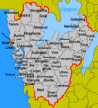
 Sotenäs Municipality in Västra Götaland County.png 573 × 553; 27 KB
-
 Sotenäs vapen.svg 251 × 304; 7 KB
-
 Sotenäset - KMB - 16001000092744.jpg 378 × 570; 198 KB
-
 Stenbrott i Bua på Sotenäs 2015.jpg 5,496 × 3,670; 5.76 MB
-
 Swedish shrimp trawler at Smögen, Bohuslän - panoramio.jpg 3,776 × 2,500; 9.69 MB
-
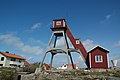
 Söö Lighthouse - panoramio.jpg 2,592 × 1,728; 1.95 MB
-
 Ulebergshamn.jpg 2,816 × 2,112; 3.35 MB
-

-
 View from Skt. Görans Ö, Hunnebostrand, Bohuslän, Sweden - panoramio (2).jpg 1,280 × 406; 651 KB
-
 Vämlingen - Södra Buskär IMG 0189 Smögen - Kleven.jpg 4,032 × 3,024; 3.19 MB
-
 Vämlingen - Södra Buskär IMG 0190 Smögen - Kleven.jpg 4,032 × 3,024; 2.76 MB
-
 Yttre Huö, Hunnebostrand, Bohuskän - panoramio.jpg 1,280 × 960; 1.89 MB
-
 Ödby ö Sunset (133037667).jpeg 2,048 × 2,048; 870 KB
-
 Örn på Sotenäs 2015.jpg 5,496 × 3,670; 2.41 MB
-
 Örns nya Ångbåtsbrygga 2015.jpg 5,496 × 3,670; 3.07 MB
_Stone,_Stein.JPG)
_Strandnelke.JPG)


.jpg)


.jpeg)
.jpg)
.jpeg)


.jpeg)


.jpg)