Category:Sound, Cheshire
Jump to navigation
Jump to search
English: Sound is a hamlet (at SJ 619 483) and civil parish in the unitary authority of Cheshire East and the ceremonial county of Cheshire, England. The village is located 3¼ miles to the south west of Nantwich. The parish also includes the settlements of Newtown and Sound Heath. Nearby villages include Aston, Ravensmoor and Wrenbury. The Welsh Marches railway line runs north–south through the parish and the A530 runs along its south-east edge.
village and civil parish in Cheshire, United Kingdom  | |||||
| Upload media | |||||
| Instance of | |||||
|---|---|---|---|---|---|
| Location | Cheshire East, Cheshire, North West England, England | ||||
 | |||||
Media in category "Sound, Cheshire"
The following 31 files are in this category, out of 31 total.
-
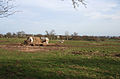
 Access Road to Hill Farm - geograph.org.uk - 6173247.jpg 800 × 600; 518 KB
-
 Arable field north of the Weaver - geograph.org.uk - 1220002.jpg 640 × 445; 127 KB
-
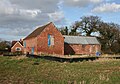
 Barn near Field's Farm - geograph.org.uk - 6090098.jpg 800 × 516; 70 KB
-
 Farmland north of the River Weaver - geograph.org.uk - 1219968.jpg 640 × 427; 118 KB
-
 Field's Farm - geograph.org.uk - 6090099.jpg 800 × 521; 84 KB
-
 Grazing east of Wrenbury Heath - geograph.org.uk - 6090101.jpg 800 × 600; 65 KB
-
 Hill Farm - geograph.org.uk - 6173249.jpg 800 × 533; 537 KB
-
 Maltkiln Sound.jpg 1,200 × 837; 499 KB
-
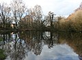 Mere at Sound Heath - geograph.org.uk - 1209828.jpg 640 × 470; 158 KB
-
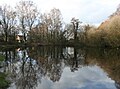
 Mere in scrubland at Sound Heath - geograph.org.uk - 1209858.jpg 640 × 487; 192 KB
-
 Pasture near Sound Lodge - geograph.org.uk - 1201984.jpg 640 × 414; 136 KB
-
 Pasture Sound Heath.jpg 1,200 × 790; 372 KB
-
 Pasture Sound.jpg 1,200 × 788; 464 KB
-
 R Weaver Sound.jpg 800 × 1,200; 479 KB
-
 Rose Cottage - geograph.org.uk - 1735538.jpg 640 × 480; 156 KB
-
 Scrubland at Sound Heath - geograph.org.uk - 1209746.jpg 640 × 469; 192 KB
-
 Broomhall and Sound Chapel.jpg 1,200 × 799; 366 KB
-
 Sound - Mere.jpg 640 × 396; 137 KB
-
 Sound and District Primary School.jpg 1,200 × 751; 447 KB
-
 Sound and District Primary School2.jpg 1,200 × 661; 419 KB
-
 Sound Hall, Sound Heath - geograph.org.uk - 1220093.jpg 640 × 446; 152 KB
-
 Sound Heath mere.jpg 1,200 × 886; 483 KB
-
 Sound Heath pond.jpg 1,200 × 800; 583 KB
-
 Sound Heath SSSI.jpg 1,200 × 800; 693 KB
-
 Sound Heath2.jpg 1,200 × 858; 495 KB
-
 Sound Lodge, Sound Heath - geograph.org.uk - 1202141.jpg 640 × 439; 169 KB
-
 Sound Oak Farm - geograph.org.uk - 126304.jpg 640 × 480; 47 KB
-
 Sound Oak Farm.jpg 320 × 352; 47 KB
-
 Sound Oak Farm2.jpg 1,000 × 727; 315 KB
-
 Track through scrubland at Sound Heath - geograph.org.uk - 1209784.jpg 640 × 451; 250 KB
-
 Wrenbury Heath Road, Sound Heath - geograph.org.uk - 1202171.jpg 640 × 461; 208 KB


