Category:Southam, Warwickshire
Jump to navigation
Jump to search
town in Warwickshire, United Kingdom  | |||||
| Upload media | |||||
| Pronunciation audio | |||||
|---|---|---|---|---|---|
| Instance of | |||||
| Location | Stratford-on-Avon, Warwickshire, West Midlands, England | ||||
| Population |
| ||||
| Area |
| ||||
| Different from | |||||
 | |||||
English: Southam is a small town in Warwickshire, England.
Subcategories
This category has the following 7 subcategories, out of 7 total.
Media in category "Southam, Warwickshire"
The following 200 files are in this category, out of 270 total.
(previous page) (next page)-
-

-
 A bend in Welsh Road - geograph.org.uk - 3906820.jpg 640 × 480; 72 KB
-

-
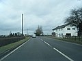
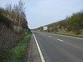 A423 heading north - geograph.org.uk - 3906839.jpg 640 × 480; 62 KB
-
 A423 north of Bungalow Farm - geograph.org.uk - 3105335.jpg 3,648 × 2,736; 1.16 MB
-
 A423 Southam By-Pass - geograph.org.uk - 2838077.jpg 640 × 481; 42 KB
-
 A425 north of Southam Cricket Ground - geograph.org.uk - 3105322.jpg 3,500 × 2,616; 1.07 MB
-
 Abandoned building on path to Holy Well - geograph.org.uk - 4541329.jpg 480 × 640; 111 KB
-
 AL-KO Kober Ltd. Southam - geograph.org.uk - 6387140.jpg 800 × 533; 112 KB
-
-

-

-

-
 B4451 in the rain (1) - geograph.org.uk - 1138375.jpg 640 × 464; 58 KB
-
 B4451 in the rain (2) - geograph.org.uk - 1138378.jpg 640 × 465; 60 KB
-
 B4451 northeast of Fields Farm - geograph.org.uk - 3105312.jpg 3,648 × 2,736; 1.45 MB
-

-
 Banbury Road junction, Southam - geograph.org.uk - 1311941.jpg 640 × 613; 95 KB
-
 Banbury Road, Southam - geograph.org.uk - 6240963.jpg 800 × 600; 96 KB
-

-
 Barns, Welsh Road East, Southam - geograph.org.uk - 1140456.jpg 640 × 508; 67 KB
-
 Bend in Leamington Road (A425) - geograph.org.uk - 6240953.jpg 800 × 600; 178 KB
-
 Bridge over the Itchen - geograph.org.uk - 4541325.jpg 480 × 640; 68 KB
-
 Bridleway to Broadwell - geograph.org.uk - 6024691.jpg 1,280 × 851; 709 KB
-
 Bridleway to Broadwell - geograph.org.uk - 6024695.jpg 1,280 × 851; 547 KB
-
 Bridleway to Broadwell - geograph.org.uk - 6025482.jpg 1,280 × 851; 489 KB
-
 Bridleway to Southam Holt (1) - geograph.org.uk - 1497120.jpg 640 × 426; 104 KB
-
 Bridleway to Southam Holt (2) - geograph.org.uk - 1497122.jpg 640 × 418; 127 KB
-
 Bridleway to Southam Holt (3) - geograph.org.uk - 1497123.jpg 640 × 426; 135 KB
-
 Bridleway to Southam Holt (4) - geograph.org.uk - 1497125.jpg 640 × 416; 114 KB
-
 Bridleway to Southam Holt - geograph.org.uk - 5999607.jpg 768 × 1,024; 116 KB
-
 Bridleway to Southam Holt - geograph.org.uk - 5999608.jpg 1,024 × 768; 69 KB
-
 Bridleway to Southam Holt - geograph.org.uk - 5999611.jpg 1,024 × 768; 161 KB
-
 Budgens supermarket, Southam - geograph.org.uk - 1311942.jpg 640 × 432; 94 KB
-

-

-
-
 Cedar of Lebanon - geograph.org.uk - 4541308.jpg 480 × 640; 79 KB
-
 Cereal crop off Welsh Road East - geograph.org.uk - 6240988.jpg 800 × 600; 138 KB
-
 Chickabiddy Lane, Southam (2) - geograph.org.uk - 1311943.jpg 485 × 640; 120 KB
-
 Chickabiddy Lane, Southam - geograph.org.uk - 1308139.jpg 640 × 475; 132 KB
-
 Coffer Dam on the River Itchen - geograph.org.uk - 3471727.jpg 640 × 480; 140 KB
-
 Congregational Chapel, Southam - geograph.org.uk - 4541305.jpg 480 × 640; 69 KB
-
 Cottages on Oxford Street, Soutnam - geograph.org.uk - 1311947.jpg 640 × 583; 106 KB
-
 Coventry Road, Southam (2) - geograph.org.uk - 1308153.jpg 640 × 426; 96 KB
-
 Coventry Road, Southam - geograph.org.uk - 1308149.jpg 640 × 568; 131 KB
-
 Craven Arms, Southam - geograph.org.uk - 1311945.jpg 640 × 513; 101 KB
-
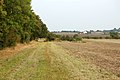
 Crop field south of Daventry Road - geograph.org.uk - 3906841.jpg 640 × 480; 87 KB
-

-
 Daventry Road (A425) - geograph.org.uk - 3906842.jpg 640 × 480; 40 KB
-
 Daventry Road (A425) - geograph.org.uk - 3906849.jpg 640 × 480; 65 KB
-
 Daventry Street, Southam - geograph.org.uk - 6025486.jpg 851 × 1,280; 276 KB
-
 Daventry Street, Southam - geograph.org.uk - 6209539.jpg 1,024 × 576; 177 KB
-

-
 Detail of old stone barn, Southam - geograph.org.uk - 3067275.jpg 640 × 480; 113 KB
-

-

-
 Driveway to Larkfield House - geograph.org.uk - 6240970.jpg 800 × 499; 125 KB
-

-

-
 Elizabeth II postbox on Welsh Road East, Southam - geograph.org.uk - 6241712.jpg 2,844 × 4,704; 3.42 MB
-
 Entering Southam - geograph.org.uk - 3906822.jpg 640 × 480; 101 KB
-
 Entering Southam - geograph.org.uk - 6240956.jpg 800 × 600; 201 KB
-
 Entrance to the Holy Well walk - geograph.org.uk - 4541320.jpg 480 × 640; 74 KB
-
 Farm entrance, B4451, Southam - geograph.org.uk - 1138381.jpg 640 × 442; 60 KB
-
-
 Farmland beside the River Itchin - geograph.org.uk - 3906819.jpg 640 × 480; 75 KB
-
 Field entrance and track - geograph.org.uk - 3906847.jpg 640 × 480; 73 KB
-

-

-
 Field north of Southam - geograph.org.uk - 3363656.jpg 640 × 341; 24 KB
-
 Field on the Harry Green Way - geograph.org.uk - 4541335.jpg 480 × 640; 88 KB
-
 Field view on the Harry Green Way - geograph.org.uk - 4541339.jpg 480 × 640; 73 KB
-

-

-

-
 Footpath to Ladbroke Hill Farm - geograph.org.uk - 5999615.jpg 768 × 1,024; 240 KB
-

-

-
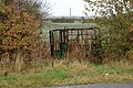
 Gateway on path to Holy Well - geograph.org.uk - 4541331.jpg 480 × 640; 84 KB
-
 Hedgerow and crop fields - geograph.org.uk - 6240986.jpg 800 × 600; 142 KB
-
 High Street, Southam - geograph.org.uk - 3906835.jpg 640 × 480; 49 KB
-
 High Street, Southam in party mood - geograph.org.uk - 3157259.jpg 640 × 427; 75 KB
-

-
 Highfields Farm, Welsh Road East - geograph.org.uk - 1140509.jpg 640 × 480; 107 KB
-
 Hillside cereal crop, Southam Holt - geograph.org.uk - 6240984.jpg 800 × 600; 131 KB
-

-
 Horses on Napton Road Farm - geograph.org.uk - 1497078.jpg 640 × 430; 76 KB
-

-
 House with archway for coaches - geograph.org.uk - 4541313.jpg 640 × 480; 63 KB
-
 Houses in Daventry Street, Southam - geograph.org.uk - 6209542.jpg 1,024 × 576; 156 KB
-
 Housing estate, Southam - geograph.org.uk - 1103364.jpg 640 × 421; 103 KB
-

-
 Industrial estate entrance, Southam - geograph.org.uk - 1140360.jpg 640 × 495; 98 KB
-
 Industrial estate, Southam - geograph.org.uk - 1140355.jpg 640 × 513; 75 KB
-
 Industrial Units, Southam - geograph.org.uk - 3424602.jpg 640 × 480; 47 KB
-

-

-

-

-
 Kineton Road (B4451), Southam - geograph.org.uk - 6240959.jpg 800 × 452; 60 KB
-
 Laser hand Tools - geograph.org.uk - 3422674.jpg 640 × 480; 75 KB
-
 Layby on the A423 - geograph.org.uk - 5999605.jpg 768 × 1,024; 100 KB
-
 Leamington Hastings, UK - panoramio (1).jpg 5,472 × 3,648; 8.46 MB
-
 Leamington Hastings, UK - panoramio (3).jpg 5,472 × 3,648; 7.01 MB
-
 Leamington Hastings, UK - panoramio.jpg 5,472 × 3,648; 10.96 MB
-
 Leaving Starbold Farm - geograph.org.uk - 5999628.jpg 1,024 × 768; 155 KB
-

-

-

-

-

-

-

-

-
 Lower Farm - geograph.org.uk - 3906846.jpg 640 × 480; 59 KB
-
 Market Hill -Southam -6Jan2005.jpg 1,000 × 652; 212 KB
-
 Market Hill -Southam -Feb2005.jpg 1,000 × 483; 184 KB
-
 Market Hill -Southam -Warwickshire.jpg 1,644 × 832; 454 KB
-
 Market Tavern, Southam - geograph.org.uk - 1111651.jpg 640 × 508; 113 KB
-
 Memorial to the Dispensary - geograph.org.uk - 4541311.jpg 480 × 640; 91 KB
-
 Mysterious gate in Southam car park - geograph.org.uk - 4541303.jpg 480 × 640; 123 KB
-
 Napton Road Farm - geograph.org.uk - 1893275.jpg 640 × 480; 104 KB
-

-

-
 New houses on Banbury Road, Southam - geograph.org.uk - 6240961.jpg 800 × 453; 109 KB
-
 New houses, Wattons Lane, Southam - geograph.org.uk - 3007649.jpg 640 × 480; 92 KB
-

-

-

-
 Old Barn near Mill Pits, Southam - geograph.org.uk - 3458778.jpg 800 × 480; 86 KB
-
 Ordnance Survey One-Inch Sheet 83 Northampton, Published 1919.jpg 11,817 × 8,810; 38.55 MB
-
 Ordnance Survey Sheet SP 46 Southam, Published 1951.jpg 7,588 × 8,827; 19.16 MB
-

-
 Oxford Street, Southam - geograph.org.uk - 1311949.jpg 640 × 451; 116 KB
-
 Oxford Street, Southam, at night - geograph.org.uk - 1575363.jpg 640 × 429; 86 KB
-
 Pendicke Street, Southam - geograph.org.uk - 5021758.jpg 2,560 × 1,920; 2.69 MB
-
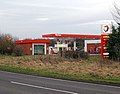 Petrol station, A423, Southam - geograph.org.uk - 1140337.jpg 640 × 501; 81 KB
-

-

-
 Post Office, Southam - geograph.org.uk - 3906833.jpg 640 × 480; 78 KB
-

-

-
 River Itchen - geograph.org.uk - 3471734.jpg 640 × 480; 128 KB
-
 River Itchen from bridge - geograph.org.uk - 4541327.jpg 480 × 640; 128 KB
-
 River Stowe, Browns Bridge, Southam (1) - geograph.org.uk - 1103370.jpg 640 × 467; 152 KB
-
 River Stowe, Browns Bridge, Southam (2) - geograph.org.uk - 1103380.jpg 640 × 447; 141 KB
-
 River Stowe, Browns Bridge, Southam (3) - geograph.org.uk - 1103383.jpg 640 × 474; 153 KB
-
 River Stowe, Browns Bridge, Southam (4) - geograph.org.uk - 1103388.jpg 640 × 490; 180 KB
-
 River Stowe, near Southam - geograph.org.uk - 1102708.jpg 640 × 473; 183 KB
-
 River Stowe, Southam - geograph.org.uk - 1099666.jpg 640 × 486; 166 KB
-

-

-
 School playing fields, Southam - geograph.org.uk - 3906821.jpg 640 × 480; 41 KB
-

-
 Shopfronts on Market Hill, Southam - geograph.org.uk - 1549580.jpg 640 × 428; 117 KB
-

-
 Site for new Tesco store (1) - geograph.org.uk - 1632986.jpg 640 × 426; 66 KB
-
 Site for new Tesco store (2) - geograph.org.uk - 1632989.jpg 640 × 426; 63 KB
-
 Site for new Tesco store (3) - geograph.org.uk - 1632991.jpg 640 × 426; 66 KB
-

-

-
 Southam - geograph.org.uk - 511539.jpg 640 × 480; 118 KB
-
 Southam - Warwickshire dot.png 417 × 599; 122 KB
-
 Southam -Daventry Street - geograph.org.uk - 507926.jpg 640 × 480; 112 KB
-
 Southam Bridleway - geograph.org.uk - 1893313.jpg 640 × 480; 88 KB
-
 Southam By-Pass - geograph.org.uk - 2838074.jpg 640 × 480; 48 KB
-
 Southam College playing field - geograph.org.uk - 1313985.jpg 640 × 480; 101 KB
-
 Southam Congregational Church - geograph.org.uk - 5357427.jpg 480 × 640; 64 KB
-
Southam en GB.ogg 1.3 s; 32 KB
-
 Southam Fields Farm - geograph.org.uk - 1491187.jpg 640 × 409; 73 KB
-
 Southam fire station - geograph.org.uk - 288315.jpg 640 × 427; 170 KB
-
 Southam Fire Station - geograph.org.uk - 3906826.jpg 640 × 480; 60 KB
-
 Southam Fire Station - geograph.org.uk - 5357430.jpg 640 × 480; 44 KB
-
 Southam High Street - geograph.org.uk - 2672612.jpg 1,024 × 766; 211 KB
-
 Southam Holt - geograph.org.uk - 1858948.jpg 640 × 480; 102 KB
-
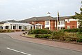
 Southam Leisure Centre - geograph.org.uk - 1103318.jpg 640 × 448; 91 KB
-
 Southam Library - geograph.org.uk - 5019819.jpg 2,560 × 1,599; 2.32 MB
-
 Southam Library from the High Street - geograph.org.uk - 5019814.jpg 2,560 × 1,933; 2.89 MB
-
 Southam Market - geograph.org.uk - 6025493.jpg 1,280 × 851; 390 KB
-
 Southam Pharmacy - geograph.org.uk - 2672627.jpg 1,024 × 756; 138 KB
-
 Southam Pharmacy - geograph.org.uk - 5021753.jpg 2,560 × 1,883; 2.15 MB
-
 Southam Police Station - geograph.org.uk - 3906834.jpg 640 × 480; 68 KB
-
 Southam Post Office - geograph.org.uk - 2672617.jpg 1,024 × 812; 151 KB
-
 Southam Post Office - geograph.org.uk - 493080.jpg 640 × 428; 88 KB
-
 Southam Road near Starbold Farm - geograph.org.uk - 2838069.jpg 640 × 480; 48 KB
-
 Southam Royal Mail depot - geograph.org.uk - 1140330.jpg 640 × 459; 69 KB
-
 Southam Rugby Club - geograph.org.uk - 1847491.jpg 640 × 480; 88 KB
-
 Southam Rugby Club clubhouse - geograph.org.uk - 1139009.jpg 640 × 545; 97 KB
-
 Southam Rugby Club pitch - geograph.org.uk - 1138392.jpg 640 × 492; 65 KB
-
 Southam School - geograph.org.uk - 1103321.jpg 640 × 465; 64 KB
-
 Southam School, front gates - geograph.org.uk - 1104216.jpg 640 × 447; 109 KB
-
 Southam, playground - geograph.org.uk - 2672604.jpg 1,024 × 768; 143 KB
-
 Southam, roundabout on Daventry road - geograph.org.uk - 1098068.jpg 640 × 522; 117 KB
-
 Southam, Stowe bridge - geograph.org.uk - 1098059.jpg 640 × 499; 163 KB
-
 Southam, Welsh Road East - geograph.org.uk - 1098080.jpg 640 × 444; 67 KB
-
 Southam-Coventry Street - geograph.org.uk - 511514.jpg 640 × 480; 109 KB
-
 Southam-Coventry Street - geograph.org.uk - 511531.jpg 640 × 480; 122 KB
-
 Southam-Market Hill - geograph.org.uk - 515295.jpg 640 × 480; 130 KB


,_Southam_-_geograph.org.uk_-_6240958.jpg)


_-_geograph.org.uk_-_1138375.jpg)
_-_geograph.org.uk_-_1138378.jpg)


_-_geograph.org.uk_-_6240953.jpg)


_-_geograph.org.uk_-_1497120.jpg)
_-_geograph.org.uk_-_1497122.jpg)
_-_geograph.org.uk_-_1497123.jpg)
_-_geograph.org.uk_-_1497125.jpg)


_-_geograph.org.uk_-_1496788.jpg)
_-_geograph.org.uk_-_1496790.jpg)


_-_geograph.org.uk_-_1311943.jpg)


_-_geograph.org.uk_-_1308153.jpg)


_-_geograph.org.uk_-_3906842.jpg)
_-_geograph.org.uk_-_3906849.jpg)


_-_geograph.org.uk_-_6240950.jpg)


_and_Warwick_Road,_Southam_-_geograph.org.uk_-_1551725.jpg)


,_Southam_-_geograph.org.uk_-_6240959.jpg)


.jpg)
.jpg)


_-_geograph.org.uk_-_1430198.jpg)
_-_geograph.org.uk_-_1430203.jpg)


_-_geograph.org.uk_-_1103370.jpg)
_-_geograph.org.uk_-_1103380.jpg)
_-_geograph.org.uk_-_1103383.jpg)
_-_geograph.org.uk_-_1103388.jpg)


_-_geograph.org.uk_-_1632986.jpg)
_-_geograph.org.uk_-_1632989.jpg)
_-_geograph.org.uk_-_1632991.jpg)


