Category:Southern Africa
Перейти до навігації
Перейти до пошуку
日本語: 南部アフリカ
southernmost region of the African continent   | |||||
| Завантажити медіафайл | |||||
| Є одним із | |||||
|---|---|---|---|---|---|
| Частина від | |||||
| Місце розташування | Африка, Південна півкуля | ||||
| Складники | |||||
| Не плутати з | |||||
 | |||||
Підкатегорії
Показано 14 підкатегорій із 14.
.
2
B
C
E
S
Y
Файли в категорії «Southern Africa»
Показано 37 файлів цієї категорії (із 37).
-
 2002 Satellite Image of Southern Africa.jpg 6800 × 5200; 4,36 МБ
-
 Southern Africa 2002 Satellite Image.jpg 4000 × 5200; 2,36 МБ
-
 Southern Africa 1640, Jan Jansson (4265384-verso).jpg 7112 × 6022; 7,24 МБ
-
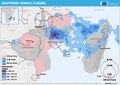 20150114 ECHO Southern Africa Flood Editable A4 Landscape.pdf 1754 × 1239; 1,96 МБ
-
 Africa (Southern region).png 341 × 341; 10 КБ
-
 Africa fldas 2023dec surface soil percent saturation.jpg 720 × 750; 374 КБ
-
 Africa-countries-southern.png 360 × 392; 10 КБ
-
 Base Map of Southern Africa.png 1344 × 871; 381 КБ
-
 BlankMap-SouthernAfrica.png 633 × 421; 13 КБ
-
 Charewa Mythical hunt scene.jpg 3008 × 2000; 3,36 МБ
-
-
 COSAFA.svg 550 × 550; 296 КБ
-
 Decorative details of outer wall of Nalatele Ruins.jpg 2736 × 1824; 1,71 МБ
-
 Dianas Vow Main Panel.jpg 1417 × 1890; 1,24 МБ
-
 Drought in Southern Africa (MODIS 2024-06-23).jpg 968 × 759; 94 КБ
-
 Explore the Namib Desert of Southern Africa (NESDIS 2020-04-24).jpg 1920 × 1080; 1,04 МБ
-
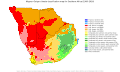 Koppen-Geiger Map Southern Africa present.svg 1420 × 850; 1,25 МБ
-
 Langkloof00.jpg 781 × 547; 137 КБ
-
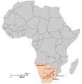
 LocationSouthernAfrica.png 359 × 359; 8 КБ
-
 Mapa Cor-de-Rosa.jpg 800 × 636; 172 КБ
-
 Mthwakazi Flag-01.png 13 568 × 7972; 725 КБ
-
 Mthwakazi Flag-01.svg 512 × 301; 1,13 МБ
-
 Political map of Southern Africa according UN mk.svg 1200 × 1230; 59 КБ
-
 Political map of Southern Africa mk.svg 1200 × 1230; 63 КБ
-
 Southern Africa (UN subregion).svg 1013 × 1000; 18 КБ
-
 Southern Africa Map B1.jpg 1600 × 1166; 471 КБ
-
 Southern-Africa-map.svg 1000 × 1000; 264 КБ
-
 Southern-Africa.svg 1200 × 1230; 55 КБ
-
 Southernafrica fldas 201902 soil moisture anomalies.png 720 × 545; 228 КБ
-
 Strong Winds Prompted Sandstorm in Southern Africa (NESDIS 2019-09-27).gif 992 × 558; 8,52 МБ
-
 Tere Ruin Mutoko.jpg 1417 × 2126; 2,15 МБ
-
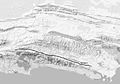
 The Great Escarpment.jpg 9910 × 6960; 1,62 МБ
-

-
 Thunderstorms Bring Much-Needed Rain to Southern Africa (NESDIS 2018-12-07).jpg 1920 × 1080; 584 КБ
-
 Veterinary-Fences SouthernAfrica.png 673 × 619; 40 КБ
-
 ZAMBIA, siavonga, Lake kariba.jpg 720 × 1600; 604 КБ
-
 Газания.jpg 2816 × 2112; 1,53 МБ


.jpg)
.png)


.jpg)
.jpg)


.svg)


.gif)


.jpg)


