Category:Sowjetischer Ehrenfriedhof Reitwein
Jump to navigation
Jump to search
| Object location | | View all coordinates using: OpenStreetMap |
|---|
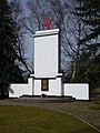
cemetery in Reitwein, Germany  | |||||
| Upload media | |||||
| Instance of | |||||
|---|---|---|---|---|---|
| Location | Reitwein, Märkisch-Oderland District, Brandenburg, Germany | ||||
| Heritage designation | |||||
 | |||||
This is the category of the Brandenburger Baudenkmal (cultural heritage monument) with the ID 09180636 (Wikidata)
|
Media in category "Sowjetischer Ehrenfriedhof Reitwein"
The following 3 files are in this category, out of 3 total.
-
 Reitwein 2014 001.JPG 4,912 × 3,264; 9.41 MB
-
 Reitwein Ehrenfriedhof.jpg 3,872 × 2,592; 1.73 MB
-
 Sowjetischer Ehrenfriedhof Reitwein 2018.jpg 1,920 × 2,560; 2.83 MB

