Category:St Andrew's Church, Bainton
Jump to navigation
Jump to search
| Object location | | View all coordinates using: OpenStreetMap |
|---|
church in Bainton, East Riding of Yorkshire, United Kingdom  | |||||
| Upload media | |||||
| Instance of | |||||
|---|---|---|---|---|---|
| Dedicated to | |||||
| Location | Bainton, East Riding of Yorkshire, Yorkshire and the Humber, England | ||||
| Diocese | |||||
| Heritage designation |
| ||||
| Inception |
| ||||
| Religion or worldview | |||||
 | |||||
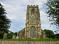
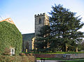
This is a category about listed building number 1083830. |
Subcategories
This category has only the following subcategory.
Media in category "St Andrew's Church, Bainton"
The following 11 files are in this category, out of 11 total.
-
 Bainton Church from Dead Lane. - geograph.org.uk - 1035682.jpg 640 × 480; 77 KB
-
 Bainton St Andrew from SW GeoUK5466027.jpg 2,082 × 1,372; 327 KB
-
 St Andrew's Church Bainton - geograph.org.uk - 3954908.jpg 1,600 × 1,200; 678 KB
-
 St Andrew's Church, Bainton (geograph 5466027).jpg 1,200 × 799; 348 KB
-
 St Andrew's Church, Bainton - geograph.org.uk - 1453807.jpg 480 × 640; 88 KB
-
 St Andrew's Church, Bainton - geograph.org.uk - 5466038.jpg 1,200 × 799; 309 KB
-
 St Andrew's Church, Bainton - geograph.org.uk - 755669.jpg 427 × 640; 148 KB
-
 St Andrew's Church, Bainton.jpg 640 × 480; 104 KB
-
 St Andrews Church Bainton - geograph.org.uk - 23520.jpg 640 × 480; 146 KB
-
 St. Andrew's Church, Bainton - geograph.org.uk - 365046.jpg 640 × 473; 148 KB
-
 The churchyard, Bainton - geograph.org.uk - 804545.jpg 640 × 427; 201 KB


.jpg)


