Category:St Bartholomew's church, Winstone
Jump to navigation
Jump to search
| Object location | | View all coordinates using: OpenStreetMap |
|---|
Grade I listed church, Cotswold, United Kingdom  | |||||
| Upload media | |||||
| Instance of | |||||
|---|---|---|---|---|---|
| Location | Winstone, Cotswold, Gloucestershire, South West England, England | ||||
| Diocese | |||||
| Heritage designation |
| ||||
| Inception |
| ||||
| Religion or worldview | |||||
| Adjacent building |
| ||||
 | |||||
Subcategories
This category has only the following subcategory.
Media in category "St Bartholomew's church, Winstone"
The following 11 files are in this category, out of 11 total.
-
 Churchyard cross at St Bartholomew's, Winstone.jpg 4,000 × 3,000; 4.71 MB
-
 Cross in St. Bartholomew's churchyard - geograph.org.uk - 3771469.jpg 800 × 600; 350 KB
-
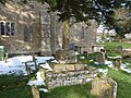
 Listed monument (1088410) in St Bartholomew's churchyard, Winstone.jpg 4,000 × 3,000; 4.59 MB
-
 Listed monument (1341805) in St Bartholomew's churchyard, Winstone.jpg 4,000 × 3,000; 4.89 MB
-
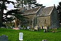 St Bartholomew's Church, Winstone - geograph.org.uk - 525906.jpg 640 × 427; 133 KB
-
 Winstone Church (geograph 2272911).jpg 3,264 × 2,448; 2.41 MB
-
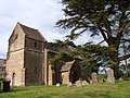
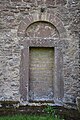 Winstone Church (St. Bartholomew) (29842537041).jpg 4,000 × 6,000; 6.01 MB
-
 Winstone Church (St. Bartholomew) (29842557251).jpg 6,000 × 4,000; 6.62 MB
-
 Winstone Church (St. Bartholomew) (29925863195).jpg 4,000 × 6,000; 6.04 MB
-
 Winstone Church (St. Bartholomew) (29925865865).jpg 6,000 × 4,000; 6.3 MB
-
 Winstone Church - geograph.org.uk - 1539315.jpg 640 × 460; 106 KB


_in_St_Bartholomew%27s_churchyard,_Winstone.jpg)
_in_St_Bartholomew%27s_churchyard,_Winstone.jpg)

.jpg)
_(29842537041).jpg)
_(29842557251).jpg)
_(29925863195).jpg)
_(29925865865).jpg)