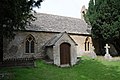
Category:St Leonard's Church, Lower Lemington
Jump to navigation
Jump to search
| Object location | | View all coordinates using: OpenStreetMap |
|---|
church in Cotswold, United Kingdom  | |||||
| Upload media | |||||
| Instance of | |||||
|---|---|---|---|---|---|
| Dedicated to | |||||
| Location | Batsford, Cotswold, Gloucestershire, South West England, England | ||||
| Diocese | |||||
| Heritage designation |
| ||||
| Religion or worldview | |||||
 | |||||
Media in category "St Leonard's Church, Lower Lemington"
The following 6 files are in this category, out of 6 total.
-
 Lower Lemington church (geograph 2528915).jpg 480 × 640; 47 KB
-
 Lower Lemington church (geograph 4649318).jpg 1,024 × 680; 314 KB
-
 Lower Lemington Church - geograph.org.uk - 247205.jpg 640 × 480; 89 KB
-
 St Leonard's Church, Lower Lemington, Gloucestershire - geograph-6358833.jpg 1,024 × 768; 252 KB
-
 St Leonards Church (geograph 5291933).jpg 1,600 × 1,066; 328 KB
-
 Sundial on a gravestone (geograph 4649326).jpg 680 × 1,024; 344 KB
.jpg)
.jpg)

.jpg)
.jpg)