Category:St Mary, Farcet
Jump to navigation
Jump to search
| Object location | | View all coordinates using: OpenStreetMap |
|---|
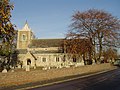
This is a category about listed building number 1215281. |
church in Huntingdonshire, UK  | |||||
| Upload media | |||||
| Instance of | |||||
|---|---|---|---|---|---|
| Location | Farcet, Huntingdonshire, Cambridgeshire, East of England, England | ||||
| Diocese | |||||
| Heritage designation |
| ||||
| Religion or worldview | |||||
 | |||||
Media in category "St Mary, Farcet"
The following 2 files are in this category, out of 2 total.
-
 St Mary's Church, Farcet - geograph.org.uk - 81551.jpg 640 × 480; 121 KB
-
 St. Mary’s Church Farcet.jpg 4,032 × 3,024; 4.82 MB
