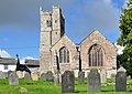
Category:St Michael's church, Lawhitton
Jump to navigation
Jump to search
| Object location | | View all coordinates using: OpenStreetMap |
|---|
church in Lawhitton Rural, United Kingdom  | |||||
| Upload media | |||||
| Instance of | |||||
|---|---|---|---|---|---|
| Dedicated to | |||||
| Location | Lawhitton Rural, Cornwall, South West England, England | ||||
| Diocese | |||||
| Heritage designation |
| ||||
| Religion or worldview | |||||
 | |||||
Media in category "St Michael's church, Lawhitton"
The following 6 files are in this category, out of 6 total.
-
 Lawhitton Church - geograph.org.uk - 330652.jpg 640 × 427; 95 KB
-
 Lawhitton Church - geograph.org.uk - 330657.jpg 640 × 426; 106 KB
-
 Lawhitton Church and Lych Gate - geograph.org.uk - 330660.jpg 640 × 427; 98 KB
-
 Lawhitton church-CN.jpg 3,200 × 2,275; 8.11 MB
-
 Lawhitton church.jpg 3,974 × 2,686; 5.1 MB
-
 St Michael's church, Lawhitton - geograph.org.uk - 463321.jpg 640 × 480; 105 KB


