Category:St Peter's Church, Derby
Jump to navigation
Jump to search
| Object location | | View all coordinates using: OpenStreetMap |
|---|
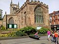
church in Derby, UK  | |||||
| Upload media | |||||
| Instance of | |||||
|---|---|---|---|---|---|
| Dedicated to | |||||
| Location | Derby, City of Derby, Derbyshire, East Midlands, England | ||||
| Diocese | |||||
| Heritage designation |
| ||||
| Religion or worldview | |||||
| official website | |||||
 | |||||
Subcategories
This category has only the following subcategory.
Media in category "St Peter's Church, Derby"
The following 17 files are in this category, out of 17 total.
-
 Derby St Peters at night camera removed.JPG 3,692 × 2,424; 3.97 MB
-
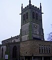 Derby St Peters NW aspect.jpg 1,928 × 2,200; 519 KB
-
 BoultonChurchStPeters.jpg 600 × 400; 66 KB
-
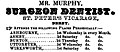 Mr. Murphy, Derby.jpg 722 × 310; 91 KB
-
 St Peter's Church by moonlight.jpg 600 × 377; 63 KB
-
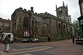
 St Peter's Church, Derby (1).JPG 4,608 × 3,440; 4.01 MB
-
 St Peter's Church, Derby (2).JPG 4,608 × 3,440; 4.25 MB
-
 St Peter's Church, Derby (3).JPG 4,608 × 3,440; 3.54 MB
-
 St Peter's Church, Derby (4).JPG 4,608 × 3,440; 3.23 MB
-
 St Peter's Church, Derby - geograph.org.uk - 1459295.jpg 640 × 426; 62 KB
-
 St Peter's Church, Derby - geograph.org.uk - 1711057.jpg 800 × 600; 131 KB
-
 St Peter's Church, Derby - geograph.org.uk - 1814422.jpg 1,600 × 1,200; 393 KB
-
 St Peter's Churchyard, Derby - geograph.org.uk - 721643.jpg 640 × 598; 104 KB
-
 St Peters Church Derby.jpg 640 × 465; 88 KB
-
 St Peters church derby.jpg 3,280 × 2,464; 3.17 MB
-
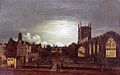
 StPetersChurchSamuelRayner.jpg 600 × 400; 70 KB
-
 St Peter's Church Hall - geograph.org.uk - 287973.jpg 640 × 471; 92 KB


.JPG)
.JPG)
.JPG)
.JPG)


