Category:St Peter's, Kent
Jump to navigation
Jump to search
village in Kent, United Kingdom  | |||||
| Upload media | |||||
| Instance of | |||||
|---|---|---|---|---|---|
| Location | Broadstairs and St Peter's, Thanet, Kent, South East England, England | ||||
 | |||||
St Peter's is an historic village north of and conjoined to the town of Broadstairs, in the civil parish of Broadstairs and St Peters in Kent, England.
Subcategories
This category has only the following subcategory.
Media in category "St Peter's, Kent"
The following 43 files are in this category, out of 43 total.
-
 19 High Street, St Peter's, Broadstairs, January 2022 01.jpg 3,024 × 4,032; 5.86 MB
-
 19 High Street, St Peter's, Broadstairs, January 2022 02.jpg 3,024 × 4,032; 4.67 MB
-
 High Street windows Broadstairs St Peters Kent England 2.jpg 5,472 × 3,648; 15.83 MB
-
 Brick wall with flaking paint in St Peters Broadstairs Kent England.jpg 2,000 × 3,000; 3.41 MB
-
 Avery Hardoll petrol pump in St Peters Broadstairs Kent England.jpg 2,000 × 3,000; 4.01 MB
-
 Barn beside St. Peter's Footpath - geograph.org.uk - 2280052.jpg 3,072 × 2,304; 2.08 MB
-
 Beacon Road, St Peter's - geograph.org.uk - 1410661.jpg 640 × 426; 73 KB
-

-
 Church Street pub Broadstairs St Peters Kent England 1.jpg 3,648 × 5,472; 15.08 MB
-
 Church Street pub Broadstairs St Peters Kent England 2.jpg 3,648 × 5,472; 15.64 MB
-
 Callis Court Road, St Peter's - geograph.org.uk - 1411379.jpg 640 × 426; 101 KB
-
 Church Street pigeons Broadstairs St Peters Kent England.jpg 2,364 × 2,392; 3.32 MB
-
 Close-up of St. Peter's Village Sign - geograph.org.uk - 2280493.jpg 2,304 × 3,072; 2.73 MB
-
 Cove Cottage, High Street, St Peter's, January 2022.jpg 4,032 × 3,024; 5.43 MB
-
 Fish and kebab shop Broadstairs St Peters Kent England.jpg 3,648 × 4,723; 9.78 MB
-
 Gas workings on Reading Street, St Peter's - geograph.org.uk - 2654481.jpg 1,024 × 680; 214 KB
-
 Houses in St Peter's - geograph.org.uk - 1411385.jpg 640 × 426; 87 KB
-
 Junction of Star Lane with Nash Road - geograph.org.uk - 1690627.jpg 640 × 480; 109 KB
-
 New housing development on Nash Road - geograph.org.uk - 1690625.jpg 640 × 480; 101 KB
-
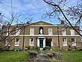
 Nuckell's Almshouses, High Street, St Peter's, January 2022 01.jpg 4,032 × 3,024; 6.69 MB
-
 Nuckell's Almshouses, High Street, St Peter's, January 2022 02.jpg 4,032 × 3,024; 5.63 MB
-
 Plaque of St.Peter's Village Sign Post - geograph.org.uk - 2280500.jpg 2,304 × 3,072; 2.3 MB
-
 Reading Street, St Peter's - geograph.org.uk - 1411869.jpg 640 × 426; 73 KB
-

-
 Road junction in St Peter's - geograph.org.uk - 1410738.jpg 640 × 426; 75 KB
-

-
 St Peter's Memorial Hall - geograph.org.uk - 1411885.jpg 640 × 426; 75 KB
-
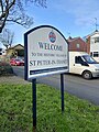 St Peter-in-Thanet road sign, January 2022.jpg 3,024 × 4,032; 4.73 MB
-
 St Peter-in-Thanet road sign.jpg 4,608 × 3,456; 6.86 MB
-
 St Peters Church, Broadstairs.jpg 640 × 425; 77 KB
-
 St Peters village sign at Broadstairs St Peters Kent England.jpg 3,505 × 5,374; 16.14 MB
-
 St Peters village sign plaque at Broadstairs St Peters Kent England.jpg 2,989 × 4,035; 6.05 MB
-
 St. Peter's Memorial Hall - geograph.org.uk - 2280463.jpg 3,072 × 2,304; 2.22 MB
-
 St. Peter's Village Sign - geograph.org.uk - 2280484.jpg 3,072 × 2,304; 2.47 MB
-
 St.Peter's Co-Operative Supermarket - geograph.org.uk - 2280478.jpg 3,072 × 2,304; 1.78 MB
-
 The Albion Inn, St Peter's - geograph.org.uk - 1411873.jpg 640 × 426; 64 KB
-
 The Albion pub on St Peter's Road - geograph.org.uk - 1365509.jpg 640 × 480; 131 KB
-
 The Coves, High Street, St Peter's, January 2022.jpg 3,024 × 4,032; 4.61 MB
-
 Turner and Dickens Walk in St.Peter's - geograph.org.uk - 2280470.jpg 3,072 × 2,304; 1.92 MB
-
 Upton Road junction with St Peter's Road - geograph.org.uk - 1365515.jpg 640 × 480; 102 KB
-
 Vicarage Street, St Peter's - geograph.org.uk - 2080583.jpg 640 × 480; 130 KB
-
 View along Sowell Street - geograph.org.uk - 1365524.jpg 640 × 480; 158 KB
-


