Category:St Stephen-in-Brannel
Jump to navigation
Jump to search
village and civil parish in Cornwall, United Kingdom  | |||||
| Upload media | |||||
| Instance of | |||||
|---|---|---|---|---|---|
| Location | Cornwall, South West England, England | ||||
 | |||||
English: St Stephen-in-Brannel ( known locally as St Stephen's) is a village and parish in mid-Cornwall, England. The village of St Stephen's is on the A3058 road linking Newquay and St Austell. It is on the northern edge of the china clay district which encouraged the growth of the village to the present population of over 5000. The principal villages of the parish are the Churchtown, Whitemoor, Currian and Nanpean.
Subcategories
This category has the following 9 subcategories, out of 9 total.
C
- Coombe Viaduct (2 F)
F
- Fal viaduct (4 F)
- Foxhole, Cornwall (21 F)
H
- High Street, Cornwall (2 F)
N
T
- Treviscoe (4 F)
W
- Whitemoor (4 F)
Media in category "St Stephen-in-Brannel"
The following 192 files are in this category, out of 192 total.
-
 A misty Cornish landscape - geograph.org.uk - 5156170.jpg 640 × 426; 38 KB
-
 A woodland in mist - geograph.org.uk - 5156195.jpg 640 × 426; 40 KB
-
 Access road in Melbur China Clay quarry - geograph.org.uk - 1854274.jpg 640 × 480; 195 KB
-
 Along the road - geograph.org.uk - 198366.jpg 640 × 427; 110 KB
-
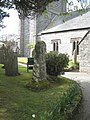 Ancient cross in St Stephen churchyard - geograph.org.uk - 1235028.jpg 480 × 640; 108 KB
-
 Barton Road, Treviscoe, St Stephen-in-Brannel - geograph.org.uk - 6151302.jpg 1,024 × 763; 215 KB
-
 Below Coombe Viaduct - geograph.org.uk - 5089492.jpg 640 × 536; 90 KB
-
 Blackpool China Clay works - geograph.org.uk - 2962859.jpg 800 × 600; 103 KB
-
 Blackpool China Clay works - geograph.org.uk - 2962862.jpg 800 × 600; 79 KB
-
 Blackpool China Clay works - geograph.org.uk - 2962866.jpg 800 × 600; 123 KB
-
 Brannel School, St Stephen - geograph.org.uk - 81251.jpg 640 × 426; 56 KB
-
 Bridge over the Fal - geograph.org.uk - 5428002.jpg 3,072 × 2,048; 1.37 MB
-
 Bridge over the Fal - geograph.org.uk - 5428013.jpg 2,048 × 3,072; 1.16 MB
-
 Bridge over the Fal - geograph.org.uk - 5428043.jpg 3,072 × 2,048; 1.32 MB
-
 Bridge, Crowhill - geograph.org.uk - 5428015.jpg 3,072 × 2,048; 1.31 MB
-
 Bus stop at High Street - geograph.org.uk - 2713598.jpg 640 × 427; 75 KB
-
 Carpalla - geograph.org.uk - 83763.jpg 640 × 353; 65 KB
-
 Carrick , Hedgerows ^ Fields - geograph.org.uk - 3381980.jpg 4,288 × 2,848; 4.53 MB
-
 Carrick , Small Road - geograph.org.uk - 3381986.jpg 3,932 × 1,926; 2.59 MB
-
 Cattle in pasture at Trenowth Mill - geograph.org.uk - 2352307.jpg 640 × 480; 83 KB
-
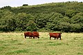 Cattle in the Fal Valley - geograph.org.uk - 228786.jpg 640 × 427; 117 KB
-
 Chapel at Scarcewater - geograph.org.uk - 1235981.jpg 480 × 640; 81 KB
-

-
 China Clay Spoil Heap - geograph.org.uk - 54597.jpg 640 × 480; 69 KB
-
 Church and post office, Coombe - geograph.org.uk - 5428207.jpg 1,789 × 1,313; 350 KB
-

-
 Clay Pit at Trethosa - geograph.org.uk - 228831.jpg 640 × 427; 81 KB
-
 Converted Engine House - geograph.org.uk - 228818.jpg 640 × 427; 93 KB
-
 Coombe Hill - geograph.org.uk - 5089489.jpg 640 × 426; 64 KB
-
 Coombe Hill - geograph.org.uk - 5265817.jpg 1,952 × 1,295; 542 KB
-
 Cornish Countryside - geograph.org.uk - 5089473.jpg 640 × 426; 67 KB
-
 Cornish Countryside - geograph.org.uk - 5089479.jpg 640 × 426; 62 KB
-
 Cornish hillside, Fal valley - geograph.org.uk - 6025699.jpg 1,024 × 681; 126 KB
-
 Cornish landscape - geograph.org.uk - 5894892.jpg 1,024 × 681; 90 KB
-
 Cornish Pasture - geograph.org.uk - 5089481.jpg 640 × 426; 30 KB
-
 Cornish scenery - geograph.org.uk - 5156185.jpg 640 × 426; 63 KB
-
 Cornish scenery - geograph.org.uk - 5885485.jpg 1,024 × 681; 114 KB
-
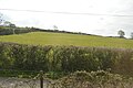
 Crop Field - geograph.org.uk - 81114.jpg 640 × 426; 109 KB
-
 Crop field, Crugwallins - geograph.org.uk - 5650006.jpg 640 × 401; 56 KB
-
 Crossroads, Downderry - geograph.org.uk - 5428616.jpg 3,013 × 1,744; 792 KB
-
 Crugwallins - geograph.org.uk - 5089383.jpg 640 × 426; 50 KB
-

-
 Disused mine chimney - geograph.org.uk - 6025690.jpg 1,024 × 681; 112 KB
-
 Dowgas Farm - geograph.org.uk - 2416931.jpg 640 × 480; 210 KB
-
-
 Entrance to Tolgarrick Farm - geograph.org.uk - 1235127.jpg 640 × 480; 85 KB
-
 Fal Valley Flood Plain - geograph.org.uk - 226344.jpg 640 × 427; 105 KB
-
 Fal Valley near Melbur Mill - geograph.org.uk - 228826.jpg 640 × 427; 98 KB
-
 Farmland by the Cornish Main Line - geograph.org.uk - 5089385.jpg 640 × 426; 43 KB
-
 Farmland, Crugwallins - geograph.org.uk - 5885474.jpg 1,024 × 681; 119 KB
-
 Farmland, St Stephen-in-Brannel - geograph.org.uk - 6151253.jpg 1,024 × 768; 247 KB
-
 Farmland, St Stephen-in-Brannel - geograph.org.uk - 6151262.jpg 1,024 × 768; 253 KB
-
 Farmland, St Stephen-in-Brannel - geograph.org.uk - 6151270.jpg 1,024 × 768; 268 KB
-
 Farmland, St Stephen-in-Brannel - geograph.org.uk - 6151274.jpg 1,024 × 768; 264 KB
-
 Farmland, St Stephen-in-Brannel - geograph.org.uk - 6151280.jpg 1,024 × 768; 284 KB
-
 Field boundaries near Pedna Park - geograph.org.uk - 4689184.jpg 640 × 480; 85 KB
-
 Field entrance by Coombe Hill - geograph.org.uk - 5428560.jpg 3,072 × 2,048; 1.36 MB
-
 Field near Crugwallins - geograph.org.uk - 6025684.jpg 1,024 × 681; 117 KB
-
 Field near the River Fal - geograph.org.uk - 5650008.jpg 640 × 417; 72 KB
-
 Field near Trewithen Farm - geograph.org.uk - 6025689.jpg 1,024 × 681; 120 KB
-
 Field south of Crugwallins - geograph.org.uk - 6025688.jpg 1,024 × 681; 88 KB
-
 Field southwest of Pennance - geograph.org.uk - 5268603.jpg 3,065 × 1,888; 1.24 MB
-
 Field southwest of Pennance - geograph.org.uk - 5268608.jpg 3,072 × 2,048; 1.44 MB
-
 Fore Street, Nanpean - geograph.org.uk - 3981927.jpg 640 × 480; 74 KB
-
 Foxhole ahead - geograph.org.uk - 2713584.jpg 640 × 428; 67 KB
-

-

-

-

-

-
 Grass triangle, Downderry - geograph.org.uk - 5428627.jpg 3,072 × 2,048; 1.38 MB
-
 Grassy field below Trenowth Viaduct - geograph.org.uk - 5098159.jpg 640 × 426; 63 KB
-
 Grazing towards Hendra - geograph.org.uk - 5476064.jpg 640 × 444; 59 KB
-
 Green Lane - geograph.org.uk - 2517109.jpg 640 × 403; 145 KB
-
 Hay, postbox № PL26 163 - geograph.org.uk - 4308935.jpg 480 × 640; 137 KB
-
 Hill Head, St Stephen-in-Brannel - geograph.org.uk - 6151285.jpg 1,024 × 768; 227 KB
-
 Hillside grazing near Coombe - geograph.org.uk - 5650007.jpg 640 × 480; 42 KB
-
 Hillside seen from Coombe Viaduct - geograph.org.uk - 6025694.jpg 1,024 × 681; 169 KB
-
 Horses near Carloggas - geograph.org.uk - 81218.jpg 640 × 420; 105 KB
-
 Houses at Coombe - geograph.org.uk - 5428134.jpg 2,847 × 1,818; 1.11 MB
-
 Imery's Dry Mining Processor - geograph.org.uk - 3411280.jpg 640 × 424; 91 KB
-
 Imery's Dry Mining Processor - geograph.org.uk - 3497731.jpg 424 × 640; 268 KB
-
 Imery's Little John Pit - geograph.org.uk - 3477623.jpg 640 × 424; 75 KB
-

-
 Junction at Crowhill - geograph.org.uk - 5265729.jpg 3,014 × 1,871; 1.2 MB
-
 Junction on the corner on the B3279 - geograph.org.uk - 2713436.jpg 640 × 427; 87 KB
-
 Junction, Downderry - geograph.org.uk - 5428623.jpg 3,072 × 2,048; 1.08 MB
-
 Lane in the Fal valley - geograph.org.uk - 5427775.jpg 3,072 × 2,048; 1.41 MB
-
 Lane junction, Downderry - geograph.org.uk - 5261784.jpg 3,072 × 1,803; 953 KB
-
 Lane near Coombe - geograph.org.uk - 5265761.jpg 2,941 × 1,956; 1.87 MB
-
 Lane to Coombe - geograph.org.uk - 5428050.jpg 3,072 × 2,048; 1.71 MB
-
 Lane to Coombe - geograph.org.uk - 5428068.jpg 3,072 × 2,048; 2 MB
-
 Lane to Crowhill - geograph.org.uk - 5428055.jpg 3,072 × 2,048; 1.68 MB
-
 Langerth Farm - geograph.org.uk - 5885478.jpg 1,024 × 681; 120 KB
-
 Lanjeth , Coombe Road - geograph.org.uk - 3382560.jpg 4,158 × 2,640; 2.82 MB
-
 Lanjeth , Roadside Scenery - geograph.org.uk - 3382555.jpg 4,098 × 2,526; 3.1 MB
-
 Lanjeth , The A3058 - geograph.org.uk - 3382553.jpg 4,288 × 2,848; 4.9 MB
-
 Lanjeth on the A3058 - geograph.org.uk - 2713610.jpg 640 × 427; 73 KB
-
 Large grazing field - geograph.org.uk - 6025904.jpg 1,024 × 738; 155 KB
-
 Little Johns pit - geograph.org.uk - 1836872.jpg 640 × 480; 77 KB
-
 Little Treviscoe, St Stephen-in-Brannel - geograph.org.uk - 6151288.jpg 1,024 × 768; 211 KB
-

-
 Near Hendra - geograph.org.uk - 5156189.jpg 640 × 346; 38 KB
-
 Near Lower Dowgas - geograph.org.uk - 5089476.jpg 640 × 426; 64 KB
-
 Near Trethullan - geograph.org.uk - 5089386.jpg 640 × 426; 34 KB
-
 Near Trewithan Farm - geograph.org.uk - 5089389.jpg 640 × 426; 53 KB
-
 Near Trewithan Farm - geograph.org.uk - 5089471.jpg 640 × 426; 68 KB
-

-

-

-
 Pasture at Hendra - geograph.org.uk - 2517113.jpg 640 × 437; 130 KB
-
 Pasture on the Flood Plain - geograph.org.uk - 228820.jpg 640 × 427; 81 KB
-
 Ploughed field - geograph.org.uk - 5089372.jpg 640 × 426; 81 KB
-
 Ploughed field - geograph.org.uk - 5089377.jpg 640 × 426; 92 KB
-
 Ploughed field by Coombe Hill - geograph.org.uk - 5266205.jpg 2,994 × 1,636; 1.24 MB
-
 Ploughed field near Pedna Park - geograph.org.uk - 4689188.jpg 640 × 480; 86 KB
-
 Ploughing at Trewithian Lane-End - geograph.org.uk - 5876932.jpg 640 × 480; 79 KB
-
 Railway at Lower Dowgas - geograph.org.uk - 4500754.jpg 1,200 × 804; 1.42 MB
-
 Railway viaduct at Trenowth - geograph.org.uk - 5265719.jpg 2,026 × 2,861; 1.11 MB
-
 Railway viaduct at Trenowth - geograph.org.uk - 5427808.jpg 1,915 × 2,788; 1.02 MB
-
 Restormel , Farm Drive - geograph.org.uk - 3382548.jpg 4,224 × 2,750; 2.99 MB
-
 Restormel , Small Road - geograph.org.uk - 3382552.jpg 4,288 × 2,848; 4.25 MB
-
 Restormel , Small Road - geograph.org.uk - 3382562.jpg 4,194 × 2,700; 2.86 MB
-
 Ripening Barley Field - geograph.org.uk - 200907.jpg 640 × 531; 142 KB
-
 River Fal near Trenowth Mill - geograph.org.uk - 5427786.jpg 3,072 × 1,759; 960 KB
-
 Road from Nanpean - geograph.org.uk - 2713445.jpg 640 × 392; 115 KB
-
 Road past Carnemough Farm - geograph.org.uk - 5268653.jpg 3,072 × 2,048; 1.33 MB
-
 Road to Coombe - geograph.org.uk - 5428630.jpg 3,072 × 2,048; 1.7 MB
-
 Rolling cornish landscape - geograph.org.uk - 5885487.jpg 1,024 × 681; 119 KB
-
 School house, Coombe - geograph.org.uk - 5428129.jpg 3,037 × 1,903; 1.07 MB
-

-
 Sewage Works - geograph.org.uk - 5098156.jpg 640 × 426; 79 KB
-
 Sheep grazing - geograph.org.uk - 5089484.jpg 640 × 426; 33 KB
-
 Sheep near Coombe - geograph.org.uk - 5265815.jpg 999 × 594; 132 KB
-
 Sidings at Burngullow china clay driers - geograph.org.uk - 4120188.jpg 800 × 532; 501 KB
-
 Sloes - geograph.org.uk - 228814.jpg 640 × 508; 96 KB
-
 Spring Farm - geograph.org.uk - 2517107.jpg 640 × 441; 143 KB
-
 Spring Farm - geograph.org.uk - 5156174.jpg 640 × 426; 48 KB
-
 St Georges Road, Nanpean - geograph.org.uk - 3981943.jpg 640 × 480; 72 KB
-
 St Stephen , Brannel School Sports Pitch - geograph.org.uk - 3382502.jpg 4,236 × 2,768; 3.99 MB
-
 St Stephen , Brannel School Sports Pitch - geograph.org.uk - 3382508.jpg 4,288 × 2,848; 5.22 MB
-
 St Stephen , Brannel School Sports Pitch - geograph.org.uk - 3382512.jpg 4,288 × 2,848; 6.52 MB
-
 St Stephen , Brannel School Sports Pitch - geograph.org.uk - 3382518.jpg 4,288 × 2,848; 4.83 MB
-
 St Stephen , Brannel School Sports Pitch - geograph.org.uk - 3382521.jpg 4,288 × 2,848; 5.27 MB
-
 St Stephen , Carkeek's Close - geograph.org.uk - 3382522.jpg 4,066 × 2,462; 3.7 MB
-
 St Stephen , Coombe Road - geograph.org.uk - 3382542.jpg 4,100 × 2,530; 2.93 MB
-
 St Stephen , Fore Street - geograph.org.uk - 3382532.jpg 4,288 × 2,848; 4.98 MB
-
 St Stephen , Grassy Field - geograph.org.uk - 3382505.jpg 4,288 × 2,848; 4.84 MB
-
 St Stephen , Park Gwyn - geograph.org.uk - 3382496.jpg 3,970 × 2,200; 2.39 MB
-
 St Stephen , Park Gwyn - geograph.org.uk - 3382525.jpg 4,106 × 2,542; 2.62 MB
-
 St Stephen , Rectory Road - geograph.org.uk - 3382524.jpg 4,288 × 2,848; 4.93 MB
-
 St Stephen , Small Road - geograph.org.uk - 3382493.jpg 4,288 × 2,848; 4.55 MB
-
 St Stephen , Terras Road - geograph.org.uk - 3382527.jpg 4,128 × 2,586; 3.03 MB
-
 St. Stephen, gold postbox plaque - geograph.org.uk - 4308933.jpg 640 × 480; 70 KB
-
 St. Stephen, postbox № PL26 114 - geograph.org.uk - 4308930.jpg 479 × 640; 50 KB
-
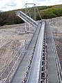 Stone conveyor belt at Melbur works - geograph.org.uk - 1852070.jpg 480 × 640; 103 KB
-
 Terras Road, St Stephen - geograph.org.uk - 5926886.jpg 4,000 × 3,000; 4.52 MB
-
 The A3058 at High Street - geograph.org.uk - 3981902.jpg 640 × 444; 76 KB
-
 The Fal Valley by Trelion - geograph.org.uk - 226339.jpg 640 × 427; 122 KB
-
 The Kings Arms Inn, St Stephen - geograph.org.uk - 3981916.jpg 640 × 443; 70 KB
-
 The lane to Higher Pennance Farm - geograph.org.uk - 5555938.jpg 800 × 600; 142 KB
-
 The leaf busting train - geograph.org.uk - 2780452.jpg 640 × 437; 102 KB
-

-

-
 Track to Little Downderry - geograph.org.uk - 5266223.jpg 640 × 427; 122 KB
-
 Train passing Crugwallins - geograph.org.uk - 3841107.jpg 1,156 × 776; 1.18 MB
-
 Trenowth Mill - geograph.org.uk - 2352274.jpg 640 × 480; 123 KB
-
 Trenowth Mill - geograph.org.uk - 5427740.jpg 3,072 × 2,048; 1.14 MB
-
 Trenowth Wood - geograph.org.uk - 5885493.jpg 1,024 × 681; 167 KB
-
 Trethosa Bible Christian Chapel - geograph.org.uk - 1234991.jpg 640 × 480; 82 KB
-
 Treviscoe, St Stephen-in-Brannel - geograph.org.uk - 6151293.jpg 1,024 × 768; 210 KB
-
 Valley Bottom Road - geograph.org.uk - 226354.jpg 480 × 640; 122 KB
-
 Valley downstream from Coombe - geograph.org.uk - 5428061.jpg 2,666 × 1,489; 970 KB
-
 Valley of the River Fal - geograph.org.uk - 5098160.jpg 640 × 426; 55 KB
-
 Valley of the River Fal - geograph.org.uk - 5156159.jpg 640 × 426; 58 KB
-
 Ventonwyn Mine - geograph.org.uk - 2416961.jpg 640 × 480; 249 KB
-
 Ventonwyn Mine - geograph.org.uk - 5261797.jpg 2,048 × 3,072; 1.7 MB
-
 Viaduct near Coombe - geograph.org.uk - 5265816.jpg 3,072 × 2,048; 1.36 MB
-
 Viaduct near Coombe - geograph.org.uk - 5428078.jpg 3,072 × 2,048; 1.36 MB
-
 Viaduct near Coombe - geograph.org.uk - 5428089.jpg 2,931 × 1,859; 1.2 MB
-
 View from a train towards St Stephen approaching Burngullow - geograph.org.uk - 3146022.jpg 3,872 × 2,592; 4.37 MB
-
 View from Coombe Viaduct - geograph.org.uk - 5089495.jpg 640 × 426; 62 KB
-
 View from Coombe Viaduct - geograph.org.uk - 6025696.jpg 1,024 × 681; 171 KB
-
 View from the viaduct - geograph.org.uk - 5098158.jpg 640 × 426; 60 KB
-

-

-
 View over Coombe Hill - geograph.org.uk - 5428597.jpg 2,330 × 1,146; 510 KB
-
 View towards Hendra - geograph.org.uk - 2517115.jpg 640 × 478; 141 KB
-
 Woodland along a stream - geograph.org.uk - 5156191.jpg 640 × 426; 48 KB
-
 Woodland at Trenowth - geograph.org.uk - 2517095.jpg 640 × 427; 158 KB
-
 Lane passing Dowgas Farm - geograph.org.uk - 560262.jpg 640 × 480; 90 KB
-
 St Stephen - geograph.org.uk - 81244.jpg 640 × 387; 72 KB


.jpg)