Category:St. Ewouds- en St. Elisabethgasthuis, Wijk bij Duurstede
Jump to navigation
Jump to search
| Object location | | View all coordinates using: OpenStreetMap |
|---|
 | |||||
| Upload media | |||||
| Instance of | |||||
|---|---|---|---|---|---|
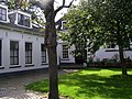
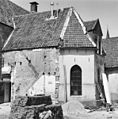
| Location | Wijk bij Duurstede, Utrecht, Netherlands | ||||
| Street address |
| ||||
| Heritage designation |
| ||||
 | |||||
|
This is a category about rijksmonument number 39725
|
| Address |
|
Media in category "St. Ewouds- en St. Elisabethgasthuis, Wijk bij Duurstede"
The following 40 files are in this category, out of 40 total.
-
 Achter Ewoud & Elisabeth gasthuis.Rechts Mon 39725.jpg 2,288 × 1,712; 1.28 MB
-
 Exterieur achterzijde - Wijk bij Duurstede - 20213335 - RCE.jpg 788 × 1,200; 263 KB
-
 Exterieur achterzijde - Wijk bij Duurstede - 20213336 - RCE.jpg 1,200 × 788; 304 KB
-
 Exterieur achterzijde - Wijk bij Duurstede - 20213337 - RCE.jpg 788 × 1,200; 258 KB
-
 Exterieur linker zijtopgevel - Wijk bij Duurstede - 20213338 - RCE.jpg 788 × 1,200; 210 KB
-
 Oeverstraat 21 - Wijk bij Duurstede - 20213339 - RCE.jpg 810 × 1,200; 184 KB
-
 Oeverstraat 26, achtergevels - Wijk bij Duurstede - 20213345 - RCE.jpg 1,194 × 1,200; 411 KB
-
 Oeverstraat 26, achterzijde - Wijk bij Duurstede - 20213347 - RCE.jpg 1,188 × 1,200; 340 KB
-
 Oeverstraat 26, achterzijde - Wijk bij Duurstede - 20213350 - RCE.jpg 1,181 × 1,200; 421 KB
-

-
 Oeverstraat 26, binnenplaats - Wijk bij Duurstede - 20213348 - RCE.jpg 1,183 × 1,200; 440 KB
-
 Oeverstraat 26, binnenplaats - Wijk bij Duurstede - 20213349 - RCE.jpg 1,192 × 1,200; 338 KB
-
 Oeverstraat 26, detail achtergevel - Wijk bij Duurstede - 20213353 - RCE.jpg 1,195 × 1,200; 472 KB
-
-
 Oeverstraat 26, details kap zijkapel - Wijk bij Duurstede - 20213327 - RCE.jpg 1,188 × 1,200; 278 KB
-

-
 Oeverstraat 26, interieur - Wijk bij Duurstede - 20213354 - RCE.jpg 1,183 × 1,200; 220 KB
-
 Oeverstraat 26, interieur - Wijk bij Duurstede - 20213355 - RCE.jpg 1,195 × 1,200; 204 KB
-
 Oeverstraat 26, interieur - Wijk bij Duurstede - 20213356 - RCE.jpg 1,183 × 1,200; 232 KB
-
 Oeverstraat 26, interieur - Wijk bij Duurstede - 20213357 - RCE.jpg 1,192 × 1,200; 241 KB
-
 Oeverstraat 26, kap detail noordwand - Wijk bij Duurstede - 20213332 - RCE.jpg 1,194 × 1,200; 291 KB
-
 Oeverstraat 26, kap detail zuid-oost zijde - Wijk bij Duurstede - 20213331 - RCE.jpg 1,188 × 1,200; 333 KB
-
 Oeverstraat 26, kap naar het oosten - Wijk bij Duurstede - 20213334 - RCE.jpg 1,190 × 1,200; 318 KB
-
 Oeverstraat 26, kap naar het oosten. - Wijk bij Duurstede - 20213329 - RCE.jpg 1,190 × 1,200; 339 KB
-
 Oeverstraat 26, kap naar het westen - Wijk bij Duurstede - 20213330 - RCE.jpg 1,188 × 1,200; 317 KB
-

-
 Oeverstraat 26, kapwand zuid-oost zijde - Wijk bij Duurstede - 20213333 - RCE.jpg 1,183 × 1,200; 312 KB
-

-
 Oeverstraat 26, overzicht achtergevel - Wijk bij Duurstede - 20213344 - RCE.jpg 1,176 × 1,200; 415 KB
-
 Oeverstraat 26, overzicht achterzijde - Wijk bij Duurstede - 20213351 - RCE.jpg 1,195 × 1,200; 363 KB
-

-

-
 Oeverstraat 26, spantdetail zuidzijde zijkapel - Wijk bij Duurstede - 20213324 - RCE.jpg 1,197 × 1,200; 291 KB
-
 Oeverstraat 26, torentje oostzijde - Wijk bij Duurstede - 20213342 - RCE.jpg 1,200 × 1,200; 379 KB
-
 Oeverstraat 26, torentje westzijde - Wijk bij Duurstede - 20213343 - RCE.jpg 1,192 × 1,200; 240 KB
-
 Oeverstraat 26, voorgevel - Wijk bij Duurstede - 20213341 - RCE.jpg 1,200 × 1,197; 323 KB
-
 Oeverstraat 26, zuid-oost gevel achterzijde - Wijk bij Duurstede - 20213346 - RCE.jpg 1,185 × 1,200; 394 KB
-
 Oeverstraat 26, zuid-oost hoek koorkap - Wijk bij Duurstede - 20213352 - RCE.jpg 1,183 × 1,200; 305 KB
-

-


_voorkamer_straatzijde_-_Wijk_bij_Duurstede_-_20213358_-_RCE.jpg)


_-_Wijk_bij_Duurstede_-_20213322_-_RCE.jpg)