Category:St. Gangolf (Heinsberg)
Jump to navigation
Jump to search
| Object location | | View all coordinates using: OpenStreetMap |
|---|
.jpg) | |||||
| Upload media | |||||
| Instance of | |||||
|---|---|---|---|---|---|
| Location | Heinsberg, Cologne Government Region, North Rhine-Westphalia, Germany | ||||
| Diocese | |||||
| Heritage designation | |||||
 | |||||
This is the category for an architectural monument.
It is on the list of cultural monuments of Heinsberg, no. 20.
It is on the list of cultural monuments of Heinsberg, no. 20.
Media in category "St. Gangolf (Heinsberg)"
The following 57 files are in this category, out of 57 total.
-
 5981180.Erwin Quedenfeldt.jpg 1,930 × 2,654; 824 KB
-
 5981181.Erwin Quedenfeldt.jpg 1,944 × 2,663; 1.06 MB
-
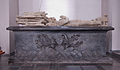
 93 Hochgrab, Kirchberg (Heinsberg).jpg 600 × 400; 47 KB
-
 Blick auf Heinsberg von Westen-2.JPG 2,108 × 1,300; 1.19 MB
-
 Blick auf Heinsberg von Westen.JPG 3,008 × 2,000; 2.73 MB
-
 Blick auf Schlangenkapellchen und St. Gangolf III.jpg 2,919 × 1,759; 2.39 MB
-
 Blick auf Schlangenkapellchen und St.Gangolf I.jpg 2,893 × 1,889; 2.92 MB
-
 Blick auf Schlangenkapellchen und St.Gangolf II.jpg 2,981 × 1,982; 4.05 MB
-
 Blick auf St. Gangolf, Heinsberg.JPG 3,008 × 2,000; 2.96 MB
-
 Blick vom Burgberg auf St. Gangolf.jpg 2,000 × 3,008; 5.13 MB
-
 Burg- und Kirchberg über Schlangenkapellchen.jpg 3,851 × 2,578; 7.03 MB
-
 Burgbergplateau in Heinsberg.jpg 1,954 × 2,938; 4.43 MB
-
 Darstellung Jan II van Loon-Heinsberg auf dem Hochgrab in St. Gangolf, Heinsberg.jpg 2,246 × 3,289; 4.74 MB
-
 Evangelistensymbolskulptur Johannes am Turm von St. Gangolf.jpg 3,009 × 2,000; 3.34 MB
-
 Evangelistensymbolskulptur Markus am Turm von St. Gangolf.jpg 2,977 × 1,979; 3.1 MB
-
 Evangelistensymbolskulptur Matthäus am Turm von St. Gangolf.jpg 2,851 × 1,895; 3.18 MB
-
 Evangelistensymbolskulptur Stier für Lukas am Turm von St. Gangolf.jpg 3,000 × 1,995; 3.45 MB
-
 Geflügelter Stier als Symbol für Lukas auf St Gangolf.jpg 3,008 × 2,000; 3.07 MB
-
 Grabmal Herren von Heinsberg 2.jpg 3,284 × 1,927; 2.41 MB
-
 H v Efferen Grabmal.jpg 3,662 × 2,378; 4.44 MB
-
 Heinsberg 1851.jpg 798 × 466; 41 KB
-
 Heinsberg Denkmal-Nr. 20, Kirchberg (4159).jpg 400 × 600; 42 KB
-
 Heinsberg Gangolf von Norden.jpg 1,933 × 2,550; 3.21 MB
-
 Heinsberg Hl. Gangolf Altarraum.jpg 2,400 × 1,600; 363 KB
-
 Heinsberg Hl. Gangolf Chorgestühl.jpg 2,400 × 1,600; 311 KB
-
 Heinsberg Hl. Gangolf Chorraum.jpg 2,400 × 1,600; 375 KB
-
 Heinsberg Hl. Gangolf Kreuz.jpg 1,600 × 2,400; 359 KB
-
 Heinsberg Hl. Gangolf Krippe.jpg 2,400 × 1,600; 354 KB
-
 Heinsberg Hl. Gangolf Orgel 2.jpg 2,400 × 1,600; 316 KB
-
 Heinsberg Hl. Gangolf Orgel.jpg 1,600 × 2,400; 296 KB
-
 Heinsberg Hl. Gangolf Schmerzhafte Mutter.jpg 2,400 × 1,600; 275 KB
-
 Heinsberg Hl. Gangolf Taufstein.jpg 1,600 × 2,400; 345 KB
-
 Heinsberg St. Gangolf.jpg 2,716 × 3,801; 604 KB
-
 Heinsberg, ehemalige Stiftskirche Sankt Gangolfus Dm20 foto3 2016-09-08 12.46.jpg 3,206 × 4,275; 10.07 MB
-
 Heinsberg, kerk positie2 foto6 2011-03-22 13.50.JPG 3,027 × 4,039; 10.7 MB
-
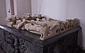 Hochgrab Herren von Heinsberg.jpg 3,771 × 2,372; 3.96 MB
-
 Kirchturm St. Gangolf I.jpg 1,951 × 2,935; 4.38 MB
-
 Kirchturm St. Gangolf II.jpg 1,650 × 2,725; 2.17 MB
-
 Morgendlicher Blick über die Wiesen des Klosterhofes auf St.jpg 2,597 × 1,834; 2.58 MB
-
 Oskar Begas St Gangolf in Heinsberg 1851.jpg 705 × 466; 54 KB
-
 St. Gangolf DSC 4519 b Kopie.jpg 1,713 × 2,358; 2.02 MB
-
 St. Gangolf Heinsberg, Details von Turm, Hochchor und Stadtmauer.jpg 2,880 × 1,948; 3.91 MB
-
 St. Gangolf in Heinsberg- Kirchturmspitze .jpg 1,868 × 2,810; 3.58 MB
-
 St. Gangolf in Heinsberg- Kirchturmspitze.jpg 1,868 × 2,810; 3.59 MB
-
 St. Gangolf von der Schleidener Aue aus gesehen.jpg 2,712 × 1,983; 2.74 MB
-
 St. Gangolf von Norden.jpg 1,933 × 2,827; 2.47 MB
-
 St. Gangolf über der Lindenallee zum Kapellchen.jpg 1,780 × 2,754; 2.28 MB
-
 St. Gangolf, Heinsberg, Detail Chor SO.jpg 2,858 × 1,920; 4.35 MB
-
 St. Gangolf, Heinsberg, Turm, Stadtmauerturm und Lourdesgrotte Version 2.jpg 1,720 × 2,588; 3.5 MB
-
 St. Gangolf, Heinsberg, Turm, Stadtmauerturm und Lourdesgrotte.jpg 1,720 × 2,588; 3.29 MB
-
 St. Gangolf, Heinsberg.jpg 1,543 × 2,507; 2.35 MB
-
 St. Gangolf, Teilansicht auf den Turm.jpg 2,646 × 1,760; 3.83 MB
-
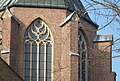
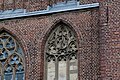
 St. Gangolf- Turmhallenfenster.jpg 2,895 × 1,925; 4.05 MB
-
 St.Gangolf Heinsberg Turmdetail SO.JPG 3,008 × 2,000; 2.7 MB
-
 StGangolfHeinsberg.jpg 1,056 × 1,408; 166 KB
-
 Teilansicht St.Gangolf von Norden.jpg 2,000 × 3,008; 4.03 MB
-
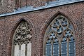
 Turmhallenfenster St Gangolf.jpg 2,887 × 1,916; 3.91 MB


.jpg)


