Category:St. Georg und Michael (Göggingen)
Jump to navigation
Jump to search
| Object location | | View all coordinates using: OpenStreetMap |
|---|
church building in Augsburg, Swabia, Germany  | |||||
| Upload media | |||||
| Instance of | |||||
|---|---|---|---|---|---|
| Named after | |||||
| Location | Augsburg, Swabia, Bavaria, Germany | ||||
| Street address |
| ||||
| Architectural style | |||||
| Heritage designation | |||||
 | |||||
This is the category of the Bavarian Baudenkmal (cultural heritage monument) with the ID D-7-61-000-555 (Wikidata)
|
Media in category "St. Georg und Michael (Göggingen)"
The following 32 files are in this category, out of 32 total.
-
 Göggingen, Georg u Michael v S, 1.jpeg 5,008 × 4,000; 7.79 MB
-
 Kirche St. Georg und Michael, Augsburg. Altarraum.jpg 3,000 × 2,000; 1.08 MB
-
 Kirche St. Georg und Michael, Augsburg. Empore.jpg 3,000 × 2,000; 759 KB
-
 Kirche St. Georg und Michael, Augsburg. Innenraum.jpg 3,000 × 2,000; 975 KB
-
 Kirche St. Georg und Michael, Augsburg. Kirchenraum.jpg 3,000 × 2,000; 944 KB
-
 Kirche St. Georg und Michael, Augsburg. Nord-Ansicht.jpg 3,000 × 2,000; 2.01 MB
-
 Kirche St. Georg und Michael, Augsburg. Südost-Ansicht.jpg 3,000 × 2,000; 720 KB
-
 Kirche St. Georg und Michael, Augsburg. Taufbecken.jpg 3,000 × 2,000; 855 KB
-
 Kirche St. Georg und Michael, Augsburg. West-Ansicht.jpg 3,000 × 2,000; 1.09 MB
-
 Pfarrkirche St. Georg und Michael.JPG 581 × 437; 172 KB
-
 St. Georg und Michael (Göggingen) 1.jpg 9,328 × 9,138; 9.93 MB
-
 St. Georg und Michael (Göggingen) 2.jpg 9,730 × 9,125; 15.67 MB
-
 St. Georg und Michael (Göggingen) Chor.jpg 9,303 × 11,357; 12.92 MB
-
 St. Georg und Michael (Göggingen) Chorgewölbe.jpg 12,240 × 13,799; 14.97 MB
-
 St. Georg und Michael (Göggingen) Empore.jpg 11,337 × 10,435; 12.77 MB
-
 St. Georg und Michael (Göggingen) Geißelchristus.jpg 4,031 × 9,302; 20.91 MB
-
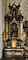
 St. Georg und Michael (Göggingen) Hochaltar 1.jpg 8,002 × 12,368; 15.45 MB
-
 St. Georg und Michael (Göggingen) Hochaltar 2.jpg 9,422 × 10,750; 17.7 MB
-
 St. Georg und Michael (Göggingen) Innenraum 1.jpg 16,320 × 12,240; 22.6 MB
-
 St. Georg und Michael (Göggingen) Innenraum 2.jpg 15,697 × 11,773; 21.49 MB
-
 St. Georg und Michael (Göggingen) Kanzel.jpg 5,414 × 10,695; 6.3 MB
-
 St. Georg und Michael (Göggingen) Kruzifix.jpg 6,032 × 8,210; 4.63 MB
-
 St. Georg und Michael (Göggingen) Langhausgewölbe - mittlerer Teil.jpg 12,240 × 16,320; 14.8 MB
-
 St. Georg und Michael (Göggingen) linker Seitenaltar 1.jpg 6,358 × 13,466; 12.21 MB
-
 St. Georg und Michael (Göggingen) linker Seitenaltar 2.jpg 10,755 × 10,258; 17.25 MB
-
 St. Georg und Michael (Göggingen) rechter Seitenaltar 1.jpg 6,057 × 12,428; 11.25 MB
-
 St. Georg und Michael (Göggingen) rechter Seitenaltar 2.jpg 10,989 × 12,293; 21.63 MB
-
 St. Georg und Michael (Göggingen) Taufstein.jpg 7,143 × 14,829; 13.77 MB
-
 St. Georg und Michael 100428 - panoramio.jpg 3,648 × 2,736; 3.07 MB
-
 Von-Cobres-Straße 6 Augsburg.JPG 1,455 × 2,076; 1.24 MB
-
 Von-Cobres-Straße 6 aussen.JPG 2,304 × 1,728; 1.16 MB
-
 Von-Cobres-Straße 6 innen.JPG 2,265 × 1,647; 1.1 MB


_1.jpg)
_2.jpg)
_Chor.jpg)
_Chorgew%C3%B6lbe.jpg)
_Empore.jpg)
_Gei%C3%9Felchristus.jpg)
_Hochaltar_1.jpg)
_Hochaltar_2.jpg)
_Innenraum_1.jpg)
_Innenraum_2.jpg)
_Kanzel.jpg)
_Kruzifix.jpg)
_Langhausgew%C3%B6lbe_-_mittlerer_Teil.jpg)
_linker_Seitenaltar_1.jpg)
_linker_Seitenaltar_2.jpg)
_rechter_Seitenaltar_1.jpg)
_rechter_Seitenaltar_2.jpg)
_Taufstein.jpg)


Categories:
- Cultural heritage monuments in Augsburg-Göggingen
- Churches in Augsburg
- Churches in Dekanat Augsburg II
- Saint George churches in Swabia (administrative region)
- Saint Michael churches in Swabia (administrative region)
- Baroque churches in Augsburg
- Parish churches in Swabia (administrative region)
- Buildings in Augsburg-Göggingen
- Churches dedicated to multiple saints