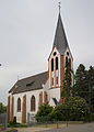
Category:St. Gertrud (Oedingen)
Jump to navigation
Jump to search
| Authority control |
| Object location | | View all coordinates using: OpenStreetMap |
|---|
| Upload media | |||||
| Instance of | |||||
|---|---|---|---|---|---|
| Location | Oedingen, Remagen, Ahrweiler, Rhineland-Palatinate, Germany | ||||
| Heritage designation | |||||
 | |||||
Media in category "St. Gertrud (Oedingen)"
The following 2 files are in this category, out of 2 total.
-
 Kirche st gertrudis c.jpg 2,458 × 3,420; 3.99 MB
-
 Oedingen (Remagen) St. Gertrudis283.JPG 2,520 × 3,776; 3.01 MB

_St._Gertrudis283.JPG)