Category:St. Peter (Koblenz-Neuendorf)
Jump to navigation
Jump to search
| Object location | | View all coordinates using: OpenStreetMap |
|---|
 | |||||
| Upload media | |||||
| Instance of | |||||
|---|---|---|---|---|---|
| Named after | |||||
| Location | Koblenz, Rhineland-Palatinate, Germany | ||||
| Architectural style | |||||
| Heritage designation | |||||
 | |||||
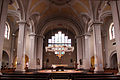
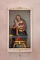
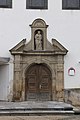
Media in category "St. Peter (Koblenz-Neuendorf)"
The following 16 files are in this category, out of 16 total.
-
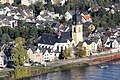 IKoblenz, Festung Ehrenbreitstein, Blick zur Kirche St. Peter.jpg 4,272 × 2,848; 4.86 MB
-
 Kath. Pfarrkirche St. Peter, Koblenz-Neuendorf.jpg 4,566 × 3,099; 9.75 MB
-
 Koblenz, der Rhein, Blick zum Turm der Kirche St. Peter.jpg 4,272 × 2,848; 3.86 MB
-
 Koblenz-Neuendorf.JPG 2,816 × 2,112; 1.64 MB
-
 St Peter 01 Koblenz 2012.jpg 4,500 × 3,000; 4.45 MB
-
 St Peter 02 Koblenz 2012.jpg 4,500 × 3,000; 4.37 MB
-
 St Peter 03 Koblenz 2012.jpg 3,000 × 4,500; 3.71 MB
-
 St Peter 04 Koblenz 2013.jpg 4,500 × 3,000; 2.99 MB
-
 St Peter 05 Koblenz 2013.jpg 4,500 × 3,000; 2.95 MB
-
 St Peter 06 Koblenz 2013.jpg 4,500 × 3,000; 2.78 MB
-
 St Peter 07 Koblenz 2013.jpg 3,000 × 4,500; 3.52 MB
-
 St Peter 08 Koblenz 2013.jpg 4,500 × 3,000; 3.12 MB
-
 St Peter 09 Koblenz 2013.jpg 3,000 × 4,500; 2.91 MB
-
 St Peter 10 Koblenz 2013.jpg 4,500 × 3,000; 3.28 MB
-
 St Peter 12 Koblenz 2013.jpg 3,000 × 4,500; 3.38 MB
-
 St Peter 13 Koblenz 2013.jpg 3,227 × 4,840; 3.55 MB


