Category:St. Petri (Mönkebude)
Jump to navigation
Jump to search
| Object location | | View all coordinates using: OpenStreetMap |
|---|
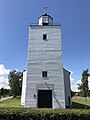
church in Mönkebude, Germany _S%C3%BCdostansicht.jpg) | |||||
| Upload media | |||||
| Instance of | |||||
|---|---|---|---|---|---|
| Named after | |||||
| Location | Mönkebude, Vorpommern-Greifswald District, Mecklenburg-Western Pomerania, Germany | ||||
| Heritage designation | |||||
 | |||||
Media in category "St. Petri (Mönkebude)"
The following 13 files are in this category, out of 13 total.
-
 Kirche Moenkebude 07 2014 01.jpg 3,648 × 2,736; 1.86 MB
-
 Kirche Moenkebude 07 2014 02.jpg 2,736 × 3,648; 1.73 MB
-
 Kirche Moenkebude 07 2014 03.jpg 3,648 × 2,736; 1.54 MB
-
 Kirche Moenkebude 07 2014 04.jpg 2,736 × 3,648; 1.79 MB
-
 Kirche Moenkebude 07 2014 05.jpg 3,648 × 2,736; 1.76 MB
-
 Kirche Moenkebude 07 2014 06.jpg 2,736 × 3,648; 1.73 MB
-
 St. Petri (Mönkebude) Kirchenschiff Südansicht.jpg 4,032 × 3,024; 2.6 MB
-
 St. Petri (Mönkebude) Nordostansicht.jpg 4,032 × 3,024; 2.09 MB
-
 St. Petri (Mönkebude) Ostansicht.jpg 4,032 × 3,024; 2.35 MB
-
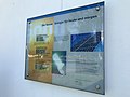 St. Petri (Mönkebude) PV-Infotafel.jpg 4,032 × 3,024; 1.84 MB
-
 St. Petri (Mönkebude) Südostansicht.jpg 4,032 × 3,024; 2.88 MB
-
 St. Petri (Mönkebude) Südwestansicht.jpg 4,032 × 3,024; 2.55 MB
-
 St. Petri (Mönkebude) Westansicht.jpg 3,024 × 4,032; 2.44 MB


_Kirchenschiff_S%C3%BCdansicht.jpg)
_Nordostansicht.jpg)
_Ostansicht.jpg)
_PV-Infotafel.jpg)
_S%C3%BCdwestansicht.jpg)
_Westansicht.jpg)