Category:St. Simons, Georgia
Jump to navigation
Jump to search
barrier island and census-designated place on St. Simons Island in Glynn County, Georgia, United States  | |||||
| Upload media | |||||
| Instance of | |||||
|---|---|---|---|---|---|
| Location | Glynn County, Georgia | ||||
| Population |
| ||||
| Area |
| ||||
| Elevation above sea level |
| ||||
| Different from | |||||
 | |||||
Subcategories
This category has the following 14 subcategories, out of 14 total.
A
- Animals of St. Simons, Georgia (58 F)
B
- Battle of Bloody Marsh (3 F)
E
- Epworth By The Sea (11 F)
F
- Flora of St. Simons, Georgia (9 F)
- Fort St. Simons (5 F)
K
M
N
- Neptune Park (15 F)
S
- St. Simons Island Light (37 F)
- St. Simons Pier (6 F)
Media in category "St. Simons, Georgia"
The following 100 files are in this category, out of 100 total.
-
 A. W. Jones Heritage Center, St, Simons, GA, US.jpg 6,016 × 2,880; 19.87 MB
-
 A.W. Jones Heritage Center plaque.JPG 4,608 × 3,456; 5.9 MB
-
 ACTIVITY ON ST. SIMON'S ISLAND - NARA - 547025.jpg 3,000 × 2,036; 695 KB
-
 Aerial view, St. Simons Island, Georgia LCCN2017712470.tif 5,288 × 3,718; 112.55 MB
-
 AIRPORT ON ST. SIMON'S ISLAND - NARA - 547018.jpg 3,000 × 2,027; 701 KB
-
 American Church History Series Volume 4.pdf 718 × 1,147, 570 pages; 31.86 MB
-
 AN OLD BOAT ROTS IN A MARSH ON ST. SIMON'S ISLAND - NARA - 547017.jpg 2,020 × 3,000; 1.42 MB
-
 Ascendingpamperpole.jpg 2,304 × 3,072; 3.76 MB
-

-

-
 Bananas Foster Cheesecake.jpg 1,024 × 768; 204 KB
-
 Bell telephone magazine (1941) (14733128276).jpg 2,020 × 1,090; 387 KB
-
 Bloody Marsh, St. Simons Island, Georgia, USA, 2015.jpg 6,000 × 4,000; 5.3 MB
-
 BloodyMarsh2008.jpg 3,008 × 2,000; 3.1 MB
-
 BloodyMarshMonument.jpg 2,000 × 3,008; 4 MB
-
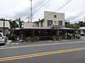
 Boulevard Cafe, St. Simons.JPG 4,608 × 3,456; 5.02 MB
-
 Brunswick Georgia.jpg 960 × 720; 70 KB
-
 Casino swimming pool, St. Simon Island, Ga. (8343883546).jpg 1,500 × 939; 1.07 MB
-
 Catholic Chapel on Frederica Road, St. Simon's Island, Georgia (8343882510).jpg 1,500 × 962; 1.17 MB
-
 Chapel at Methodist Center, St. Simon Island, Ga. (8343884324).jpg 1,500 × 937; 977 KB
-
 Christ Church Frederica, St. Simon Island.jpg 4,562 × 3,404; 4.23 MB
-
 Christ Episcopal Church, St. Simons Island, Georgia, USA, 2015.jpg 6,000 × 4,000; 6.54 MB
-
 Christchurch cem. st simions.jpg 2,304 × 1,536; 1.22 MB
-
 COMMERCIAL CLUTTER ON ST. SIMON'S ISLAND - NARA - 547021.jpg 3,000 × 2,031; 1,004 KB
-
 Compass near St. Simons Pier.JPG 4,608 × 3,456; 5.03 MB
-
 Couper's Point marker.JPG 4,608 × 3,456; 5.63 MB
-
 Covid-19 sign, Island Cinema, GA, US.jpg 4,912 × 4,016; 15.46 MB
-
 Crabdaddy's Seafood Grill, St. Simons.JPG 4,608 × 3,456; 5.15 MB
-
 Delegal's Fort historical marker.JPG 4,608 × 3,456; 5.6 MB
-

-
 Enjoying the sun on the beach at St. Simons Island, Ga. (8343883210).jpg 1,500 × 966; 1.11 MB
-
 Epworth by the Sea plaque.jpg 5,114 × 3,619; 11.61 MB
-
 Epworth by the Sea sign.jpg 6,016 × 3,745; 13.86 MB
-
 Epworth by the Sea, Arthur J. Moore Museum.jpg 6,248 × 3,673; 12.79 MB
-
 Epworth by the Sea, Lovely Lane Chapel.jpg 4,374 × 4,016; 6.92 MB
-
 Epworth by the Sea, Wright prayer tower.jpg 6,016 × 4,017; 12.93 MB
-

-
 Fort Oglethorpe Islands.jpg 2,000 × 2,738; 513 KB
-
 Fredrica Academy, St. Simons, GA, US.jpg 6,016 × 1,875; 4.74 MB
-
 Fresh water lake in Glynn Haven, St. Simons Island, Georgia (8343882778).jpg 1,500 × 943; 1.06 MB
-
 GA St Simons Wesley Oak marker01.jpg 3,216 × 4,288; 2.27 MB
-
 GAMap-doton-StSimons.PNG 258 × 300; 19 KB
-
 Gascoigne Bluff historical marker.JPG 4,608 × 3,456; 6.64 MB
-
 Gascoigne bluff marker, St. Simons, GA, US.JPG 6,000 × 4,000; 13.13 MB
-
 Gascoigne Bluff marker, St. Simons, GA, USA.JPG 6,000 × 4,000; 17.22 MB
-
 Gascoigne Bluff view, St. Simons, GA, US.jpg 6,000 × 4,000; 15.49 MB
-
 Glynn County Casino and Lighthouse, St. Simons Island, Georgia (8342824901).jpg 1,500 × 950; 1.02 MB
-
 Golden Isles Welcome Center.JPG 4,608 × 3,456; 5.1 MB
-
 Golf Carts on St. Simons.JPG 4,608 × 3,456; 6.27 MB
-
 Gould's inlet . St Simon's Island (38082515376).jpg 3,452 × 2,277; 1.2 MB
-
 Greetings from St. Simons Island, Ga. (8342824595).jpg 1,500 × 943; 1.06 MB
-
 GullyHoleCreek.jpg 3,008 × 2,000; 2.91 MB
-
 Hamilton Plantation slave houses, St. Simons, GA, USA.jpg 6,000 × 4,000; 17.93 MB
-

-
 Ibo or Igbo Landing historical marker, St. Simons, GA, US.jpg 3,701 × 3,707; 3.71 MB
-
 Iguana's Seafood Restaurant, St. Simons.JPG 4,608 × 3,456; 6.13 MB
-
 Jekyll Island State Park - Blick St. Simons Island und das Lighthouse.jpg 1,595 × 1,196; 305 KB
-
 Land Mollusca of North America (north of Mexico) Vol. I Part 2 (1st half).pdf 1,275 × 1,650, 220 pages; 49.79 MB
-
 Land Mollusca of North America (north of Mexico) Vol. II Part 1 (1st half).pdf 1,275 × 1,650, 264 pages; 58.15 MB
-
 Land Mollusca of North America (north of Mexico) Vol. II Part 2 (2nd half).pdf 1,275 × 1,650, 324 pages; 71.82 MB
-
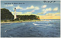 Light house, St. Simon's Island, Ga. (8342824519).jpg 1,500 × 951; 1,006 KB
-
 Low Country Gullah Culture.pdf 1,275 × 1,650, 435 pages; 7.79 MB
-
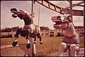 MERRY-GO-ROUND AT AN AMUSEMENT PARK ON ST. SIMON'S ISLAND - NARA - 547002.jpg 3,000 × 2,022; 821 KB
-

-
 Neptune Small plaque, St. Simons, GA, US.jpg 6,016 × 4,016; 35.11 MB
-
 Ocean Inn and Suits, St. Simons.JPG 4,608 × 3,456; 5.41 MB
-
 Oglethorpe Point Elementary School, St. Simons, GA, US.jpg 5,517 × 2,802; 3.81 MB
-
 Post Office, St. Simons, GA, US.jpg 6,016 × 2,089; 8.76 MB
-

-
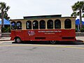 Saint Simons Colonial Island Trolley.JPG 4,608 × 3,456; 4.95 MB
-
 Saint Simons Inn by the Lighthouse, Swimming pool and fountain.JPG 4,608 × 3,456; 5.83 MB
-
 Saint Simons Inn by the Lighthouse.JPG 4,608 × 3,456; 6.41 MB
-
 Scientific American - Series 1 - Volume 007 - Issue 12.pdf 1,593 × 2,302, 8 pages; 3.16 MB
-
 Scientific American - Series 1 - Volume 007 - Issue 30.pdf 1,652 × 2,360, 8 pages; 4.32 MB
-
 Sea Island Golf Clubhouse, Sea Island, near St. Simon's Island, Ga. (8343878378).jpg 1,500 × 950; 1.02 MB
-

-
 Silvian Springs, Glynn Haven, St. Simons Island, Georgia (8343883748).jpg 1,500 × 932; 1.09 MB
-
 SSW tip of St. Simons Island - panoramio.jpg 2,816 × 2,112; 1.22 MB
-
 St Simons Park marker, St. Simons, GA, US.jpg 6,000 × 4,000; 17.32 MB
-
 St. Simon's Sound, Brunswick Harbor, and Turtle River, Georgia LOC 80690728.jpg 8,997 × 6,447; 5.45 MB
-
 St. Simon's Sound, Brunswick Harbor, and Turtle River, Georgia LOC 80690728.tif 8,997 × 6,447; 165.95 MB
-
 St. Simond's Island Causeway (38105364272).jpg 4,273 × 2,420; 1.82 MB
-
 St. Simons boating and fishing club.JPG 4,608 × 3,456; 4.95 MB
-
 St. Simons Elementary School, St. Simons, GA, US.jpg 6,016 × 2,283; 5.1 MB
-
 St. Simons Island 1 Mile past Pier - panoramio.jpg 1,436 × 1,077; 765 KB
-
 St. Simons Island Pier at night.jpg 15,059 × 5,020; 75.34 MB
-
 Standing on beach facing Driving Range - panoramio.jpg 2,816 × 2,112; 2.1 MB
-
 Stracham House Garage, St. Simons, GA, US.jpg 5,789 × 3,853; 12.5 MB
-
 StSimons beacon Sept29 1896.jpg 650 × 460; 81 KB
-
 Tabby House, St. Simons, GA, US.jpg 6,014 × 2,576; 22.65 MB
-
 The Crab Trap, St. Simons.JPG 4,608 × 3,456; 4.55 MB
-
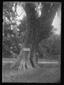 The John Wesley tree.jpg 2,000 × 2,667; 666 KB
-
 The King and Prince Hotel, St. Simons Island, Ga. (8342824239).jpg 1,500 × 948; 1.04 MB
-
 The Plantation St. Simon's Island (38218300991).jpg 4,326 × 2,935; 3.71 MB
-
 The St. Simons Methodist Church, St. Simons Island, Georgia (8342824063).jpg 1,500 × 945; 1.12 MB
-
Tide St. Simons, GA 2018.webm 23 s, 1,920 × 1,080; 17.64 MB
-
 Tiramisu at Delaney's (7712308084).jpg 4,928 × 3,264; 11.61 MB
-
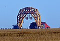 Versabar VB-10,000 and Golden Ray, St. Simons.jpg 2,970 × 2,018; 3.17 MB
-
 Versabar VB-10,000 St. Simons.jpg 3,988 × 5,209; 23.85 MB
-
 Wesley Oak marker, St. Simons, GA, US.jpg 4,072 × 3,496; 8.86 MB


.jpg)


_(14733128276).jpg)


.jpg)
.jpg)
.jpg)


.jpg)
.jpg)


.jpg)


.jpg)


.jpg)
.jpg)


.jpg)

.jpg)


.jpg)


.jpg)
.jpg)
.jpg)


.jpg)


.jpg)
.jpg)
.jpg)
.jpg)


