Category:St. George's Tower
Jump to navigation
Jump to search
| Object location | | View all coordinates using: OpenStreetMap |
|---|
artem Kraft  | |||||
| Upload media | |||||
| Instance of | |||||
|---|---|---|---|---|---|
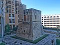
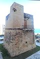
| Location | St. Julian's, Eastern Region (Lvant), Malta | ||||
| Commissioned by | |||||
| Owned by | |||||
| Operator | |||||
| Heritage designation |
| ||||
| Inception |
| ||||
 | |||||
| This category is about Maltese cultural property with inventory number 01382. |
Media in category "St. George's Tower"
The following 6 files are in this category, out of 6 total.
-
 St George's Bay Tower.jpg 2,048 × 1,529; 554 KB
-
 St George's Tower.jpeg 2,486 × 3,540; 2.47 MB
-
 St. George Tower and Corinthia Hotel.jpeg 2,592 × 1,936; 1.26 MB
-
 St. George Tower shooting box.jpeg 1,936 × 1,936; 881 KB
-
 St.George's Tower.jpeg 2,530 × 3,732; 2.61 MB
-
 Torri ta' San Gorg.jpeg 2,500 × 2,954; 2.15 MB


