Category:St. Richard's school and rectory (Omaha, Nebraska)
Jump to navigation
Jump to search
| Object location | | View all coordinates using: OpenStreetMap |
|---|
|
This is a category about a place or building that is listed on the National Register of Historic Places in the United States of America. Its reference number is 12000103. |
Media in category "St. Richard's school and rectory (Omaha, Nebraska)"
The following 7 files are in this category, out of 7 total.
-
 St. Richard's Church & School.JPG 2,592 × 1,944; 2.27 MB
-
 St. Richard's rectory (Omaha) 1.JPG 2,416 × 963; 930 KB
-
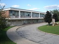
 St. Richard's school (Omaha) from SE 1.JPG 2,322 × 903; 798 KB
-
 St. Richard's school (Omaha) from SE 2.JPG 2,339 × 788; 751 KB
-
 St. Richard's school (Omaha) SW corner 1.JPG 2,271 × 1,078; 1.15 MB
-
 St. Richard's school (Omaha) W side 1.JPG 2,416 × 941; 825 KB
-
 St. Richards complex (Omaha) retaining wall 1.JPG 2,560 × 1,736; 1.8 MB

_SW_corner_1.JPG)
_retaining_wall_1.JPG)
_1.JPG)
_from_SE_1.JPG)
_from_SE_2.JPG)
_W_side_1.JPG)
Categories:
- Religious buildings in Omaha, Nebraska
- National Register of Historic Places in Douglas County, Nebraska
- Built in Nebraska in 1963
- Former schools in Nebraska
- Schools in the Roman Catholic Archdiocese of Omaha
- Buildings of religious function on the National Register of Historic Places in Nebraska
- Schools on the National Register of Historic Places in Nebraska