Category:St Hilary, Cornwall
Jump to navigation
Jump to search
village in Cornwall, England  | |||||
| Upload media | |||||
| Instance of | |||||
|---|---|---|---|---|---|
| Location | Cornwall, South West England, England | ||||
 | |||||
Deutsch: St Hilary ist ein Ort und eine Gemeinde im District Penwith der Grafschaft Cornwall in England. Die Kirche des Ortes, die im Perpendicular Style erbaut wurde, hat einen Kirchturm aus dem 13. Jahrhundert. Der Rest der Kirche, die 1853 bei einem Brand schwer beschädigt wurde, wurde 1855 wieder aufgebaut und von William White konstruiert. Sie ist dem Heiligen Hilarius von Poitiers gewidmet.
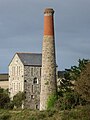
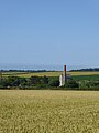
St Hilary is a village and civil parish in Cornwall, United Kingdom. St Hilary has many former mines, especially notable was a mine called Wheal Fortune which extended into the parish of Ludgvan. For the purposes of local government St Hilary is a parish council and elects councillors every four years. The principal local authority in the area is the Cornwall Council.
Subcategories
This category has the following 5 subcategories, out of 5 total.
C
- Cudden Point (15 F)
P
- Penberthy Croft Mine (5 F)
R
- Relubbus (9 F)
S
- St Hilary's Church, St Hilary (13 F)
Media in category "St Hilary, Cornwall"
The following 182 files are in this category, out of 182 total.
-
 A crossroads of bridle paths - geograph.org.uk - 5581757.jpg 4,032 × 2,268; 6.04 MB
-
 A cultivated field near Greenberry - geograph.org.uk - 2498508.jpg 640 × 427; 118 KB
-
 A Stone Cattle Grid - geograph.org.uk - 107041.jpg 640 × 480; 156 KB
-

-
 A394 Rosudgeon Cornwall - geograph.org.uk - 5020867.jpg 640 × 424; 37 KB
-
 Across Bessy's Cove - geograph.org.uk - 4719580.jpg 1,306 × 979; 423 KB
-
 Acton Castle Hotel - geograph.org.uk - 5883997.jpg 4,896 × 3,672; 6.73 MB
-
 An entrance to Friendship Wood - geograph.org.uk - 5906262.jpg 4,896 × 3,672; 6.51 MB
-
 An entrance to Friendship Wood - geograph.org.uk - 5906263.jpg 4,896 × 3,672; 6.62 MB
-
 Approaching Cudden Point - geograph.org.uk - 3189983.jpg 640 × 480; 100 KB
-
 Barlowenath Farmhouse Holiday Let - geograph.org.uk - 5452386.jpg 640 × 480; 60 KB
-
 Barlowenath Farmyard - geograph.org.uk - 5452387.jpg 640 × 480; 61 KB
-
 Barn at Greenberry farm - geograph.org.uk - 5581750.jpg 4,032 × 2,268; 5.7 MB
-
 Barn at Millpool - 11 years on - geograph.org.uk - 5581710.jpg 4,032 × 2,268; 5.11 MB
-
 Barn at Millpool - geograph.org.uk - 185740.jpg 640 × 480; 109 KB
-
 Barns and machinery at Chyrase Farm - geograph.org.uk - 5581702.jpg 4,032 × 2,268; 5.21 MB
-
 Bessy's Cove - geograph.org.uk - 4214257.jpg 3,872 × 2,592; 4.64 MB
-
 Bessy's Cove - geograph.org.uk - 4972511.jpg 640 × 480; 119 KB
-

-
 Bridle path junction - geograph.org.uk - 5546039.jpg 4,032 × 2,268; 6.61 MB
-
 Bridle path near Greenberry farm - geograph.org.uk - 5581754.jpg 4,032 × 2,268; 5.81 MB
-
 Bridle path, river or swamp^ - geograph.org.uk - 5546033.jpg 4,032 × 2,268; 5.88 MB
-
 Bridleway at Colenso - geograph.org.uk - 2687798.jpg 427 × 640; 126 KB
-
 Bridleway between hedges - geograph.org.uk - 2498492.jpg 427 × 640; 144 KB
-
 Bridleway near Colenso Cross - geograph.org.uk - 5545828.jpg 1,600 × 900; 713 KB
-
 Buildings and bridlepath near Retallack - geograph.org.uk - 5546118.jpg 4,032 × 2,268; 4.35 MB
-
 Bus shelter - geograph.org.uk - 21357.jpg 640 × 480; 152 KB
-
 BWOC filling station, Rosudgeon - geograph.org.uk - 4881210.jpg 1,600 × 1,200; 243 KB
-
 Byway open to all traffic, near North Treveneague Farm - geograph.org.uk - 5906267.jpg 4,896 × 3,672; 7.12 MB
-
 Byway open to all traffic, near North Treveneague Farm - geograph.org.uk - 5906268.jpg 4,896 × 3,672; 6.96 MB
-
 Chimney beside lane - geograph.org.uk - 3110579.jpg 640 × 427; 41 KB
-
 Chynoweth Lane Chynoweth Cornwall - geograph.org.uk - 5452389.jpg 640 × 444; 57 KB
-
 Chyvellan Cottage - geograph.org.uk - 5463573.jpg 640 × 480; 66 KB
-
 Coastal path above Porth Sampson - geograph.org.uk - 4214225.jpg 3,872 × 2,592; 5.55 MB
-

-
 Cornwall , Acton Castle Hotel - geograph.org.uk - 5750523.jpg 6,000 × 4,000; 6.19 MB
-
 Cornwall , Coastal Scenery - geograph.org.uk - 5750527.jpg 6,000 × 4,000; 7.16 MB
-
 Cornwall , Coastal Scenery - geograph.org.uk - 5750529.jpg 6,000 × 4,000; 7.7 MB
-
 Cornwall , Coastal Scenery - geograph.org.uk - 5750532.jpg 6,000 × 4,000; 7.35 MB
-
 Cornwall , Coastal Scenery - geograph.org.uk - 5750535.jpg 6,000 × 4,000; 7.16 MB
-
 Cornwall , Coastal Scenery - geograph.org.uk - 5750536.jpg 6,000 × 4,000; 7.23 MB
-
 Cornwall , Coastal Scenery - geograph.org.uk - 5750537.jpg 6,000 × 4,000; 7.22 MB
-
 Cornwall , Coastal Scenery - geograph.org.uk - 5750539.jpg 6,000 × 4,000; 5.95 MB
-
 Cornwall , Coastal Scenery - geograph.org.uk - 5750540.jpg 6,000 × 4,000; 6.79 MB
-
 Cornwall , Country Lane - geograph.org.uk - 5750519.jpg 6,000 × 4,000; 7.82 MB
-
 Cornwall , Countryside Scenery - geograph.org.uk - 5750522.jpg 6,000 × 4,000; 5.9 MB
-
 Cornwall , Countryside Scenery - geograph.org.uk - 5750524.jpg 6,000 × 4,000; 7.68 MB
-
 Cornwall , Cudden Point - geograph.org.uk - 5750528.jpg 6,000 × 4,000; 6.41 MB
-
 Cornwall , Cudden Point - geograph.org.uk - 5750531.jpg 6,000 × 4,000; 7.58 MB
-
 Cornwall , Cudden Point - geograph.org.uk - 5750533.jpg 6,000 × 4,000; 6.06 MB
-
 Cornwall , Cudden Point - geograph.org.uk - 5750534.jpg 6,000 × 4,000; 5.77 MB
-
 Cornwall , Footpath - geograph.org.uk - 5750520.jpg 4,000 × 6,000; 6.51 MB
-
 Cornwall , Footpath - geograph.org.uk - 5750521.jpg 4,000 × 6,000; 7.45 MB
-
 Cornwall , Footpath - geograph.org.uk - 5750525.jpg 6,000 × 4,000; 6.25 MB
-
 Cornwall , Grassy Field - geograph.org.uk - 5750510.jpg 6,000 × 4,000; 6.98 MB
-
 Cornwall , Grassy Field ^ Cattle - geograph.org.uk - 5750514.jpg 6,000 × 4,000; 6.3 MB
-
 Cornwall , Grassy Field ^ Cattle - geograph.org.uk - 5750516.jpg 6,000 × 4,000; 6.38 MB
-
 Cornwall , Grassy Field ^ Cattle - geograph.org.uk - 5750518.jpg 6,000 × 4,000; 6.34 MB
-
 Cornwall , Lower Rosudgeon Farm - geograph.org.uk - 5750511.jpg 6,000 × 4,000; 6.68 MB
-
 Cornwall , Lower Rosudgeon Farm - geograph.org.uk - 5750512.jpg 6,000 × 4,000; 7.77 MB
-
 Cornwall , Rosudgeon Farm - geograph.org.uk - 5750513.jpg 6,000 × 4,000; 5.71 MB
-
 Cornwall , Western Shag Rock - geograph.org.uk - 5750538.jpg 6,000 × 4,000; 5.81 MB
-
 Cottage and bridle path near Woodstock - geograph.org.uk - 5581769.jpg 4,032 × 2,268; 5.95 MB
-
 Cottages near St Hilary Church - geograph.org.uk - 105532.jpg 640 × 443; 97 KB
-
 Cudden Point - geograph.org.uk - 3189621.jpg 640 × 480; 101 KB
-
 Cudden Point and The Greeb - geograph.org.uk - 2978650.jpg 800 × 600; 83 KB
-
 Cultivated area - geograph.org.uk - 5546122.jpg 4,032 × 2,268; 5.55 MB
-

-
 Elizabeth II postbox, Gwallon - geograph.org.uk - 5465383.jpg 2,136 × 2,848; 1.16 MB
-
-
 Farm near Retallack - geograph.org.uk - 5546113.jpg 4,032 × 2,268; 4.51 MB
-

-
 Field at Chyrase Farm Millpool - geograph.org.uk - 2687785.jpg 640 × 427; 79 KB
-
 Field near Colenso Cross - geograph.org.uk - 5581776.jpg 4,032 × 2,268; 5.49 MB
-
 Field of horses, St. Hilary, Cornwall - geograph.org.uk - 2386644.jpg 1,600 × 1,200; 492 KB
-
 Fields at Middle Colenso - geograph.org.uk - 2687791.jpg 640 × 427; 71 KB
-
 Fields at St. Hilary, Cornwall - geograph.org.uk - 2407636.jpg 1,600 × 1,200; 542 KB
-
 Fisherman's cottage overlooking Bessy's Cove - geograph.org.uk - 4214251.jpg 3,872 × 2,592; 5.73 MB
-
 Fishing lake - geograph.org.uk - 2509149.jpg 640 × 427; 107 KB
-
 Footbridge across the Hayle River - geograph.org.uk - 3096327.jpg 640 × 427; 104 KB
-
 Former chapel at Rosudgeon - geograph.org.uk - 4240750.jpg 3,872 × 2,592; 5.31 MB
-

-
 From Kennegy - geograph.org.uk - 2029808.jpg 3,264 × 2,448; 3.1 MB
-
 Gurlyn Hill. - panoramio.jpg 3,648 × 2,736; 6.14 MB
-
 Halamanning Farm - geograph.org.uk - 5545851.jpg 4,032 × 2,268; 5.38 MB
-
-
 Hillside above Cudden Point - geograph.org.uk - 4214242.jpg 3,872 × 2,592; 4.64 MB
-
 House at Colenso - geograph.org.uk - 2487509.jpg 640 × 427; 100 KB
-
 Incoming tide at Zawn Susan - geograph.org.uk - 4719588.jpg 1,346 × 1,795; 539 KB
-
 Inland from Cudden Point - geograph.org.uk - 3189559.jpg 640 × 480; 125 KB
-
 Lane leading from the A394 - geograph.org.uk - 2498517.jpg 640 × 427; 124 KB
-
 Lane near Colenso - geograph.org.uk - 2487492.jpg 427 × 640; 120 KB
-
 Little Cudden (7681).jpg 4,288 × 2,848; 6.93 MB
-
 Little Cudden (7683).jpg 4,288 × 2,848; 6.48 MB
-
 Little Cudden (7685).jpg 4,288 × 2,848; 6.15 MB
-
 Little Cudden - geograph.org.uk - 3189640.jpg 640 × 480; 83 KB
-
 Little Cudden and Piskies Cove (7686).jpg 4,288 × 2,848; 5.91 MB
-
 Little Cudden and Piskies Cove (7687).jpg 4,288 × 2,848; 6.3 MB
-
 Long Lane - geograph.org.uk - 5382051.jpg 4,000 × 3,000; 4.03 MB
-
 Long Lane - geograph.org.uk - 5382054.jpg 4,000 × 3,000; 3.1 MB
-
 Long Lane to the east of Frythens Farm - geograph.org.uk - 5384844.jpg 4,000 × 3,000; 3.36 MB
-
-
 Luxuriant late-summer vegetation - geograph.org.uk - 5546061.jpg 4,032 × 2,268; 5.32 MB
-
 Marazion Caravan and Motorhome Club site - geograph.org.uk - 5906260.jpg 4,896 × 3,672; 7.04 MB
-
 Mine shaft - geograph.org.uk - 2487543.jpg 640 × 427; 108 KB
-
 Minor road, Gwallon - geograph.org.uk - 5465385.jpg 640 × 480; 83 KB
-
 North chapel, St. Hilary's - geograph.org.uk - 2407640.jpg 1,600 × 1,200; 343 KB
-
 Oblivious cows - geograph.org.uk - 3190038.jpg 640 × 480; 60 KB
-
 Old Fishermens Huts - geograph.org.uk - 3039297.jpg 1,024 × 768; 272 KB
-
 Old Milestone by the A394, east of Rosudgeon (geograph 6416095).jpg 644 × 862; 238 KB
-
 Old Wayside Cross moved to St Hilary church (geograph 7068958).jpg 1,536 × 2,048; 811 KB
-
 Old Wayside Cross moved to St Hilary church (geograph 7068967).jpg 1,536 × 2,048; 917 KB
-
 Old Wayside Cross moved to St Hilary church (geograph 7068977).jpg 1,536 × 2,048; 801 KB
-
 Ordnance Survey Cut Mark - geograph.org.uk - 5432409.jpg 4,000 × 3,000; 5.26 MB
-
 Ordnance Survey Flush Bracket 1808 - geograph.org.uk - 5432461.jpg 4,000 × 3,000; 4.41 MB
-
 Ordnance Survey Flush Bracket G2001 - geograph.org.uk - 5430019.jpg 4,000 × 3,000; 3.11 MB
-
 OS benchmark - Bessy's Cove gatepost - geograph.org.uk - 4719581.jpg 857 × 1,142; 560 KB
-
 Overgrown path near Tregurtha Engine House - geograph.org.uk - 5906255.jpg 4,896 × 3,672; 6.83 MB
-
 Penberthy Mine - geograph.org.uk - 20333.jpg 640 × 480; 156 KB
-
 Penwith hilary.png 217 × 208; 31 KB
-
 Piskie's Cove - geograph.org.uk - 4719586.jpg 857 × 1,142; 443 KB
-

-
 Plain an Gwarry stone.jpg 2,163 × 2,887; 3.36 MB
-
 Playing fields at Rosudgeon, Cornwall - geograph.org.uk - 2386611.jpg 1,600 × 1,200; 374 KB
-
 Polwhellan at Bostrase - geograph.org.uk - 5546142.jpg 4,032 × 2,268; 5.21 MB
-
 Post by South West Coast Path near Cudden Point (7682).jpg 2,848 × 4,288; 6.37 MB
-
 Post west of Prussia Cove (7688).jpg 4,288 × 2,848; 5.72 MB
-
 Prussia Cove cut out harbour and tracks - geograph.org.uk - 3767792.jpg 2,304 × 3,072; 3.43 MB
-
 Public byway to Halamanning - geograph.org.uk - 2487530.jpg 640 × 427; 101 KB
-
 Reedy pool - geograph.org.uk - 2509155.jpg 640 × 427; 94 KB
-
 Road (B3280) and Bridge at Relubbus - geograph.org.uk - 5384846.jpg 4,000 × 3,000; 3.19 MB
-
 Road and bridle path near South Treveneague Farm - geograph.org.uk - 5906265.jpg 4,896 × 3,672; 6.86 MB
-
 Road from Colenso Cross to Millpool - geograph.org.uk - 5382045.jpg 4,000 × 3,000; 3.39 MB
-
 Road junction at Millpool - geograph.org.uk - 5581704.jpg 4,032 × 2,268; 3.34 MB
-
 Road junction near Friendship Woods - geograph.org.uk - 5906261.jpg 4,896 × 3,672; 7.01 MB
-
 Roadside Houses on Relubbus Lane - geograph.org.uk - 720064.jpg 640 × 480; 102 KB
-

-
 Rosudgeon , Former Bible Christian School - geograph.org.uk - 5750506.jpg 6,000 × 4,000; 6.45 MB
-
 Rosudgeon , Playing Field - geograph.org.uk - 5750507.jpg 6,000 × 4,000; 6.53 MB
-
 Rosudgeon , Rosudgeon Common - geograph.org.uk - 5750508.jpg 6,000 × 4,000; 6.46 MB
-
 Rosudgeon , Rosudgeon Common - geograph.org.uk - 5750509.jpg 6,000 × 4,000; 6.04 MB
-
 Rosudgeon , Westcountry Classics - geograph.org.uk - 4608139.jpg 4,288 × 2,848; 5.59 MB
-
 Rosudgeon - former chapel now a pottery.jpg 4,608 × 3,456; 5.18 MB
-
 Rosudgeon FC warm-up, Playing fields, Rosudgeon - geograph.org.uk - 2386631.jpg 1,600 × 1,200; 363 KB
-
 Rosudgeon ^ Kenneggy Cricket Club - geograph.org.uk - 2592524.jpg 1,600 × 1,200; 275 KB
-
 Rosudgeon ^ Kenneggy Cricket Club - Pitch - geograph.org.uk - 2592531.jpg 1,600 × 1,200; 328 KB
-
 Row of cottages by church, St. Hilary's, Cornwall - geograph.org.uk - 2407644.jpg 1,600 × 1,200; 470 KB
-
 Small pool with water lilies - geograph.org.uk - 2509153.jpg 427 × 640; 98 KB
-
 Spoil heap at Halamanning - geograph.org.uk - 5545835.jpg 4,032 × 2,268; 5.52 MB
-
 St Hilary Church - geograph.org.uk - 5452388.jpg 480 × 640; 69 KB
-
 St Hilary, Cornwall - Victorian Post Box.jpg 2,708 × 3,638; 2.84 MB
-
 St. Hilary memorial garden, Cornwall - geograph.org.uk - 2398440.jpg 1,600 × 1,200; 403 KB
-
 St. Hilary School, Cornwall - geograph.org.uk - 2382781.jpg 1,600 × 1,200; 344 KB
-
 The chimney near Trevarthian Farm - geograph.org.uk - 5906258.jpg 4,896 × 3,672; 6.95 MB
-
 The chimney near Trevarthian Farm - geograph.org.uk - 5906259.jpg 4,896 × 3,672; 6.58 MB
-
 The Church of St Hilary at St Hilary, Cornwall - geograph.org.uk - 5384820.jpg 4,000 × 3,000; 4.28 MB
-
 The entrance to Retallack Lodge - geograph.org.uk - 5545858.jpg 4,032 × 2,268; 5.42 MB
-
 The entrance to Tregurtha Engine House - geograph.org.uk - 5906257.jpg 4,896 × 3,672; 6.4 MB
-
 The Falmouth Packet - geograph.org.uk - 3215413.jpg 3,648 × 2,048; 1.28 MB
-
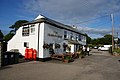
 The Falmouth Packet Inn - geograph.org.uk - 2509135.jpg 640 × 427; 60 KB
-
 The Falmouth Packet inn, Rosudgeon - geograph.org.uk - 4881202.jpg 1,600 × 1,200; 275 KB
-
 The Falmouth Packet, Rosudgeon - geograph.org.uk - 4240759.jpg 3,872 × 2,592; 1.53 MB
-
 The fine chimney of Tregurtha Engine House - geograph.org.uk - 5906256.jpg 4,896 × 3,672; 6.61 MB
-
 The fisherman's capstan - geograph.org.uk - 4719592.jpg 857 × 1,142; 535 KB
-
 The fishing lake - geograph.org.uk - 5546096.jpg 4,032 × 2,268; 4.5 MB
-
 Track from New Road to Higher Downs - geograph.org.uk - 5382047.jpg 4,000 × 3,000; 5.08 MB
-
-
 Tregurtha Downs from Plain-an-Gwarry - geograph.org.uk - 4384445.jpg 1,795 × 1,024; 718 KB
-
 Tregurtha Downs pumping engine house - geograph.org.uk - 5844524.jpg 480 × 640; 59 KB
-
 Trenalls House and Old Farmhouse - geograph.org.uk - 3215429.jpg 3,648 × 2,048; 1.44 MB
-
 View across a large field - geograph.org.uk - 2498478.jpg 640 × 427; 97 KB
-
 View across the field - geograph.org.uk - 2487523.jpg 640 × 427; 90 KB
-

-
 View from the bridleway to Woodstock - geograph.org.uk - 2498527.jpg 640 × 427; 90 KB
-
 View north from Cudden Point (7679).jpg 4,288 × 2,848; 6.2 MB
-

-
 Western Shag Rock - geograph.org.uk - 3189569.jpg 640 × 480; 88 KB
-

-
 Wheat fields at Tregilliowe Farm - geograph.org.uk - 4060998.jpg 3,872 × 2,592; 4.34 MB
-
 Where the bridleway meets the BOAT - geograph.org.uk - 5906698.jpg 4,896 × 3,672; 6.99 MB
-
 Woodland Byway to the south of North Treveneague - geograph.org.uk - 5384839.jpg 4,000 × 3,000; 4.21 MB
-
 Woodland Footpath from St Hilary to Trevabyn - geograph.org.uk - 5384826.jpg 4,000 × 3,000; 4.63 MB


.jpg)
.jpg)
.jpg)

.jpg)
.jpg)


.jpg)
.jpg)
.jpg)
.jpg)


.jpg)
.jpg)


_and_Bridge_at_Relubbus_-_geograph.org.uk_-_5384846.jpg)


.jpg)


_-_converted_engine_house_-_geograph.org.uk_-_5133826.jpg)


