Category:St Mary the Virgin's church, Gillingham, Dorset
Jump to navigation
Jump to search
| Object location | | View all coordinates using: OpenStreetMap |
|---|
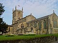
Grade I listed church in the United Kingdom  _(38747595680).jpg)  | |||||
| Upload media | |||||
| Instance of | |||||
|---|---|---|---|---|---|
| Dedicated to | |||||
| Location |
| ||||
| Diocese | |||||
| Has part(s) | |||||
| Heritage designation |
| ||||
| Inception |
| ||||
| Religion or worldview | |||||
| official website | |||||
 | |||||
This is a category about listed building number 1172499. |
Subcategories
This category has only the following subcategory.
S
Media in category "St Mary the Virgin's church, Gillingham, Dorset"
The following 26 files are in this category, out of 26 total.
-
 Detail, St Mary's Church - geograph.org.uk - 2304096.jpg 480 × 640; 90 KB
-
 Door, St Mary's Church - geograph.org.uk - 2304112.jpg 480 × 640; 86 KB
-

-
 Flush bracket 10046, St Mary's Church - geograph.org.uk - 2304140.jpg 481 × 640; 108 KB
-
 St. Mary the Virgin, Gillingham - geograph.org.uk - 6085.jpg 640 × 480; 155 KB
-
 Gillingham Church (St. Mary the Virgin) (25687354267).jpg 4,896 × 3,672; 7.83 MB
-
 Gillingham Church (St. Mary the Virgin) (38747601330).jpg 4,896 × 3,672; 7.5 MB
-
 Gillingham Church (St. Mary the Virgin) (40515377752).jpg 4,896 × 3,672; 6.18 MB
-

-
 Ordnance Survey Flush Bracket 10046 - geograph.org.uk - 3924875.jpg 4,000 × 3,000; 4.6 MB
-

-

-
 St Mary's Church Tower - geograph.org.uk - 630377.jpg 640 × 561; 63 KB
-
 St Mary's Church, Gillingham - geograph.org.uk - 2302088.jpg 640 × 480; 78 KB
-
 St Mary's Church, Gillingham - geograph.org.uk - 2304083.jpg 640 × 480; 97 KB
-

-
 St Mary, Gillingham, churchyard (1) - geograph.org.uk - 4523056.jpg 640 × 480; 130 KB
-
 St Mary, Gillingham, churchyard (2) - geograph.org.uk - 4523061.jpg 640 × 480; 88 KB
-
 St Mary, Gillingham, churchyard (3) - geograph.org.uk - 4523063.jpg 640 × 480; 115 KB
-
 St Mary, Gillingham, churchyard (4) - geograph.org.uk - 4523067.jpg 640 × 480; 102 KB
-
 St Mary, Gillingham, churchyard (5) - geograph.org.uk - 4523070.jpg 640 × 480; 112 KB
-
 St Mary, Gillingham, churchyard (6) - geograph.org.uk - 4523072.jpg 640 × 480; 88 KB
-
 St Mary, Gillingham, churchyard (6) - geograph.org.uk - 4523075.jpg 640 × 480; 109 KB
-
 St Mary, Gillingham, churchyard (7) - geograph.org.uk - 4523076.jpg 640 × 480; 111 KB
-
 St Mary, Gillingham, early June 2015 - geograph.org.uk - 4516185.jpg 640 × 480; 87 KB
-
 The Church of St Mary the Virgin at Gillingham - geograph.org.uk - 3924831.jpg 4,000 × 3,000; 2.08 MB


_(25687354267).jpg)
_(38747601330).jpg)
_(40515377752).jpg)


_-_geograph.org.uk_-_4523056.jpg)
_-_geograph.org.uk_-_4523061.jpg)
_-_geograph.org.uk_-_4523063.jpg)
_-_geograph.org.uk_-_4523067.jpg)
_-_geograph.org.uk_-_4523070.jpg)
_-_geograph.org.uk_-_4523072.jpg)
_-_geograph.org.uk_-_4523075.jpg)
_-_geograph.org.uk_-_4523076.jpg)

