Category:St Osyth
Aller à la navigation
Aller à la recherche
Article Wikipédia principal : St Osyth.

village britannique  | |||||
| Téléverser des médias | |||||
| Nature de l’élément | |||||
|---|---|---|---|---|---|
| Lieu | Tendring, Essex, Angleterre de l'Est, Angleterre | ||||
 | |||||
Sous-catégories
Cette catégorie comprend 15 sous-catégories, dont les 15 ci-dessous.
A
- St. Osyth's Abbey (24 F)
C
- Colne Point (10 F)
F
- Flag Inn, St Osyth (3 F)
H
- Howlands Marsh (4 F)
K
- The Kings Arms, St Osyth (2 F)
L
- Lee-over-Sands (17 F)
P
R
- The Red Lion, St Osyth (3 F)
- Riddles Wood (8 F)
- Row Heath (1 F)
S
- Seawick (12 F)
- St Clere's Hall, Tendring (1 F)
- St Osyth Pit (3 F)
Média dans la catégorie « St Osyth »
Cette catégorie comprend 373 fichiers, dont les 200 ci-dessous.
(page précédente) (page suivante)-
 A Beach View - geograph.org.uk - 2827935.jpg 1 600 × 1 200 ; 664 kio
-
 A Brightlingsea View - geograph.org.uk - 2827870.jpg 1 600 × 1 200 ; 238 kio
-
 A view of Gunfleet Sands - geograph.org.uk - 2181555.jpg 1 024 × 682 ; 127 kio
-
 A133 near Weeley Heath - geograph.org.uk - 4579249.jpg 640 × 480 ; 72 kio
-
 A133 towards Clacton - geograph.org.uk - 5384714.jpg 640 × 480 ; 58 kio
-
 A133 towards Colchester - geograph.org.uk - 2946325.jpg 640 × 452 ; 70 kio
-
 A133 towards Colchester - geograph.org.uk - 5384712.jpg 640 × 480 ; 60 kio
-
 A133 Weeley Bypass - geograph.org.uk - 3848006.jpg 640 × 480 ; 284 kio
-
 A133 westbound - geograph.org.uk - 4212267.jpg 640 × 480 ; 40 kio
-
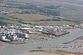 Aerial view of Brightlingsea - geograph.org.uk - 2156254.jpg 1 024 × 683 ; 211 kio
-
 Aerial view of part of Point Clear - geograph.org.uk - 2156282.jpg 1 024 × 682 ; 224 kio
-
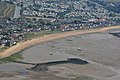
 Aerial view of the Saltmarsh - geograph.org.uk - 2156217.jpg 1 024 × 682 ; 206 kio
-
 B1027 towards Clacton-on-Sea - geograph.org.uk - 2943014.jpg 640 × 480 ; 76 kio
-
 B1027 towards Clacton-on-Sea - geograph.org.uk - 2943028.jpg 640 × 480 ; 74 kio
-
 B1027 towards Clacton-on-Sea - geograph.org.uk - 2943034.jpg 640 × 480 ; 91 kio
-
 B1027 towards Clacton-on-Sea - geograph.org.uk - 2944031.jpg 640 × 480 ; 64 kio
-
 B1027 towards Thorrington - geograph.org.uk - 2944011.jpg 640 × 480 ; 60 kio
-
 Batemans Tower ^ beach huts from across the water at Point Clear - geograph.org.uk - 6076246.jpg 1 200 × 1 600 ; 555 kio
-
 Beach at Colne Point Nature Reserve - geograph.org.uk - 2750566.jpg 4 000 × 3 000 ; 4,36 Mio
-
 Beach at mouth of River Colne, Colne Point Nature Reserve - geograph.org.uk - 2750565.jpg 4 000 × 3 000 ; 4,27 Mio
-
 Beach Road - geograph.org.uk - 2138912.jpg 1 024 × 768 ; 224 kio
-
 Beach Road - geograph.org.uk - 5442766.jpg 2 816 × 1 880 ; 681 kio
-
 Beach Road - geograph.org.uk - 5442772.jpg 2 742 × 1 815 ; 873 kio
-
 Beach Road, Lee-over-Sands - geograph.org.uk - 2750577.jpg 4 000 × 3 000 ; 3,93 Mio
-
 Beach Road, Lee-over-Sands - geograph.org.uk - 2750578.jpg 4 000 × 3 000 ; 3,89 Mio
-
 Beach Road, Seawick - geograph.org.uk - 5448818.jpg 4 608 × 3 456 ; 3,35 Mio
-
 Bel-Air Chalet Estate - geograph.org.uk - 5448886.jpg 4 608 × 3 456 ; 3,36 Mio
-
 Bel-Air Estate from the Sea Wall - geograph.org.uk - 5448856.jpg 4 608 × 3 456 ; 3,33 Mio
-
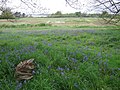
 Bluebells in Toft's Wood - geograph.org.uk - 2379824.jpg 428 × 640 ; 140 kio
-
 Borrow Dyke - geograph.org.uk - 5442786.jpg 2 748 × 1 821 ; 750 kio
-
 Borrow Dyke and Sea Wall - geograph.org.uk - 5442819.jpg 2 760 × 1 821 ; 873 kio
-
 Borrow Dyke and Sea Wall, Lee-over-Sands - geograph.org.uk - 5442822.jpg 2 724 × 1 761 ; 823 kio
-
 Borrow Dyke and Sewage Works - geograph.org.uk - 5442783.jpg 2 739 × 1 818 ; 725 kio
-
 Brackish Pond - geograph.org.uk - 5448834.jpg 4 608 × 3 456 ; 3,24 Mio
-
 Brackish Ponds - geograph.org.uk - 5448907.jpg 4 608 × 3 456 ; 3,27 Mio
-
 Bridge crossing Ray Creek at Colne Point Nature Reserve - geograph.org.uk - 2750572.jpg 4 000 × 3 000 ; 4,28 Mio
-
 Bridge over the A133 - geograph.org.uk - 2946320.jpg 640 × 480 ; 84 kio
-
 Brightlingsea and Point Clear - geograph.org.uk - 2114623.jpg 1 024 × 683 ; 244 kio
-

-
 Brightlingsea Reach, Foreshore near Point Clear Bay - geograph.org.uk - 6092431.jpg 1 024 × 764 ; 237 kio
-
 Brightlingsea Reach, Sea defence wall at Point Clear - geograph.org.uk - 6092425.jpg 1 024 × 768 ; 164 kio
-
 Bungalows, Point Clear - geograph.org.uk - 2029684.jpg 1 000 × 667 ; 172 kio
-
 Buoy at approach to Brightlingsea Harbour - geograph.org.uk - 5614211.jpg 640 × 428 ; 142 kio
-
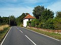
 Bus shelter east of St Osyth, on B1027 - geograph.org.uk - 5439619.jpg 1 600 × 1 197 ; 813 kio
-
 Bus stop and pull-off on B1027 west of Clacton-on-Sea - geograph.org.uk - 5439624.jpg 1 600 × 1 198 ; 585 kio
-
 Cafe, Seaview Terrace, Point Clear - geograph.org.uk - 2029699.jpg 1 000 × 667 ; 156 kio
-
 Car sales business and Gulf filling station, St Osyth - geograph.org.uk - 5439234.jpg 1 600 × 800 ; 542 kio
-
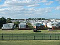
 Caravan Park Entrance - geograph.org.uk - 5448812.jpg 4 608 × 3 456 ; 3,18 Mio
-
 Caravan park near Clacton - geograph.org.uk - 4579424.jpg 640 × 480 ; 84 kio
-
 Caravan Site at Seawick - geograph.org.uk - 5448821.jpg 4 608 × 3 456 ; 3,19 Mio
-
 Caravan Site at Seawick - geograph.org.uk - 5448893.jpg 4 608 × 3 456 ; 3,28 Mio
-
 Caravans at Seawick - geograph.org.uk - 5069680.jpg 1 024 × 768 ; 129 kio
-
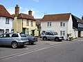 Church Square, St Osyth - geograph.org.uk - 476833.jpg 640 × 480 ; 85 kio
-
 Clacton Road, St Osyth - geograph.org.uk - 2944004.jpg 640 × 480 ; 53 kio
-
 Clacton Road, St. Osyth - geograph.org.uk - 4579388.jpg 640 × 480 ; 67 kio
-
 Clacton Road, St. Osyth - geograph.org.uk - 4579401.jpg 640 × 480 ; 78 kio
-
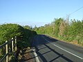 Clay Lane towards St Osyth - geograph.org.uk - 5384664.jpg 640 × 480 ; 75 kio
-
 Clay Lane, near St. Osyth - geograph.org.uk - 4579315.jpg 640 × 480 ; 98 kio
-
 Clay Lane, near St. Osyth - geograph.org.uk - 4579321.jpg 640 × 480 ; 110 kio
-
 Clay Lane, near St. Osyth - geograph.org.uk - 4579330.jpg 640 × 480 ; 101 kio
-
 Clay Lane, near St. Osyth - geograph.org.uk - 4579336.jpg 640 × 480 ; 100 kio
-
 Clay Lane, near St. Osyth - geograph.org.uk - 4579346.jpg 640 × 480 ; 100 kio
-
 Clay Lane, St Osyth Heath - geograph.org.uk - 5384654.jpg 640 × 480 ; 49 kio
-
 Close up, George V postbox on Heath Road, St Osyth Heath - geograph.org.uk - 5387376.jpg 1 429 × 1 925 ; 607 kio
-
 Cockett Wick Farm - geograph.org.uk - 5448772.jpg 4 608 × 3 456 ; 3,19 Mio
-
 Cockett Wick Lane - geograph.org.uk - 5448761.jpg 4 608 × 3 456 ; 3,48 Mio
-
 Colne Point Hide - geograph.org.uk - 218960.jpg 640 × 432 ; 133 kio
-
 Colne Point Landing Beach - geograph.org.uk - 219030.jpg 640 × 426 ; 138 kio
-
 Colne Point Nature Reserve - geograph.org.uk - 2156224.jpg 1 024 × 733 ; 199 kio
-
 Colne Point Nature Reserve - geograph.org.uk - 2186982.jpg 1 024 × 682 ; 155 kio
-
 Colne Point Nature Reserve - geograph.org.uk - 2187024.jpg 1 024 × 575 ; 88 kio
-
 Colne Point Nature Reserve - geograph.org.uk - 2187619.jpg 1 024 × 742 ; 147 kio
-
 Colne Point Nature Reserve - geograph.org.uk - 2187633.jpg 1 024 × 682 ; 122 kio
-
 Colne Point Nature Reserve - geograph.org.uk - 2187643.jpg 1 024 × 647 ; 157 kio
-
 Colne Point Nature Reserve - geograph.org.uk - 2187651.jpg 1 024 × 768 ; 204 kio
-
 Colne Point Nature Reserve - geograph.org.uk - 2187671.jpg 1 024 × 683 ; 130 kio
-
 Colne Point Nature Reserve - geograph.org.uk - 2187678.jpg 1 024 × 682 ; 125 kio
-
 Colne Point Nature Reserve - geograph.org.uk - 2187692.jpg 1 024 × 761 ; 172 kio
-
 Colne Point Nature Reserve - geograph.org.uk - 2187697.jpg 1 024 × 768 ; 142 kio
-
 Colne Point Nature Reserve - geograph.org.uk - 2187699.jpg 1 024 × 768 ; 72 kio
-
 Colne Point Nature Reserve - geograph.org.uk - 2187704.jpg 3 296 × 2 472 ; 1,81 Mio
-
 Colne Point Nature Reserve - geograph.org.uk - 2752341.jpg 2 000 × 1 500 ; 1 012 kio
-
 Colne Point Nature Reserve - geograph.org.uk - 2829708.jpg 1 600 × 1 200 ; 395 kio
-
 Colne Point Nature Reserve - geograph.org.uk - 5442799.jpg 2 757 × 1 806 ; 949 kio
-
 Colne Point Nature Reserve - geograph.org.uk - 735415.jpg 640 × 416 ; 209 kio
-
 Cottages near Woodlands Farm - geograph.org.uk - 5384699.jpg 640 × 480 ; 87 kio
-
 Cottages on Rectory Road - geograph.org.uk - 5384707.jpg 640 × 480 ; 57 kio
-
 Cowley Park, St Osyth - geograph.org.uk - 2146674.jpg 1 024 × 612 ; 133 kio
-

-
 Crop field off Clay Lane - geograph.org.uk - 5384660.jpg 640 × 480 ; 69 kio
-
 Crop field off Rectory Road - geograph.org.uk - 5384692.jpg 640 × 480 ; 71 kio
-
 Crop field off Wick Road - geograph.org.uk - 5384621.jpg 640 × 480 ; 79 kio
-
 Crop field towards Bush Wood - geograph.org.uk - 5384687.jpg 640 × 480 ; 72 kio
-
 Crop field, St Osyth Heath - geograph.org.uk - 5384680.jpg 640 × 451 ; 49 kio
-
 Crop Irrigation - geograph.org.uk - 5442679.jpg 2 816 × 1 880 ; 2,51 Mio
-
 Crossroads St.Osyth - geograph.org.uk - 1431967.jpg 640 × 480 ; 82 kio
-
 Curve Wake Park - geograph.org.uk - 5443508.jpg 2 816 × 1 880 ; 1,14 Mio
-
 Curve Wake Park - geograph.org.uk - 5443521.jpg 2 763 × 1 818 ; 842 kio
-
 Daltes Lane - geograph.org.uk - 5448801.jpg 4 608 × 3 456 ; 3,49 Mio
-
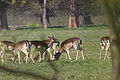 Deer park stosyth.JPG 3 504 × 2 336 ; 3,04 Mio
-
 Derelict Boats in St Osyth Creek - geograph.org.uk - 5443550.jpg 2 816 × 1 880 ; 2,54 Mio
-
 Derelict building on Beach Road, Lee-over-Sands - geograph.org.uk - 2750575.jpg 4 000 × 3 000 ; 4,05 Mio
-
 Deserted Beach - geograph.org.uk - 2185152.jpg 1 024 × 768 ; 259 kio
-
 Detail Of Finger Post - geograph.org.uk - 1431971.jpg 640 × 479 ; 80 kio
-
 Earls Hall Drive heading north - geograph.org.uk - 2944025.jpg 640 × 480 ; 112 kio
-
 Earls Hall Farm Wind Farm, from St Osyth allotments.JPG 5 568 × 2 688 ; 5,99 Mio
-
 Earls Hall Mast - geograph.org.uk - 538506.jpg 426 × 640 ; 73 kio
-
 Entrance road to Colne Point Nature Reserve - geograph.org.uk - 2751588.jpg 4 000 × 3 000 ; 2,42 Mio
-
 Entrance to Martin's Farm Country Park - geograph.org.uk - 2138952.jpg 1 024 × 735 ; 215 kio
-
 Essex Coast - geograph.org.uk - 2829701.jpg 1 600 × 1 200 ; 517 kio
-
 Farm Reservoir and Fishing Lake - geograph.org.uk - 5448793.jpg 4 608 × 3 456 ; 3,33 Mio
-
 Farm track near St. Osyth - geograph.org.uk - 4579360.jpg 640 × 480 ; 113 kio
-
 Farmland and bluebells off the B1027 - geograph.org.uk - 2943024.jpg 640 × 480 ; 123 kio
-
 Farmland near St Osyth - geograph.org.uk - 2943030.jpg 640 × 480 ; 63 kio
-
 Farmland off Bypass Road - geograph.org.uk - 2944009.jpg 640 × 480 ; 55 kio
-
 Farmland off the B1027 - geograph.org.uk - 2943010.jpg 640 × 480 ; 63 kio
-
 Farmland off the B1027 - geograph.org.uk - 2943020.jpg 640 × 480 ; 58 kio
-
 Farmland off the B1027 - geograph.org.uk - 2944017.jpg 640 × 480 ; 41 kio
-
 Farmland, Weeley Heath - geograph.org.uk - 2946327.jpg 640 × 480 ; 67 kio
-
 Field Drain, St Osyth Marsh - geograph.org.uk - 5442728.jpg 2 745 × 1 815 ; 1,06 Mio
-
 Field Drain, St Osyth Marsh - geograph.org.uk - 5442739.jpg 2 816 × 1 880 ; 2,84 Mio
-
 Field margin beside Bowshots Wood - geograph.org.uk - 5384633.jpg 640 × 480 ; 64 kio
-
 Field margin, St Osyth Heath - geograph.org.uk - 5384683.jpg 640 × 480 ; 68 kio
-
 Field, Bowshots - geograph.org.uk - 5384630.jpg 640 × 480 ; 32 kio
-
 Field, St Osyth Heath - geograph.org.uk - 5384649.jpg 640 × 480 ; 62 kio
-
 Flag Creek from Howlands Marsh, St Osyth - geograph.org.uk - 5856295.jpg 1 024 × 471 ; 180 kio
-
 Flag creek st osyth.jpg 3 090 × 2 187 ; 1,55 Mio
-
 Flag Hill (B1027) - geograph.org.uk - 2943008.jpg 640 × 480 ; 62 kio
-
 Flag Hill - geograph.org.uk - 2138900.jpg 1 024 × 750 ; 289 kio
-
 Footpath and track to Wellwick Farm - geograph.org.uk - 5439215.jpg 1 600 × 799 ; 475 kio
-
 Footpath on Wigboro Wick Farm - geograph.org.uk - 5442705.jpg 2 816 × 1 880 ; 2,54 Mio
-
 Footpath Past Tofts Wood - geograph.org.uk - 2379816.jpg 428 × 640 ; 96 kio
-
 Frowick Lane - geograph.org.uk - 5438901.jpg 1 600 × 639 ; 407 kio
-
 Frowick Lane, near St. Osyth - geograph.org.uk - 4579438.jpg 640 × 480 ; 46 kio
-
 Furrowed field near Coppice Farm - geograph.org.uk - 5384624.jpg 640 × 480 ; 61 kio
-
 George V postbox on Heath Road, St Osyth Heath - geograph.org.uk - 5387372.jpg 640 × 480 ; 144 kio
-
 Golf Course - geograph.org.uk - 2165458.jpg 1 024 × 714 ; 176 kio
-
 Golf Course - geograph.org.uk - 5443545.jpg 2 816 × 1 880 ; 2,32 Mio
-
 Grassland towards Stockets Grove - geograph.org.uk - 5384626.jpg 640 × 480 ; 48 kio
-
 Grassland, St Osyth Heath - geograph.org.uk - 5384651.jpg 640 × 480 ; 64 kio
-
 Grazing near College Farm - geograph.org.uk - 5384629.jpg 640 × 480 ; 57 kio
-
 Gunfleet Construction Vessel - geograph.org.uk - 2187703.jpg 1 024 × 665 ; 75 kio
-
 Hartley Wood - geograph.org.uk - 2165448.jpg 1 024 × 653 ; 146 kio
-
 Hartley Wood - geograph.org.uk - 5990616.jpg 1 024 × 684 ; 242 kio
-
 Hartleywood Farm, St. Osyth Heath - geograph.org.uk - 4579282.jpg 640 × 480 ; 67 kio
-
 Heath Road, St Osyth Heath - geograph.org.uk - 5387379.jpg 2 848 × 2 136 ; 1,43 Mio
-
 Hide at Howlands Marsh - geograph.org.uk - 6289929.jpg 4 608 × 3 456 ; 3,12 Mio
-
 High tide in Ray Creek - geograph.org.uk - 2111707.jpg 1 024 × 768 ; 98 kio
-
 High Tide, Colne Point Nature Reserve - geograph.org.uk - 2186950.jpg 1 024 × 682 ; 169 kio
-
 Highbirch Road - geograph.org.uk - 5384632.jpg 640 × 480 ; 158 kio
-
 Highbirch Road - geograph.org.uk - 5384635.jpg 640 × 480 ; 64 kio
-
 Holiday Park Signboards - geograph.org.uk - 5448816.jpg 4 608 × 3 456 ; 3,38 Mio
-
 House on Clay Lane - geograph.org.uk - 5384666.jpg 640 × 480 ; 44 kio
-
 House on Stilts, Lee-over-Sands - geograph.org.uk - 5442829.jpg 2 816 × 1 880 ; 1,94 Mio
-
 Houseboats on St Osyth Creek - geograph.org.uk - 5443537.jpg 2 816 × 1 880 ; 2,63 Mio
-
 Houses on Beach Road, Lee-Over-Sands - geograph.org.uk - 2751587.jpg 4 000 × 3 000 ; 2,35 Mio
-
 Hurst Green from Point Clear - geograph.org.uk - 2029713.jpg 1 000 × 667 ; 130 kio
-
 I've left my mark. - geograph.org.uk - 2827888.jpg 1 600 × 1 200 ; 746 kio
-
 Island at War - geograph.org.uk - 2715077.jpg 2 000 × 1 486 ; 1,57 Mio
-
 Jaywick Martello Tower - geograph.org.uk - 2152983.jpg 1 024 × 768 ; 145 kio
-
 Lane towards St Osyth Heath - geograph.org.uk - 2943016.jpg 640 × 480 ; 78 kio
-
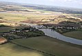
 Lee Over Sands from the air - geograph.org.uk - 3201370.jpg 640 × 480 ; 117 kio
-
 Lee Wick Farm - geograph.org.uk - 2124338.jpg 1 024 × 683 ; 161 kio
-
 Lee Wick Farm - geograph.org.uk - 2124339.jpg 1 024 × 670 ; 191 kio
-
 Lee Wick Lane - geograph.org.uk - 2138922.jpg 1 024 × 768 ; 249 kio
-
 Lee Wick Lane - geograph.org.uk - 2138929.jpg 1 024 × 768 ; 189 kio
-
 Lee Wick Sluice - geograph.org.uk - 5442806.jpg 2 816 × 1 880 ; 2,87 Mio
-
 Lee Wick Sluice and Sewage Works - geograph.org.uk - 5442813.jpg 2 816 × 1 880 ; 3,47 Mio
-
 Longfields, St. Osyth - geograph.org.uk - 4579395.jpg 640 × 480 ; 59 kio
-
 Looking north-northeast along Point Clear Road - geograph.org.uk - 3984954.jpg 1 044 × 783 ; 157 kio
-
 Looking south-southeast along Spring Road - geograph.org.uk - 3986651.jpg 1 011 × 758 ; 169 kio
-
 Looking southeast along the Eastern Promenade - geograph.org.uk - 3984936.jpg 1 010 × 737 ; 154 kio
-
 Looking west-southwest along Clacton Road - geograph.org.uk - 3986623.jpg 1 077 × 807 ; 156 kio
-
 Looking west-southwest along Mill Street - geograph.org.uk - 3984969.jpg 1 055 × 782 ; 173 kio
-
 Low Tide - geograph.org.uk - 2187702.jpg 1 024 × 768 ; 213 kio
-
 Low Tide - geograph.org.uk - 2827849.jpg 1 600 × 1 200 ; 199 kio
-
 Low tide in Ray Creek - geograph.org.uk - 2139150.jpg 1 024 × 739 ; 211 kio
-
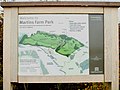 Map of Martin's Farm Country Park - geograph.org.uk - 2138950.jpg 3 296 × 2 472 ; 1,73 Mio
-
 Martin's Farm Country Park - geograph.org.uk - 2148391.jpg 1 024 × 664 ; 183 kio
-
 Mersea Island ^ Colne estuary from Point Clear - geograph.org.uk - 6125861.jpg 1 600 × 1 203 ; 517 kio
-
 Mill Dam Lake - geograph.org.uk - 2182699.jpg 1 024 × 688 ; 167 kio
-
 Mill Dam Lake - geograph.org.uk - 5442661.jpg 2 816 × 1 880 ; 953 kio
-
 Mill Dam Lake - geograph.org.uk - 5443527.jpg 2 816 × 1 880 ; 2,31 Mio
-
 Mill Dam Lake - geograph.org.uk - 755606.jpg 640 × 427 ; 252 kio
-
 Mill dam lake empty.jpg 3 504 × 2 336 ; 4,39 Mio
-
 Mill Dam Lake Inlet - geograph.org.uk - 5443514.jpg 2 816 × 1 880 ; 2,84 Mio
-
 Mill dam lake valve.jpg 2 336 × 3 504 ; 4,71 Mio
-
 Mill Dam Lake, 'Empty' - geograph.org.uk - 1069558.jpg 640 × 427 ; 64 kio
-
 Mill Dam Lake, St Osyth - geograph.org.uk - 2134086.jpg 1 024 × 683 ; 150 kio
-
 Mill Dam Lake, Valve - geograph.org.uk - 1069563.jpg 427 × 640 ; 73 kio
-
 Mill dam lake.jpg 3 504 × 2 336 ; 4,55 Mio
-
 Mill House, St Osyth - geograph.org.uk - 2688966.jpg 2 848 × 2 144 ; 1,54 Mio
-
 Moored boats at Low Tide - geograph.org.uk - 1036336.jpg 640 × 427 ; 84 kio
-
 Moorings at St Osyth Creek - geograph.org.uk - 2688910.jpg 2 848 × 2 144 ; 1,51 Mio
-
 Mud flats at Point Clear Bay - geograph.org.uk - 2695994.jpg 2 848 × 2 144 ; 1,52 Mio
-
 Natural High Tide - geograph.org.uk - 595236.jpg 640 × 427 ; 88 kio
-
 Nature Reserve - geograph.org.uk - 756736.jpg 640 × 427 ; 346 kio
-
 New Hedgerow - geograph.org.uk - 6289944.jpg 4 608 × 3 456 ; 1,96 Mio
-
 North Hide - geograph.org.uk - 2827131.jpg 1 600 × 1 200 ; 560 kio
-
 Norwood Lodge - geograph.org.uk - 2150054.jpg 1 024 × 682 ; 152 kio


_-_geograph.org.uk_-_2943008.jpg)


