Category:Stadel Mühlanger (Kinding)
Jump to navigation
Jump to search
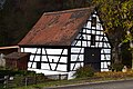
This is the category of the Bavarian Baudenkmal (cultural heritage monument) with the ID D-1-76-137-4 (Wikidata)
|
_01.jpg) | |||||
| Upload media | |||||
| Instance of | |||||
|---|---|---|---|---|---|
| Location | Kinding, Eichstätt, Upper Bavaria, Bavaria, Germany | ||||
| Street address |
| ||||
| Heritage designation | |||||
 | |||||
Media in category "Stadel Mühlanger (Kinding)"
The following 3 files are in this category, out of 3 total.
-
 Stadel Mühlanger (Kinding) 01.jpg 6,000 × 4,000; 6.34 MB
-
 Stadel Mühlanger (Kinding) 02.jpg 6,000 × 4,000; 6.1 MB
-
 Stadel Mühlanger (Kinding) 03.jpg 6,000 × 4,000; 6.33 MB
_02.jpg)
_03.jpg)