Category:Stambourne
Aller à la navigation
Aller à la recherche

village britannique  | |||||
| Téléverser des médias | |||||
| Nature de l’élément | |||||
|---|---|---|---|---|---|
| Lieu | Braintree, Essex, Angleterre de l'Est, Angleterre | ||||
 | |||||
Sous-catégories
Cette catégorie comprend 4 sous-catégories, dont les 4 ci-dessous.
Média dans la catégorie « Stambourne »
Cette catégorie comprend 87 fichiers, dont les 87 ci-dessous.
-
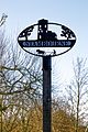 Stambourne village sign, Essex, England 01.jpg 2 330 × 3 500 ; 5,18 Mio
-
 Stambourne village sign, Essex, England 02.jpg 3 000 × 3 000 ; 5,07 Mio
-
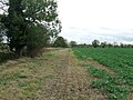
 Arable field boundary, Chappelend, Stambourne - geograph.org.uk - 4480993.jpg 3 648 × 2 736 ; 3,83 Mio
-
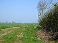
 Arable land near Rockall's Farm, Stambourne - geograph.org.uk - 4979068.jpg 3 648 × 2 432 ; 2,5 Mio
-
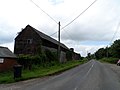
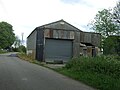 Barn on Cornish Hall End Road - geograph.org.uk - 5399187.jpg 640 × 480 ; 69 kio
-

-
 Birdbrook Road and Warren Farm - geograph.org.uk - 5342145.jpg 640 × 428 ; 95 kio
-
 Birdbrook Road at the junction of Cornish Hall End Road - geograph.org.uk - 5514158.jpg 2 304 × 1 728 ; 1,08 Mio
-
 Bridleway near Craig's End, Stambourne - geograph.org.uk - 4480887.jpg 3 648 × 2 736 ; 2,46 Mio
-
 Bridleway near Rockall's Farm, Stambourne - geograph.org.uk - 4979065.jpg 1 024 × 683 ; 455 kio
-
 Byway to Essex Hall - geograph.org.uk - 4003756.jpg 640 × 424 ; 65 kio
-
 Cereal crop near Hill Farm - geograph.org.uk - 5399236.jpg 640 × 480 ; 66 kio
-
 Chapel End Way, Stambourne - geograph.org.uk - 5399235.jpg 640 × 480 ; 79 kio
-
 Chapelend Way from the air - geograph.org.uk - 2962819.jpg 640 × 480 ; 109 kio
-
 Close up, Elizabeth II postbox on Chapel End Way - geograph.org.uk - 5401654.jpg 1 239 × 2 486 ; 630 kio
-
 Congregational Church Stambourne Essex - geograph.org.uk - 2186521.jpg 640 × 480 ; 95 kio
-
 Corner Of A Field - geograph.org.uk - 3275209.jpg 1 024 × 768 ; 279 kio
-
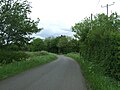 Cornish Hall End Road - geograph.org.uk - 5399183.jpg 640 × 480 ; 86 kio
-
 Cornish Hall End Road - geograph.org.uk - 5399190.jpg 640 × 480 ; 83 kio
-
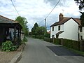 Cornish Hall End Road, Stambourne Green - geograph.org.uk - 5399196.jpg 640 × 480 ; 68 kio
-
 Country Road - geograph.org.uk - 3275225.jpg 1 024 × 768 ; 217 kio
-
 Crop field and hedgerow, Wesley End - geograph.org.uk - 5399239.jpg 640 × 480 ; 67 kio
-
 Deer In The Frost - geograph.org.uk - 3275192.jpg 1 024 × 768 ; 226 kio
-
 Elizabeth II postbox on Chapel End Way - geograph.org.uk - 5401653.jpg 640 × 480 ; 100 kio
-
 Elizabeth II postbox on Cornish Hall End Road - geograph.org.uk - 5401656.jpg 1 506 × 2 123 ; 781 kio
-
 Entering Stambourne - geograph.org.uk - 5399199.jpg 640 × 480 ; 72 kio
-
 Farm building, Green Farm - geograph.org.uk - 5399193.jpg 640 × 480 ; 56 kio
-
 Farm Machinery - geograph.org.uk - 3275203.jpg 1 024 × 768 ; 281 kio
-
 Farmland and hedgerow, Stambourne - geograph.org.uk - 5399231.jpg 640 × 480 ; 79 kio
-
 Field Boundary - geograph.org.uk - 5632451.jpg 1 024 × 769 ; 266 kio
-
 Field north of Elm's Farm - geograph.org.uk - 598929.jpg 640 × 387 ; 98 kio
-
 Footbridge - geograph.org.uk - 3275216.jpg 1 024 × 768 ; 266 kio
-
 Footpath - geograph.org.uk - 3275205.jpg 1 024 × 768 ; 374 kio
-
 Footpath And Track - geograph.org.uk - 5632445.jpg 1 024 × 768 ; 332 kio
-
 Footpath Junction - geograph.org.uk - 3275206.jpg 768 × 1 024 ; 314 kio
-
 Footpath on arable field boundary, Wesley End, Stambourne - geograph.org.uk - 4481003.jpg 3 648 × 2 736 ; 3,26 Mio
-
 Footpath on border of Oilseed Rape field nr Levitts Farm, Stambourne - geograph.org.uk - 4480880.jpg 3 648 × 2 736 ; 3,46 Mio
-
 Footpath Sign and Country Road - geograph.org.uk - 3275227.jpg 1 024 × 768 ; 288 kio
-
 Footpath through arable land, south of Chappelend, Stambourne - geograph.org.uk - 4480988.jpg 3 648 × 2 736 ; 2,85 Mio
-
 Footpath to Finchingfield Road - geograph.org.uk - 4490726.jpg 424 × 640 ; 56 kio
-
 Footpath to Stambourne Green - geograph.org.uk - 5341864.jpg 640 × 480 ; 127 kio
-
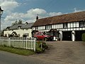
 Formerly the Red Lion, Stambourne - geograph.org.uk - 5343871.jpg 640 × 428 ; 103 kio
-
 Frosty Trees And Hedge - geograph.org.uk - 3275194.jpg 768 × 1 024 ; 358 kio
-
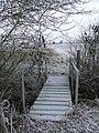 Frozen Footbridge - geograph.org.uk - 3275190.jpg 768 × 1 024 ; 390 kio
-
 Frozen Hedge - geograph.org.uk - 3275211.jpg 1 024 × 768 ; 297 kio
-
 Frozen Hedge - geograph.org.uk - 3275661.jpg 1 024 × 768 ; 341 kio
-
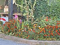 Garden outside Moat Hill Farm Shop - geograph.org.uk - 5514160.jpg 2 304 × 1 728 ; 1,56 Mio
-
 Grassland off Chapel End Way, Stambourne - geograph.org.uk - 5399232.jpg 640 × 480 ; 76 kio
-
 Great Tagley Farm - geograph.org.uk - 4004892.jpg 4 320 × 3 240 ; 3,44 Mio
-
 House At Stambourne Green - geograph.org.uk - 5632439.jpg 1 024 × 768 ; 222 kio
-
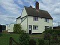
 House on Cornish Hall End Road - geograph.org.uk - 5401657.jpg 2 848 × 2 136 ; 1,46 Mio
-
 House, Slough Farm - geograph.org.uk - 5342141.jpg 640 × 480 ; 125 kio
-
 Houses, Wesley End - geograph.org.uk - 5399238.jpg 640 × 480 ; 68 kio
-
 Just The Fireplace - geograph.org.uk - 3275233.jpg 1 024 × 768 ; 253 kio
-
 Looking SE towards Robin Hood Farm - geograph.org.uk - 552934.jpg 640 × 426 ; 110 kio
-
 Mill Road - geograph.org.uk - 5399237.jpg 640 × 444 ; 60 kio
-
 Near Nortons - geograph.org.uk - 4355851.jpg 4 320 × 3 240 ; 4,91 Mio
-
 Old Barn by Pettyfield Wood - geograph.org.uk - 4003750.jpg 640 × 424 ; 78 kio
-
 Picnic table, Stambourne - geograph.org.uk - 5341870.jpg 640 × 480 ; 178 kio
-
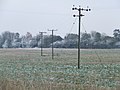 Power Lines - geograph.org.uk - 3275219.jpg 1 024 × 768 ; 196 kio
-
 Public Footpath - geograph.org.uk - 3275197.jpg 1 024 × 768 ; 268 kio
-
 Robin Hood Cottage - geograph.org.uk - 4004876.jpg 4 320 × 3 240 ; 2,93 Mio
-
 Robinhood Farm - geograph.org.uk - 4004858.jpg 4 320 × 3 240 ; 2,96 Mio
-
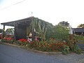 Shop outside Moat Hill Farm, Stambourne Green - geograph.org.uk - 5514159.jpg 2 304 × 1 728 ; 1,17 Mio
-
 Stambourne church - geograph.org.uk - 5341867.jpg 640 × 428 ; 109 kio
-
 Stambourne Road - geograph.org.uk - 5399240.jpg 640 × 480 ; 74 kio
-
 Stile and Signpost, Dyer's End, Stambourne - geograph.org.uk - 4480899.jpg 3 648 × 2 736 ; 3,38 Mio
-
 Telephone box on Chapel End Way - geograph.org.uk - 5401655.jpg 2 848 × 2 136 ; 1,42 Mio
-
 Thatched cottage, Green Farm - geograph.org.uk - 5399195.jpg 640 × 480 ; 73 kio
-
 The Lilacs - geograph.org.uk - 5399184.jpg 640 × 480 ; 99 kio
-
 Towards Craig's End - geograph.org.uk - 4490716.jpg 640 × 424 ; 67 kio
-
 Towards Tagley Wood - geograph.org.uk - 4490709.jpg 640 × 424 ; 71 kio
-
 Track to Rockall's Farm - geograph.org.uk - 5342130.jpg 640 × 480 ; 212 kio
-
 Tractor track in arable field near Great Tagley Farm, Stambourne - geograph.org.uk - 4480892.jpg 3 648 × 2 736 ; 2,66 Mio
-
 Trees on arable field boundary near Hill Farm, Stambourne - geograph.org.uk - 4480998.jpg 2 639 × 1 484 ; 1,2 Mio
-
 Village Hall, Stanbourne - geograph.org.uk - 4004973.jpg 4 320 × 3 240 ; 3,31 Mio
-
 Wesley End Road - geograph.org.uk - 5341875.jpg 640 × 480 ; 97 kio
-
 WWII pillbox - geograph.org.uk - 4004912.jpg 4 320 × 3 240 ; 6,55 Mio
-
 Young crop field near Nortons - geograph.org.uk - 5399182.jpg 640 × 480 ; 66 kio
-
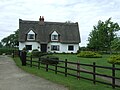
 Cottages at Stambourne Green, Essex - geograph.org.uk - 166827.jpg 640 × 480 ; 71 kio
-

-
 Farmhouse at Hill Farm - geograph.org.uk - 269956.jpg 640 × 480 ; 96 kio
-
 Farmhouse at Robin Hood Farm - geograph.org.uk - 270179.jpg 640 × 480 ; 74 kio
-
 House near Chapelend way - geograph.org.uk - 552842.jpg 640 × 426 ; 59 kio
-
 Nortons Farm, near Stambourne Green, Essex - geograph.org.uk - 166803.jpg 640 × 453 ; 83 kio
-
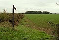 Public Footpath - geograph.org.uk - 270074.jpg 640 × 445 ; 69 kio
-
 Road to Chapelend Way - geograph.org.uk - 552851.jpg 640 × 426 ; 48 kio


