Category:Stamfordham
Aller à la navigation
Aller à la recherche
village britannique ABirdsEyeView_PicA.jpg) | |||||
| Téléverser des médias | |||||
| Nature de l’élément | |||||
|---|---|---|---|---|---|
| Lieu | Northumberland, Angleterre du Nord-Est, Angleterre | ||||
| Population |
| ||||
| site officiel | |||||
 | |||||
English: Stamfordham is a village in Northumberland. It is located about 5 miles to the west of Ponteland.
Sous-catégories
Cette catégorie comprend 10 sous-catégories, dont les 10 ci-dessous.
B
C
- Cheeseburn Grange (3 F)
D
E
H
- Hawkwell, Northumberland (6 F)
- Heugh (6 F)
O
- RAF Ouston (4 F)
- Ouston, Stamfordham (3 F)
S
- St Mary's Church, Stamfordham (22 F)
Média dans la catégorie « Stamfordham »
Cette catégorie comprend 501 fichiers, dont les 200 ci-dessous.
(page précédente) (page suivante)-
 "Amarylla Guerilla" (1) - geograph.org.uk - 5784481.jpg 640 × 480 ; 337 kio
-
 "Amarylla Guerilla" (2) - geograph.org.uk - 5784484.jpg 640 × 480 ; 349 kio
-
 "Anyone there", Cheeseburn Sculpture Exhibition - geograph.org.uk - 4971472.jpg 480 × 640 ; 328 kio
-
 "Bottle, Books, Hat" - geograph.org.uk - 5784395.jpg 640 × 480 ; 242 kio
-

-

-
 "Garden P's" - geograph.org.uk - 5784737.jpg 640 × 480 ; 349 kio
-
 "In Each Phase I" - geograph.org.uk - 5784387.jpg 480 × 640 ; 356 kio
-
 "In Each Phase II" (1) - geograph.org.uk - 5784373.jpg 640 × 480 ; 317 kio
-
 "In Each Phase II" (2) - geograph.org.uk - 5784377.jpg 640 × 480 ; 339 kio
-
 "Juggernaut" - geograph.org.uk - 5784419.jpg 640 × 480 ; 339 kio
-
 "Oak Table" - geograph.org.uk - 5784399.jpg 640 × 480 ; 273 kio
-

-

-

-
 "Orbit 1", Cheeseburn Sculpture Exhibition - geograph.org.uk - 4971483.jpg 480 × 640 ; 314 kio
-
 "Parcel" at Cheeseburn Sculpture Exhibition - geograph.org.uk - 4971459.jpg 480 × 640 ; 386 kio
-
 "Pear", Cheeseburn Sculpture Exhibition - geograph.org.uk - 4971497.jpg 480 × 640 ; 355 kio
-

-
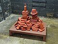
 "Pyramid" at Cheeseburn Sculpture Exhibition - geograph.org.uk - 4971456.jpg 480 × 640 ; 374 kio
-

-
 "SKP1 Stealth" and "SKP2 Stealth" - geograph.org.uk - 5784426.jpg 640 × 480 ; 376 kio
-
 "Stele" at Cheeseburn Sculpture Exhibition - geograph.org.uk - 4971453.jpg 480 × 640 ; 369 kio
-
 'The Church on the Green', Grange Road, Stamfordham - geograph.org.uk - 2783072.jpg 1 024 × 641 ; 186 kio
-

-
 13 ^ 14 The Green, Stamfordham - geograph.org.uk - 2783302.jpg 1 024 × 768 ; 302 kio
-
 Abandoned car near Eachwick House - geograph.org.uk - 5601807.jpg 1 024 × 769 ; 401 kio
-
 Access to Coldside - geograph.org.uk - 4014218.jpg 640 × 480 ; 65 kio
-
 Albermarle Barracks - geograph.org.uk - 2194394.jpg 3 114 × 1 722 ; 1,1 Mio
-
 Approaching Eppies Hill - geograph.org.uk - 1027897.jpg 640 × 480 ; 110 kio
-
 Approaching Stamfordham - geograph.org.uk - 4462085.jpg 640 × 480 ; 58 kio
-
 Aqueduct east of Whittle Dene Water Treatment Works - geograph.org.uk - 2798578.jpg 1 024 × 768 ; 243 kio
-
 Arable field at Eachwick House - geograph.org.uk - 5790984.jpg 2 000 × 1 333 ; 549 kio
-
 Arable field beside Eachwick Moor - geograph.org.uk - 5791021.jpg 2 000 × 1 333 ; 635 kio
-
 Arable field south of Eachwick Moor - geograph.org.uk - 5791034.jpg 2 000 × 1 333 ; 465 kio
-
 Arable land near Black Heddon - geograph.org.uk - 4989265.jpg 1 024 × 768 ; 350 kio
-
 Arable land near Kyloe House - geograph.org.uk - 5785731.jpg 2 000 × 1 333 ; 587 kio
-
 Arable land, Stamfordham - geograph.org.uk - 4868024.jpg 1 024 × 699 ; 338 kio
-
 B6309 at Blackheddon Bridge - geograph.org.uk - 3023550.jpg 640 × 480 ; 156 kio
-
 B6309 at Heugh - geograph.org.uk - 3023553.jpg 640 × 479 ; 132 kio
-
 B6309 heading east - geograph.org.uk - 3431810.jpg 640 × 480 ; 90 kio
-
 B6309 heading east - geograph.org.uk - 3432479.jpg 640 × 480 ; 104 kio
-
 B6309 heading north east - geograph.org.uk - 4462107.jpg 640 × 480 ; 73 kio
-
 B6309 heading south - geograph.org.uk - 3432487.jpg 640 × 480 ; 93 kio
-
 B6309 heading west at Dodley - geograph.org.uk - 3432482.jpg 640 × 480 ; 83 kio
-
 B6309, Black Heddon - geograph.org.uk - 4989261.jpg 1 024 × 768 ; 530 kio
-
 B6309, Hawkwell - geograph.org.uk - 4462099.jpg 640 × 480 ; 69 kio
-
 B6309, Stamfordham - geograph.org.uk - 4868025.jpg 1 024 × 768 ; 391 kio
-
 B6318 heading east - geograph.org.uk - 3432502.jpg 640 × 480 ; 70 kio
-
 B6318 heading east - geograph.org.uk - 3432509.jpg 640 × 480 ; 62 kio
-
 Barclays Bank^ Stamfordham - geograph.org.uk - 3024785.jpg 480 × 640 ; 60 kio
-
 Barn at Sweet Hill - geograph.org.uk - 2801135.jpg 1 024 × 769 ; 318 kio
-
 Beech wood with snowdrops - geograph.org.uk - 3854990.jpg 480 × 640 ; 151 kio
-
 Bend in the road near Kyloe House - geograph.org.uk - 4461128.jpg 640 × 480 ; 94 kio
-
 Bend in the road through Eachwick - geograph.org.uk - 5785688.jpg 2 000 × 1 333 ; 649 kio
-
 Bird hide ^ picnic tables, Whittle Dene Reservoir - geograph.org.uk - 2787656.jpg 1 024 × 768 ; 184 kio
-
 Bridge End, Stamfordham - geograph.org.uk - 2231952.jpg 640 × 480 ; 70 kio
-
 Bridge End, Stamfordham from the east - geograph.org.uk - 2782928.jpg 1 024 × 769 ; 217 kio
-
 Bridge End, Stamfordham from the south - geograph.org.uk - 2800746.jpg 1 024 × 642 ; 215 kio
-
 Bridge over Whittle Dene Watercourse - geograph.org.uk - 2259354.jpg 1 600 × 1 088 ; 1,97 Mio
-
 Bridges over How Burn west of St Mary's Church - geograph.org.uk - 2784772.jpg 1 024 × 769 ; 349 kio
-
 Bridges over How Burn west of St Mary's Church - geograph.org.uk - 2790997.jpg 1 024 × 768 ; 425 kio
-
 Brixter Hill Farm, Stamfordham - geograph.org.uk - 905306.jpg 640 × 480 ; 103 kio
-
 Bugle (Ajuga reptans) by Hadrian's Wall Path - geograph.org.uk - 5413190.jpg 768 × 1 024 ; 348 kio
-
 Butter Cross, Stamfordham - geograph.org.uk - 5965028.jpg 4 320 × 3 240 ; 1,59 Mio
-
 Byway to Harlow Hill - geograph.org.uk - 2099296.jpg 600 × 450 ; 345 kio
-
 Can spring be far behind^ - geograph.org.uk - 3855573.jpg 480 × 640 ; 152 kio
-
 Cheeseburn Grange - geograph.org.uk - 4445637.jpg 640 × 480 ; 86 kio
-
 Cheeseburn Grange, Stamfordham - geograph.org.uk - 4206350.jpg 640 × 480 ; 365 kio
-
 Cheeseburn Grange, Stamfordham - the Chapel - geograph.org.uk - 4206344.jpg 480 × 640 ; 105 kio
-

-
 Church House, The Green, Stamfordham - geograph.org.uk - 2783319.jpg 1 024 × 768 ; 229 kio
-
 Compound formed from old rocket pods, west of RAF Ouston - geograph.org.uk - 2800228.jpg 1 024 × 769 ; 309 kio
-
 Converted buildings at Leager House - geograph.org.uk - 5601831.jpg 1 024 × 768 ; 240 kio
-
 Converted outbuildings at Richmond Hill - geograph.org.uk - 2800692.jpg 1 024 × 768 ; 297 kio
-
 Corner of field - waterlogged - geograph.org.uk - 2259374.jpg 1 600 × 1 086 ; 1,94 Mio
-
 Corner of the garden, Cheeseburn Grange - geograph.org.uk - 4206353.jpg 640 × 480 ; 527 kio
-
 Cottages, Bridge End - geograph.org.uk - 4462101.jpg 640 × 480 ; 49 kio
-
 Cottages, Stamfordham - geograph.org.uk - 4462104.jpg 640 × 480 ; 66 kio
-
 Country Road - geograph.org.uk - 4012333.jpg 640 × 480 ; 55 kio
-
 Croft House, No 4 The Green, Stamfordham - geograph.org.uk - 2782984.jpg 1 024 × 769 ; 257 kio
-
 Crop field and power lines - geograph.org.uk - 4423255.jpg 640 × 480 ; 45 kio
-
 Crop field beside Hillhead Plantation - geograph.org.uk - 4423267.jpg 640 × 480 ; 67 kio
-
 Crop field between Harlow Hill and Whittle Dene - geograph.org.uk - 6235305.jpg 4 608 × 3 456 ; 5,5 Mio
-
 Crop field near Apperley House - geograph.org.uk - 4423312.jpg 640 × 480 ; 72 kio
-
 Crop field near Dyke House - geograph.org.uk - 4423289.jpg 640 × 480 ; 91 kio
-
 Crop field near Eachwick - geograph.org.uk - 4461125.jpg 640 × 480 ; 75 kio
-
 Crop field near Hillhead Plantation - geograph.org.uk - 4423272.jpg 640 × 480 ; 45 kio
-
 Crop field near the Plough Inn - geograph.org.uk - 4461132.jpg 640 × 480 ; 64 kio
-
 Crop field towards Hilltop Plantations - geograph.org.uk - 4462058.jpg 640 × 480 ; 43 kio
-
 Cross House, Stamfordham - geograph.org.uk - 5965023.jpg 4 320 × 3 240 ; 1,66 Mio
-
 Crossroads at Eachwick Lodge - geograph.org.uk - 2232574.jpg 640 × 480 ; 107 kio
-
 Cyclist on the Reivers Cycle Route - geograph.org.uk - 2270509.jpg 640 × 480 ; 99 kio
-
 Dalton Hillhead Farm - geograph.org.uk - 905324.jpg 640 × 480 ; 85 kio
-
 Dalton House and Dalton Farm - geograph.org.uk - 1183215.jpg 640 × 480 ; 84 kio
-
 Dalton Sike - geograph.org.uk - 1182656.jpg 640 × 480 ; 108 kio
-
 Dalton Sike - geograph.org.uk - 1182741.jpg 480 × 640 ; 123 kio
-
 Dark Lane near Sweet Hill - geograph.org.uk - 2801118.jpg 1 024 × 769 ; 381 kio
-
 Deep ridge and furrow north of Dalton - geograph.org.uk - 1182986.jpg 640 × 360 ; 55 kio
-
 Derelict gin-gang at rear of Nesbitt Hill Head - geograph.org.uk - 2800169.jpg 1 024 × 769 ; 259 kio
-
 Direction Sign – Signpost - geograph.org.uk - 6527320.jpg 2 304 × 3 072 ; 4,11 Mio
-
 Direction Sign – Signpost - geograph.org.uk - 6527323.jpg 2 304 × 3 072 ; 3,73 Mio
-
 Direction Sign – Signpost - geograph.org.uk - 6527325.jpg 2 072 × 2 763 ; 1,82 Mio
-
 Dissington Park - geograph.org.uk - 5785670.jpg 2 000 × 1 333 ; 463 kio
-
 Disused lime kiln, Oaten Bank - geograph.org.uk - 2799478.jpg 1 024 × 769 ; 307 kio
-
 Disused lime kiln, Oaten Bank - geograph.org.uk - 2799488.jpg 1 024 × 641 ; 246 kio
-
 Disused Ouston Airfield from the west - geograph.org.uk - 2800212.jpg 1 024 × 769 ; 246 kio
-
 Disused Quarry near Harlow Hill - geograph.org.uk - 2099303.jpg 600 × 450 ; 250 kio
-
 Ditch beside Medburn Plantations - geograph.org.uk - 4462050.jpg 640 × 480 ; 96 kio
-
 Dodley - geograph.org.uk - 2194503.jpg 3 888 × 2 188 ; 1,25 Mio
-
 Drive to Hawkwell Grange - geograph.org.uk - 2800766.jpg 1 024 × 769 ; 267 kio
-
 Eachwick - geograph.org.uk - 4868330.jpg 1 024 × 768 ; 322 kio
-
 Eachwick Bridge - geograph.org.uk - 5785661.jpg 2 000 × 1 333 ; 522 kio
-
 Eachwick House - geograph.org.uk - 5601796.jpg 1 024 × 768 ; 239 kio
-
 Eachwick Lodge - geograph.org.uk - 2142152.jpg 1 824 × 1 216 ; 803 kio
-
 Eachwick South Houses - geograph.org.uk - 5601784.jpg 1 024 × 768 ; 238 kio
-
 Eachwick South Houses - geograph.org.uk - 5601788.jpg 1 024 × 768 ; 172 kio
-
 East end of North Side, Stamfordham - geograph.org.uk - 2782958.jpg 1 024 × 641 ; 215 kio
-
 East end of Stamfordham Green - geograph.org.uk - 2782998.jpg 993 × 620 ; 239 kio
-
 Edge of Hillhead Plantation - geograph.org.uk - 2270511.jpg 640 × 480 ; 102 kio
-
 Electricity pylons east of Dalton Hillhead - geograph.org.uk - 1182774.jpg 480 × 640 ; 58 kio
-
 End On - geograph.org.uk - 5601826.jpg 1 024 × 768 ; 238 kio
-
 Entering Stamfordham - geograph.org.uk - 4462086.jpg 640 × 480 ; 54 kio
-
 Entrance to Cheeseburn Grange - geograph.org.uk - 4971449.jpg 640 × 480 ; 368 kio
-
 Erosion control on Hadrian's Wall National Trail - geograph.org.uk - 1027879.jpg 640 × 480 ; 121 kio
-

-

-
 Farm buildings, Eachwick House - geograph.org.uk - 5601803.jpg 1 024 × 768 ; 225 kio
-
 Farmland and woodland west of Whitchester - geograph.org.uk - 2601492.jpg 640 × 480 ; 67 kio
-
 Farmland below Standwell - geograph.org.uk - 2601480.jpg 640 × 480 ; 85 kio
-
 Farmland east of Harlow Hill - geograph.org.uk - 2602441.jpg 640 × 480 ; 102 kio
-
 Farmland near Coldside - geograph.org.uk - 3431798.jpg 640 × 480 ; 68 kio
-
 Farmland near Eachwick Red House - geograph.org.uk - 4445526.jpg 640 × 480 ; 69 kio
-
 Farmland near End On - geograph.org.uk - 5601823.jpg 1 024 × 768 ; 228 kio
-
 Farmland near Harlow Hill - geograph.org.uk - 3432506.jpg 640 × 480 ; 60 kio
-
 Farmland near Harlow Hill - geograph.org.uk - 3432511.jpg 640 × 480 ; 64 kio
-
 Farmland near Ouston - geograph.org.uk - 3431817.jpg 640 × 480 ; 69 kio
-
 Farmland north of Kiln House - geograph.org.uk - 3431806.jpg 640 × 480 ; 85 kio
-

-

-
 Farmland south of Harlow Hill - geograph.org.uk - 2601466.jpg 640 × 480 ; 90 kio
-
 Farmland south of Harlow Hill - geograph.org.uk - 2602450.jpg 640 × 480 ; 100 kio
-
 Farmland towards Chapel Farm - geograph.org.uk - 4445653.jpg 640 × 399 ; 29 kio
-
 Farmland towards Crag Plantation - geograph.org.uk - 3432500.jpg 640 × 480 ; 79 kio
-
 Farmland towards Fox Covert - geograph.org.uk - 3432486.jpg 640 × 480 ; 58 kio
-
 Farmland towards Ouston Moor - geograph.org.uk - 3431811.jpg 640 × 480 ; 72 kio
-
 Farmland towards Square Plantation - geograph.org.uk - 4462054.jpg 640 × 480 ; 54 kio
-
 Farmland west of Whitchester - geograph.org.uk - 2601489.jpg 640 × 480 ; 61 kio
-
 Farmland, Dodley - geograph.org.uk - 3432481.jpg 640 × 480 ; 74 kio
-
 Farmland, Oatens Bank - geograph.org.uk - 3432513.jpg 640 × 480 ; 64 kio
-
 Field and line of trees near Stamfordham - geograph.org.uk - 3854981.jpg 640 × 480 ; 121 kio
-
 Field and Pont valley east of Stamfordham - geograph.org.uk - 2782919.jpg 1 024 × 768 ; 228 kio
-
 Field Beans near Harlow Hill - geograph.org.uk - 4664427.jpg 1 024 × 768 ; 235 kio
-
 Field entrance near Hillhead Plantation - geograph.org.uk - 3854998.jpg 640 × 480 ; 102 kio
-
 Field entrance off National Cycle Route 10 - geograph.org.uk - 4423282.jpg 640 × 480 ; 100 kio
-
 Field entrance off the B6309 - geograph.org.uk - 4445649.jpg 640 × 480 ; 83 kio
-
 Field gate near End On - geograph.org.uk - 5601825.jpg 1 024 × 769 ; 319 kio
-
 Field pond, Ouston - geograph.org.uk - 2800604.jpg 1 024 × 768 ; 345 kio
-
 Field, Silverhill - geograph.org.uk - 4867979.jpg 1 024 × 768 ; 380 kio
-
 Field, Stamfordham - geograph.org.uk - 4868262.jpg 1 024 × 768 ; 271 kio
-
 Fields and winter trees north of Nesbitt Hill Head - geograph.org.uk - 2800197.jpg 1 024 × 642 ; 224 kio
-
 Fields below Standwell Farm - geograph.org.uk - 3496417.jpg 2 592 × 1 944 ; 1,99 Mio
-
 Fields near Whitchester - geograph.org.uk - 3496412.jpg 2 592 × 1 944 ; 2,18 Mio
-
 Fingerpost near Stamfordham - geograph.org.uk - 4868272.jpg 1 024 × 768 ; 504 kio
-
 Footbridge crossing the Swarden Burn - geograph.org.uk - 5785613.jpg 2 000 × 1 333 ; 937 kio
-
 Footbridge over River Pont - geograph.org.uk - 2784759.jpg 1 024 × 768 ; 321 kio
-
 Footpath across barley fields - geograph.org.uk - 508641.jpg 640 × 480 ; 78 kio
-
 Footpath behind the Plough Inn - geograph.org.uk - 5601817.jpg 1 024 × 768 ; 162 kio
-
 Footpath near Eachwick South Houses - geograph.org.uk - 5601780.jpg 1 024 × 768 ; 261 kio
-
 Footpath through Farmland - geograph.org.uk - 6140666.jpg 5 184 × 3 888 ; 587 kio
-
 Footpath through fields near Hawkwell Grange - geograph.org.uk - 2800741.jpg 1 024 × 768 ; 320 kio
-
 Footpath to Eachwick Red House - geograph.org.uk - 4445535.jpg 640 × 480 ; 83 kio
-
 Footpath to Stamfordham from Dark Lane - geograph.org.uk - 2801150.jpg 1 024 × 769 ; 331 kio
-
 Footpath west of Eachwick House - geograph.org.uk - 5601812.jpg 1 024 × 768 ; 303 kio
-
 Former chapel on Northside, Stamfordham - geograph.org.uk - 3023570.jpg 640 × 480 ; 136 kio
-
 Former RAF Ouston from the air - geograph.org.uk - 6051721.jpg 1 024 × 768 ; 257 kio
-
 Gas Valve Compound (GVC) near Westerheugh - geograph.org.uk - 1184429.jpg 640 × 480 ; 99 kio
-
 Gateway near Stamfordham - geograph.org.uk - 2211030.jpg 640 × 350 ; 163 kio
-
 Gateway to Hawkwell Grange - geograph.org.uk - 4462097.jpg 640 × 480 ; 91 kio
-
 Gilchesters - geograph.org.uk - 2801174.jpg 1 024 × 768 ; 292 kio
-
 Gilchesters - geograph.org.uk - 2801183.jpg 1 024 × 641 ; 217 kio
-
 Gilchesters - geograph.org.uk - 2801209.jpg 1 024 × 640 ; 249 kio
-
 Glass sculptures in the parterre garden - geograph.org.uk - 5784732.jpg 640 × 480 ; 411 kio
-
 Grange Road, Stamfordham - geograph.org.uk - 4868250.jpg 640 × 480 ; 68 kio
-
 Grassland at Eachwick Red House - geograph.org.uk - 5785716.jpg 2 000 × 1 333 ; 428 kio
-
 Grazing near Med Burn - geograph.org.uk - 4445582.jpg 640 × 480 ; 83 kio
-
 Grazing near Stamfordham - geograph.org.uk - 4462111.jpg 640 × 480 ; 68 kio
-
 Grazing near Stob Hill - geograph.org.uk - 4462065.jpg 640 × 480 ; 54 kio
-
 Grazing, Meadows - geograph.org.uk - 4445759.jpg 640 × 480 ; 53 kio
-
 Grazing, Silverhill - geograph.org.uk - 4423243.jpg 640 × 480 ; 69 kio
-
 Grazing, Stob Hill - geograph.org.uk - 4445623.jpg 640 × 480 ; 52 kio
-
 Great Northern Reservoir, Whittle Dene - geograph.org.uk - 2800036.jpg 1 024 × 641 ; 190 kio
-
 Green lane west of Bygate - geograph.org.uk - 1191188.jpg 640 × 480 ; 109 kio
-
 Grown out hedge, Stob Hill - geograph.org.uk - 4868298.jpg 1 024 × 768 ; 479 kio
-

-
 Hadrian's Wall Path - geograph.org.uk - 4111940.jpg 3 456 × 4 608 ; 6,44 Mio
-
 Hadrian's Wall Path east of Harlow Hill - geograph.org.uk - 4664408.jpg 1 024 × 768 ; 381 kio
-
 Hadrian's Wall Path near Albemarle - geograph.org.uk - 4664415.jpg 1 024 × 770 ; 172 kio
-
 Hadrian's Wall Path near Milecastle 15 - geograph.org.uk - 5287771.jpg 1 024 × 766 ; 331 kio
-
 Hadrian's Wall Path towards Eppies Hill - geograph.org.uk - 4664412.jpg 1 024 × 642 ; 241 kio
_-_geograph.org.uk_-_5784481.jpg)
_-_geograph.org.uk_-_5784484.jpg)


_-_geograph.org.uk_-_5784373.jpg)
_-_geograph.org.uk_-_5784377.jpg)


,_Cheeseburn_Sculpture_Exhibition_-_geograph.org.uk_-_4971501.jpg)
,_Cheeseburn_Sculpture_Exhibition_-_geograph.org.uk_-_4971503.jpg)
,_Cheeseburn_Sculpture_Exhibition_-_geograph.org.uk_-_4971505.jpg)


_Hadrian%27s_Wall_east_of_Milecastle_17_-_geograph.org.uk_-_2601371.jpg)


_by_Hadrian%27s_Wall_Path_-_geograph.org.uk_-_5413190.jpg)


_-_geograph.org.uk_-_3508634.jpg)


_near_Westerheugh_-_geograph.org.uk_-_1184429.jpg)


