Category:Standon, Hertfordshire
Jump to navigation
Jump to search
English: Standon is a village and civil parish in Hertfordshire. The parish includes the adjoining village of Puckeridge. The village church of St Mary has Saxon origins with much Victorian restoration.
village and civil parish in Hertfordshire, England, United Kingdom  | |||||
| Upload media | |||||
| Instance of | |||||
|---|---|---|---|---|---|
| Location | East Hertfordshire, Hertfordshire, East of England, England | ||||
 | |||||
Subcategories
This category has the following 10 subcategories, out of 10 total.
B
- Bromley, Hertfordshire (1 F)
C
L
- Latchford, Hertfordshire (6 F)
P
S
- Standon Lordship (12 F)
- Standon Puddingstone (3 F)
- The Star, Standon (3 F)
W
- Wellpond Green (1 F)
Media in category "Standon, Hertfordshire"
The following 139 files are in this category, out of 139 total.
-
 'The Bell' inn at Standon - geograph.org.uk - 1448353.jpg 640 × 480; 74 KB
-
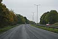
 A10 approaching a roundabout - geograph.org.uk - 4790521.jpg 640 × 426; 41 KB
-
 A10, end of Puckeridge bypass - geograph.org.uk - 4790526.jpg 640 × 390; 43 KB
-
 A10, Puckeridge bypass - geograph.org.uk - 4790522.jpg 640 × 426; 49 KB
-
 A10, Puckeridge bypass - geograph.org.uk - 4790523.jpg 640 × 426; 54 KB
-
 A10, Puckeridge bypass - geograph.org.uk - 4790525.jpg 640 × 426; 43 KB
-
 A10, southbound - geograph.org.uk - 4790527.jpg 640 × 407; 32 KB
-
 A10, southbound - geograph.org.uk - 4790530.jpg 640 × 426; 28 KB
-
 A10, southbound - geograph.org.uk - 4790531.jpg 640 × 380; 31 KB
-
 A10, southbound - geograph.org.uk - 4790534.jpg 640 × 426; 32 KB
-
 A10, southbound - geograph.org.uk - 4790535.jpg 640 × 426; 31 KB
-
 A120 road at Standon - geograph.org.uk - 3584081.jpg 640 × 360; 57 KB
-
 A120 towards Bishop's Stortford - geograph.org.uk - 212996.jpg 640 × 480; 61 KB
-
 Approaching A10 - geograph.org.uk - 3299115.jpg 640 × 480; 49 KB
-
 Bartram's Wood - geograph.org.uk - 548206.jpg 640 × 428; 115 KB
-
 Barwick Road - geograph.org.uk - 1890752.jpg 1,024 × 768; 396 KB
-
 Barwick Road meets the A120 - geograph.org.uk - 6063388.jpg 1,024 × 684; 267 KB
-
 Barwick Road, Barwick - geograph.org.uk - 3584026.jpg 640 × 360; 65 KB
-
 Batchelors, Standon - geograph.org.uk - 3584093.jpg 640 × 360; 57 KB
-
 Biggins Farm - geograph.org.uk - 196592.jpg 640 × 480; 183 KB
-
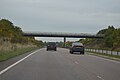 Bridge over the A10 - geograph.org.uk - 4790532.jpg 640 × 426; 38 KB
-
 Bridge Over the Nimney Bourne - geograph.org.uk - 2985657.jpg 2,560 × 1,920; 1.11 MB
-
 Bridleway runs parallel to the A10 - geograph.org.uk - 4492617.jpg 4,320 × 3,240; 5 MB
-
 Bridleway towards Plashes Wood - geograph.org.uk - 3447360.jpg 4,320 × 3,240; 4.21 MB
-
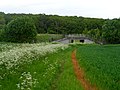 Bridleway under the A10 near Colliers End - geograph.org.uk - 4492610.jpg 4,320 × 3,240; 5.56 MB
-
 Bromley Lane towards Much Hadham - geograph.org.uk - 2801870.jpg 640 × 477; 68 KB
-
 Bus stop on Standon Hill - geograph.org.uk - 5358292.jpg 2,286 × 1,704; 944 KB
-
 Car approaching the ford near Latchford - geograph.org.uk - 1891764.jpg 1,024 × 768; 509 KB
-
 Chapel, St Edmunds College, Old Hall Green - geograph.org.uk - 5057100.jpg 1,600 × 1,082; 227 KB
-
 Clump of trees by Standon Road, Broken Green - geograph.org.uk - 5359565.jpg 2,304 × 1,728; 1.18 MB
-
 Country lane near Standon - geograph.org.uk - 3584066.jpg 640 × 360; 64 KB
-
 Country lane near Standon - geograph.org.uk - 3584077.jpg 640 × 360; 56 KB
-
 Countryside south of Standon - geograph.org.uk - 421478.jpg 640 × 480; 100 KB
-
 Cow Parsley and gravestones, St Mary's Standon - geograph.org.uk - 4493455.jpg 4,320 × 3,240; 6.99 MB
-

-
 Crossroads in the Lanes North of Ware - geograph.org.uk - 2985620.jpg 2,560 × 1,920; 1.12 MB
-
 Dog daisies in field margin - geograph.org.uk - 4535629.jpg 4,320 × 3,240; 4.83 MB
-
 Dowsett's Lane, near Standon - geograph.org.uk - 3584059.jpg 640 × 360; 50 KB
-
 Dusk over Hadham Road, Horse Cross - geograph.org.uk - 5359564.jpg 2,304 × 1,728; 1.16 MB
-
 Entrance to Arches Hall - geograph.org.uk - 4492651.jpg 4,320 × 3,240; 5.32 MB
-
 Entrance to ford at Standon - geograph.org.uk - 4493420.jpg 4,320 × 3,240; 3.47 MB
-
 Entrance to St Edmund's College - geograph.org.uk - 4534077.jpg 4,320 × 3,240; 4.25 MB
-
 Entrance to Standon - geograph.org.uk - 3299122.jpg 640 × 457; 78 KB
-
 Ermine Street - geograph.org.uk - 3299107.jpg 640 × 480; 56 KB
-
 Farmland at Standon - geograph.org.uk - 5684273.jpg 3,264 × 2,448; 3.58 MB
-
 Farmland near Barwick Road - geograph.org.uk - 1890748.jpg 1,024 × 768; 564 KB
-
 Farmland near Barwick Road - geograph.org.uk - 1890757.jpg 1,024 × 768; 323 KB
-
 Footpath - geograph.org.uk - 213003.jpg 480 × 640; 70 KB
-
 Footpath near to Arches Hall - geograph.org.uk - 4492667.jpg 4,320 × 3,240; 3.73 MB
-
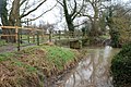
 Ford and footbridge over River Rib - geograph.org.uk - 322260.jpg 640 × 480; 195 KB
-
 Ford at Standon - geograph.org.uk - 4493429.jpg 4,320 × 3,240; 4.38 MB
-
 Ford near to Plashes Farm - geograph.org.uk - 4492643.jpg 4,320 × 3,240; 5.55 MB
-
 Former flour mill, Standon, Hertfordshire - geograph.org.uk - 1870597.jpg 2,448 × 3,264; 3.05 MB
-
 Grain Silos at Mentley Farm - geograph.org.uk - 4534100.jpg 4,320 × 3,240; 2.97 MB
-
 Hadham Road - geograph.org.uk - 212992.jpg 640 × 480; 114 KB
-
 Hanging Wood Ford, Latchford - geograph.org.uk - 3373681.jpg 3,872 × 2,592; 2.36 MB
-
 Hanging Wood, Lane to Standon - geograph.org.uk - 622752.jpg 640 × 447; 110 KB
-
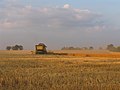 Harvesting - geograph.org.uk - 213000.jpg 640 × 480; 60 KB
-

-
 Knight's Court, Standon - geograph.org.uk - 3410166.jpg 640 × 480; 77 KB
-
 Knight's Court, Standon - geograph.org.uk - 3410174.jpg 640 × 480; 119 KB
-
 Lane from Barwick to Puckeridge - geograph.org.uk - 6063349.jpg 1,024 × 684; 235 KB
-
 Lane from Barwick to Puckeridge - geograph.org.uk - 6063353.jpg 1,024 × 768; 237 KB
-
 Lane from Barwick to Puckeridge - geograph.org.uk - 6063377.jpg 1,024 × 684; 442 KB
-
 Lane to Old Hall Green - geograph.org.uk - 4534046.jpg 4,320 × 3,240; 2.92 MB
-
 Latchford Ford - geograph.org.uk - 3373689.jpg 3,872 × 2,592; 2.33 MB
-

-

-
 Layby on the A10, Colliers End - geograph.org.uk - 5587374.jpg 2,048 × 1,536; 884 KB
-
 Looking south near River Rib on Barwick Road - geograph.org.uk - 1890736.jpg 1,024 × 768; 375 KB
-
 Milestone 25 on C183 at Colliers End.jpg 2,736 × 3,648; 4.79 MB
-
 Narrow road near Barwick - geograph.org.uk - 3584037.jpg 360 × 640; 83 KB
-
 Northbound A10 - geograph.org.uk - 5677964.jpg 640 × 428; 87 KB
-
 Northbound A10 - geograph.org.uk - 5678067.jpg 640 × 428; 83 KB
-
 Northbound A10 - geograph.org.uk - 5678090.jpg 640 × 428; 85 KB
-
 Northbound A10 - geograph.org.uk - 5678105.jpg 640 × 428; 79 KB
-
 Northbound A10 - geograph.org.uk - 5678116.jpg 640 × 428; 109 KB
-
 Northbound A10 - geograph.org.uk - 5678130.jpg 640 × 428; 110 KB
-
 Old Hall Green Water Tower - geograph.org.uk - 4180742.jpg 640 × 480; 80 KB
-
 Old Milepost - geograph.org.uk - 3207360.jpg 1,024 × 768; 173 KB
-
 Old Milepost - geograph.org.uk - 3207364.jpg 768 × 1,024; 296 KB
-
 Old Milestone - geograph.org.uk - 3650901.jpg 1,024 × 768; 383 KB
-
 Old Milestone - geograph.org.uk - 3650904.jpg 768 × 1,024; 393 KB
-
 Old Milestone - geograph.org.uk - 3650906.jpg 1,024 × 768; 237 KB
-
 Old Milestone - geograph.org.uk - 3650909.jpg 768 × 1,024; 308 KB
-
 Open farmland near Latchford, Herts - geograph.org.uk - 396018.jpg 640 × 480; 97 KB
-
 Papermill House, - geograph.org.uk - 4493435.jpg 4,320 × 3,240; 3.86 MB
-
 Part of Bromley Lane - geograph.org.uk - 1030108.jpg 640 × 480; 114 KB
-
 Part of Standon village - geograph.org.uk - 1448356.jpg 640 × 480; 69 KB
-
 Private drive to Standon Lordship - geograph.org.uk - 6063372.jpg 1,024 × 768; 385 KB
-
 Private lane leading to Standon Lordship - geograph.org.uk - 322355.jpg 640 × 480; 128 KB
-

-

-
 Ready for harvest^ - geograph.org.uk - 212995.jpg 640 × 480; 60 KB
-
 River Rib near Latchford - geograph.org.uk - 1891759.jpg 1,024 × 768; 464 KB
-

-
 River Rib, Papermill Lane ford, Standon - geograph.org.uk - 65284.jpg 640 × 425; 129 KB
-
 Road into Barwick - geograph.org.uk - 3447367.jpg 4,320 × 3,240; 4.77 MB
-
 Road junction - geograph.org.uk - 3299113.jpg 640 × 480; 43 KB
-
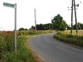
 Road junction near Much Hadham - geograph.org.uk - 3583975.jpg 640 × 360; 58 KB
-
 Road just south of Ford - geograph.org.uk - 1891771.jpg 1,024 × 768; 519 KB
-
 Road near Arches Hall, Standon - geograph.org.uk - 1890769.jpg 1,024 × 768; 380 KB
-
 Road to Latchford, Hertfordshire - geograph.org.uk - 3584044.jpg 640 × 360; 53 KB
-
 Road towards Thundridge - geograph.org.uk - 4541013.jpg 640 × 480; 137 KB
-
 Roundabout on the A10 at Ermine Street, Standon - geograph.org.uk - 2992172.jpg 1,594 × 1,156; 428 KB
-
 Roundabout on the A10 at Ermine Street, Standon - geograph.org.uk - 3054747.jpg 1,600 × 1,200; 545 KB
-
 Roundabout on the A10, Standon - geograph.org.uk - 5582189.jpg 2,014 × 1,490; 832 KB
-
 Rush Green at the junction of Gore Lane - geograph.org.uk - 4830952.jpg 2,304 × 1,728; 1.1 MB
-
 Sacombe, Lowgate Lane Roman Road - geograph.org.uk - 4174735.jpg 640 × 480; 90 KB
-
 Sadlier Road, Standon - geograph.org.uk - 3584091.jpg 640 × 360; 49 KB
-
 Sign on right of way near Arches Hall - geograph.org.uk - 4492673.jpg 4,320 × 3,240; 3.52 MB
-
 Standon - geograph.org.uk - 1181.jpg 640 × 427; 147 KB
-
 Standon and St Mary's church - geograph.org.uk - 4493415.jpg 4,320 × 3,240; 4.67 MB
-
 Standon Ford - geograph.org.uk - 3373699.jpg 3,872 × 2,592; 2.33 MB
-
 Standon Ford in use, seen from the West. - geograph.org.uk - 4392079.jpg 1,024 × 683; 198 KB
-
 Standon Ford, Paper Mill Lane - geograph.org.uk - 4392075.jpg 1,024 × 683; 157 KB
-
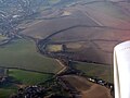
 Standon from the air - geograph.org.uk - 5684268.jpg 3,264 × 2,448; 4.02 MB
-
 Standon High Street (geograph 4493451).jpg 4,320 × 3,240; 4.19 MB
-
 Standon Hill - geograph.org.uk - 5358293.jpg 2,304 × 1,728; 1.22 MB
-
 Standon in the morning sun - geograph.org.uk - 6133404.jpg 3,264 × 2,448; 1.74 MB
-
 Standon post office.jpg 3,072 × 2,304; 6.29 MB
-
 Standon Pudding Stone - geograph.org.uk - 1180.jpg 640 × 427; 180 KB
-
 Standon Puddingstone - geograph.org.uk - 3410195.jpg 640 × 480; 128 KB
-
 Standon Puddingstone - geograph.org.uk - 3410223.jpg 480 × 640; 122 KB
-
 Standon, the Pudding Stone - geograph.org.uk - 2938.jpg 640 × 511; 88 KB
-

-
 Stinking Hellebore (Helleborus foetidus) (8423796959).jpg 3,879 × 2,913; 6.74 MB
-
 The A10 - geograph.org.uk - 4790533.jpg 640 × 426; 33 KB
-
 The China Garden, Standon - geograph.org.uk - 5359567.jpg 2,304 × 1,729; 959 KB
-
 The Lordship, Standon - geograph.org.uk - 4493109.jpg 4,320 × 3,240; 5.63 MB
-
 Track leading to lake, near Barwick Road - geograph.org.uk - 1890742.jpg 1,024 × 768; 480 KB
-
 Trees by Church Lane - geograph.org.uk - 3886121.jpg 640 × 480; 125 KB
-
 Trees by Ermine Street, Colliers End - geograph.org.uk - 4832560.jpg 2,304 × 1,728; 1.76 MB
-
 Trees by Hadham Road, Horse Cross - geograph.org.uk - 5359563.jpg 2,304 × 1,728; 2.12 MB
-
 Unclassified road near Arches Hall, Standon - geograph.org.uk - 1891754.jpg 1,024 × 768; 300 KB
-
 Water tower near Old Hall Green - geograph.org.uk - 4534055.jpg 4,320 × 3,240; 4.5 MB
-
 Westwards along the A120 - geograph.org.uk - 212998.jpg 640 × 480; 76 KB
-
 Wild roses in the hedgerow - geograph.org.uk - 4535591.jpg 4,320 × 3,240; 4.14 MB
-
 Latchford, Footpath to Standon Lodge Farm - geograph.org.uk - 619999.jpg 640 × 480; 116 KB


.jpg)


_(8423796959).jpg)


