Category:Stansted, Kent
Jump to navigation
Jump to search
English: Category:Villages in Kent
Polski: Stansted - wieś w dystrykcie Tonbridge and Malling w hrabstwie Kent w Anglii (Wielka Brytania), położona przy autostradzie M20.
village and parish in the Tonbridge and Malling district of the county of Kent, England, UK | |||||
| Upload media | |||||
| Instance of | |||||
|---|---|---|---|---|---|
| Location | Tonbridge and Malling, Kent, South East England, England | ||||
| Different from | |||||
 | |||||
Subcategories
This category has the following 4 subcategories, out of 4 total.
Media in category "Stansted, Kent"
The following 200 files are in this category, out of 215 total.
(previous page) (next page)-
 A kentish lane on Christmas Day 2014 - geograph.org.uk - 4290470.jpg 4,000 × 3,000; 4.16 MB
-
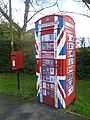 A new use for an old telephone kiosk - geograph.org.uk - 3321275.jpg 3,000 × 4,000; 4.08 MB
-
 A square of seats - geograph.org.uk - 3321548.jpg 4,000 × 3,000; 4.37 MB
-
 A227 - geograph.org.uk - 3530695.jpg 640 × 430; 99 KB
-
 A227 - geograph.org.uk - 3530759.jpg 640 × 430; 76 KB
-
 A227, Gravesend Rd - geograph.org.uk - 3530692.jpg 640 × 398; 72 KB
-
 A227, Gravesend Rd - geograph.org.uk - 3530697.jpg 640 × 430; 72 KB
-
 A227, northbound - geograph.org.uk - 3630824.jpg 640 × 419; 84 KB
-
 A227, Vigo - geograph.org.uk - 3627824.jpg 640 × 400; 102 KB
-
 A227, Vigo - geograph.org.uk - 3627865.jpg 640 × 430; 86 KB
-
 Across fields to the North Downs ridge - geograph.org.uk - 228136.jpg 640 × 480; 103 KB
-
 Anchor ^ Hope, Ash - geograph.org.uk - 5074295.jpg 3,264 × 2,448; 1.99 MB
-
 Approaching Fairseat - geograph.org.uk - 3611209.jpg 640 × 430; 75 KB
-
 Ash Lane - geograph.org.uk - 1638699.jpg 640 × 480; 70 KB
-
 Ash Lane, Ash - geograph.org.uk - 1638733.jpg 640 × 480; 60 KB
-
 Autumn trees - geograph.org.uk - 2126404.jpg 640 × 428; 135 KB
-
 Barnfield Park, Ash - geograph.org.uk - 1638730.jpg 640 × 480; 35 KB
-
 Black Horse, Stansted - geograph.org.uk - 5071661.jpg 3,264 × 2,448; 2.04 MB
-
 Bridleway off Vigo Rd - geograph.org.uk - 3611273.jpg 640 × 430; 110 KB
-

-
 By Vigo Rd - geograph.org.uk - 3627808.jpg 640 × 430; 78 KB
-
 Carved Bench on hill in farm - geograph.org.uk - 1178001.jpg 640 × 481; 116 KB
-
 Cattle at Coldharbour - geograph.org.uk - 3793482.jpg 4,000 × 3,000; 4.18 MB
-
 Cattle by Vigo Rd - geograph.org.uk - 3627798.jpg 640 × 430; 52 KB
-
 Christmas Day 2014 at the top of Stansted Hill - geograph.org.uk - 4290469.jpg 4,000 × 3,000; 3.98 MB
-
 Christmas Day 2014 near Stansted - geograph.org.uk - 4290466.jpg 4,000 × 3,000; 4.12 MB
-
 Church of the Holy Innocents - geograph.org.uk - 3611222.jpg 640 × 430; 121 KB
-

-
 Closed footpath on Terry's Lodge Road - geograph.org.uk - 1256388.jpg 640 × 480; 108 KB
-
 Closed Horse and Groom Public House - geograph.org.uk - 1254133.jpg 640 × 480; 52 KB
-
 Cottage at the junction, Fairseat - geograph.org.uk - 2331004.jpg 640 × 428; 118 KB
-
 Countryside near Fairseat - geograph.org.uk - 3793499.jpg 4,000 × 3,000; 4.19 MB
-
 Countryside near Fairseat - geograph.org.uk - 3793527.jpg 4,000 × 3,000; 3.85 MB
-
 Countryside near Fairseat - geograph.org.uk - 3793529.jpg 4,000 × 3,000; 4.26 MB
-
 Court House - geograph.org.uk - 1177117.jpg 640 × 481; 77 KB
-
 Crabtree Close, Fairseat - geograph.org.uk - 5070742.jpg 3,264 × 2,448; 2.08 MB
-
 Dairy Farm - geograph.org.uk - 3611208.jpg 640 × 430; 84 KB
-
 Daisy Cottage - geograph.org.uk - 1177128.jpg 640 × 481; 91 KB
-
 Double Stile on hedge line - geograph.org.uk - 1178007.jpg 481 × 640; 143 KB
-
 Electric car charging point - geograph.org.uk - 3726955.jpg 640 × 480; 137 KB
-
 Fairseat - geograph.org.uk - 3611258.jpg 640 × 430; 79 KB
-
 Fairseat Court Farm - geograph.org.uk - 3497315.jpg 4,000 × 3,000; 3.97 MB
-
 Fairseat Farmhouse - geograph.org.uk - 3611252.jpg 640 × 430; 71 KB
-
 Fairseat Farmhouse - geograph.org.uk - 3611255.jpg 640 × 430; 75 KB
-
 Fairseat House - geograph.org.uk - 3611216.jpg 640 × 430; 73 KB
-
 Fairseat Lane - geograph.org.uk - 3321692.jpg 3,000 × 4,000; 4.06 MB
-
 Fairseat Lane on Christmas Day 2014 - geograph.org.uk - 4290472.jpg 4,000 × 3,000; 4.17 MB
-
 Fairseat Lane, Fairseat - geograph.org.uk - 5071780.jpg 3,264 × 2,448; 2.41 MB
-
 Fairseat Manor - geograph.org.uk - 3611234.jpg 640 × 430; 87 KB
-
 Fairseat Manor - geograph.org.uk - 3611247.jpg 640 × 430; 86 KB
-
 Farmland by Vigo Rd - geograph.org.uk - 3627806.jpg 640 × 430; 66 KB
-
 Farmland, Fairseat - geograph.org.uk - 3611184.jpg 640 × 430; 46 KB
-
 Fence boundary between two Parishes. - geograph.org.uk - 1178318.jpg 481 × 640; 93 KB
-
 Field corner near Plaxdale Green Farm - geograph.org.uk - 2126411.jpg 640 × 428; 104 KB
-
 Field next to the Anchor ^ Hope - geograph.org.uk - 3300657.jpg 4,000 × 3,000; 3.95 MB
-
 Field of buttercups next to Wrotham Hill Road - geograph.org.uk - 3497304.jpg 4,000 × 3,000; 3.87 MB
-
 Field of buttercups seen from Wrotham Hill Road - geograph.org.uk - 3496124.jpg 4,000 × 3,000; 3.83 MB
-
 Field opposite the Anchor ^ Hope - geograph.org.uk - 3300633.jpg 4,000 × 3,000; 3.91 MB
-
 Footpath at Fairseat Lane - geograph.org.uk - 3321718.jpg 4,000 × 3,000; 4.1 MB
-
 Footpath junction near Mingram Wood - geograph.org.uk - 1178021.jpg 640 × 481; 139 KB
-
 Footpath leading from Fairseat Lane - geograph.org.uk - 3321687.jpg 4,000 × 3,000; 4.06 MB
-
 Footpath MR212 across a ploughed field - geograph.org.uk - 2126392.jpg 640 × 428; 135 KB
-
 Footpath near Hollands Farm - geograph.org.uk - 3321313.jpg 3,538 × 2,776; 1.72 MB
-
 Footpath through hedge - geograph.org.uk - 3611180.jpg 640 × 430; 97 KB
-
 Footpath through Mingram Wood - geograph.org.uk - 3793468.jpg 4,000 × 3,000; 4.18 MB
-
 Footpath to Fairseat - geograph.org.uk - 3611172.jpg 640 × 430; 81 KB
-
 Footpath to Stansted - geograph.org.uk - 3321724.jpg 3,000 × 4,000; 4.15 MB
-
 Footpath to Stansted - geograph.org.uk - 3800564.jpg 640 × 428; 157 KB
-
 Footpath to Stansted - geograph.org.uk - 3800577.jpg 640 × 428; 168 KB
-
 Footpath to Vigo - geograph.org.uk - 3627894.jpg 640 × 430; 129 KB
-
 Frosty field next to the Anchor ^ Hope - geograph.org.uk - 3300651.jpg 4,000 × 3,000; 4.09 MB
-
 Frosty scene seen from Ash Lane - geograph.org.uk - 3300620.jpg 4,000 × 3,000; 4.16 MB
-
 Gate on Fairseat Lane - geograph.org.uk - 3321684.jpg 4,000 × 3,000; 4.25 MB
-
 Gravesend Road at the junction of Vigo Hill - geograph.org.uk - 5174973.jpg 2,304 × 1,728; 870 KB
-
 Gravesend Road at the junction of Vigo Road - geograph.org.uk - 5174389.jpg 2,304 × 1,728; 806 KB
-
 Gravesend Road, near Fairseat - geograph.org.uk - 5070735.jpg 3,264 × 2,448; 1.53 MB
-
 Hall Wood - geograph.org.uk - 3611175.jpg 640 × 430; 52 KB
-
 Hatham Green Lane - Steep Hill 1-6 - geograph.org.uk - 1528502.jpg 640 × 400; 115 KB
-
 Hatham Green Lane - Steep Hill 1-6 - geograph.org.uk - 1528508.jpg 640 × 400; 116 KB
-
 Hatham Green Lane, Stansted - geograph.org.uk - 5071626.jpg 3,264 × 2,448; 2.2 MB
-
 Hatham Green Lane, Stansted - geograph.org.uk - 5071632.jpg 3,264 × 2,448; 2.14 MB
-
 House on Vigo Rd - geograph.org.uk - 3627809.jpg 640 × 430; 74 KB
-
 Joseph Farington - A Church at Stanstead - B1975.4.315 - Yale Center for British Art.jpg 1,920 × 1,311; 337 KB
-

-
 Labour In Vain Road, near Wrotham - geograph.org.uk - 5070809.jpg 3,264 × 2,448; 2.44 MB
-
 Labour In Vain Road, near Wrotham - geograph.org.uk - 5070810.jpg 3,264 × 2,448; 1.93 MB
-
 Lone trees - geograph.org.uk - 1092205.jpg 640 × 480; 127 KB
-
 Looking along Vigo Road on Christmas Day 2014 - geograph.org.uk - 4290474.jpg 4,000 × 3,000; 4.16 MB
-
 Looking down Stansted Hill on Christmas Day 2014 - geograph.org.uk - 4290465.jpg 4,000 × 3,000; 4.29 MB
-
 Looking into the London Golf Club course - geograph.org.uk - 1092110.jpg 640 × 480; 129 KB
-
 Lych gate, Fairseat - geograph.org.uk - 3611226.jpg 640 × 430; 114 KB
-
 Malthouse Road, Stansted - geograph.org.uk - 5071681.jpg 3,264 × 2,448; 1.97 MB
-
 Mast near Vigo - geograph.org.uk - 3611186.jpg 640 × 430; 42 KB
-
 Meeting of uncertain paths (Wise's Lane) - geograph.org.uk - 1092183.jpg 640 × 480; 247 KB
-
 Modern house, Fairseat - geograph.org.uk - 3611263.jpg 640 × 430; 88 KB
-
 Oakwood Farm - geograph.org.uk - 3627804.jpg 640 × 430; 80 KB
-
 Old field gate on Vigo Road - geograph.org.uk - 2603942.jpg 4,000 × 3,000; 4.43 MB
-
 Old quarry next to Stansted Hill - geograph.org.uk - 4290463.jpg 4,000 × 3,000; 4.12 MB
-
 Old telephone kiosk now put to a new use - geograph.org.uk - 3321285.jpg 4,000 × 3,000; 4.12 MB
-
 Parsons Lane, Stansted - geograph.org.uk - 1092222.jpg 640 × 480; 200 KB
-
 Pease Hill, Ash - geograph.org.uk - 5074303.jpg 3,264 × 2,448; 2.2 MB
-
 Pilgrims' Way - geograph.org.uk - 3627873.jpg 640 × 430; 118 KB
-
 Platt House Lane - Vigo Rd junction - geograph.org.uk - 3611260.jpg 640 × 430; 98 KB
-
 Platt House Lane, Fairseat - geograph.org.uk - 5070776.jpg 3,264 × 2,448; 1.74 MB
-
 Platt House Lane, Fairseat - geograph.org.uk - 5070780.jpg 3,264 × 2,448; 2.36 MB
-
 Platt House Lane, near Fairseat - geograph.org.uk - 5070786.jpg 3,264 × 2,448; 1.83 MB
-
 Plaxdale Green Road - geograph.org.uk - 3321253.jpg 4,000 × 3,000; 4.28 MB
-
 Plaxdale Green Road - geograph.org.uk - 3321259.jpg 4,000 × 3,000; 4.19 MB
-
 Plaxdale Green Road at Stansted - geograph.org.uk - 3321541.jpg 4,000 × 3,000; 4.31 MB
-
 Plaxdale Green Road near Stansted - geograph.org.uk - 3321317.jpg 4,000 × 3,000; 4.36 MB
-
 Plaxdale Green Road, near Stansted - geograph.org.uk - 5070812.jpg 2,448 × 2,448; 1.62 MB
-
 Plaxdale Green Road, near Stansted - geograph.org.uk - 5071616.jpg 3,015 × 2,261; 1.17 MB
-
 Plaxdale Green Road, Stansted - geograph.org.uk - 5071618.jpg 3,264 × 2,448; 1.66 MB
-
 Plaxdale Green Road, Stansted - geograph.org.uk - 5071621.jpg 3,264 × 2,448; 2.02 MB
-
 Post box on Hatham Green Lane - geograph.org.uk - 3300595.jpg 4,000 × 3,000; 4.08 MB
-

-
 Pumping station, Vigo Road - geograph.org.uk - 5546169.jpg 640 × 428; 151 KB
-
 Pylons across the fields - geograph.org.uk - 1092198.jpg 640 × 480; 64 KB
-
-
 Roadside pond by Stansted Hill - geograph.org.uk - 3321666.jpg 4,000 × 3,000; 4.18 MB
-
 Rumney Farm - geograph.org.uk - 1092191.jpg 640 × 480; 139 KB
-
 Rural telephone kiosk - geograph.org.uk - 22602.jpg 640 × 480; 169 KB
-
 Sheep beyond the fence - geograph.org.uk - 1092058.jpg 640 × 480; 132 KB
-
 Sheep near Wise's Lane - geograph.org.uk - 1092118.jpg 640 × 480; 86 KB
-
 Signpost on Tumblefield Road - geograph.org.uk - 3726958.jpg 1,024 × 768; 416 KB
-
 St Mary's Church, Stansted - geograph.org.uk - 3321629.jpg 4,000 × 3,000; 3.91 MB
-
 Stanstead Hill - geograph.org.uk - 1266980.jpg 640 × 480; 143 KB
-
 Stansted Church - geograph.org.uk - 2208408.jpg 1,116 × 727; 331 KB
-
 Stansted Hill - geograph.org.uk - 3321663.jpg 4,000 × 3,000; 4.21 MB
-
 Stansted Hill on Christmas Day 2014 - geograph.org.uk - 4290476.jpg 4,000 × 3,000; 4.47 MB
-
 Stansted Hill, Stansted - geograph.org.uk - 5071683.jpg 3,264 × 2,448; 1.86 MB
-
 Stansted Hill, Stansted - geograph.org.uk - 5071685.jpg 3,264 × 2,448; 3.16 MB
-
 Stansted Hill, Stansted - geograph.org.uk - 5071688.jpg 3,264 × 2,448; 1.54 MB
-
 Stansted Information Box - geograph.org.uk - 3130214.jpg 480 × 640; 158 KB
-
 Stansted Information Box - geograph.org.uk - 3321271.jpg 4,000 × 3,000; 4.3 MB
-
 Stansted Lodge Farm, Stansted, Kent - geograph.org.uk - 1266971.jpg 640 × 427; 96 KB
-
 Stansted village - geograph.org.uk - 2271016.jpg 3,264 × 2,448; 2.37 MB
-
 Stansted Village Sign - geograph.org.uk - 5071673.jpg 3,264 × 2,448; 2.3 MB
-
 Stansted War Memorial - geograph.org.uk - 3321388.jpg 4,000 × 3,000; 3.97 MB
-
 Stansted War Memorial - geograph.org.uk - 3793377.jpg 4,000 × 3,000; 4.06 MB
-
 Stansted war memorial - geograph.org.uk - 5063704.jpg 1,024 × 683; 256 KB
-
 Stansted War Memorial - geograph.org.uk - 5071678.jpg 2,448 × 3,264; 1.69 MB
-
 An attractive house on the Kemsing Road - geograph.org.uk - 245327.jpg 640 × 480; 133 KB
-
 Stile at Stansted, Kent - geograph.org.uk - 1112345.jpg 640 × 480; 163 KB
-
 Stile beside gate into Wessells Wood - geograph.org.uk - 1178015.jpg 640 × 481; 147 KB
-
 Stile on Fairseat Lane - geograph.org.uk - 3321725.jpg 3,000 × 4,000; 4.48 MB
-
 Telephone kiosk on Plaxdale Green Road - geograph.org.uk - 3321280.jpg 3,000 × 4,000; 4.1 MB
-
 Terry's Lodge Road at the junction of London Road - geograph.org.uk - 3156997.jpg 2,048 × 1,536; 723 KB
-
 Terrys Lodge Road - geograph.org.uk - 1714396.jpg 2,048 × 1,536; 1.32 MB
-
 Terrys Lodge Road - geograph.org.uk - 1714403.jpg 2,048 × 1,536; 1.24 MB
-
 The Anchor ^ Hope, South Ash Road - geograph.org.uk - 3300628.jpg 4,000 × 3,000; 4.05 MB
-
 The Black Horse, Stansted - geograph.org.uk - 1092208.jpg 640 × 480; 103 KB
-
 The centre of Stansted - geograph.org.uk - 3321619.jpg 4,000 × 3,000; 4.06 MB
-
 The duckpond at Fairseat - geograph.org.uk - 3793511.jpg 4,000 × 3,000; 4.09 MB
-
 The edge of Hall Wood - geograph.org.uk - 3793532.jpg 4,000 × 3,000; 4.28 MB
-
 The North Downs Way entering Trosley Country Park - geograph.org.uk - 4922206.jpg 4,608 × 3,456; 5.04 MB
-
 The North Downs Way in Hognore Wood - geograph.org.uk - 4922199.jpg 4,608 × 3,456; 5.14 MB
-
 The North Downs Way passes through Hognore Wood - geograph.org.uk - 2603926.jpg 3,000 × 4,000; 4.49 MB
-
 The North Downs Way through Hognore Wood - geograph.org.uk - 2603922.jpg 3,000 × 4,000; 4.09 MB
-
 The Old Rectory - geograph.org.uk - 3611267.jpg 640 × 430; 88 KB
-
 The Vigo Inn - geograph.org.uk - 3726947.jpg 1,024 × 768; 229 KB
-
 Thrift Wood - geograph.org.uk - 1178038.jpg 640 × 481; 65 KB
-
 Tumblefield Road - geograph.org.uk - 3494339.jpg 4,000 × 3,000; 3.88 MB
-
 Tumblefield Road at its junction with Wrotham Hill Road - geograph.org.uk - 3496098.jpg 4,000 × 3,000; 3.95 MB
-

-
 Tumblefield Road, near Wrotham - geograph.org.uk - 5070807.jpg 3,264 × 2,448; 2.29 MB
-
 Tumblefield Road, Stansted - geograph.org.uk - 3321558.jpg 4,000 × 3,000; 4.08 MB
-
 Tumblefield Road, Stansted - geograph.org.uk - 3793411.jpg 4,000 × 3,000; 4.01 MB
-
 Tumblefield Road, Stansted - geograph.org.uk - 5071653.jpg 3,264 × 2,448; 1.89 MB
-
 Vale near Cox's Wood - geograph.org.uk - 4176486.jpg 640 × 430; 75 KB
-
 Vale north of Wrotham - geograph.org.uk - 4176479.jpg 640 × 430; 66 KB
-
 Valley seen from Mingram Wood - geograph.org.uk - 3793448.jpg 4,000 × 3,000; 3.91 MB
-
 Valley seen from Mingram Wood - geograph.org.uk - 3793458.jpg 4,000 × 3,000; 4.13 MB
-
 Valley view between two woods - geograph.org.uk - 1178027.jpg 640 × 481; 52 KB
-
 Victorian postbox at Vigo - geograph.org.uk - 3726949.jpg 1,024 × 768; 545 KB
-
 View from Labour-in-Vain Road - geograph.org.uk - 3494315.jpg 4,000 × 3,000; 4.25 MB
-
 View from Plaxdale Green Road - geograph.org.uk - 3321292.jpg 4,000 × 3,000; 4.2 MB
-
 View from Stansted Hill - geograph.org.uk - 3321657.jpg 4,000 × 3,000; 4.34 MB
-
 View from Vigo Road - geograph.org.uk - 2603938.jpg 4,000 × 3,000; 4.43 MB
-
 View in valley to Stanstead - geograph.org.uk - 1177134.jpg 640 × 481; 51 KB
-
 Vigo Inn - geograph.org.uk - 3627813.jpg 640 × 430; 61 KB
-
 Vigo Inn, Vigo - geograph.org.uk - 2087543.jpg 3,479 × 2,005; 2.05 MB
-
 Vigo Rd - geograph.org.uk - 3611229.jpg 640 × 430; 110 KB
-
 Vigo Rd - geograph.org.uk - 3611269.jpg 640 × 430; 72 KB
-
 Vigo Rd - geograph.org.uk - 3627791.jpg 640 × 430; 93 KB
-
 Vigo Rd - geograph.org.uk - 3627795.jpg 640 × 430; 85 KB
-
 Vigo Rd - geograph.org.uk - 3627802.jpg 640 × 430; 87 KB
-
 Vigo Rd - geograph.org.uk - 3627810.jpg 640 × 430; 80 KB
-
 Vigo Road - geograph.org.uk - 1266983.jpg 640 × 480; 119 KB
-
 Vigo Road - geograph.org.uk - 5168676.jpg 640 × 428; 217 KB
-
 Vigo Road, Fairseat - geograph.org.uk - 1081608.jpg 640 × 427; 70 KB
-
 Vigo Road, Fairseat - geograph.org.uk - 4741568.jpg 2,272 × 1,704; 918 KB
-
 Vigo Road, Fairseat - geograph.org.uk - 4741571.jpg 2,272 × 1,704; 884 KB
-
 Vigo Road, Fairseat - geograph.org.uk - 5070747.jpg 3,264 × 2,448; 1.74 MB
-
 Vigo Road, Fairseat - geograph.org.uk - 5070769.jpg 3,264 × 2,448; 2 MB
-
 Vigo Road, Fairseat - geograph.org.uk - 5071782.jpg 3,264 × 2,448; 2.9 MB
-
 Vigo Road, Fairseat - geograph.org.uk - 5071785.jpg 3,264 × 2,448; 2.32 MB
-
 Village pond, Fairseat - geograph.org.uk - 3611218.jpg 640 × 430; 126 KB
-
 Village pond, Fairseat - geograph.org.uk - 3611236.jpg 640 × 430; 121 KB
-
 Visitor Centre, Troseley Park - geograph.org.uk - 3627890.jpg 640 × 430; 153 KB


_-_geograph.org.uk_-_1092183.jpg)


