Category:Stanton Lacy
Jump to navigation
Jump to search
village in United Kingdom  | |||||
| Upload media | |||||
| Instance of | |||||
|---|---|---|---|---|---|
| Location | Shropshire, West Midlands, England | ||||
| Population |
| ||||
 | |||||
Subcategories
This category has the following 4 subcategories, out of 4 total.
Media in category "Stanton Lacy"
The following 200 files are in this category, out of 233 total.
(previous page) (next page)-
 1 Stanton Lacy and School House - geograph.org.uk - 3198386.jpg 640 × 425; 354 KB
-
 A font at Stanton Lacy Church - geograph.org.uk - 5738040.jpg 3,264 × 1,840; 1.9 MB
-

-
 A steep hill, Hayton's Bent - geograph.org.uk - 4716701.jpg 1,024 × 683; 468 KB
-
 About to be harvested - geograph.org.uk - 2035349.jpg 640 × 480; 114 KB
-
 Above Whitbatch - geograph.org.uk - 5558991.jpg 1,000 × 662; 729 KB
-
 Across the fields at Titterhill - geograph.org.uk - 2262342.jpg 640 × 480; 117 KB
-
 An organ at Stanton Lacy Church - geograph.org.uk - 5738041.jpg 3,264 × 1,840; 2.1 MB
-
 An upright piano at Stanton Lacy Church - geograph.org.uk - 5738050.jpg 3,264 × 1,840; 1.71 MB
-
 Approach to St Peter's church, Stanton Lacy - geograph.org.uk - 3951115.jpg 4,320 × 3,240; 3.93 MB
-
 Arable field near The Barn - geograph.org.uk - 6104588.jpg 800 × 600; 125 KB
-
 Arable field near Walton - geograph.org.uk - 6642202.jpg 1,024 × 768; 375 KB
-
 Archaeological Journal, Volume 3, 0319c.png 768 × 902; 474 KB
-
 Aumbry at St. Peter's Church (Nave ^ Stanton Lacy) - geograph.org.uk - 5800235.jpg 3,264 × 2,448; 1.67 MB
-
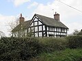
 Ayntree Farmhouse.jpg 621 × 455; 102 KB
-
-

-
 B4365 at entrance to Langley Farm - geograph.org.uk - 2703211.jpg 640 × 432; 55 KB
-

-
 B4365 near Lnagley - geograph.org.uk - 6105203.jpg 800 × 600; 142 KB
-
 B4365 north of Stanton Lacy - geograph.org.uk - 2867198.jpg 640 × 469; 79 KB
-
 B4365 towards Culmington - geograph.org.uk - 6104598.jpg 800 × 600; 135 KB
-
 B4365 towards Culmington - geograph.org.uk - 6105201.jpg 800 × 600; 118 KB
-
 B4365, Corve Dale - geograph.org.uk - 6104585.jpg 800 × 600; 108 KB
-
 Below Rotten Wood - geograph.org.uk - 1093821.jpg 640 × 359; 82 KB
-
 Beside Cuckoopen Coppice - geograph.org.uk - 2262951.jpg 640 × 480; 112 KB
-
 Bin day - geograph.org.uk - 6009314.jpg 1,024 × 768; 115 KB
-
 Bridge, Stanton Lacy - geograph.org.uk - 437024.jpg 640 × 480; 119 KB
-
 Bridleway at New House - geograph.org.uk - 2262938.jpg 640 × 480; 79 KB
-
 Bull in a field, in Stanton Lacy, Shropshire, England.jpg 640 × 480; 96 KB
-
 Carpenters Lane, Stanton Lacy - geograph.org.uk - 2435719.jpg 800 × 600; 255 KB
-
 Cattle, Sutton Hill - geograph.org.uk - 2547539.jpg 640 × 480; 103 KB
-
 Ceiling at St. Peter's Church (Chancel ^ Stanton Lacy) - geograph.org.uk - 5800221.jpg 3,264 × 2,448; 1.72 MB
-
 Church Farm (Stanton Lacy) - geograph.org.uk - 5800561.jpg 3,264 × 2,448; 2.42 MB
-
 Church Farm (Stanton Lacy) - geograph.org.uk - 5801068.jpg 3,264 × 2,448; 3.28 MB
-
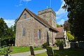
 Church of St Peter - geograph.org.uk - 3717597.jpg 4,000 × 3,000; 3.47 MB
-
 Churchyard outside St. Peter's Church (Stanton Lacy) - geograph.org.uk - 5800339.jpg 3,264 × 2,448; 2.7 MB
-
 Clock on St. Peter's Church (Bell Tower ^ Stanton Lacy) - geograph.org.uk - 5780828.jpg 3,264 × 2,448; 2.75 MB
-
 Converted Chapel at The Hope - geograph.org.uk - 2262333.jpg 640 × 480; 83 KB
-
 Converted Methodist chapel - geograph.org.uk - 6642203.jpg 1,024 × 768; 295 KB
-
 Corve Dale - geograph.org.uk - 6104570.jpg 640 × 480; 85 KB
-
 Cottage at Woodside - geograph.org.uk - 2262317.jpg 640 × 480; 79 KB
-
 Cottage near Hayton's Bent - geograph.org.uk - 3846729.jpg 640 × 480; 110 KB
-
 Countryside Bus Stop - geograph.org.uk - 676153.jpg 640 × 426; 50 KB
-
 Crop field near Langley - geograph.org.uk - 6105202.jpg 640 × 464; 59 KB
-
 Crop field near Langley - geograph.org.uk - 6105204.jpg 800 × 600; 145 KB
-
 Drain off the B4365 - geograph.org.uk - 6104611.jpg 800 × 600; 146 KB
-
 Driveway to Witchcot - geograph.org.uk - 2262953.jpg 640 × 480; 119 KB
-
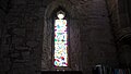
 East window at Stanton Lacy Church (far-away view) - geograph.org.uk - 5738053.jpg 3,264 × 1,840; 1.78 MB
-
 East window at Stanton Lacy Church - geograph.org.uk - 5738060.jpg 3,264 × 1,840; 1.57 MB
-
 Easter display at Stanton Lacy Church - geograph.org.uk - 5738044.jpg 3,264 × 1,840; 1.97 MB
-
 Entrance Gate to St. Peter's Church (Stanton Lacy) - geograph.org.uk - 5801104.jpg 3,264 × 2,448; 3.17 MB
-
 Entrance to St. Peter's Church (Bell Tower ^ Stanton Lacy) - geograph.org.uk - 5800323.jpg 3,264 × 2,448; 2.23 MB
-
 Entrance to St. Peter's Church (Stanton Lacy) - geograph.org.uk - 5800333.jpg 3,264 × 2,448; 3.26 MB
-
 Farm buildings at Lower Hayton - geograph.org.uk - 2262322.jpg 640 × 480; 74 KB
-
 Farm road by Witchcott - geograph.org.uk - 6009320.jpg 1,024 × 768; 142 KB
-
 Farmland at Stanton Lacy - geograph.org.uk - 6642150.jpg 1,024 × 768; 267 KB
-
 Field entrance - geograph.org.uk - 6642155.jpg 1,024 × 768; 259 KB
-
 Field near pools Farm - geograph.org.uk - 6105199.jpg 800 × 600; 129 KB
-
 Field view near Ludlow Golf Club - geograph.org.uk - 5756429.jpg 640 × 480; 111 KB
-

-
 Field, Upper Hayton - geograph.org.uk - 2470795.jpg 640 × 359; 66 KB
-
 Footpath to Stanton Lacy - geograph.org.uk - 6104607.jpg 800 × 600; 134 KB
-
 Footpath to Upper Hayton in winter - geograph.org.uk - 2262347.jpg 640 × 480; 97 KB
-
 Ford at Hayton - geograph.org.uk - 4596646.jpg 1,084 × 725; 379 KB
-
 Game crops, Ayntree - geograph.org.uk - 1638722.jpg 640 × 359; 116 KB
-
 Grass field, Lower Hayton - geograph.org.uk - 2470792.jpg 640 × 359; 89 KB
-
 Grazing towards the River Corve - geograph.org.uk - 6104596.jpg 800 × 600; 122 KB
-
 Hedge, fence and field - geograph.org.uk - 2262946.jpg 599 × 480; 136 KB
-
 Hedgerow near Hopton Cangeford - geograph.org.uk - 3846829.jpg 640 × 480; 126 KB
-
 House driveway - geograph.org.uk - 4908405.jpg 2,048 × 1,536; 1.58 MB
-
 House in Corvedale - geograph.org.uk - 4908410.jpg 2,048 × 1,536; 1.49 MB
-
 House on the B4365 near Stanton Lacy - geograph.org.uk - 6104602.jpg 800 × 600; 115 KB
-
 Information board at Stanton Lacy Church ^1 - geograph.org.uk - 5738070.jpg 3,264 × 1,840; 1.95 MB
-
 Information board at Stanton Lacy Church ^2 - geograph.org.uk - 5738072.jpg 3,264 × 1,840; 1.55 MB
-
 Information board at Stanton Lacy Church ^3 - geograph.org.uk - 5738073.jpg 3,264 × 1,840; 1.72 MB
-
 Junction at Stanton Lacy Post Office - geograph.org.uk - 5800565.jpg 3,264 × 2,448; 1.8 MB
-
 Lane above Whitbatch - geograph.org.uk - 5522593.jpg 1,000 × 662; 614 KB
-
 Lane junction - geograph.org.uk - 3198413.jpg 640 × 425; 236 KB
-
 Lane junction at Hayton's Bent - geograph.org.uk - 2262933.jpg 640 × 480; 118 KB
-
 Lane junction near The Hope - geograph.org.uk - 3198437.jpg 640 × 425; 322 KB
-
 Lane near Stanton Lacy - geograph.org.uk - 2035287.jpg 640 × 480; 157 KB
-
 Lane near to Hopton Cangeford, Ludlow - geograph.org.uk - 3844743.jpg 1,906 × 1,304; 956 KB
-
 Lane northeast of Stanton Lacy - geograph.org.uk - 3198396.jpg 640 × 425; 321 KB
-
 Lane to 'The Hope' - geograph.org.uk - 2035343.jpg 640 × 480; 146 KB
-

-
 Leaving Carpenters Lane towards The Hope - geograph.org.uk - 2435750.jpg 800 × 600; 276 KB
-

-
 Looking north along the B4365 - geograph.org.uk - 2736923.jpg 640 × 480; 89 KB
-
 Ludlow golf course and racecourse - geograph.org.uk - 3198333.jpg 640 × 425; 268 KB
-
 Ludlow to Clee St Margaret road - geograph.org.uk - 2547542.jpg 640 × 480; 130 KB
-
 Near Hayton’s Bent - geograph.org.uk - 6009307.jpg 1,024 × 768; 214 KB
-
 No 3, Stanton Lacy.jpg 3,264 × 2,448; 2.43 MB
-
 No 4, Stanton Lacy.jpg 3,264 × 2,448; 2.15 MB
-
 No. 1 Stanton Lacy ^ School House - geograph.org.uk - 5800550.jpg 3,264 × 2,448; 1.56 MB
-
 No. 1 Stanton Lacy ^ School House - geograph.org.uk - 5801088.jpg 3,264 × 2,448; 3.36 MB
-
 North stained glass window at Stanton Lacy Church - geograph.org.uk - 5738051.jpg 3,264 × 1,840; 1.64 MB
-
 North-east stained glass window at Stanton Lacy Church - geograph.org.uk - 5738058.jpg 3,264 × 1,840; 1.51 MB
-
 Oak trees in farmland - geograph.org.uk - 6642145.jpg 1,024 × 768; 251 KB
-
 Oak trees touch over the B4365 near Stanton Lacy - geograph.org.uk - 3951059.jpg 4,320 × 3,240; 4.2 MB
-
 Oilseed rape crop south of Langley - geograph.org.uk - 6105200.jpg 800 × 600; 184 KB
-
 Oilseed rape, Corvedale - geograph.org.uk - 2542341.jpg 640 × 359; 98 KB
-
 Old post office - geograph.org.uk - 628939.jpg 640 × 480; 85 KB
-
 Older and newer barns at Woodlands - geograph.org.uk - 1562279.jpg 640 × 480; 80 KB
-
 On Downton Hall estate, Shropshire - geograph.org.uk - 3846892.jpg 640 × 480; 148 KB
-
 On the plateau - geograph.org.uk - 6009295.jpg 1,024 × 768; 157 KB
-
 Part of the Downton Hall estate parkland - geograph.org.uk - 3846908.jpg 640 × 480; 144 KB
-

-
 Pulpit at Stanton Lacy Church - geograph.org.uk - 5738069.jpg 3,264 × 1,840; 1.91 MB
-
 Race horses at Downton Hall Stables - geograph.org.uk - 3846887.jpg 640 × 480; 93 KB
-
 Road passing St Peter, Stanton Lacy - geograph.org.uk - 1443272.jpg 640 × 480; 99 KB
-
 Road to Stanton Lacy Post Office - geograph.org.uk - 5801076.jpg 3,264 × 2,448; 2.15 MB
-
 Saint Peters, Stanton Lacy - geograph.org.uk - 2435701.jpg 800 × 600; 310 KB
-
 Sandstone plateau - geograph.org.uk - 6009328.jpg 1,024 × 768; 120 KB
-
 Saxon Doorway in St. Peter's Church (Nave ^ Stanton Lacy) - geograph.org.uk - 5800240.jpg 3,264 × 2,448; 1.73 MB
-
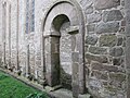 Saxon Doorway in St. Peter's Church (Nave ^ Stanton Lacy) - geograph.org.uk - 5800296.jpg 3,264 × 2,448; 2.32 MB
-
 Saxon Doorway in St. Peter's Church (Nave ^ Stanton Lacy) - geograph.org.uk - 5800307.jpg 3,264 × 2,448; 2.55 MB
-
 Sheep on Sutton Hill - geograph.org.uk - 2277670.jpg 640 × 480; 101 KB
-
 Sign at St. Peter's Church (Stanton Lacy) - geograph.org.uk - 5755988.jpg 3,264 × 2,448; 2.73 MB
-

-

-
 South stained glass window at Stanton Lacy Church - geograph.org.uk - 5738057.jpg 3,264 × 1,840; 1.48 MB
-
 South-west stained glass window at Stanton Lacy Church - geograph.org.uk - 5738085.jpg 3,264 × 1,840; 1.39 MB
-
 St Peter's and Church Farm, Stanton Lacy - geograph.org.uk - 3970610.jpg 4,820 × 2,810; 2.38 MB
-

-
 St Peter's church, Stanton Lacy - geograph.org.uk - 3951134.jpg 4,320 × 3,240; 4.95 MB
-
 St Peter's Stanton Lacy - geograph.org.uk - 2277302.jpg 640 × 480; 54 KB
-
 St Peter, Stanton Lacy - geograph.org.uk - 3968868.jpg 3,815 × 2,415; 2.03 MB
-
 St Peter, Stanton Lacy - geograph.org.uk - 3968886.jpg 6,016 × 4,000; 5.23 MB
-
 St Peter, Stanton Lacy - geograph.org.uk - 3968914.jpg 1,559 × 1,189; 588 KB
-
 St Peter, Stanton Lacy - geograph.org.uk - 3970363.jpg 3,800 × 5,825; 3.93 MB
-
 St Peter, Stanton Lacy - geograph.org.uk - 3970393.jpg 6,016 × 4,000; 5.63 MB
-
 St Peter, Stanton Lacy - geograph.org.uk - 3970443.jpg 4,211 × 2,800; 2.23 MB
-
 St Peter, Stanton Lacy - geograph.org.uk - 3970462.jpg 5,728 × 3,686; 4.7 MB
-
 St. Peter's at Stanton Lacy - geograph.org.uk - 2035273.jpg 625 × 459; 136 KB
-
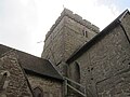
 St. Peter's Church (Bell Tower ^ Stanton Lacy) - geograph.org.uk - 5780840.jpg 3,264 × 2,448; 1.8 MB
-
 St. Peter's Church (Bell Tower ^ Stanton Lacy) - geograph.org.uk - 5800319.jpg 3,264 × 2,448; 1.75 MB
-
 St. Peter's Church (Bell Tower ^ Stanton Lacy) - geograph.org.uk - 5800325.jpg 3,264 × 2,448; 1.56 MB
-
 St. Peter's Church (Bell Tower ^ Stanton Lacy) - geograph.org.uk - 5801101.jpg 3,264 × 2,448; 2.33 MB
-
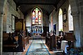
 St. Peter's Church (Chancel ^ Stanton Lacy) - geograph.org.uk - 5800205.jpg 3,264 × 2,448; 1.92 MB
-
-

-
 St. Peter's Church (Font ^ Stanton Lacy) - geograph.org.uk - 5800179.jpg 3,264 × 2,448; 1.93 MB
-
 St. Peter's Church (Font ^ Stanton Lacy) - geograph.org.uk - 5800260.jpg 3,264 × 2,448; 1.84 MB
-
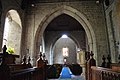
 St. Peter's Church (Nave ^ Stanton Lacy) - geograph.org.uk - 5800226.jpg 3,264 × 2,448; 1.68 MB
-
 St. Peter's Church (North Transept ^ Stanton Lacy) - geograph.org.uk - 5800210.jpg 3,264 × 2,448; 1.55 MB
-
 St. Peter's Church (North Transept ^ Stanton Lacy) - geograph.org.uk - 5800214.jpg 3,264 × 2,448; 1.46 MB
-
 St. Peter's Church (Pilaster Strips ^ Stanton Lacy) - geograph.org.uk - 5800292.jpg 3,264 × 2,448; 2.68 MB
-
 St. Peter's Church (Pilaster Strips ^ Stanton Lacy) - geograph.org.uk - 5800313.jpg 3,264 × 2,448; 2.4 MB
-
 St. Peter's Church (Porch ^ Stanton Lacy) - geograph.org.uk - 5780837.jpg 3,264 × 2,448; 1.91 MB
-
 St. Peter's Church (Porch ^ Stanton Lacy) - geograph.org.uk - 5801098.jpg 3,264 × 2,448; 2.55 MB
-
 St. Peter's Church (Porch ^2 ^ Stanton Lacy) - geograph.org.uk - 5800317.jpg 3,264 × 2,448; 2.54 MB
-
 St. Peter's Church (Pulpit ^ Stanton Lacy) - geograph.org.uk - 5800207.jpg 3,264 × 2,448; 1.61 MB
-
 St. Peter's Church (South Aisle ^ Stanton Lacy) - geograph.org.uk - 5800186.jpg 3,264 × 2,448; 1.66 MB
-
 St. Peter's Church (South Aisle ^ Stanton Lacy) - geograph.org.uk - 5800248.jpg 4,096 × 3,072; 5.1 MB
-
 St. Peter's Church (Stanton Lacy) - geograph.org.uk - 5755982.jpg 3,264 × 2,448; 2.12 MB
-
 St. Peter's Church (Stanton Lacy) - geograph.org.uk - 5755986.jpg 3,264 × 2,448; 1.98 MB
-
 St. Peter's Church (Stanton Lacy) - geograph.org.uk - 5780824.jpg 3,264 × 2,448; 2.34 MB
-
 St. Peter's Church (Stanton Lacy) - geograph.org.uk - 5800216.jpg 3,264 × 2,448; 1.79 MB
-
 St. Peter's Church (Stanton Lacy) - geograph.org.uk - 5800223.jpg 3,264 × 2,448; 2 MB
-
 St. Peter's Church (Stanton Lacy) - geograph.org.uk - 5800251.jpg 3,264 × 2,448; 1.86 MB
-
 St. Peter's Church (Stanton Lacy) - geograph.org.uk - 5800280.jpg 4,096 × 3,072; 5.98 MB
-
 St. Peter's Church (Stanton Lacy) - geograph.org.uk - 5800298.jpg 3,264 × 2,448; 2.25 MB
-
 St. Peter's Church (Stanton Lacy) - geograph.org.uk - 5800326.jpg 3,264 × 2,448; 1.96 MB
-
 St. Peter's Church (Stanton Lacy) - geograph.org.uk - 5800330.jpg 3,264 × 2,448; 2.16 MB
-
 St. Peter's Church (Stanton Lacy) - geograph.org.uk - 5800349.jpg 3,264 × 2,448; 3 MB
-
 St. Peter's Church (Stanton Lacy) - geograph.org.uk - 5801102.jpg 3,264 × 2,448; 3.08 MB
-
 St. Peter's Church (Tomb Recesses ^ Stanton Lacy) - geograph.org.uk - 5800273.jpg 3,264 × 2,448; 3.07 MB
-
 St. Peter's Church (Tomb Recesses ^ Stanton Lacy) - geograph.org.uk - 5801093.jpg 3,264 × 2,448; 2.67 MB
-
 St. Peter's Church (War Memorial ^ Stanton Lacy) - geograph.org.uk - 5757203.jpg 3,264 × 2,448; 2.92 MB
-
 St. Peter's Church (War Memorial ^ Stanton Lacy) - geograph.org.uk - 5780820.jpg 3,264 × 2,448; 1.65 MB
-
 St. Peter's Church (War Memorial ^ Stanton Lacy) - geograph.org.uk - 5800267.jpg 4,096 × 3,072; 7.57 MB
-
 Stanton Lacy - Unsplash.jpg 3,888 × 1,689; 2.15 MB
-
 Stanton Lacy Bridge - geograph.org.uk - 5755972.jpg 3,264 × 2,448; 1.64 MB
-
 Stanton Lacy Bridge - geograph.org.uk - 5755980.jpg 3,264 × 2,448; 2.15 MB
-
 Stanton Lacy Bridge - geograph.org.uk - 5755983.jpg 3,264 × 2,448; 2.45 MB
-
 Stanton Lacy Bridge - geograph.org.uk - 907766.jpg 639 × 425; 145 KB
-
 Stanton Lacy Church (back view) - geograph.org.uk - 5738031.jpg 3,264 × 1,840; 1.98 MB
-
 Stanton Lacy Church (entrance view ^2) - geograph.org.uk - 5738084.jpg 3,264 × 1,840; 2.29 MB
-
 Stanton Lacy Church (entrance view) - geograph.org.uk - 5738033.jpg 3,264 × 1,840; 2.63 MB
-
 Stanton Lacy Church (front view) - geograph.org.uk - 5738026.jpg 3,264 × 1,840; 1.77 MB
-
 Stanton Lacy Church (west view ^2) - geograph.org.uk - 5738078.jpg 3,264 × 1,840; 1.94 MB
-
 Stanton Lacy Church (west view) - geograph.org.uk - 5738076.jpg 3,264 × 1,840; 2.09 MB
-
 Stanton Lacy Church - geograph.org.uk - 5738019.jpg 3,264 × 1,840; 1.81 MB
-
 Stanton Lacy church - geograph.org.uk - 6641886.jpg 1,024 × 768; 255 KB
-
 Stanton Lacy church - geograph.org.uk - 6641888.jpg 1,024 × 768; 257 KB
-
 Stanton Lacy Church sign - geograph.org.uk - 5738037.jpg 3,264 × 1,840; 1.57 MB
-
 Stanton Lacy church viewed from the west - geograph.org.uk - 6642140.jpg 1,024 × 768; 340 KB
-
 Stanton Lacy Post Office - geograph.org.uk - 5738087.jpg 3,264 × 1,840; 1.56 MB
-
 Stanton Lacy Post Office - geograph.org.uk - 5744024.jpg 3,264 × 2,448; 1.67 MB
-
 Stanton Lacy war memorial - geograph.org.uk - 6642131.jpg 768 × 1,024; 370 KB
-
 Star of David ceiling at Stanton Lacy Church - geograph.org.uk - 5738055.jpg 3,264 × 1,840; 2.23 MB
-
 Statue in Downton Hall parkland - geograph.org.uk - 3846904.jpg 640 × 480; 149 KB
-
 Stubble field - geograph.org.uk - 5522598.jpg 1,000 × 662; 695 KB
-
 Stubble field - geograph.org.uk - 5559001.jpg 1,000 × 662; 729 KB
-
 Stubble field - geograph.org.uk - 5559002.jpg 1,000 × 662; 662 KB
-
 Stubble field - geograph.org.uk - 5559003.jpg 1,000 × 662; 585 KB
-

-
 Tank, Hayton's Bent - geograph.org.uk - 4716703.jpg 1,024 × 683; 393 KB
-
 Telephone Box by Stanton Lacy Post Office - geograph.org.uk - 5800567.jpg 3,264 × 2,448; 2.6 MB


_-_geograph.org.uk_-_5800235.jpg)


_-_geograph.org.uk_-_5800221.jpg)
_-_geograph.org.uk_-_5800561.jpg)
_-_geograph.org.uk_-_5801068.jpg)

_-_geograph.org.uk_-_5800339.jpg)
_-_geograph.org.uk_-_5780828.jpg)


_-_geograph.org.uk_-_5738053.jpg)


_-_geograph.org.uk_-_5801104.jpg)
_-_geograph.org.uk_-_5800323.jpg)
_-_geograph.org.uk_-_5800333.jpg)


_-_geograph.org.uk_-_5800240.jpg)
_-_geograph.org.uk_-_5800296.jpg)
_-_geograph.org.uk_-_5800307.jpg)

_-_geograph.org.uk_-_5755988.jpg)


_-_geograph.org.uk_-_5725263.jpg)


_-_geograph.org.uk_-_5780840.jpg)
_-_geograph.org.uk_-_5800319.jpg)
_-_geograph.org.uk_-_5800325.jpg)
_-_geograph.org.uk_-_5801101.jpg)
_-_geograph.org.uk_-_5800205.jpg)
_-_geograph.org.uk_-_5757199.jpg)
_-_geograph.org.uk_-_5800304.jpg)
_-_geograph.org.uk_-_5800179.jpg)
_-_geograph.org.uk_-_5800260.jpg)
_-_geograph.org.uk_-_5800226.jpg)
_-_geograph.org.uk_-_5800292.jpg)
_-_geograph.org.uk_-_5800313.jpg)
_-_geograph.org.uk_-_5780837.jpg)
_-_geograph.org.uk_-_5801098.jpg)
_-_geograph.org.uk_-_5800317.jpg)
_-_geograph.org.uk_-_5800207.jpg)
_-_geograph.org.uk_-_5800186.jpg)
_-_geograph.org.uk_-_5800248.jpg)
_-_geograph.org.uk_-_5755982.jpg)
_-_geograph.org.uk_-_5755986.jpg)
_-_geograph.org.uk_-_5780824.jpg)
_-_geograph.org.uk_-_5800216.jpg)
_-_geograph.org.uk_-_5800223.jpg)
_-_geograph.org.uk_-_5800251.jpg)
_-_geograph.org.uk_-_5800280.jpg)
_-_geograph.org.uk_-_5800298.jpg)
_-_geograph.org.uk_-_5800326.jpg)
_-_geograph.org.uk_-_5800330.jpg)
_-_geograph.org.uk_-_5800349.jpg)
_-_geograph.org.uk_-_5801102.jpg)
_-_geograph.org.uk_-_5800273.jpg)
_-_geograph.org.uk_-_5801093.jpg)
_-_geograph.org.uk_-_5757203.jpg)
_-_geograph.org.uk_-_5780820.jpg)
_-_geograph.org.uk_-_5800267.jpg)


_-_geograph.org.uk_-_5738031.jpg)
_-_geograph.org.uk_-_5738084.jpg)
_-_geograph.org.uk_-_5738033.jpg)
_-_geograph.org.uk_-_5738026.jpg)
_-_geograph.org.uk_-_5738078.jpg)
_-_geograph.org.uk_-_5738076.jpg)


_-_geograph.org.uk_-_5800258.jpg)


_-_geograph.org.uk_-_5800210.jpg)
_-_geograph.org.uk_-_5800214.jpg)