Category:Stapleton, Herefordshire
Aller à la navigation
Aller à la recherche
hamlet and civil parish in Herefordshire, UK  | |||||
| Téléverser des médias | |||||
| Nature de l’élément | |||||
|---|---|---|---|---|---|
| Lieu | Herefordshire, Midlands de l'Ouest, Angleterre | ||||
 | |||||
English: Stapleton is a small hamlet and civil parish in Herefordshire near the Welsh border town of Presteigne. The hamlet itself has approximately 25 residents as well as the ruins of a medieval castle.
Sous-catégories
Cette catégorie comprend 3 sous-catégories, dont les 3 ci-dessous.
L
- Lugg Bridge (14 F)
S
- Stapleton Castle (6 F)
- Stapleton Lodge (6 F)
Média dans la catégorie « Stapleton, Herefordshire »
Cette catégorie comprend 83 fichiers, dont les 83 ci-dessous.
-

-
 A Stapleton panorama - geograph.org.uk - 2587683.jpg 640 × 480 ; 96 kio
-
 Arable land, Stapleton - geograph.org.uk - 4686044.jpg 800 × 450 ; 344 kio
-
 Brink Lane, Stapleton near Presteigne - geograph.org.uk - 4108311.jpg 800 × 547 ; 168 kio
-
 Bryan's Ground - geograph.org.uk - 4021645.jpg 3 456 × 2 592 ; 2,85 Mio
-
 Bryan's Ground - geograph.org.uk - 4021720.jpg 2 419 × 1 814 ; 1,31 Mio
-
 Bryan's Ground - geograph.org.uk - 4021721.jpg 2 419 × 1 814 ; 1,39 Mio
-
 Cottage on the lane to Stapleton - geograph.org.uk - 2587682.jpg 640 × 480 ; 101 kio
-
 Cottages in Stapleton - geograph.org.uk - 2587685.jpg 640 × 480 ; 90 kio
-
 Edge of the woods - geograph.org.uk - 846906.jpg 640 × 480 ; 118 kio
-
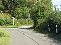
 End of the 30mph speed limit in Stapleton - geograph.org.uk - 4108347.jpg 800 × 537 ; 124 kio
-
 Endless wheat - geograph.org.uk - 846909.jpg 640 × 480 ; 92 kio
-
 Farmland at Stapleton - geograph.org.uk - 5477297.jpg 1 280 × 851 ; 477 kio
-
 Farmland at Stapleton - geograph.org.uk - 6313980.jpg 3 648 × 2 736 ; 3,98 Mio
-
 Field on Stapleton Hill - geograph.org.uk - 4701362.jpg 1 024 × 684 ; 241 kio
-
 Ford Cottages (Stapleton) - geograph.org.uk - 6313955.jpg 3 648 × 2 736 ; 4,07 Mio
-
 Ford Cottages, Stapleton - geograph.org.uk - 4213238.jpg 800 × 549 ; 145 kio
-
 Ford Street (Stapleton) - geograph.org.uk - 6313941.jpg 3 648 × 2 736 ; 4,01 Mio
-
 Ford Street (Stapleton) - geograph.org.uk - 6313993.jpg 3 648 × 2 736 ; 4,3 Mio
-
 Ford Street (Stapleton) - geograph.org.uk - 6313995.jpg 3 648 × 2 736 ; 3,8 Mio
-
 Fuel lorry ascending Stapleton Hill - geograph.org.uk - 870484.jpg 640 × 480 ; 132 kio
-
 Green lane, Stapleton Hill - geograph.org.uk - 6004887.jpg 1 024 × 683 ; 453 kio
-
 Hillside up from roadway - geograph.org.uk - 822828.jpg 630 × 491 ; 27 kio
-
 Hillside up from roadway - geograph.org.uk - 822835.jpg 640 × 441 ; 22 kio
-
 Lane adjoining Presteigne cemetery - geograph.org.uk - 2587680.jpg 640 × 480 ; 92 kio
-
 Lane at Bryan's Ground - geograph.org.uk - 2587676.jpg 640 × 480 ; 95 kio
-
 Lane at Middlemoor - geograph.org.uk - 2587678.jpg 640 × 480 ; 71 kio
-
 Lane climbing to Stapleton Hill - geograph.org.uk - 2587687.jpg 640 × 480 ; 86 kio
-
 Lane junction at Hill Crest - geograph.org.uk - 2587688.jpg 640 × 480 ; 79 kio
-
 Lane junction near Hillcrest Cottage - geograph.org.uk - 3550580.jpg 640 × 480 ; 103 kio
-
 Lane junction, Stapleton - geograph.org.uk - 2587686.jpg 640 × 480 ; 100 kio
-
 Looking back - geograph.org.uk - 846892.jpg 640 × 480 ; 110 kio
-
 Lugg Bridge (Presteigne) - geograph.org.uk - 6313935.jpg 3 648 × 2 736 ; 4,08 Mio
-
 Lugg Bridge (Presteigne) - geograph.org.uk - 6313999.jpg 3 648 × 2 736 ; 4,15 Mio
-
 Lugg Bridge (Presteigne) - geograph.org.uk - 6314000.jpg 3 648 × 2 736 ; 4,12 Mio
-
 Noisy Hall - geograph.org.uk - 846872.jpg 640 × 480 ; 106 kio
-
 Oaks, Pokewell Wood - geograph.org.uk - 6005562.jpg 1 024 × 683 ; 483 kio
-
 Old horse in the paddock on Stapleton Hill - geograph.org.uk - 3550587.jpg 640 × 480 ; 76 kio
-
 Pokewell Wood - geograph.org.uk - 6005557.jpg 1 024 × 683 ; 543 kio
-
 Potatoes on Stapleton Hill - geograph.org.uk - 6005565.jpg 1 024 × 683 ; 396 kio
-
 Presteigne Cemetery - geograph.org.uk - 5476177.jpg 1 280 × 851 ; 541 kio
-
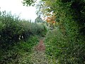
 Public Footpath to the River Lugg (Stapleton) - geograph.org.uk - 6313987.jpg 3 648 × 2 736 ; 4,17 Mio
-
 Road on Stapleton Hill - geograph.org.uk - 4701358.jpg 1 024 × 684 ; 282 kio
-
 Sheep at Stapleton - geograph.org.uk - 6313989.jpg 3 648 × 2 736 ; 4,5 Mio
-
 Sheep pasture south of Pokewell Wood - geograph.org.uk - 846900.jpg 640 × 480 ; 95 kio
-
 Sign at the Old Grove (Stapleton) - geograph.org.uk - 6313960.jpg 3 648 × 2 736 ; 4,68 Mio
-
 Sign on Ford Cottages (Stapleton) - geograph.org.uk - 6313956.jpg 3 648 × 2 736 ; 4,46 Mio
-
 Sounding the alert - geograph.org.uk - 846883.jpg 640 × 480 ; 103 kio
-
 St. Andrew's Church (Presteigne) - geograph.org.uk - 6313924.jpg 3 648 × 2 736 ; 4,78 Mio
-
 Stapleton - geograph.org.uk - 4701346.jpg 1 024 × 684 ; 306 kio
-
 Stapleton Castle - geograph.org.uk - 4444039.jpg 1 665 × 942 ; 1,88 Mio
-
 Stapleton Castle - geograph.org.uk - 6313982.jpg 3 648 × 2 736 ; 2,76 Mio
-
 Stapleton hell peak.JPG 500 × 272 ; 32 kio
-
 Stapleton Presteigne.JPG 500 × 375 ; 42 kio
-
 Stapleton to Kinsham road - geograph.org.uk - 4686052.jpg 800 × 600 ; 418 kio
-
 Stapleton to Kinsham Road - geograph.org.uk - 4701343.jpg 1 024 × 684 ; 259 kio
-
 Stream in Stapleton - geograph.org.uk - 4213229.jpg 800 × 750 ; 244 kio
-
 Sunset at Presteigne - geograph.org.uk - 6313992.jpg 3 648 × 2 736 ; 2,92 Mio
-
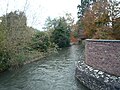
 The River Lugg (Presteigne) - geograph.org.uk - 6313951.jpg 3 648 × 2 736 ; 4,76 Mio
-
 The River Lugg (Presteigne) - geograph.org.uk - 6314001.jpg 3 648 × 2 736 ; 4,59 Mio
-
 The River Lugg (Stapleton) - geograph.org.uk - 6313976.jpg 3 648 × 2 736 ; 4,45 Mio
-
 The River Lugg (Stapleton) - geograph.org.uk - 6313977.jpg 3 648 × 2 736 ; 4,55 Mio
-
 The River Lugg at Bryan's Ground - geograph.org.uk - 4021726.jpg 3 387 × 2 540 ; 2,3 Mio
-
 Track by Ford Street (Stapleton) - geograph.org.uk - 6313970.jpg 3 648 × 2 736 ; 4,7 Mio
-
 Track by Ford Street (Stapleton) - geograph.org.uk - 6313973.jpg 3 648 × 2 736 ; 4,7 Mio
-
 Track junction - geograph.org.uk - 3550584.jpg 640 × 480 ; 78 kio
-
 Track to Ford Street (Stapleton) - geograph.org.uk - 6313990.jpg 3 648 × 2 736 ; 4,79 Mio
-
 Up to Pokewell Wood - geograph.org.uk - 846897.jpg 640 × 480 ; 71 kio
-
 Victorian postbox, Stapleton - geograph.org.uk - 4213242.jpg 647 × 1 091 ; 161 kio
-
 View of Cole's Hill - geograph.org.uk - 4686037.jpg 800 × 450 ; 324 kio
-
 Winter wheat, Middlemoor - geograph.org.uk - 4701340.jpg 1 024 × 684 ; 292 kio
-
 Winter wheat, Moor Farm - geograph.org.uk - 4701335.jpg 1 024 × 684 ; 288 kio
-
 Workers cottages at The Moor Farm - geograph.org.uk - 2587677.jpg 640 × 480 ; 75 kio
-
 Yew Tree Cottage, Stapleton near Presteigne - geograph.org.uk - 4108330.jpg 800 × 517 ; 105 kio
-

-
 Herefordshire Landscape - geograph.org.uk - 413213.jpg 640 × 480 ; 69 kio
-
 Leintwardine from Harley's Mountain - geograph.org.uk - 383588.jpg 640 × 480 ; 67 kio
-
 Looking North from Cemetery - geograph.org.uk - 98032.jpg 640 × 430 ; 93 kio
-
 Ploughed Field on Spring Evening - geograph.org.uk - 410988.jpg 600 × 450 ; 102 kio
-
 The lane between Stapleton and Lower Kinsham - geograph.org.uk - 44201.jpg 640 × 480 ; 147 kio
-
 The lane between Stapleton and Lower Kinsham - geograph.org.uk - 44202.jpg 640 × 480 ; 147 kio
-
 The lane between Stapleton Hill and Stapleton - geograph.org.uk - 44268.jpg 640 × 480 ; 148 kio
-


_-_geograph.org.uk_-_6313955.jpg)

_-_geograph.org.uk_-_6313941.jpg)
_-_geograph.org.uk_-_6313993.jpg)
_-_geograph.org.uk_-_6313995.jpg)


_-_geograph.org.uk_-_6313935.jpg)
_-_geograph.org.uk_-_6313999.jpg)
_-_geograph.org.uk_-_6314000.jpg)


_-_geograph.org.uk_-_6313987.jpg)


_-_geograph.org.uk_-_6313960.jpg)
_-_geograph.org.uk_-_6313956.jpg)

_-_geograph.org.uk_-_6313924.jpg)


_-_geograph.org.uk_-_6313951.jpg)
_-_geograph.org.uk_-_6314001.jpg)
_-_geograph.org.uk_-_6313976.jpg)
_-_geograph.org.uk_-_6313977.jpg)

_-_geograph.org.uk_-_6313970.jpg)
_-_geograph.org.uk_-_6313973.jpg)

_-_geograph.org.uk_-_6313990.jpg)


_just_north_of_Presteigne_-_geograph.org.uk_-_44269.jpg)