Category:Stará Boleslav
Jump to navigation
Jump to search
| Object location | | View all coordinates using: OpenStreetMap |
|---|
Deutsch: Altbunzlau, Alt-Bunzlau (Stará Boleslav), Region Mittelböhmen (Středočeský kraj), Tschechien.
neighborhood of Brandýs nad Labem-Stará Boleslav   | |||||
| Upload media | |||||
| Instance of | |||||
|---|---|---|---|---|---|
| Location | Brandýs nad Labem-Stará Boleslav, Prague-East District, Central Bohemian Region, Czechia | ||||
| Population |
| ||||
| Area |
| ||||
| Elevation above sea level |
| ||||
 | |||||
Subcategories
This category has the following 11 subcategories, out of 11 total.
B
C
H
M
N
S
T
~
Media in category "Stará Boleslav"
The following 9 files are in this category, out of 9 total.
-
 Lípy u křížku v ulici Třebízského (01).jpg 3,170 × 4,421; 5.99 MB
-
 Lípy u křížku v ulici Třebízského (02).jpg 3,888 × 4,618; 6.07 MB
-
 Pohled od baziliky sv. Václava ke kostelu Nanebevzetí Panny Marie ve Staré Boleslavi.jpg 1,944 × 2,592; 930 KB
-
 Stara Boleslav letecky.JPG 5,112 × 3,140; 4.58 MB
-
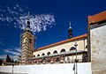 Stará Boleslav kostel sv. Václava.jpg 2,048 × 1,426; 1.96 MB
-
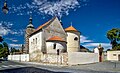 Stará Boleslav kostely 2.jpg 2,048 × 1,248; 2.5 MB
-
 Stará Boleslav náměstí 1a.jpg 2,048 × 1,072; 2.01 MB
-
 Stará Boleslav náměstí 1b.jpg 2,048 × 1,210; 2.27 MB
-
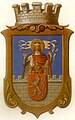 Znak města.jpg 1,220 × 1,947; 371 KB
.jpg)
.jpg)


