Category:Staunton on Wye
Aller à la navigation
Aller à la recherche
village britannique  | |||||
| Téléverser des médias | |||||
| Nature de l’élément | |||||
|---|---|---|---|---|---|
| Lieu | Herefordshire, Midlands de l'Ouest, Angleterre | ||||
 | |||||
Cymraeg: Pentref a chymuned yn Lloegr ydy Staunton on Wye.
English: Staunton-on-Wye is a relatively unpopulated civil parish in North Herefordshire, which is perhaps one of the most uninhabited locations of England. The parish of Staunton, which includes Moorhampton and Bredwardine, is a key player in trading in Herefordshire. The population of this parish taken at the 2011 census was 213.
Polski: Staunton on Wye – wieś i civil parish w Anglii, w hrabstwie Herefordshire. W 2011 civil parish liczyła 488 mieszkańców. Staunton on Wye jest wspomniana w Domesday Book (1086) jako Standune/Stantune.

Sous-catégories
Cette catégorie comprend 2 sous-catégories, dont les 2 ci-dessous.
S
- Staunton on Wye War Memorial (2 F)
Média dans la catégorie « Staunton on Wye »
Cette catégorie comprend 49 fichiers, dont les 49 ci-dessous.
-

-
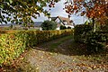
 A farmhouse in Staunton on Wye - geograph.org.uk - 325936.jpg 640 × 426 ; 132 kio
-
 A438 approaching Letton Court, 2016 - geograph.org.uk - 4791328.jpg 1 600 × 901 ; 635 kio
-
 Cottage at Staunton on Wye - geograph.org.uk - 604824.jpg 640 × 426 ; 142 kio
-
 Cottage by the footpath - geograph.org.uk - 2788247.jpg 1 024 × 577 ; 316 kio
-
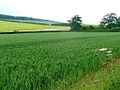
 Crop tunnels near Hackford Farm, Staunton on Wye - geograph.org.uk - 316535.jpg 640 × 426 ; 135 kio
-
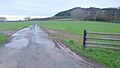 Farm track - geograph.org.uk - 4791323.jpg 1 600 × 901 ; 673 kio
-
 Farmland near Little London, Staunton on Wye - geograph.org.uk - 602913.jpg 640 × 426 ; 82 kio
-
 Farmland near Monnington - geograph.org.uk - 3724398.jpg 2 592 × 1 944 ; 1,2 Mio
-
 Former Staunton on Wye Youth Hostel - geograph.org.uk - 6437820.jpg 1 800 × 1 200 ; 338 kio
-
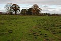
 Herefordshire landscape - geograph.org.uk - 2787154.jpg 1 024 × 577 ; 319 kio
-
 Kilkington Farm - geograph.org.uk - 2787160.jpg 1 024 × 577 ; 294 kio
-
 Mixed arable and horticultural land - geograph.org.uk - 1355353.jpg 640 × 480 ; 263 kio
-
 New cider orchard - geograph.org.uk - 1355338.jpg 640 × 480 ; 256 kio
-
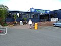 Oakchurch country store - geograph.org.uk - 1514727.jpg 640 × 482 ; 75 kio
-
 Oakchurch Farm Shop 1 - geograph.org.uk - 1355320.jpg 640 × 480 ; 263 kio
-
 Oakchurch Farm Shop 2 - geograph.org.uk - 1355324.jpg 640 × 480 ; 240 kio
-
 Oakchurch Garden Centre - geograph.org.uk - 1042477.jpg 640 × 480 ; 148 kio
-
 Oakchurch garden centre and farm shop - geograph.org.uk - 3169981.jpg 640 × 480 ; 58 kio
-
 Oilseed rape - geograph.org.uk - 2366910.jpg 2 048 × 1 536 ; 702 kio
-
 On its last legs, 1 - geograph.org.uk - 4791335.jpg 1 200 × 1 600 ; 1,11 Mio
-
 On its last legs, 2 - geograph.org.uk - 4791342.jpg 1 200 × 1 600 ; 833 kio
-
 On its last legs, 3 - geograph.org.uk - 4791345.jpg 1 200 × 1 600 ; 940 kio
-
 On its last legs, 4 - geograph.org.uk - 4791349.jpg 1 600 × 1 200 ; 916 kio
-
 Ordnance Survey Cut Mark - geograph.org.uk - 4757802.jpg 480 × 640 ; 132 kio
-
 Ordnance Survey Cut Mark - geograph.org.uk - 4757811.jpg 480 × 640 ; 114 kio
-
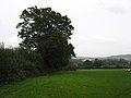
 Pastoral scene near Little London - geograph.org.uk - 2788243.jpg 1 024 × 577 ; 290 kio
-
 Pasture land north of Staunton on Wye - geograph.org.uk - 2788256.jpg 1 024 × 577 ; 294 kio
-
 Poly Tunnels, Handmore Cross - geograph.org.uk - 3382196.jpg 1 600 × 1 200 ; 294 kio
-
 Poly-tunnels, near Staunton-on-Wye - geograph.org.uk - 376278.jpg 640 × 439 ; 42 kio
-
 Potato field - geograph.org.uk - 2366907.jpg 2 048 × 1 536 ; 588 kio
-
 Strawberry fields forever - geograph.org.uk - 376282.jpg 640 × 480 ; 71 kio
-
 The A438, Staunton on Wye - geograph.org.uk - 2782320.jpg 1 024 × 680 ; 228 kio
-
 The Beeches, Staunton on Wye - geograph.org.uk - 316516.jpg 640 × 426 ; 195 kio
-
 The Jarvis Charity - geograph.org.uk - 4038935.jpg 4 790 × 3 410 ; 3,14 Mio
-
 The Jarvis Charity School (geograph 4038523).jpg 5 070 × 3 040 ; 3,3 Mio
-
 The Jarvis Charity School - geograph.org.uk - 4038540.jpg 4 946 × 3 305 ; 3,58 Mio
-
 The Portway Inn - geograph.org.uk - 3170276.jpg 640 × 480 ; 56 kio
-
 The Portway Inn Hotel, Staunton on Wye - geograph.org.uk - 316503.jpg 640 × 426 ; 102 kio
-
 View from the 'Scar' - geograph.org.uk - 1267472.jpg 640 × 480 ; 99 kio
-
 Young cider orchard - geograph.org.uk - 2788236.jpg 1 024 × 577 ; 322 kio
-
 Field mushroom at Staunton on Wye - geograph.org.uk - 604849.jpg 640 × 426 ; 65 kio
-
 Field mushrooms (Agaricus Campestris) - geograph.org.uk - 604856.jpg 640 × 426 ; 58 kio
-
 Kilkington Farm, Staunton on Wye - geograph.org.uk - 316481.jpg 640 × 426 ; 125 kio
-
 Old Letton Court - geograph.org.uk - 316569.jpg 640 × 426 ; 125 kio
-
 Orchard near Staunton on Wye - geograph.org.uk - 602916.jpg 640 × 426 ; 112 kio
-
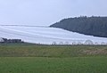
 Rough grassland near Letton Lake - geograph.org.uk - 602912.jpg 640 × 426 ; 90 kio
-
 Stile and footpath at Staunton on Wye - geograph.org.uk - 604833.jpg 426 × 640 ; 132 kio
-
 The New Inn, Staunton on Wye - geograph.org.uk - 316511.jpg 640 × 426 ; 100 kio


.jpg)


_-_geograph.org.uk_-_604856.jpg)


