Category:Steep, Hampshire
Jump to navigation
Jump to search
village and civil parish in Hampshire, United Kingdom _(July_2019)_(2).JPG) | |||||
| Upload media | |||||
| Instance of | |||||
|---|---|---|---|---|---|
| Location | East Hampshire, Hampshire, South East England, England | ||||
| Different from | |||||
 | |||||
English: Steep is a village and civil parish north of Petersfield in the East Hampshire district of Hampshire, England
Subcategories
This category has the following 6 subcategories, out of 6 total.
Media in category "Steep, Hampshire"
The following 200 files are in this category, out of 224 total.
(previous page) (next page)-
 "The Ravine" - geograph.org.uk - 2126553.jpg 480 × 640; 123 KB
-

-
 A wavy fence within Warren Copse - geograph.org.uk - 1325102.jpg 480 × 640; 134 KB
-

-
 A3 bridge over Farnham Road - geograph.org.uk - 5255829.jpg 5,202 × 3,465; 3.77 MB
-
 A3 from Harrow Lane bridge - geograph.org.uk - 463254.jpg 640 × 480; 94 KB
-
 A3 from the Hangers Way - geograph.org.uk - 3823840.jpg 640 × 480; 63 KB
-
 A3 northbound - geograph.org.uk - 3052248.jpg 640 × 480; 52 KB
-
 A3 northbound - geograph.org.uk - 3052292.jpg 640 × 464; 50 KB
-
 A3 northbound - geograph.org.uk - 3052335.jpg 640 × 480; 56 KB
-

-
 A3 southbound near Burnt Ash Farm - geograph.org.uk - 3119620.jpg 640 × 481; 44 KB
-
 A3 southbound near The Lodge - geograph.org.uk - 3119579.jpg 640 × 481; 34 KB
-

-

-
 A3, Approaching Liss turning - geograph.org.uk - 2794532.jpg 640 × 433; 43 KB
-
 A3, Liss turning - geograph.org.uk - 2794545.jpg 640 × 369; 45 KB
-
 A3, northbound - geograph.org.uk - 4256155.jpg 640 × 334; 30 KB
-
 A3, northbound - geograph.org.uk - 4256156.jpg 640 × 319; 24 KB
-
 A3, northbound - geograph.org.uk - 4256157.jpg 640 × 351; 28 KB
-
 A3, northbound - geograph.org.uk - 4256160.jpg 640 × 373; 35 KB
-
 A3, northbound - geograph.org.uk - 5208830.jpg 640 × 394; 45 KB
-

-
 Aldersnapp Farm - geograph.org.uk - 3763619.jpg 640 × 428; 71 KB
-

-
 Approaching road junction on A3 - geograph.org.uk - 4712981.jpg 800 × 386; 57 KB
-
 Ashford Chace - geograph.org.uk - 5259289.jpg 2,560 × 1,920; 1.72 MB
-
 Ashford Chace - geograph.org.uk - 5259296.jpg 2,560 × 1,920; 1.77 MB
-
 Autumn at a lane junction - geograph.org.uk - 3758332.jpg 640 × 480; 204 KB
-
 Autumn on Shoulder of Mutton Hill - geograph.org.uk - 2126686.jpg 480 × 640; 104 KB
-
 Autumn tree colour on Stoner Hill - geograph.org.uk - 2126694.jpg 480 × 640; 101 KB
-
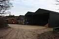
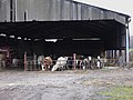 Barn with cattle at Steep Marsh Farm - geograph.org.uk - 2215660.jpg 800 × 600; 118 KB
-
 Bend in Island Farm Lane - geograph.org.uk - 1324709.jpg 640 × 480; 92 KB
-
 Butler sinks opposite The Harrow - geograph.org.uk - 2126640.jpg 640 × 480; 141 KB
-
 Buttresses and Camelid off Lythe Lane - geograph.org.uk - 6034899.jpg 4,032 × 1,960; 3.67 MB
-
 Canopy within Northfield Wood - geograph.org.uk - 1324805.jpg 480 × 640; 155 KB
-

-
 Coach house to old Ashford Manor, Steep.jpg 5,152 × 3,864; 11.6 MB
-
 Cottages on Ridge Common - geograph.org.uk - 2215385.jpg 800 × 600; 168 KB
-
 Cottages on the edge of Petersfield golf course - geograph.org.uk - 5255823.jpg 5,184 × 3,456; 5.87 MB
-
 County signs - geograph.org.uk - 2169458.jpg 800 × 600; 164 KB
-

-
 Down the footpath into Lutcombe Bottom - geograph.org.uk - 953929.jpg 480 × 640; 167 KB
-
 East Hampshire , London Road B2070 - geograph.org.uk - 5739038.jpg 6,000 × 4,000; 6.28 MB
-
 East Hampshire , London Road B2070 - geograph.org.uk - 5739040.jpg 6,000 × 4,000; 7.16 MB
-
 East Hampshire , London Road B2070 - geograph.org.uk - 5739041.jpg 6,000 × 4,000; 7.45 MB
-
 East Hampshire , London Road B2070 - geograph.org.uk - 5739043.jpg 6,000 × 4,000; 5.82 MB
-
 East Hampshire , London Road B2070 - geograph.org.uk - 5739045.jpg 6,000 × 4,000; 6.67 MB
-
 East Hampshire , London Road B2070 - geograph.org.uk - 5739184.jpg 6,000 × 4,000; 5.6 MB
-
 East Hampshire , London Road B2070 - geograph.org.uk - 5739186.jpg 6,000 × 4,000; 7.51 MB
-
 East Hampshire , Winchester Road A272 - geograph.org.uk - 5739195.jpg 6,000 × 4,000; 5.56 MB
-
 Edward Thomas memorial stone.jpg 3,072 × 2,304; 2.96 MB
-
 Entering Steep from the east - geograph.org.uk - 463203.jpg 640 × 531; 107 KB
-
 Entering West Sussex, A272 - geograph.org.uk - 5219136.jpg 640 × 426; 45 KB
-
 Entrance to Ridge Hanger - geograph.org.uk - 6047394.jpg 4,032 × 1,960; 5.64 MB
-
 Farmland at the foot of the Hangers - geograph.org.uk - 356.jpg 640 × 480; 80 KB
-
 Farmland just before Northfield Wood - geograph.org.uk - 1324741.jpg 640 × 480; 77 KB
-
 Field entrance with hay bale turkey - geograph.org.uk - 3758274.jpg 640 × 480; 164 KB
-

-
 Foot and cycle path by A3 - geograph.org.uk - 3758385.jpg 640 × 480; 165 KB
-
 Footbridge near Mellstock Farm - geograph.org.uk - 6034831.jpg 4,032 × 1,960; 5.65 MB
-
 Footbridge over London to Portsmouth railway line - geograph.org.uk - 5254965.jpg 5,184 × 3,456; 7.28 MB
-
 Footbridge over the River Rother - geograph.org.uk - 2741158.jpg 768 × 1,024; 254 KB
-
 Footpath goes west from Farnham Road - geograph.org.uk - 5391491.jpg 800 × 600; 220 KB
-
 Footpath stile to A3 - geograph.org.uk - 3758413.jpg 640 × 480; 129 KB
-
 Footpath towards Steep. The A3 in the background - geograph.org.uk - 5255833.jpg 5,202 × 3,465; 5.38 MB
-
 Forest Access Track, Ridge Hanger - geograph.org.uk - 6047387.jpg 4,032 × 1,960; 6.71 MB
-
 Gate within Warren Copse - geograph.org.uk - 1325109.jpg 640 × 423; 103 KB
-
 Gates at Bowyers House - geograph.org.uk - 2215687.jpg 800 × 600; 147 KB
-
 Gateway at Middlemarch - geograph.org.uk - 2215656.jpg 800 × 600; 191 KB
-
 Gateway to Ashford Chase, Steep.jpg 5,152 × 3,864; 4.45 MB
-

-
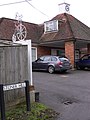
 Harrow Inn sign - geograph.org.uk - 5255837.jpg 640 × 427; 69 KB
-
 Harrow Lane ,Steep - geograph.org.uk - 463208.jpg 640 × 480; 147 KB
-
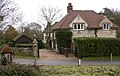 House at Steep - geograph.org.uk - 2215415.jpg 800 × 510; 139 KB
-
 Houses at Steep Marsh - geograph.org.uk - 2215669.jpg 800 × 565; 131 KB
-
 Houses, Ridge Common - geograph.org.uk - 3763598.jpg 640 × 428; 96 KB
-
 Is it a gate^ - geograph.org.uk - 1325137.jpg 640 × 417; 111 KB
-
 Joining the A3 - geograph.org.uk - 5219128.jpg 640 × 378; 35 KB
-

-
 Kettlebrook cottages in autumn - geograph.org.uk - 2126619.jpg 480 × 640; 97 KB
-
 Kettlebrook in autumn - geograph.org.uk - 2126607.jpg 480 × 640; 139 KB
-
 Kettlebrook Lane- looking down - geograph.org.uk - 2126592.jpg 640 × 475; 124 KB
-
 Kettlebrook Lane- looking up - geograph.org.uk - 2126597.jpg 640 × 480; 148 KB
-
 Kettlewell Meadow - geograph.org.uk - 2126630.jpg 640 × 480; 147 KB
-
 Kitchen Garden Wall, Steep 01.jpg 5,152 × 3,864; 4.4 MB
-
 Kitchen Garden Wall, Steep 02.jpg 5,152 × 3,864; 4.39 MB
-
 Lane at Steep Marsh Farm Cottages - geograph.org.uk - 5690424.jpg 640 × 427; 92 KB
-
 Large house on Church Road in Steep - geograph.org.uk - 2215434.jpg 800 × 515; 146 KB
-
 Liss turning, A3 - geograph.org.uk - 5208833.jpg 640 × 426; 54 KB
-
 Little Langleys - geograph.org.uk - 1324700.jpg 640 × 480; 143 KB
-
 Little Waggoners - geograph.org.uk - 5254981.jpg 5,202 × 3,465; 6.78 MB
-
 Logs within Northfield Wood - geograph.org.uk - 1324819.jpg 640 × 480; 148 KB
-

-
 Lone LDWA competitor within Warren Copse - geograph.org.uk - 1325124.jpg 480 × 640; 148 KB
-

-

-

-

-
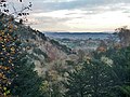
 Looking down from Stoner Hill (1) - geograph.org.uk - 2126690.jpg 640 × 480; 102 KB
-
 Looking down from Stoner Hill (2) - geograph.org.uk - 2126691.jpg 480 × 640; 89 KB
-
 Looking north on Ridge Common Lane - geograph.org.uk - 2215371.jpg 800 × 600; 106 KB
-

-
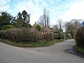
 Looking westwards along Church Road - geograph.org.uk - 1194976.jpg 480 × 640; 63 KB
-
 Lutcombe Bottom and Ashford Hill - geograph.org.uk - 355.jpg 640 × 480; 63 KB
-
 Lythe and Ridge Hangers - geograph.org.uk - 6047401.jpg 4,032 × 1,960; 3.72 MB
-
 Lythe Lane Junction with Footpath - geograph.org.uk - 6034927.jpg 4,032 × 1,960; 6.57 MB
-
 Lythe Lane Looking Towards Lythe Hanger - geograph.org.uk - 6034917.jpg 4,032 × 1,960; 5.03 MB
-
 Mid section of path to Northfield Wood - geograph.org.uk - 1324742.jpg 640 × 480; 104 KB
-
 Mid section of the Kettlewell path - geograph.org.uk - 2126623.jpg 640 × 456; 144 KB
-
 New House at Broadmeadow Farm - geograph.org.uk - 6034875.jpg 4,032 × 1,960; 4.12 MB
-
 Northbound train - geograph.org.uk - 5254961.jpg 5,202 × 3,465; 3.76 MB
-
 Northfield Wood - geograph.org.uk - 1324814.jpg 640 × 480; 159 KB
-
 Notice board at Little Langleys - geograph.org.uk - 1324707.jpg 640 × 480; 129 KB
-
-
 Outbuildings at Soal Farm - geograph.org.uk - 6034866.jpg 4,032 × 1,960; 4.81 MB
-
 Part of Ashford Hangers - geograph.org.uk - 3758314.jpg 640 × 480; 103 KB
-
 Path by golf course - geograph.org.uk - 5254996.jpg 5,184 × 3,456; 6.2 MB
-

-

-
 Path near Steep Church - geograph.org.uk - 1325097.jpg 640 × 480; 119 KB
-
 Path through Ashford Chase - geograph.org.uk - 4416632.jpg 480 × 640; 123 KB
-
 Petersfield Golf Course - geograph.org.uk - 2629955.jpg 640 × 430; 59 KB
-
 Petersfield golf course path - geograph.org.uk - 5255820.jpg 5,202 × 3,465; 4.83 MB
-
 Petersfield Means Business (173) - geograph.org.uk - 6313518.jpg 640 × 480; 79 KB
-
 Petersfield Means Business (174) - geograph.org.uk - 6313519.jpg 640 × 480; 67 KB
-
 Petersfield Means Business (175) - geograph.org.uk - 6313522.jpg 640 × 480; 118 KB
-
 Plant stall outside The Harrow - geograph.org.uk - 2126567.jpg 640 × 480; 143 KB
-
 Pond at Little Langleys - geograph.org.uk - 1324781.jpg 640 × 480; 124 KB
-
 Railway line towards Petersfield - geograph.org.uk - 5254901.jpg 4,846 × 3,104; 3.23 MB
-

-
 Rear of Steep Primary School - geograph.org.uk - 1324852.jpg 640 × 480; 134 KB
-

-

-
 Ridge Top Lane - geograph.org.uk - 6042769.jpg 4,032 × 1,960; 6.05 MB
-
 River Rother, At Prince's Bridge, Liss (2) - geograph.org.uk - 5905323.jpg 1,024 × 768; 260 KB
-
 River Rother, Sheet - geograph.org.uk - 3758360.jpg 640 × 480; 202 KB
-
 Rough shrubland by the railway - geograph.org.uk - 2629951.jpg 640 × 430; 67 KB
-
 Shadows on the Kettlebrook Path - geograph.org.uk - 2126617.jpg 640 × 480; 143 KB
-
 Shared drive to dwellings at Steep - geograph.org.uk - 2215411.jpg 800 × 600; 182 KB
-
 Shipwrights Way footpath by golf course - geograph.org.uk - 5254987.jpg 5,202 × 3,465; 3.86 MB
-
 Shipwrights' Way 116 - geograph.org.uk - 5391530.jpg 800 × 600; 188 KB
-
 Shipwrights' Way 117 - geograph.org.uk - 5391537.jpg 800 × 600; 202 KB
-
 Shipwrights' Way 118 - geograph.org.uk - 5391554.jpg 800 × 600; 141 KB
-
 Shipwrights' Way 119 - geograph.org.uk - 5391577.jpg 800 × 600; 146 KB
-
 Shipwrights' Way 120 - geograph.org.uk - 5391585.jpg 800 × 600; 199 KB
-
 Shipwrights' Way 121 - geograph.org.uk - 5391593.jpg 800 × 600; 212 KB
-
 Shipwrights' Way 122 - geograph.org.uk - 5391599.jpg 800 × 600; 226 KB
-
 Shipwrights' Way 123 - geograph.org.uk - 5391620.jpg 800 × 600; 179 KB
-
 Shipwrights' Way 124 - geograph.org.uk - 5391642.jpg 800 × 600; 210 KB
-
 Shipwrights' Way 125 - geograph.org.uk - 5391662.jpg 800 × 600; 135 KB
-
 Shoulder of Mutton Hill - geograph.org.uk - 3823673.jpg 640 × 480; 107 KB
-
 Shoulder of Mutton Hill - geograph.org.uk - 3823839.jpg 640 × 480; 78 KB
-
 Signpost at Ashford - geograph.org.uk - 2215642.jpg 800 × 600; 113 KB
-
 Small traffic island by the A3 - geograph.org.uk - 2215682.jpg 800 × 600; 108 KB
-
 Spring at Oakhurst Farm - geograph.org.uk - 1324825.jpg 640 × 480; 106 KB
-
 Stagnant pool within Ashford Chace - geograph.org.uk - 1324686.jpg 640 × 480; 135 KB
-
 Start of footpath to Northfield Wood - geograph.org.uk - 1324738.jpg 640 × 480; 121 KB
-
 Steep book monument - geograph.org.uk - 5255842.jpg 5,184 × 3,456; 6.99 MB
-
 Steep Church, Easter Monday 2015 - geograph.org.uk - 4416622.jpg 640 × 480; 61 KB
-
 Steep Primary School - geograph.org.uk - 1194825.jpg 640 × 480; 88 KB
-
 Steep, Hampshire - geograph.org.uk - 4688426.jpg 4,320 × 3,240; 5.22 MB
-
 Steep, Hampshire, All Saints - geograph.org.uk - 5907464.jpg 4,608 × 3,456; 3.99 MB
-
 Steep, The 'Harrow' - geograph.org.uk - 4143632.jpg 4,608 × 3,456; 6.43 MB
-
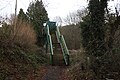
 Steps in Ridge Hanger - geograph.org.uk - 6047379.jpg 1,960 × 4,032; 5.72 MB
-
 Stile off Ridge Common Lane - geograph.org.uk - 6034858.jpg 4,032 × 1,960; 6.07 MB
-
-
 Stoner Hill Rd - geograph.org.uk - 1200927.jpg 640 × 430; 86 KB
-
 Stoner Hill Rd, Cockshott Lane junction - geograph.org.uk - 1200919.jpg 640 × 430; 107 KB
-

-
 Stoner Hill- the road down - geograph.org.uk - 2126672.jpg 640 × 458; 107 KB
-
 Stoner Hill- the road up - geograph.org.uk - 2126700.jpg 640 × 480; 130 KB
-
 Stream by Mill Lane, Steep - geograph.org.uk - 3758301.jpg 640 × 480; 178 KB
-
 Sunken Lane, Ashford Hill - geograph.org.uk - 1200906.jpg 640 × 430; 168 KB
-
 Tankerdale Farm - geograph.org.uk - 5254983.jpg 5,184 × 3,456; 5.41 MB
-
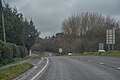
 The A3, Steep - geograph.org.uk - 6344078.jpg 1,920 × 1,280; 1.02 MB
-
 The A3, Steep - geograph.org.uk - 6344079.jpg 1,920 × 1,280; 1.73 MB
-
 The A3, Steep - geograph.org.uk - 6344080.jpg 1,920 × 1,280; 1.66 MB
-
 The Dragon House - geograph.org.uk - 5254958.jpg 5,184 × 3,456; 7.58 MB
-

-
 The Harrow Inn , Steep - geograph.org.uk - 6152055.jpg 4,608 × 3,456; 6.27 MB
-

-
 The River Rother by Stodham Copse - geograph.org.uk - 2215753.jpg 640 × 480; 100 KB
-
 The River Rother east of Durford Mill - geograph.org.uk - 2741146.jpg 1,024 × 768; 296 KB
-
 The road through Ridge Common - geograph.org.uk - 2215394.jpg 800 × 600; 136 KB
-
 There's a dragon at the gates - geograph.org.uk - 2215733.jpg 800 × 600; 194 KB
-
 Track to Ashford Hanger - geograph.org.uk - 955500.jpg 640 × 480; 119 KB
-
 Tree in field - geograph.org.uk - 3763464.jpg 640 × 480; 87 KB
-

-
 Up the footpath from Lutcombe Bottom - geograph.org.uk - 953944.jpg 480 × 640; 131 KB
-
 Up the footpath from Lutcombe Bottom - geograph.org.uk - 953957.jpg 480 × 640; 186 KB
-
 Very wrong clock on Stoner Hill - geograph.org.uk - 2215403.jpg 600 × 800; 124 KB
-

-
 View over Lutcombe Bottom - geograph.org.uk - 3754652.jpg 640 × 480; 113 KB
-
 View south from Wheetham Hill - geograph.org.uk - 4416638.jpg 640 × 480; 133 KB
-
-
 View to the Downs - geograph.org.uk - 5391486.jpg 800 × 600; 207 KB
-
 View Towards Aldersnapp Farm - geograph.org.uk - 6034842.jpg 4,032 × 1,960; 3.09 MB
-
 Warren Copse - geograph.org.uk - 1325122.jpg 640 × 480; 146 KB
-
 Waterfall at Little Langleys - geograph.org.uk - 1324732.jpg 480 × 640; 102 KB


_Stile_9_-_geograph.org.uk_-_1324811.jpg)


_-_geograph.org.uk_-_2126690.jpg)
_-_geograph.org.uk_-_2126691.jpg)


_-_geograph.org.uk_-_6313518.jpg)
_-_geograph.org.uk_-_6313519.jpg)
_-_geograph.org.uk_-_6313522.jpg)


_-_geograph.org.uk_-_5905323.jpg)


