Category:Stenhousemuir
Перейти до навігації
Перейти до пошуку
town in Falkirk, Scotland, UK  | |||||
| Завантажити медіафайл | |||||
| Є одним із | |||||
|---|---|---|---|---|---|
| Місце розташування |
| ||||
| Кількість населення |
| ||||
| Площа |
| ||||
| офіційний сайт | |||||
 | |||||
English: Stenhousemuir is a small town in the district of Falkirk, Scotland, situated to the north of Falkirk town itself. In 2001 the population was reported as being 10,351. The town adjoins Larbert to the West and to a lesser extent Carron & Carronshore to the East.
Gàidhlig: 'S e baile ann an Comhairle na h-Eaglaise Brice a tha ann an Stenhousemuir. Tha e suidhichte gu tuath air an Eaglais Bhric. 'S e seo na co-chomharran aige: 56° 1′ 43.68″ Tuath agus 3° 48′ 38.88″ Iar.
Підкатегорії
Показано 4 підкатегорії з 4.
Файли в категорії «Stenhousemuir»
Показано 25 файлів цієї категорії (із 25).
-

-

-
 Antonshill roundabout.jpg 640 × 480; 75 КБ
-
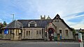
 Church Street, Stenhousemuir - geograph.org.uk - 129749.jpg 640 × 480; 92 КБ
-
 Drainage pond - geograph.org.uk - 302098.jpg 640 × 424; 80 КБ
-
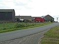
 Drum of Kinnaird farm - geograph.org.uk - 199170.jpg 640 × 480; 106 КБ
-
 Housing - geograph.org.uk - 299720.jpg 640 × 424; 40 КБ
-

-

-
 Kersebrock Farm - geograph.org.uk - 199164.jpg 640 × 480; 52 КБ
-
 Kinnaird House - geograph.org.uk - 199216.jpg 640 × 480; 63 КБ
-
 Larbert and Stenhousemuir from the air (geograph 5229642).jpg 640 × 480; 222 КБ
-
 Larbert East Church Hall.jpg 4032 × 2268; 2,48 МБ
-
 Larbert Stenhousemuir.JPG 3072 × 2304; 1,69 МБ
-

-
 M9 looking east - geograph.org.uk - 1734417.jpg 640 × 480; 70 КБ
-
 M9 looking west - geograph.org.uk - 1734422.jpg 640 × 480; 70 КБ
-
 Main Street, Stenhousemuir - geograph.org.uk - 2129325.jpg 640 × 359; 70 КБ
-
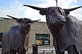 McCowan's Highland Toffee statue - panoramio.jpg 4512 × 3000; 5,85 МБ
-

-
 Motorway - geograph.org.uk - 301902.jpg 640 × 424; 46 КБ
-
 Round bales, Kersebrock - geograph.org.uk - 1734458.jpg 640 × 480; 104 КБ
-
 Stubble, Kinnaird - geograph.org.uk - 1732559.jpg 640 × 480; 107 КБ
-

-


.jpg)


