Category:Stirling Highway
Jump to navigation
Jump to search
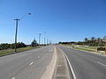
English: Stirling Highway is, for most of its length, a four-lane single carriageway and major arterial road between Perth and the port city of Fremantle in Western Australia on the northern side of the Swan River. The speed limit is 60 km/h. East of Crawley, it continues as Mounts Bay Road which links Crawley and the nearby University of Western Australia to the Perth central business district.
highway in Perth, Western Australia | |||||
| Upload media | |||||
| Instance of | |||||
|---|---|---|---|---|---|
| Named after | |||||
| Location | |||||
| Inception |
| ||||
| Length |
| ||||
| Partially coincident with |
| ||||
 | |||||
Subcategories
This category has the following 18 subcategories, out of 18 total.
C
- Christ Church, Claremont (32 F)
- Claremont Council Offices (11 F)
- Claremont Medical Centre (20 F)
- Claremont War Memorial (12 F)
- Cottesloe Police Station (3 F)
- Cottesloe Primary School (3 F)
F
- Former Nedlands Post Office (6 F)
G
O
- Old Claremont Fire Station (5 F)
P
- Pillar Box, Claremont (2 F)
R
- Rose Hotel, North Fremantle (3 F)
S
T
- The Maisonettes (8 F)
W
- Windsor Cinema (2 F)
Media in category "Stirling Highway"
The following 25 files are in this category, out of 25 total.
-
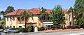
 Captain Stirling Hotel - Stirling Highway frontage.jpg 2,919 × 1,319; 1.34 MB
-
 Captain Stirling Hotel frontage.jpg 2,624 × 1,098; 1.07 MB
-
 CCGS Claremont from Stirling Hwy.jpg 1,600 × 600; 234 KB
-
 Claremont Stirling Hwy footbridge near CCGS.jpg 1,600 × 1,200; 545 KB
-
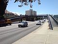
 E37 Stirling Hwy east of Broadway.jpg 3,680 × 2,760; 2.49 MB
-
 E37 Stirling Hwy SR5 marker.jpg 3,680 × 2,760; 2.47 MB
-
 Fremantle welcome - N Frem Stirling Hwy.jpg 1,600 × 1,200; 752 KB
-
 Historic building on Stirling Highway in Claremont, Western Australia.JPG 4,320 × 3,240; 4.9 MB
-
 Horseshoe-Shaped Footbridge In Perth.jpg 1,600 × 1,200; 1.08 MB
-
 Nedlands BP Rosegarden.jpg 4,624 × 3,468; 3.83 MB
-
-

-

-

-
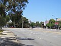
 Stirling Highway at Nedlands, December 2021.jpg 3,264 × 2,448; 2.43 MB
-
 Stirling Highway Nedlands Martin W.JPG 640 × 480; 102 KB
-
 Stirling Highway Nedlands Webster E.jpg 1,600 × 1,200; 548 KB
-
 Stirling Highway Nedlands Webster W.jpg 1,600 × 1,200; 601 KB
-
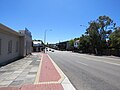
 Stirling Hwy Cottesloe Napoleon N.jpg 1,600 × 1,200; 494 KB
-
 Stirling Hwy Mosman Park Johnston N.jpg 1,600 × 1,200; 542 KB
-
 Stirling Hwy Mosman Park Johnston S.jpg 1,600 × 1,200; 527 KB
-
 Stirling Hwy N from Vlamingh.jpg 1,600 × 1,200; 480 KB
-
 Stirling Hwy SW from Albert.jpg 1,600 × 1,200; 592 KB
-
 StirlingHway Nedlands.jpg 3,072 × 2,304; 2.72 MB
-
 Victoria Street Station, Western Australia, March 2022 11.jpg 4,032 × 3,024; 2.86 MB


