Category:Stoke Climsland Church
Jump to navigation
Jump to search
| Object location | | View all coordinates using: OpenStreetMap |
|---|
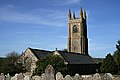
church in Cornwall, UK  | |||||
| Upload media | |||||
| Instance of | |||||
|---|---|---|---|---|---|
| Location | Stokeclimsland, Cornwall, South West England, England | ||||
| Diocese | |||||
| Heritage designation |
| ||||
| Religion or worldview | |||||
 | |||||
Media in category "Stoke Climsland Church"
The following 5 files are in this category, out of 5 total.
-
 A view of Stoke Climsland Church - geograph.org.uk - 409157.jpg 640 × 427; 90 KB
-
-
 Springtime Tower - geograph.org.uk - 409201.jpg 518 × 640; 169 KB
-
 Stoke Climsland Church - geograph.org.uk - 404815.jpg 531 × 640; 96 KB
-
 Stoke Climsland parish church - geograph.org.uk - 1764016.jpg 640 × 480; 85 KB


