Category:Stretton, Derbyshire
Jump to navigation
Jump to search
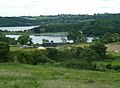
English: Stretton is a small village in Derbyshire, England. It is located near the towns of Clay Cross and three and a half miles from Alfreton on the A61. The nearest waterways are the River Amber and Smithy Brook. Since 1964, Stretton has been beside Ogston Reservoir which still has the remains of a pub (Napoleon's Home) and a light railway within its depths.
village and civil parish in North East Derbyshire, England  | |||||
| Upload media | |||||
| Instance of | |||||
|---|---|---|---|---|---|
| Location | North East Derbyshire, Derbyshire, East Midlands, England | ||||
 | |||||
Media in category "Stretton, Derbyshire"
The following 200 files are in this category, out of 219 total.
(previous page) (next page)-
 "The White Horse" pub sign in Woolley Moor - geograph.org.uk - 3254816.jpg 3,072 × 4,608; 3.42 MB
-
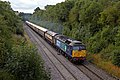
 66120 , Stretton.jpg 4,937 × 3,498; 9.03 MB
-
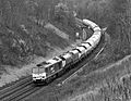
 66085 , Stretton.jpg 2,599 × 2,948; 5.35 MB
-
 66105 , Stretton (7406464532).jpg 4,675 × 3,096; 10.69 MB
-
 222001 , Stretton.jpg 5,462 × 3,641; 11.22 MB
-
 222002 , Stretton.jpg 3,500 × 2,244; 7.5 MB
-
 222013 , Stretton.jpg 2,800 × 1,867; 1.53 MB
-
 37682 , Stretton.jpg 4,387 × 3,392; 8.96 MB
-
 47501 & 47790 , Stretton.jpg 4,735 × 3,156; 7.88 MB
-
 47739 and 421881 Ogston (1).jpg 3,591 × 3,111; 8.39 MB
-
 47739 and 421881 Ogston.jpg 2,500 × 1,971; 2.58 MB
-
 56312 , Stretton (1).jpg 2,850 × 1,834; 1.52 MB
-
 56312 , Stretton.jpg 2,040 × 1,505; 957 KB
-
 60007 , Stretton.jpg 2,598 × 2,012; 1.36 MB
-
 60019 , Stretton (1).jpg 3,000 × 2,054; 6.61 MB
-
 60019 , Stretton (2).jpg 2,739 × 1,908; 1.79 MB
-
 60019 , Stretton.jpg 3,760 × 2,468; 4.58 MB
-
 60049 , Stretton.jpg 3,516 × 2,545; 2.49 MB
-
 60099 , Stretton.jpg 3,232 × 3,148; 7.03 MB
-
 66424 Stretton Derbyshire.jpg 3,573 × 2,382; 2.04 MB
-
 66545 , Stretton.jpg 2,632 × 1,985; 1.48 MB
-
 66559 , Stretton.jpg 3,793 × 2,716; 6.62 MB
-
 97301 and 97302 Ogston.jpg 2,048 × 1,536; 706 KB
-
 97302 and 97301 at Stretton.jpg 1,535 × 2,047; 877 KB
-
 97304 at Stretton.jpg 2,048 × 1,536; 1.02 MB
-
 A Door in a Wall - geograph.org.uk - 409450.jpg 480 × 640; 116 KB
-
 A rubbish view of the Amber Valley - geograph.org.uk - 6196867.jpg 480 × 640; 128 KB
-
 An older oak tree - geograph.org.uk - 2175836.jpg 640 × 480; 153 KB
-
 Approach to Woodhead Grange Farm - geograph.org.uk - 3863613.jpg 800 × 533; 130 KB
-

-
 Averill Farm - geograph.org.uk - 404701.jpg 640 × 360; 55 KB
-
 B6014 by Strathfield House - geograph.org.uk - 3013931.jpg 1,024 × 769; 238 KB
-
 B6014 near Ogston Reservoir - geograph.org.uk - 3014139.jpg 1,024 × 768; 263 KB
-
 B6014 out of Stretton - geograph.org.uk - 6227048.jpg 5,120 × 3,840; 4.23 MB
-
 Badger Lane - geograph.org.uk - 1119830.jpg 640 × 341; 43 KB
-
 Badger Lane, Woolley Moor - geograph.org.uk - 1981549.jpg 1,024 × 656; 402 KB
-
 Brackenfield - bridleway bluebells - geograph.org.uk - 629472.jpg 480 × 640; 124 KB
-
 Bridleway near Smithy Brook - geograph.org.uk - 3240919.jpg 4,000 × 3,000; 2.75 MB
-
 Bus Stop, Woolley Moor - geograph.org.uk - 2126250.jpg 640 × 480; 117 KB
-
 Calf in a Barn - geograph.org.uk - 5604462.jpg 3,541 × 4,926; 4.74 MB
-
 Cattle and farm, Ogston - geograph.org.uk - 2126241.jpg 640 × 480; 99 KB
-
 Cattle on the track to Woodhead Farm - geograph.org.uk - 1981544.jpg 1,024 × 700; 496 KB
-
 Countryside around Stubben Edge Hall - geograph.org.uk - 1981529.jpg 1,024 × 736; 394 KB
-
 Dam at end of Ogston Reservoir - geograph.org.uk - 3863013.jpg 4,000 × 2,248; 5.89 MB
-
 Dam wall, Ogston Reservoir - geograph.org.uk - 2032573.jpg 800 × 600; 172 KB
-
 December view of Ogston Reservoir - geograph.org.uk - 3255319.jpg 2,935 × 4,402; 2.81 MB
-
 Derbyshire UK parish map highlighting Stretton.svg 888 × 1,308; 2.35 MB
-
 Derelict cottage in Stretton - geograph.org.uk - 2175816.jpg 640 × 480; 109 KB
-
 Downhill from Stretton - geograph.org.uk - 1119804.jpg 640 × 480; 63 KB
-
 Drainage work at Ain Moor - geograph.org.uk - 4763057.jpg 4,619 × 3,152; 3.89 MB
-
 Evening view along South Hill Lane - geograph.org.uk - 2014168.jpg 587 × 800; 195 KB
-
 Farm track and countryside near Woodhead Farm - geograph.org.uk - 1981539.jpg 808 × 1,024; 537 KB
-
 Farm Track near Stretton - geograph.org.uk - 3149936.jpg 4,000 × 3,000; 1.5 MB
-
 Farmland near Handley Lodge - geograph.org.uk - 2334211.jpg 1,600 × 1,200; 558 KB
-
 Farmland off Ashover New Road - geograph.org.uk - 2334142.jpg 1,600 × 1,200; 728 KB
-
 Farmland view near Handley - geograph.org.uk - 3014141.jpg 1,024 × 768; 184 KB
-
 Field east of the A61, Stretton - geograph.org.uk - 5957996.jpg 1,024 × 768; 149 KB
-
 Fields and trees, South Hill - geograph.org.uk - 3014138.jpg 1,024 × 670; 184 KB
-
 Fields between Handley and Woolley - geograph.org.uk - 3014154.jpg 1,024 × 768; 225 KB
-
 Fields down towards Ogston Reservoir - geograph.org.uk - 3014147.jpg 1,024 × 750; 178 KB
-
 Footpath east of Stretton - geograph.org.uk - 2432497.jpg 713 × 950; 330 KB
-
 Footpath entering the woods west of Woodhead Farm - geograph.org.uk - 4875439.jpg 1,600 × 1,200; 921 KB
-
 Footpath from South Hill to Mickley - geograph.org.uk - 150453.jpg 640 × 480; 99 KB
-
 Footpath north of Handley - geograph.org.uk - 3014197.jpg 1,024 × 768; 258 KB
-
 Footpaths meet at Ain Moor - geograph.org.uk - 2175864.jpg 640 × 480; 88 KB
-
 Ford Farm Barn - geograph.org.uk - 3863253.jpg 800 × 533; 104 KB
-
 Ford Hall Dovecote - geograph.org.uk - 1886004.jpg 1,600 × 1,200; 675 KB
-
 Grazing land north of the Ogston Reservoir - geograph.org.uk - 3014140.jpg 1,024 × 702; 178 KB
-
 Grazing land, Broomhill Farm - geograph.org.uk - 360398.jpg 640 × 483; 135 KB
-
 Handley House - geograph.org.uk - 2334197.jpg 1,600 × 1,200; 496 KB
-
 Handley Lane and Village Entrance Sign - geograph.org.uk - 3240903.jpg 3,776 × 2,393; 2.31 MB
-
 Highstairs Lane - geograph.org.uk - 3013928.jpg 1,024 × 768; 237 KB
-
 Hill Cottage beside Boar Farm - geograph.org.uk - 3863004.jpg 4,000 × 2,248; 5.28 MB
-
 Hill Cottage, near Woolley Moor - geograph.org.uk - 878806.jpg 640 × 428; 109 KB
-
 Holly Brook Cottage - geograph.org.uk - 3863621.jpg 800 × 533; 103 KB
-

-
 Lane by South Hill Farm - geograph.org.uk - 3014136.jpg 1,024 × 803; 328 KB
-
 Lane through Handley - geograph.org.uk - 3014159.jpg 1,024 × 667; 173 KB
-
 Little-used path in Stretton - geograph.org.uk - 2175806.jpg 640 × 480; 137 KB
-
 Looking across farmland towards the Amber Valley - geograph.org.uk - 2163212.jpg 1,024 × 768; 105 KB
-
 Looking east from Woodhead Farm - geograph.org.uk - 5604459.jpg 4,774 × 3,604; 4.28 MB
-
 Looking towards Woolley Moor - geograph.org.uk - 3864292.jpg 3,970 × 2,194; 5.81 MB
-
 Low water levels at Ogston Reservoir - geograph.org.uk - 2067296.jpg 600 × 800; 126 KB
-
 Midland main line south of Clay Cross - geograph.org.uk - 3013923.jpg 1,024 × 768; 221 KB
-
 Midland main line west of Stretton Hillside - geograph.org.uk - 3013944.jpg 1,024 × 768; 298 KB
-
 Midland mainline at Stretton - geograph.org.uk - 3862996.jpg 4,000 × 2,248; 6.22 MB
-
 Milltown Inlet (Dry and Green) - geograph.org.uk - 305656.jpg 640 × 480; 59 KB
-
 Napoleon Cottage by Ogston Reservoir - geograph.org.uk - 3254850.jpg 4,144 × 2,960; 2.6 MB
-
 Napoleon Cottage overlooking Ogston Reservoir - geograph.org.uk - 3240863.jpg 3,718 × 2,348; 1.73 MB
-
 No right turn - geograph.org.uk - 2175822.jpg 640 × 480; 52 KB
-
 Oddly coloured postbox at Ford Farm - geograph.org.uk - 3255314.jpg 3,072 × 4,608; 3.29 MB
-
 Ogsten reservoir - geograph.org.uk - 5486457.jpg 2,592 × 1,944; 1.94 MB
-
 Ogston Reservoir - geograph.org.uk - 3013969.jpg 1,024 × 768; 247 KB
-
 Ogston Reservoir - geograph.org.uk - 3863247.jpg 800 × 533; 142 KB
-
 Ogston Reservoir - geograph.org.uk - 878793.jpg 640 × 428; 95 KB
-

-
 Ogston Reservoir from Ogston New Road - geograph.org.uk - 2067302.jpg 800 × 582; 115 KB
-
 Ogston Reservoir from South Hill - geograph.org.uk - 3014137.jpg 1,024 × 768; 215 KB
-
 Ogston Reservoir from Woolley Moor - geograph.org.uk - 3254847.jpg 4,289 × 3,064; 3.19 MB
-
 Ogston Reservoir in December - geograph.org.uk - 3255323.jpg 427 × 640; 55 KB
-
 Ogston reservoir North car park - geograph.org.uk - 1119818.jpg 640 × 480; 91 KB
-
 Ogston Reservoir North Car Park - geograph.org.uk - 3863627.jpg 800 × 533; 167 KB
-
 Ogston reservoir. - geograph.org.uk - 5806534.jpg 640 × 335; 52 KB
-

-
 Old Milepost by the A61, Main Road, Stretton (geograph 5623791).jpg 922 × 1,468; 182 KB
-
 Old Station House, Smithy Moor - geograph.org.uk - 2334133.jpg 1,600 × 1,200; 570 KB
-
 Old Toll cottage at Stretton - geograph.org.uk - 3863000.jpg 4,000 × 2,248; 4.64 MB
-

-
 Old wall, Ogston (detail) - geograph.org.uk - 2126660.jpg 640 × 539; 128 KB
-
 Old wall, Ogston - geograph.org.uk - 2126655.jpg 640 × 480; 91 KB
-
 On Temperance Hill, Woolley Moor - geograph.org.uk - 3254765.jpg 4,110 × 2,936; 3.13 MB
-
 Outflow from Ogston Reservoir - geograph.org.uk - 3863018.jpg 3,900 × 2,052; 6.78 MB
-

-
 Path through barley and hillside to Littlemoor - geograph.org.uk - 1981534.jpg 1,024 × 641; 401 KB
-
 Path through woodland east of Stretton - geograph.org.uk - 4762984.jpg 3,888 × 5,184; 6.27 MB
-
 Path through woods east of Stretton - geograph.org.uk - 4762978.jpg 3,888 × 5,184; 6.71 MB
-

-
 Railway footbridge - geograph.org.uk - 3013946.jpg 1,024 × 768; 301 KB
-
 Railway line towards Alfreton - geograph.org.uk - 2334128.jpg 1,600 × 1,200; 641 KB
-
 Railway west of Stretton - geograph.org.uk - 3013911.jpg 1,024 × 743; 307 KB
-
 Reservoir Houses at Ogston - geograph.org.uk - 3255310.jpg 4,431 × 2,659; 2.81 MB
-
 Reservoir Houses at Ogston - geograph.org.uk - 3863009.jpg 3,220 × 1,964; 4.87 MB
-
 Reservoir Houses, Ogston - geograph.org.uk - 3013957.jpg 1,024 × 620; 179 KB
-
 River Amber (Chute) - geograph.org.uk - 305172.jpg 480 × 640; 83 KB
-
 River Amber and Ogston Bridge - geograph.org.uk - 149613.jpg 640 × 480; 172 KB
-
 Sam's Barn (Prior to Conversion) - geograph.org.uk - 305555.jpg 640 × 480; 59 KB
-

-
 Short link road off the A61, Stretton - geograph.org.uk - 5958005.jpg 1,024 × 768; 129 KB
-
 South Hill Lane - geograph.org.uk - 3013976.jpg 1,024 × 768; 358 KB
-
 St.Mark's Church, Handley - geograph.org.uk - 2126244.jpg 640 × 480; 78 KB
-
 Stretton 087774 684c0596.jpg 640 × 480; 238 KB
-
 Stretton Handley C of E School, Woolley Moor - geograph.org.uk - 3254771.jpg 4,340 × 2,801; 2.67 MB
-
 Summer house by Napoleon Cottage, Woolley Moor - geograph.org.uk - 3254856.jpg 3,070 × 4,298; 2.93 MB
-
 The entrance to Woodhead Grange Farm - geograph.org.uk - 5604454.jpg 5,183 × 3,776; 5.54 MB
-
 The White Bear, Stretton - geograph.org.uk - 2334122.jpg 1,600 × 1,200; 364 KB
-
 Three Bridges - geograph.org.uk - 599056.jpg 640 × 421; 152 KB
-
 Toll Gate Cottage - geograph.org.uk - 3863624.jpg 800 × 533; 101 KB
-
 Track off Ashover New Road - geograph.org.uk - 2334136.jpg 1,600 × 1,200; 428 KB
-
 Trees along Smithy Brook - geograph.org.uk - 4763891.jpg 640 × 426; 50 KB
-
 Turn left for Matlock - geograph.org.uk - 1119807.jpg 640 × 480; 108 KB
-
 Valley view near Ogston - geograph.org.uk - 3013953.jpg 1,024 × 768; 171 KB
-

-
 View of Stretton, Ashover Light Railway.jpg 1,600 × 1,033; 415 KB
-
 Walled lane, Ogston - geograph.org.uk - 3013962.jpg 1,024 × 768; 279 KB
-
 White Horse Lane south of Woolley Moor - geograph.org.uk - 1981584.jpg 1,024 × 755; 474 KB
-
 White Horse, Wooley Moor - geograph.org.uk - 2126247.jpg 640 × 480; 54 KB
-
 Woodhead Farm - geograph.org.uk - 1981538.jpg 1,024 × 726; 510 KB
-
 Woodhead Farm - Woodhead Lane - geograph.org.uk - 374616.jpg 640 × 480; 62 KB
-
 Woodhead Farm - Woodhead Lane - geograph.org.uk - 374618.jpg 640 × 480; 66 KB
-

-
 Woodhead Lane - geograph.org.uk - 374609.jpg 640 × 480; 65 KB
-
 Woodhead Lane - geograph.org.uk - 374674.jpg 640 × 480; 52 KB
-
 Woodhead Lane near Handley - geograph.org.uk - 3240910.jpg 3,712 × 2,419; 2.18 MB
-
 Woolley Farm and view to Ashover Hay - geograph.org.uk - 1981574.jpg 695 × 1,024; 415 KB
-
 Woolley Moor Village Scene - geograph.org.uk - 3240880.jpg 3,682 × 2,356; 1.8 MB
-
 Yacht on Ogston Reservoir - geograph.org.uk - 2126667.jpg 640 × 480; 71 KB
-

-
 Alders Wood Rookery Ogston - geograph.org.uk - 305080.jpg 480 × 640; 64 KB
-
-
 Bridleway down to Ogston Bridge - geograph.org.uk - 599776.jpg 480 × 640; 179 KB
-
 Butterfield Lane - geograph.org.uk - 566300.jpg 640 × 480; 122 KB
-
 Castle Farm - South Hill - geograph.org.uk - 393364.jpg 640 × 480; 142 KB
-
 Cows grazing in early morning mist - geograph.org.uk - 278638.jpg 640 × 480; 127 KB
-
 Crow Lane - geograph.org.uk - 396345.jpg 640 × 480; 87 KB
-
 Crow Lane Junction with B6014 - geograph.org.uk - 396310.jpg 640 × 480; 142 KB
-
 Farmland - Shirland and Higham - geograph.org.uk - 317011.jpg 640 × 480; 85 KB
-
 Farmland Looking Towards Ogston Reservoir - geograph.org.uk - 179928.jpg 640 × 480; 113 KB
-
 Farmland opposite Ogston Reservoir - geograph.org.uk - 266488.jpg 640 × 480; 132 KB
-

-
 Footbridge over the River Amber - geograph.org.uk - 566002.jpg 640 × 480; 125 KB
-

-
 Footpath leading to Woodcock Plantation - geograph.org.uk - 566236.jpg 640 × 480; 174 KB
-
 Footpath off Mickley Lane - geograph.org.uk - 598873.jpg 640 × 449; 155 KB
-
 Footpath opposite Ogston Reservoir - geograph.org.uk - 266455.jpg 480 × 640; 127 KB
-
 Footpath view across the Amber Valley - geograph.org.uk - 565990.jpg 640 × 480; 133 KB
-
 Footpath view across the Amber Valley - geograph.org.uk - 566007.jpg 640 × 480; 120 KB
-
 Footpath view towards Butterfield Lane - geograph.org.uk - 566375.jpg 640 × 480; 123 KB
-
 Former lookout at Ogston Sailing Club - geograph.org.uk - 305711.jpg 480 × 640; 82 KB
-
 Higham Farm Ponds - geograph.org.uk - 146173.jpg 640 × 480; 93 KB
-
 Hilltop, Stretton - geograph.org.uk - 87776.jpg 640 × 480; 146 KB
-
 Houses on the Mickley Estate - geograph.org.uk - 598858.jpg 640 × 428; 109 KB
-
 Looking down into the Valley from the A61 - geograph.org.uk - 599044.jpg 640 × 480; 119 KB
-

-

-
 Midland Mainline - geograph.org.uk - 501617.jpg 640 × 480; 141 KB
-
 Ogston - Bird Club Hide and Scrapes - geograph.org.uk - 315008.jpg 640 × 480; 122 KB
-
 Ogston - Evening Sun - geograph.org.uk - 391247.jpg 640 × 480; 97 KB
-
 Ogston Dam Overflow Spray - geograph.org.uk - 305529.jpg 640 × 480; 57 KB
-
 Ogston Hall - Private Road - geograph.org.uk - 409437.jpg 640 × 480; 113 KB
-

-

-
 Ogston New Road - (Old Tractors) - geograph.org.uk - 305698.jpg 640 × 480; 54 KB
-
 Ogston New Road - North View - geograph.org.uk - 396444.jpg 640 × 480; 101 KB
-
 Ogston New Road View - geograph.org.uk - 396427.jpg 640 × 480; 88 KB
-
 Ogston Reservoir (Frozen) - geograph.org.uk - 305706.jpg 640 × 480; 59 KB
-
 Ogston Reservoir and Hot Air Balloon - geograph.org.uk - 305705.jpg 640 × 480; 56 KB
-
 Ogston Reservoir Low Water - geograph.org.uk - 305695.jpg 640 × 480; 59 KB
-
 Ogston Sailing Club - geograph.org.uk - 406739.jpg 640 × 480; 52 KB
-
 Ogston Sailing Club - geograph.org.uk - 87772.jpg 640 × 480; 136 KB
-


.jpg)


.jpg)

.jpg)


.jpg)
.jpg)


_-_geograph.org.uk_-_305656.jpg)


.jpg)


_-_geograph.org.uk_-_2126660.jpg)


_-_geograph.org.uk_-_305172.jpg)

_-_geograph.org.uk_-_305555.jpg)
_-_geograph.org.uk_-_305553.jpg)


_-_geograph.org.uk_-_305088.jpg)


_-_geograph.org.uk_-_578036.jpg)


_-_geograph.org.uk_-_305672.jpg)
_-_geograph.org.uk_-_305685.jpg)
_-_geograph.org.uk_-_305698.jpg)


_-_geograph.org.uk_-_305706.jpg)


