Category:Stronsay
Jump to navigation
Jump to search
island in Orkney Islands, Scotland, UK   | |||||
| Upload media | |||||
| Instance of | |||||
|---|---|---|---|---|---|
| Part of | |||||
| Location |
| ||||
| Located in or next to body of water | |||||
| Width |
| ||||
| Length |
| ||||
| Population |
| ||||
| Area |
| ||||
 | |||||
Subcategories
This category has the following 11 subcategories, out of 11 total.
A
- Auskerry Lighthouse (10 F)
E
- Everbay (1 F)
G
- Grobister (2 F)
H
- Holm of Huip (3 F)
O
- Odness (4 F)
R
- Rothiesholm (1 F)
S
- Stronsay Airport (4 F)
- Stronsay Beast (2 F)
V
- Vat of Kirbister (10 F)
W
- Whitehall, Orkney Islands (48 F)
Media in category "Stronsay"
The following 200 files are in this category, out of 210 total.
(previous page) (next page)-
 A turbine at Bu wind farm - geograph.org.uk - 1371392.jpg 640 × 480; 54 KB
-
 Abandoned car on the beach, Bay of Holland, Stronsay, Orkney - geograph.org.uk - 4219961.jpg 3,648 × 2,736; 1.07 MB
-
 Aerial view of Stronsay - geograph.org.uk - 2253012.jpg 1,200 × 816; 126 KB
-
 Airy - geograph.org.uk - 219158.jpg 487 × 640; 62 KB
-
 Airy Loch, Stronsay - geograph.org.uk - 212961.jpg 640 × 484; 30 KB
-
 An Orkney Yawl - geograph.org.uk - 1382626.jpg 640 × 428; 80 KB
-
 Bay of Bomasty - geograph.org.uk - 3006638.jpg 4,059 × 2,353; 1.76 MB
-
 Bay of Holland - geograph.org.uk - 3006849.jpg 3,589 × 3,325; 7.02 MB
-
 Bay of Holland, Stronsay, Orkney - geograph.org.uk - 3995229.jpg 3,562 × 2,428; 1,022 KB
-
 Bay of Houseby - geograph.org.uk - 216905.jpg 640 × 491; 69 KB
-
 Bay of Houseby, Stronsay - geograph.org.uk - 212924.jpg 640 × 485; 71 KB
-
 Beach and boat, Brae Geo - geograph.org.uk - 1245404.jpg 640 × 417; 58 KB
-
 Beach of St Catherine's Bay, Stronsay - geograph.org.uk - 6263699.jpg 3,648 × 2,736; 2.1 MB
-
 Beach, St Catherines Bay, Stronsay, Orkney - geograph.org.uk - 4220430.jpg 1,456 × 1,090; 293 KB
-
 Bight of Baywest - geograph.org.uk - 3010208.jpg 3,571 × 3,271; 6.98 MB
-
 Bight of Matpow - geograph.org.uk - 3011181.jpg 3,648 × 2,736; 6.57 MB
-
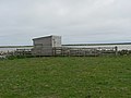 Bird hide on Lea Shun - geograph.org.uk - 217172.jpg 640 × 480; 53 KB
-
 Bluthers Geo, Stronsay - geograph.org.uk - 212901.jpg 480 × 640; 73 KB
-
 Bu, Stronsay, from the air - geograph.org.uk - 5895228.jpg 1,600 × 1,065; 463 KB
-
 Burgh Head, Stronsay. - geograph.org.uk - 531499.jpg 640 × 426; 103 KB
-
 Burgh Hill, Stronsay's "summit" - geograph.org.uk - 253390.jpg 500 × 375; 45 KB
-
 Cairn on Holm of Huip as seen from ferry to Stronsay - geograph.org.uk - 6331178.jpg 5,184 × 2,920; 4.32 MB
-
 Cleat, Stronsay - geograph.org.uk - 216933.jpg 640 × 489; 61 KB
-
 Clestrain Farm - geograph.org.uk - 3006856.jpg 3,127 × 2,797; 6.42 MB
-
 Cliffs near Burgh Head, Stronsay - geograph.org.uk - 217246.jpg 480 × 640; 77 KB
-
 Coastal erosion, Sands of Odie, Stronsay, Orkney - geograph.org.uk - 4123395.jpg 3,510 × 2,452; 1.06 MB
-
 Coastal rock formation, Stronsay - geograph.org.uk - 212980.jpg 640 × 480; 77 KB
-
 Coastline at Odin Bay on Stronsay - geograph.org.uk - 1371427.jpg 640 × 480; 90 KB
-
 Coastline near Huip, Stronsay, Orkney - geograph.org.uk - 4123429.jpg 3,530 × 2,643; 1.13 MB
-
 Coastline, Bight of Aith, Stronsay, Orkney - geograph.org.uk - 3995287.jpg 3,648 × 2,736; 1.18 MB
-
 Coastline, Grice Ness, Stronsay, Orkney - geograph.org.uk - 4329657.jpg 1,459 × 1,094; 399 KB
-
 Coastline, Holland Bay, Stronsay, Orkney - geograph.org.uk - 3994566.jpg 3,648 × 2,502; 1.39 MB
-
 Coastline, Linga Sound, Stronsay, Orkney - geograph.org.uk - 3994518.jpg 3,243 × 2,111; 1,000 KB
-
 Coastline, Mill Bay, Stronsay, Orkney - geograph.org.uk - 3994602.jpg 3,450 × 2,042; 1.12 MB
-
 Cobbie Row's Lade, Stronsay, Orkney - geograph.org.uk - 3995211.jpg 3,589 × 2,657; 1.17 MB
-
 Comley, Stronsay - geograph.org.uk - 217166.jpg 640 × 480; 68 KB
-
 Cormorants nesting on The Brough - geograph.org.uk - 214395.jpg 640 × 480; 70 KB
-
 East of Cudano Geo, Stronsay. - geograph.org.uk - 531497.jpg 640 × 426; 117 KB
-
 Erect slabs on The Brough, Stronsay, Orkney - geograph.org.uk - 3995315.jpg 2,736 × 3,648; 1,008 KB
-
 Farmland on Stronsay - geograph.org.uk - 216953.jpg 640 × 480; 76 KB
-
 Farmland, Latan, Stronsay, Orkney - geograph.org.uk - 3994555.jpg 3,648 × 1,988; 903 KB
-
 Fire station on Stronsay - geograph.org.uk - 1371407.jpg 640 × 480; 66 KB
-
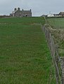
 Former school, Stronsay - geograph.org.uk - 216956.jpg 640 × 487; 69 KB
-
 From the seal hide - geograph.org.uk - 1086396.jpg 480 × 640; 65 KB
-
 Grain stacked to dry, Stronsay - geograph.org.uk - 253385.jpg 500 × 375; 47 KB
-
 Grochlie Geo, Stronsay, Orkney - geograph.org.uk - 3994576.jpg 3,648 × 2,242; 1.08 MB
-
 Hells Mouth by Lamb Head, Stronsay. - geograph.org.uk - 531902.jpg 640 × 426; 82 KB
-
 Holland Farm, Stronsay - geograph.org.uk - 212903.jpg 640 × 480; 56 KB
-
 Holm of Huip as seen from ferry to Stronsay - geograph.org.uk - 6331181.jpg 5,184 × 2,920; 5.51 MB
-
 Horse by the roadside - geograph.org.uk - 212916.jpg 640 × 480; 36 KB
-
 Housebay, Stronsay - geograph.org.uk - 216944.jpg 640 × 480; 75 KB
-
 Huip Farm, Stronsay as seen from ferry - geograph.org.uk - 6331187.jpg 5,184 × 2,920; 5.46 MB
-
 Jetty, Links Ness, Stronsay, Orkney - geograph.org.uk - 3994512.jpg 2,221 × 3,551; 835 KB
-

-
 Kelp drying wall and kiln, Latan, Stronsay, Orkney - geograph.org.uk - 4123325.jpg 3,526 × 2,014; 913 KB
-
 Kelp forest, Langa Mae, Stronsay, Orkney - geograph.org.uk - 3994617.jpg 3,648 × 2,736; 1.19 MB
-
 Kirkhall, Stronsay - geograph.org.uk - 217169.jpg 640 × 480; 41 KB
-
 Langa Mae, Stronsay, Orkney - geograph.org.uk - 3994608.jpg 3,609 × 2,518; 1.24 MB
-
 Lea Shun - geograph.org.uk - 1086440.jpg 640 × 480; 52 KB
-
 Letter box by the B9061, Stronsay, Orkney - geograph.org.uk - 4219905.jpg 1,094 × 1,239; 231 KB
-
 Links Ness, Stronsay, from the air - geograph.org.uk - 5895220.jpg 1,600 × 1,065; 396 KB
-
 Linksness and Runthall - geograph.org.uk - 1086188.jpg 640 × 480; 67 KB
-
 Loch of Rothiesholm - geograph.org.uk - 3006780.jpg 3,322 × 3,664; 6.86 MB
-
 Looking to the Coppa - geograph.org.uk - 3010306.jpg 3,648 × 2,736; 5.41 MB
-
 Looking towards Holland Farm - geograph.org.uk - 1086885.jpg 640 × 401; 73 KB
-
 Looking towards Inganoust - geograph.org.uk - 1086319.jpg 640 × 489; 94 KB
-
 Main Road on Stronsay - geograph.org.uk - 3006968.jpg 3,648 × 2,736; 4.19 MB
-
 Meadow of wild flowers - geograph.org.uk - 1086406.jpg 461 × 640; 129 KB
-
 Mill Bay on Stronsay - geograph.org.uk - 1371414.jpg 640 × 480; 72 KB
-
 Millfield Moss - geograph.org.uk - 3009889.jpg 2,525 × 2,633; 1.49 MB
-
 Minor Road on Stronsay - geograph.org.uk - 3006975.jpg 3,648 × 2,736; 5.62 MB
-
 Near Geo of Gessan, Stronsay - geograph.org.uk - 212933.jpg 640 × 480; 56 KB
-
 New fencing on Stronsay - geograph.org.uk - 213393.jpg 640 × 486; 47 KB
-
 Odiness Farm, Stronsay. - geograph.org.uk - 531502.jpg 640 × 426; 89 KB
-
 On Stronsay - Beach at Mill Bay from lane by Linksquoy - geograph.org.uk - 6331216.jpg 5,184 × 2,920; 5.97 MB
-
 On Stronsay - Coastal scenery at Outspay - geograph.org.uk - 6331320.jpg 5,184 × 2,920; 5.62 MB
-
 On Stronsay - Eastern end of Bay of Houseby - geograph.org.uk - 6331339.jpg 5,184 × 2,920; 6.42 MB
-
 On Stronsay - Gories, Everbay - geograph.org.uk - 6331363.jpg 5,184 × 2,920; 5.48 MB
-
 On Stronsay - Huip Farm - geograph.org.uk - 6331373.jpg 5,184 × 2,920; 5.84 MB
-
 On Stronsay - Lamb Bay from Lamb Head - geograph.org.uk - 6331335.jpg 5,184 × 2,920; 6.26 MB
-
 On Stronsay - Meadow between Lamb Bay ^ Bay of Houseby - geograph.org.uk - 6331332.jpg 5,184 × 2,920; 6.59 MB
-
 On Stronsay - Mid House ^ Scoulters - geograph.org.uk - 6331356.jpg 5,184 × 2,920; 7.39 MB
-
 On Stronsay - Natural arch SE of Outspay - geograph.org.uk - 6331328.jpg 5,184 × 2,920; 1.41 MB
-
 On Stronsay - Papa Stronsay from John's Hill - geograph.org.uk - 6331379.jpg 5,184 × 2,920; 5.11 MB
-

-
 On Stronsay - Path leading down to Vat of Kirbuster - geograph.org.uk - 6331301.jpg 5,184 × 2,920; 6.38 MB
-
 On Stronsay - Ramna Geo ^ Nebbi Geo - geograph.org.uk - 6331308.jpg 5,184 × 2,920; 1.83 MB
-
 On Stronsay - Rocky coast, W of Whale Geo, Lamb Head - geograph.org.uk - 6331338.jpg 5,184 × 2,920; 6.65 MB
-
 On Stronsay - S of Vat of Kirbuster - geograph.org.uk - 6331317.jpg 5,184 × 2,920; 6.17 MB
-
 On Stronsay - Sand of Rothiesholm at Bu - geograph.org.uk - 6331367.jpg 5,184 × 2,920; 4.98 MB
-
 On Stronsay - St Catherine's Bay ^ Gricey Water - geograph.org.uk - 6331213.jpg 5,184 × 2,920; 5.37 MB
-
 On Stronsay - St Catherine's Bay ^ view towards Linga Holm - geograph.org.uk - 6331214.jpg 5,184 × 2,920; 5.76 MB
-
 On Stronsay - The Brough at Burgh Head - geograph.org.uk - 6331331.jpg 5,184 × 2,920; 5.52 MB
-
 On Stronsay - Treig point on John's Hill - geograph.org.uk - 6331382.jpg 5,184 × 2,920; 6.27 MB
-
 On Stronsay - Trig point at Burgh Hill - geograph.org.uk - 6331319.jpg 5,184 × 2,920; 2.07 MB
-
 On Stronsay - Vat of Kirbuster - geograph.org.uk - 6331310.jpg 5,184 × 2,920; 5.14 MB
-
 On Stronsay - View towards Meikle Water from near Eastbank - geograph.org.uk - 6331357.jpg 5,184 × 2,920; 7.14 MB
-
 On Stronsay - View towards Meikle Water from near Eastbank - geograph.org.uk - 6331361.jpg 5,184 × 2,920; 7.25 MB
-
 On Stronsay - view towards Whitehall Farm ^ Whitehall - geograph.org.uk - 6331369.jpg 5,184 × 2,920; 5.84 MB
-
 On Stronsay - Walking towards Odiness - geograph.org.uk - 6331365.jpg 5,184 × 2,920; 6.32 MB
-
 On Stronsay - washed up buoy, Bay of Houseby (detail) - geograph.org.uk - 6331349.jpg 2,920 × 5,184; 5.55 MB
-
 On Stronsay - Washed up buoy, Bay of Houseby - geograph.org.uk - 6331345.jpg 5,184 × 2,920; 6.15 MB
-
 On the shore, Lea Shun - geograph.org.uk - 1086374.jpg 640 × 480; 85 KB
-
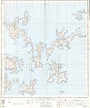 Ordnance Survey One-Inch Sheet 5 Orkney (North), Published 1958.jpg 8,280 × 9,862; 6.18 MB
-
 Ork Stronsay.jpg 1,177 × 1,454; 124 KB
-
 Orthostat, Huip Ness, Stronsay, Orkney - geograph.org.uk - 3995297.jpg 2,892 × 1,445; 715 KB
-
 Oyce of Huip, Stronsay, from the air - geograph.org.uk - 5895214.jpg 1,600 × 1,065; 387 KB
-
 Playground on Stronsay - geograph.org.uk - 195648.jpg 640 × 483; 67 KB
-
 Ploughing, near Everbay on Stronsay - geograph.org.uk - 216958.jpg 640 × 480; 48 KB
-
 Possible broch, Green Hill, Stronsay, Orkney - geograph.org.uk - 3995278.jpg 2,736 × 3,648; 2.02 MB
-
 Postman at Cowshouse, Stronsay - geograph.org.uk - 217231.jpg 640 × 480; 55 KB
-
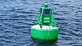 Quaibow Buoy on entry to Whitehall, Stronsay - geograph.org.uk - 6331184.jpg 5,184 × 2,920; 6.99 MB
-
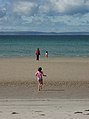
 Rothiesholm Beach Family 006.jpg 5,927 × 3,957; 4.38 MB
-
 Rothisholm trig - geograph.org.uk - 1371233.jpg 640 × 480; 61 KB
-
 Ruined farmstead at Latan, Stronsay, Orkney - geograph.org.uk - 4123369.jpg 3,585 × 1,793; 602 KB
-

-
 Sand of the Crook and ayre, Stronsay, Orkney - geograph.org.uk - 4220481.jpg 3,648 × 2,736; 1.25 MB
-
 Seals at the Bight of Scarma - geograph.org.uk - 1086390.jpg 640 × 480; 126 KB
-
 Seals on the beach - geograph.org.uk - 1086415.jpg 640 × 480; 119 KB
-
 Seals Sunbathing - geograph.org.uk - 1086402.jpg 640 × 480; 124 KB
-
 Settlement mound above Sands of Odie, Stronsay, Orkney - geograph.org.uk - 3995242.jpg 3,648 × 1,555; 667 KB
-
 Settlement mound, Lower Dishes, Stronsay, Orkney - geograph.org.uk - 3994598.jpg 3,648 × 2,736; 1.29 MB
-
 Settlement, Clestrain, Stronsay, Orkney - geograph.org.uk - 4329731.jpg 1,459 × 1,094; 390 KB
-
 Shipwreck near Whitehall - geograph.org.uk - 1086242.jpg 640 × 480; 56 KB
-
 St Catherine's Bay - geograph.org.uk - 1086201.jpg 640 × 466; 56 KB
-
 St Catherine's Bay - geograph.org.uk - 1086208.jpg 640 × 480; 40 KB
-
 St Catherine's Bay - geograph.org.uk - 1086224.jpg 640 × 480; 52 KB
-
 St Catherine's Bay - geograph.org.uk - 1086230.jpg 477 × 640; 54 KB
-
 St Johns Hill trig - geograph.org.uk - 1371231.jpg 640 × 480; 104 KB
-
 Standing stone, Huip Ness, Stronsay, Orkney - geograph.org.uk - 4123521.jpg 3,648 × 2,736; 1.28 MB
-
 Stile near Holland Farm - geograph.org.uk - 1086444.jpg 640 × 480; 63 KB
-
 Stone Sentinals - geograph.org.uk - 3011183.jpg 3,648 × 2,736; 4.09 MB
-
 Straenia Water - geograph.org.uk - 3009824.jpg 3,648 × 2,736; 4.78 MB
-

-
 Stronsay beast1.jpg 512 × 97; 15 KB
-
 Stronsay beast2.jpg 523 × 114; 19 KB
-
 Stronsay Coastline - geograph.org.uk - 3009892.jpg 3,648 × 2,736; 5.69 MB
-
 Stronsay Farmland - geograph.org.uk - 3006981.jpg 3,648 × 2,736; 5.29 MB
-
 Stronsay Orkney.svg 1,110 × 1,424; 731 KB
-
 Stronsay trig - geograph.org.uk - 1371235.jpg 640 × 480; 85 KB
-
 Stronsay, a narrow, unnamed geo - geograph.org.uk - 4713675.jpg 480 × 640; 90 KB
-
 Stronsay, arriving at Mill Bay beach - geograph.org.uk - 4711426.jpg 640 × 481; 67 KB
-

-
 Stronsay, beach at Runthall - geograph.org.uk - 4713995.jpg 640 × 481; 44 KB
-

-
 Stronsay, Bight of Scarma - geograph.org.uk - 4713956.jpg 640 × 480; 81 KB
-
 Stronsay, cemetery at Holland - geograph.org.uk - 4713957.jpg 640 × 480; 82 KB
-
 Stronsay, close-up of a rocky headland - geograph.org.uk - 4713733.jpg 480 × 640; 115 KB
-

-
 Stronsay, field at Yearnasetter - geograph.org.uk - 4711423.jpg 479 × 640; 58 KB
-

-

-

-

-
 Stronsay, Our Lady’s Chapel - geograph.org.uk - 4713987.jpg 640 × 480; 51 KB
-

-
 Stronsay, path to the coast - geograph.org.uk - 4713645.jpg 479 × 640; 102 KB
-
 Stronsay, phone box at Rothiesholm - geograph.org.uk - 4713970.jpg 480 × 640; 58 KB
-

-

-

-
 Stronsay, postbox № KW17 53, Everbay - geograph.org.uk - 4713752.jpg 480 × 640; 64 KB
-
 Stronsay, postbox № KW17 54, Rothiesholm - geograph.org.uk - 4713969.jpg 480 × 640; 105 KB
-

-
 Stronsay, Ramma Geo - geograph.org.uk - 4713657.jpg 479 × 640; 101 KB
-

-
 Stronsay, Sand of Rothiesholm - geograph.org.uk - 4713966.jpg 640 × 480; 61 KB
-

-
 Stronsay, seals making a splash - geograph.org.uk - 4713953.jpg 640 × 480; 65 KB
-
 Stronsay, St. Catherine’s Bay beach - geograph.org.uk - 4713975.jpg 640 × 480; 55 KB
-

-
 Stronsay, stile on the coast path - geograph.org.uk - 4713667.jpg 480 × 640; 85 KB
-
 Stronsay, the blue water of Mill Bay - geograph.org.uk - 4713961.jpg 640 × 480; 50 KB
-
 Stronsay, the church - geograph.org.uk - 4713960.jpg 640 × 480; 74 KB
-

-
 Stronsay, the road to Holland - geograph.org.uk - 4713948.jpg 640 × 480; 68 KB
-
 Stronsay, the Royal Bank of Scotland - geograph.org.uk - 4713628.jpg 640 × 481; 45 KB
-
 Stronsay, the Stronsay Hotel - geograph.org.uk - 4713622.jpg 640 × 481; 49 KB
-

-
 Stronsay, Two Castles - geograph.org.uk - 4713694.jpg 640 × 480; 98 KB
-
 Stronsay, two seals - geograph.org.uk - 4713954.jpg 640 × 481; 98 KB
-
 Stronsay, view across Bay of Franks - geograph.org.uk - 4713984.jpg 640 × 481; 43 KB
-

-

-

-

-
 Submarine power cable, Bay of Holland, Stronsay, Orkney - geograph.org.uk - 3995174.jpg 2,736 × 3,648; 1.12 MB
-
 Sunset beyond Odin Ness, Stronsay - geograph.org.uk - 5477698.jpg 1,024 × 682; 68 KB
-
 Tam's Castle - geograph.org.uk - 212958.jpg 480 × 640; 73 KB
-
 The bird hide - geograph.org.uk - 1086386.jpg 480 × 640; 92 KB
-
 The Coorsa, Stronsay, Orkney - geograph.org.uk - 4123299.jpg 2,591 × 3,537; 1.29 MB
-
 The Danes' Pier, Lamb Ness, Stronsay, Orkney - geograph.org.uk - 4314323.jpg 1,425 × 546; 121 KB
-
 The Roan, Papa Stronsay - geograph.org.uk - 4866808.jpg 1,200 × 656; 629 KB
-

-
 Tiffenmaka Cottage - geograph.org.uk - 3006636.jpg 3,648 × 2,736; 4.89 MB
-
 To the Sands of Odie - geograph.org.uk - 1086191.jpg 640 × 437; 112 KB
-
 Track and power lines below John's Hill, Stronsay, Orkney - geograph.org.uk - 4123412.jpg 2,576 × 3,492; 1.45 MB
-
 Track at Bay of Houseby, Stronsay - geograph.org.uk - 212929.jpg 640 × 481; 60 KB
-
 Track from Holland to Mells Kirk - geograph.org.uk - 1086317.jpg 640 × 480; 91 KB
-
 Track up to Bu wind farm - geograph.org.uk - 1371396.jpg 640 × 480; 67 KB


_-_geograph.org.uk_-_6331349.jpg)


,_Published_1958.jpg)


