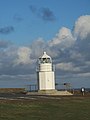
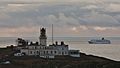
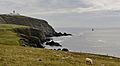
Category:Sumburgh Head Lighthouse
Aller à la navigation
Aller à la recherche

| Position de l'objet | | Voir toutes les coordonnées en utilisant : OpenStreetMap |
|---|
lighthouse at Sumburgh Head on the mainland of Shetland, Shetland Islands, Scotland, UK  .jpg) | |||||
| Téléverser des médias | |||||
| Nature de l’élément | |||||
|---|---|---|---|---|---|
| Lieu | |||||
| Usage | |||||
| Opérateur | |||||
| Comprend |
| ||||
| Statut patrimonial |
| ||||
| Date de fondation ou de création |
| ||||
| Événement clé |
| ||||
| Hauteur |
| ||||
 | |||||
Sous-catégories
Cette catégorie comprend seulement la sous-catégorie ci-dessous.
S
- Sumburgh Foghorn (17 F)
Média dans la catégorie « Sumburgh Head Lighthouse »
Cette catégorie comprend 314 fichiers, dont les 200 ci-dessous.
(page précédente) (page suivante)-
 33 Landing IMG 4152 (34824318434).jpg 4 072 × 2 092 ; 2,54 Mio
-
 Aberdeen night flight (14542608901).jpg 3 635 × 1 924 ; 1,77 Mio
-
 Abigail IMG 5144 (22370150943).jpg 4 264 × 2 166 ; 2,49 Mio
-
 Afternoon Patrol IMG 7135 (16708823585).jpg 4 272 × 2 348 ; 2,83 Mio
-
 Aidacara IMG 0109 (14398496366).jpg 4 255 × 2 355 ; 3,11 Mio
-
 Aidacara IMG 6348 (14662491206).jpg 4 247 × 2 242 ; 3,55 Mio
-
 Almost There IMG 8321 (31630637061).jpg 4 230 × 2 230 ; 1,98 Mio
-
 Another Year MG 6941 (31966328181).jpg 5 152 × 2 797 ; 2,77 Mio
-
 Astoria in Shetland (2).jpg 5 152 × 2 842 ; 5,55 Mio
-
 At the Lights IMG 6378 (23875841170).jpg 4 272 × 2 197 ; 3,13 Mio
-
 ATR 42 G-LMSA IMG 0010.jpg 5 659 × 3 331 ; 5,1 Mio
-
 ATR 72 G-FBXA MG 9796.jpg 4 938 × 2 821 ; 4,02 Mio
-
 ATR 72 G-FBXB MG 8110.jpg 5 184 × 2 891 ; 4,41 Mio
-
 Autumn at Sumburgh IMG 3724 (21089439108).jpg 4 212 × 2 294 ; 2,82 Mio
-
 Beach Breakers IMG 9517.jpg 5 893 × 3 332 ; 4,46 Mio
-
 Black Marlin IMG 0020 (18186134274).jpg 4 266 × 2 195 ; 6,33 Mio
-
 Brewing Storm MG 6611 (30855616544).jpg 5 164 × 2 719 ; 3,15 Mio
-
 Brigantia MG 2378 (27094365344).jpg 5 184 × 2 872 ; 7,36 Mio
-
 Brilliance Of The Seas IMG 6756 (9411885138).jpg 4 230 × 2 568 ; 3,35 Mio
-
 Building work at Sumburgh lighthouse - geograph.org.uk - 3281843.jpg 640 × 480 ; 43 kio
-
 Cayenne IMG 0745 (27675968546).jpg 4 141 × 2 209 ; 3,26 Mio
-
 Cayenne IMG 0829 (27710177815).jpg 4 248 × 2 437 ; 3,05 Mio
-
 Cloudbreak IMG 7501 (24559556710).jpg 4 228 × 2 322 ; 2,68 Mio
-
 Colourful Sumburgh Head IMG 8075 (17165245061).jpg 4 262 × 2 496 ; 3,79 Mio
-
 Costa Pacifica 4 (8392847488).jpg 4 191 × 2 111 ; 4,24 Mio
-
 Costa Pacifica 9 (8392919706).jpg 4 065 × 2 390 ; 5,4 Mio
-
 Dalsetter IMG 0163 (14439582871).jpg 4 245 × 2 367 ; 2,63 Mio
-
 Daroja IMG 6771 (9417041266).jpg 4 272 × 2 244 ; 2,73 Mio
-
 Dawn Patrol IMG 9247 (32347452881).jpg 4 272 × 2 216 ; 2,97 Mio
-
 December Storm IMG 0182 (16000254795).jpg 4 272 × 2 263 ; 3 Mio
-
 Draken Harald Hårfagre (26681185291).jpg 4 474 × 2 528 ; 3,19 Mio
-
 Entrance to Sumburgh Head lighthouse - geograph.org.uk - 960889.jpg 640 × 480 ; 59 kio
-
 Entrance to Sumburgh Head lighthouse - geograph.org.uk - 960890.jpg 640 × 480 ; 91 kio
-
 Eurodam IMG 3801 (21317379795).jpg 4 266 × 2 322 ; 4,33 Mio
-
 Eurodam IMG 3802 (20696300233).jpg 4 248 × 2 292 ; 4,97 Mio
-
 Europa IMG 3095 (28000494233).jpg 4 254 × 2 333 ; 3,46 Mio
-
 Evening Sumburgh Head IMG 1584 (9418243294).jpg 4 133 × 2 337 ; 3,41 Mio
-
 Evening sun IMG 5556 (14550303081).jpg 4 187 × 2 225 ; 2,76 Mio
-
 Faermie IMG 8003 (9727646076).jpg 4 160 × 2 369 ; 3,29 Mio
-
 Fair Isle Reflections IMG 5778 (23641363721).jpg 4 208 × 2 313 ; 3 Mio
-
 Fog Horn and Radar Hut (19063683815).jpg 2 304 × 1 728 ; 775 kio
-
 Foghorn and lighthouse, Sumburgh - geograph.org.uk - 2775243.jpg 1 400 × 1 000 ; 1,54 Mio
-
 Foghorn at Sumburgh Head - geograph.org.uk - 3931366.jpg 851 × 1 280 ; 240 kio
-
 Foghorn, Sumburgh Head - geograph.org.uk - 3840330.jpg 640 × 480 ; 248 kio
-
 Framnes IMG 7471 (14659228160).jpg 3 502 × 2 062 ; 2,63 Mio
-
 Fugro Symphony IMG 6280 (14682769485).jpg 3 938 × 2 083 ; 2,83 Mio
-
 Fugro Symphony IMG 8615 (13890143827).jpg 4 225 × 2 337 ; 3,03 Mio
-
 Gama G-GMAE MG 7819.jpg 5 184 × 2 927 ; 3,13 Mio
-
 Geese over Sumburgh Head IMG 2464 (11240675456).jpg 4 256 × 2 302 ; 2,55 Mio
-
 Grounded IMG 5500 (22801978013).jpg 4 212 × 2 088 ; 2,7 Mio
-
 Heading Home ! (8596403542).jpg 4 272 × 2 848 ; 3,88 Mio
-
 Hjaltland IMG 1469 (33283012984).jpg 3 837 × 2 124 ; 2,76 Mio
-
 Hurricane Gerdrude IMG 7016 (24068954534).jpg 4 248 × 2 307 ; 2,75 Mio
-
 Hurricane Gertrude IMG 7022 (24690072015).jpg 4 228 × 2 257 ; 2,48 Mio
-
 In the Pink IMG 1563 (17277996032).jpg 3 062 × 1 755 ; 2,05 Mio
-
 Landfall IMG 6861 (24024258623).jpg 4 254 × 2 350 ; 3,51 Mio
-
 Last flight IMG 8157 (14786309539).jpg 3 448 × 1 933 ; 1,84 Mio
-
 Lighthouse building - geograph.org.uk - 536944.jpg 427 × 640 ; 68 kio
-

-
 Lighthouse buildings at Sumburgh Head - geograph.org.uk - 960847.jpg 640 × 480 ; 64 kio
-
 Lighthouse buildings at Sumburgh Head - geograph.org.uk - 960861.jpg 640 × 480 ; 60 kio
-
 Lighthouse buildings at Sumburgh Head - geograph.org.uk - 960870.jpg 640 × 480 ; 66 kio
-
 Lighthouse buildings at Sumburgh Head - geograph.org.uk - 960874.jpg 640 × 480 ; 63 kio
-
 Lighthouse buildings at Sumburgh Head - geograph.org.uk - 960875.jpg 640 × 480 ; 106 kio
-
 Lighthouse lens (27655393334).jpg 6 000 × 4 000 ; 2,05 Mio
-
 Lighthouse on Sumburgh Head - geograph.org.uk - 2036661.jpg 1 920 × 2 560 ; 2,06 Mio
-
 Lighthouse tower entrance - geograph.org.uk - 960872.jpg 640 × 480 ; 69 kio
-
 Lights in the Night IMG 9594 (33132905522).jpg 4 272 × 2 362 ; 2,79 Mio
-
 Little & Large IMG 6549 (23790590474).jpg 4 233 × 2 328 ; 2,4 Mio
-
 Lone Flight IMG 6872 (24283320839).jpg 4 264 × 2 321 ; 3,78 Mio
-
 Looking across to Sumburgh Head lighthouse - geograph.org.uk - 970944.jpg 640 × 480 ; 53 kio
-
 Lulu Fyffe IMG 7121 (14836839363).jpg 3 680 × 1 914 ; 2,36 Mio
-
 Marco Polo IMG 0070 (14416671042).jpg 4 235 × 2 339 ; 3,36 Mio
-
 Marco Polo IMG 0078 (14416655472).jpg 4 210 × 2 418 ; 3,54 Mio
-
 Marco Polo IMG 0818 (18555882633).jpg 4 245 × 2 309 ; 3,37 Mio
-
 Marco Polo IMG 1337 (27167643614).jpg 4 131 × 2 277 ; 3,39 Mio
-
 Mekhanik Pyatlin IMG 4358 (9129733408).jpg 4 214 × 2 758 ; 3,74 Mio
-
 Morning Flight IMG 7529 (24934479925).jpg 4 262 × 2 374 ; 2,89 Mio
-
 Morning IMG 8351 (25657790106).jpg 4 248 × 2 381 ; 2,77 Mio
-
 Morning Light IMG 8749 (31269849123).jpg 4 190 × 2 185 ; 1,78 Mio
-
 Muckle Roe Lighthouse (18875891950).jpg 3 456 × 4 608 ; 3,5 Mio
-
 Night Hunter IMG 3679 (20654359892).jpg 4 259 × 2 401 ; 3,78 Mio
-
 Night Reflections IMG 4336 (21216539484).jpg 3 726 × 1 945 ; 2,13 Mio
-
 Norholm & CG Rescue MG 7263 (32348830645).jpg 4 817 × 2 585 ; 3,92 Mio
-
 Normand Installer IMG 7607 (14865862085).jpg 4 147 × 2 324 ; 4,04 Mio
-
 Normand Springer & Mistral MG 8262.jpg 5 031 × 2 846 ; 4,59 Mio
-
 Norrona IMG 1441 (8704067937).jpg 4 096 × 2 472 ; 4,35 Mio
-
 Norrona IMG 1445 (8704061639).jpg 3 623 × 2 269 ; 3,14 Mio
-
 Norrona IMG 2142 (14895208558).jpg 4 264 × 2 224 ; 3,83 Mio
-
 Norrona IMG 3701 (11875505024).jpg 4 176 × 2 349 ; 3,44 Mio
-
 Norrona MG 0572.jpg 5 137 × 2 986 ; 3,26 Mio
-
 North Sea Atlantic IMG 9931 (18589513760).jpg 4 244 × 2 279 ; 2,48 Mio
-
 Ocean Diamond IMG 9744 (27055994785).jpg 4 233 × 2 214 ; 2,16 Mio
-
 Oysund IMG 1412 (33994431401).jpg 4 263 × 2 442 ; 3,26 Mio
-
 Pagan IMG 9022 (26234180604).jpg 4 208 × 2 291 ; 2,88 Mio
-
 Passing Ship IMG 2977 (20402547968).jpg 4 245 × 2 466 ; 3,16 Mio
-
 Passing Ship IMG 9282 (48877033408).jpg 4 238 × 2 433 ; 2,26 Mio
-
 Passing Ships MG 2345 (27612758692).jpg 5 147 × 2 879 ; 4,57 Mio
-
 Polar Pioneer IMG 0540 (14485767891).jpg 4 230 × 2 328 ; 3,57 Mio
-
 Polar Pioneer IMG 0541 (14489144175).jpg 4 214 × 2 429 ; 3,66 Mio
-
 Polar Pioneer IMG 0547 (14487899134).jpg 4 246 × 2 463 ; 3,77 Mio
-
 Ponies in the Snow MG 4105 (2) (39038157571).jpg 5 184 × 2 781 ; 5,25 Mio
-
 Research IMG 8163.jpg 5 848 × 3 426 ; 5,89 Mio
-
 Restoration, Sumburgh Head Lighthouse - geograph.org.uk - 3840332.jpg 640 × 480 ; 281 kio
-
 RN Merlin ZJ125 IMG 4345 (35321323280).jpg 3 626 × 1 989 ; 1,81 Mio
-
 Rocks near Sumburgh Lighthouse in Shetland in Scotland.jpg 1 500 × 1 013 ; 366 kio
-
 RRobertson Fugro Symphony IMG 2720 (20247246748).jpg 4 266 × 2 490 ; 3,7 Mio
-
 RRobertson Jarlshof & Sumburgh Head IMG 0392 (18827428050).jpg 4 262 × 2 243 ; 3,44 Mio
-
 RRobertson No Keepers IMG 7188 (24578217760).jpg 4 272 × 2 357 ; 3,55 Mio
-
 RRobertson Outbound IMG 7026 (23993002779).jpg 4 233 × 2 268 ; 2,2 Mio
-
 RRobertson Sumburgh Light IMG 2973 (19967998084).jpg 4 237 × 2 650 ; 4,31 Mio
-
 Ryndam IMG 0497 (19050686666).jpg 3 889 × 2 057 ; 3,11 Mio
-
 Saab 2000 G-CDEA IMG 4733 (21551530603).jpg 4 098 × 2 141 ; 2,93 Mio
-
 Saab 340 G-LGNA IMG 1559 (34247710965).jpg 4 166 × 2 194 ; 2,1 Mio
-
 Saab 340 G-LGNC 074 (8694399058).jpg 4 192 × 2 722 ; 2,93 Mio
-
 Sailing By IMG 8430 (16707241754).jpg 4 266 × 2 387 ; 3,13 Mio
-
 Sea Power IMG 0854 (16214748550).jpg 4 244 × 2 039 ; 2,78 Mio
-
 Seahawk N-974 MG 0115.jpg 5 184 × 3 214 ; 4,12 Mio
-
 Seahawk N-974 MG 0116.jpg 4 996 × 2 760 ; 3,67 Mio
-
 Seven Seas Voyager IMG 4063 (9079248114).jpg 4 016 × 2 198 ; 3,22 Mio
-
 Shetland Visitors IMG 4151 (35625800786).jpg 4 200 × 2 304 ; 2,74 Mio
-
 Shetland. Sumburgh Hotel towards Sumburgh Head lighthouse. - panoramio.jpg 1 174 × 738 ; 1,05 Mio
-
 Ship Ahoy ! MG 2691 (27801416681).jpg 5 138 × 2 831 ; 4,39 Mio
-
 SHP IMG 2375 (10519494574).jpg 4 234 × 2 788 ; 4,38 Mio
-
 SHP IMG 2377 (10519495755).jpg 4 272 × 2 848 ; 4,26 Mio
-
 SHP IMG 2383 (10519530425).jpg 4 272 × 2 848 ; 4,42 Mio
-
 SHP IMG 2384 (10519779193).jpg 4 272 × 2 848 ; 4,14 Mio
-
 SHP IMG 2385 (10519604206).jpg 4 146 × 2 644 ; 3,65 Mio
-
 SHP IMG 2388 (10519633246).jpg 4 272 × 2 848 ; 3,82 Mio
-
 SHP IMG 2397 (10519667446).jpg 4 272 × 2 848 ; 4,32 Mio
-
 Southbound IMG 0715 (27607683562).jpg 4 223 × 2 300 ; 3,25 Mio
-
 Stormy Shores MG 0639.jpg 5 184 × 2 887 ; 5,74 Mio
-
 Stormy Shores MG 0689.jpg 5 137 × 2 980 ; 4,43 Mio
-
 Stormy Shores MG 0690.jpg 5 120 × 2 858 ; 4,29 Mio
-
 Stormy Sumburgh IMG 0130 (15798302660).jpg 4 245 × 2 387 ; 4,27 Mio
-
 Subsea Viking IMG 2525 (8857374081).jpg 3 464 × 2 017 ; 2,22 Mio
-
 Sumb moon IMG 2880 (8846594043).jpg 4 272 × 2 848 ; 2,32 Mio
-
 Sumb moon IMG 2891 (8846469683).jpg 3 414 × 2 298 ; 1,89 Mio
-
 Sumburgh Airport IMG 4209 (11998492116).jpg 4 244 × 2 239 ; 4,14 Mio
-
 Sumburgh banner Sumburgh Head.jpg 3 255 × 465 ; 566 kio
-
 Sumburgh Farm & Light IMG 6964 (14824862003).jpg 4 191 × 2 305 ; 4,02 Mio
-
 Sumburgh Foghorn & Lighhouse IMG 4374 (13518803255).jpg 4 247 × 2 319 ; 2,62 Mio
-
 Sumburgh Foghorn & Lighthouse (13942960452).jpg 4 272 × 2 405 ; 1,41 Mio
-
 Sumburgh Head & Thialf IMG 1731 (14771749508).jpg 4 225 × 2 298 ; 2,34 Mio
-
 Sumburgh Head & Thialf IMG 1733 (14771649329).jpg 4 235 × 2 294 ; 2,27 Mio
-
 Sumburgh Head (18441149704).jpg 4 608 × 3 456 ; 3,93 Mio
-
 Sumburgh Head (18442895723).jpg 2 304 × 1 728 ; 954 kio
-
 Sumburgh Head (19066862021).jpg 4 608 × 3 456 ; 2,92 Mio
-
 Sumburgh Head - Lighthouse and foghorn - geograph.org.uk - 2775239.jpg 1 424 × 1 000 ; 1,64 Mio
-
 Sumburgh Head and its lighthouse - geograph.org.uk - 2796892.jpg 1 333 × 1 000 ; 1,51 Mio
-
 Sumburgh Head car park IMG 7618 (13519317864).jpg 4 144 × 2 286 ; 4,81 Mio
-
 Sumburgh Head IMG 1192.jpg 5 120 × 3 021 ; 3,92 Mio
-
 Sumburgh Head IMG 1193.jpg 5 184 × 3 051 ; 6,15 Mio
-
 Sumburgh Head IMG 1195.jpg 5 184 × 3 034 ; 4,6 Mio
-
 Sumburgh Head IMG 1315.jpg 5 099 × 3 026 ; 4,08 Mio
-
 Sumburgh Head IMG 1318.jpg 5 054 × 3 085 ; 4,28 Mio
-
 Sumburgh Head IMG 1319.jpg 5 104 × 3 092 ; 4,76 Mio
-
 Sumburgh Head IMG 1320.jpg 5 170 × 3 099 ; 4,96 Mio
-
 Sumburgh Head IMG 1402 (14593097539).jpg 3 733 × 2 144 ; 3,16 Mio
-
 Sumburgh Head IMG 2594 (19144473621).jpg 4 233 × 2 361 ; 4,4 Mio
-
 Sumburgh Head IMG 3334 (28644945792).jpg 4 131 × 2 122 ; 2,49 Mio
-
 Sumburgh Head IMG 3787 (12575412944).jpg 4 240 × 2 800 ; 4,93 Mio
-
 Sumburgh Head IMG 6200 (12641491473).jpg 4 225 × 2 327 ; 3,6 Mio
-
 Sumburgh Head IMG 6460 (14700350026).jpg 4 272 × 2 202 ; 2,96 Mio
-
 Sumburgh Head IMG 8134 (13854515295).jpg 4 198 × 2 383 ; 1,43 Mio
-
 Sumburgh Head IMG 8186.jpg 5 946 × 3 501 ; 5,2 Mio
-
 Sumburgh Head IMG 8191.jpg 5 987 × 3 631 ; 5,67 Mio
-
 Sumburgh Head lighthouse (14675580310).jpg 3 648 × 5 472 ; 3,6 Mio
-
 Sumburgh Head Lighthouse (18938264993).jpg 3 949 × 2 099 ; 2,51 Mio
-
 Sumburgh Head Lighthouse (19037455586).jpg 1 728 × 2 304 ; 727 kio
-
 Sumburgh Head Lighthouse (19371224950).jpg 4 076 × 2 153 ; 2,64 Mio
-
 Sumburgh Head Lighthouse (19559150375).jpg 3 956 × 2 032 ; 2,3 Mio
-
 Sumburgh Head Lighthouse - geograph.org.uk - 2775249.jpg 1 000 × 1 333 ; 987 kio
-
 Sumburgh Head Lighthouse - geograph.org.uk - 3560082.jpg 640 × 480 ; 253 kio
-
 Sumburgh Head Lighthouse - geograph.org.uk - 3561724.jpg 2 560 × 1 920 ; 2,34 Mio
-
 Sumburgh Head Lighthouse - geograph.org.uk - 4437483.jpg 1 400 × 1 050 ; 319 kio
-
 Sumburgh Head Lighthouse - geograph.org.uk - 5151418.jpg 1 024 × 576 ; 104 kio
-
 Sumburgh Head Lighthouse - geograph.org.uk - 5151422.jpg 1 024 × 576 ; 90 kio
-
 Sumburgh Head lighthouse - geograph.org.uk - 960843.jpg 640 × 480 ; 76 kio
-
 Sumburgh Head lighthouse - geograph.org.uk - 960856.jpg 640 × 480 ; 56 kio
-
 Sumburgh Head Lighthouse - Shetland - geograph.org.uk - 6128.jpg 640 × 480 ; 54 kio
-
 Sumburgh Head Lighthouse 01.jpg 3 971 × 2 895 ; 2,66 Mio
-
 Sumburgh Head Lighthouse 02.jpg 4 080 × 3 072 ; 3,67 Mio
-
 Sumburgh Head Lighthouse 03.jpg 4 080 × 3 072 ; 3,79 Mio
-
 Sumburgh Head Lighthouse 05.jpg 4 080 × 3 072 ; 3,66 Mio
-
 Sumburgh Head Lighthouse 2017.jpg 2 031 × 3 047 ; 2,04 Mio
-
 Sumburgh Head lighthouse plaque - geograph.org.uk - 960866.jpg 480 × 640 ; 86 kio
-
 Sumburgh Head Lighthouse.jpg 475 × 640 ; 87 kio
-
 Sumburgh Head MG 3248 (27735642934).jpg 5 090 × 2 837 ; 5,46 Mio
-
 Sumburgh Head MG 4001 (48122611748).jpg 5 156 × 2 980 ; 5,69 Mio
-
 Sumburgh Head Orca IMG 4697 (14058805583).jpg 3 873 × 2 227 ; 1,81 Mio
-
 Sumburgh Head Project (9853424846).jpg 4 272 × 2 848 ; 3,73 Mio
-
 Sumburgh Head Project 043 (10317121455).jpg 3 632 × 2 206 ; 3,54 Mio
-
 Sumburgh Head Project 047 (10317309033).jpg 4 272 × 2 848 ; 4,48 Mio
-
 Sumburgh Head Project 048 (10317330143).jpg 4 272 × 2 848 ; 4,1 Mio
-
 Sumburgh Head Project 050 (10317186865).jpg 4 272 × 2 848 ; 4,05 Mio
-
 Sumburgh Head Project 207 (10317100655).jpg 3 158 × 2 300 ; 1,98 Mio
-
 Sumburgh Head Project IMG 0220 (10329303345).jpg 4 272 × 2 848 ; 2,2 Mio
-
 Sumburgh Head Project IMG 0493 (10333671563).jpg 3 875 × 2 125 ; 2,78 Mio
-
 Sumburgh Head Project IMG 0507 (10329338786).jpg 4 272 × 2 848 ; 4,78 Mio
.jpg)
.jpg)
.jpg)
.jpg)
.jpg)
.jpg)
.jpg)
.jpg)
.jpg)
.jpg)


.jpg)

.jpg)
.jpg)
.jpg)
.jpg)

.jpg)
.jpg)
.jpg)
.jpg)
.jpg)
.jpg)
.jpg)
.jpg)
.jpg)
.jpg)
.jpg)


.jpg)
.jpg)
.jpg)
.jpg)
.jpg)
.jpg)
.jpg)
.jpg)


.jpg)
.jpg)
.jpg)

.jpg)
.jpg)
.jpg)
.jpg)
.jpg)
.jpg)
.jpg)
.jpg)
.jpg)


.jpg)


.jpg)
.jpg)
.jpg)

.jpg)
.jpg)
.jpg)
.jpg)
.jpg)
.jpg)
.jpg)
.jpg)
.jpg)
.jpg)
.jpg)
.jpg)
.jpg)
.jpg)

.jpg)
.jpg)
.jpg)
.jpg)

.jpg)
.jpg)
.jpg)
.jpg)
.jpg)
.jpg)
.jpg)
.jpg)
.jpg)
.jpg)
_(39038157571).jpg)


.jpg)

.jpg)
.jpg)
.jpg)
.jpg)
.jpg)
.jpg)
.jpg)
.jpg)
.jpg)
.jpg)
.jpg)


.jpg)
.jpg)

.jpg)
.jpg)
.jpg)
.jpg)
.jpg)
.jpg)
.jpg)
.jpg)
.jpg)


.jpg)
.jpg)
.jpg)
.jpg)
.jpg)
.jpg)
.jpg)
.jpg)
.jpg)
.jpg)
.jpg)
.jpg)


.jpg)


.jpg)
.jpg)
.jpg)
.jpg)
.jpg)
.jpg)
.jpg)


.jpg)
.jpg)
.jpg)
.jpg)
.jpg)


.jpg)
.jpg)
.jpg)
.jpg)
.jpg)
.jpg)
.jpg)
.jpg)
.jpg)
.jpg)
.jpg)
.jpg)
Catégories :
- Lighthouses in the Shetland Islands
- 1820s lighthouses in the United Kingdom
- Built in Scotland in 1821
- Lighthouses built in 1821
- Lighthouses built by Stevenson family
- Lighthouses in Scotland by name
- Lighthouses by height, 11 to 20 meters
- Sumburgh Head
- Category A listed buildings in the Shetland Islands
- Listed lighthouses in Scotland
- Lighthouses by range, 20 to 24 nm
- Landfall lights in the United Kingdom