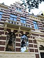
Category:Surinamestraat 6, The Hague
Jump to navigation
Jump to search
| Object location | | View all coordinates using: OpenStreetMap |
|---|
 | |||||
| Upload media | |||||
| Instance of | |||||
|---|---|---|---|---|---|
| Location | The Hague, South Holland, Netherlands | ||||
| Street address |
| ||||
| Heritage designation |
| ||||
 | |||||
|
This is a category about rijksmonument number 476053
|
| Address |
|
Media in category "Surinamestraat 6, The Hague"
The following 9 files are in this category, out of 9 total.
-
 Den Haag Surinamestraat 6.jpg 3,000 × 4,000; 1.07 MB
-
 Entree - 's-Gravenhage - 20090430 - RCE.jpg 1,200 × 1,200; 229 KB
-
 Entree - 's-Gravenhage - 20090431 - RCE.jpg 1,176 × 1,200; 153 KB
-
 Gang - 's-Gravenhage - 20090433 - RCE.jpg 1,192 × 1,200; 205 KB
-
 Gang en trappenhuis - 's-Gravenhage - 20090432 - RCE.jpg 1,186 × 1,200; 194 KB
-
 Overzicht - 's-Gravenhage - 20090420 - RCE.jpg 1,200 × 955; 285 KB
-
 Overzicht - 's-Gravenhage - 20090424 - RCE.jpg 1,192 × 1,200; 323 KB
-
 Voorgevels - 's-Gravenhage - 20090429 - RCE.jpg 1,200 × 960; 296 KB
-
 Voorgevels - 's-Gravenhage - 20090434 - RCE.jpg 1,200 × 960; 299 KB


