Category:Swansea
Jump to navigation
Jump to search

Cymraeg: Dinas a Sir Abertawe, Cymru
English: The City and County of Swansea, Wales
city in Swansea principal area, Wales   | |||||
| Վերբեռնել մեդիա նիշք | |||||
| Հասկացության մասնավոր դեպք | |||||
|---|---|---|---|---|---|
| Վայր |
| ||||
| Ստեղծում |
| ||||
| Բնակչություն |
| ||||
| Մակերես |
| ||||
| պաշտոնական կայք | |||||
 | |||||

Ենթակատեգորիաներ
Ստորև բերված է այս կատեգորիայի 22 ենթակատեգորիա՝ 22-ից։
A
C
- Swansea City Council (1 F)
E
G
H
I
N
P
- Plantasia (12 F)
- Swansea porcelain (4 F)
- Postcards of Swansea (7 F)
S
T
V
- Views of Swansea (32 F)
«Swansea» կատեգորիայի մեդիան
Ստորև բերված է այս կատեգորիայի 200 նիշք՝ 291-ից։
(նախորդ էջ) (հաջորդ էջ)-

-
 A4118 Olchfa Bridge west.jpg 512 × 384; 28 ԿԲ
-
 Across Fabian Way footbridge, Swansea - geograph.org.uk - 3769734.jpg 800 × 527; 117 ԿԲ
-
 Across the Prince of Wales - geograph.org.uk - 902861.jpg 640 × 480; 59 ԿԲ
-

-

-
 Arwydd dathlu 50 mlynedd o Abertawe bod yn ddinas.jpg 4032 × 3024; 3,46 ՄԲ
-
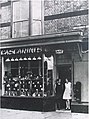
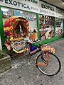 Asian supermarket with trishaw outside.jpg 3024 × 4032; 4,96 ՄԲ
-
 Autumn dusk over Swansea - geograph.org.uk - 1606640.jpg 640 × 480; 37 ԿԲ
-

-
 Bicycle Bridge - panoramio.jpg 2048 × 1536; 840 ԿԲ
-
 Bonymaen - geograph.org.uk - 3701316.jpg 690 × 518; 167 ԿԲ
-
 Boo-boo Tea.jpg 3024 × 4032; 2,57 ՄԲ
-
 Bracelet Bay (3293708778).jpg 3872 × 2592; 5,99 ՄԲ
-
 Bracelet Bay Near Swansea (NBY 442053).jpg 3600 × 2325; 1,92 ՄԲ
-
 Bridleway off the Pant-lasau road - geograph.org.uk - 1045035.jpg 640 × 480; 151 ԿԲ
-
 Bryn farm from the road - geograph.org.uk - 1035823.jpg 640 × 480; 62 ԿԲ
-
 Cascades on the Lower Clydach River - geograph.org.uk - 846484.jpg 640 × 480; 103 ԿԲ
-
 Cascarini’s ice cream parlour, Swansea.jpg 615 × 825; 95 ԿԲ
-
 Castle Square, Swansea, fountain.jpg 3024 × 4032; 4,4 ՄԲ
-
 Castle Square, Swansea.jpg 4032 × 3024; 3,8 ՄԲ
-
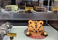 Chinese cakes for sale.jpg 3234 × 2242; 1,63 ՄԲ
-
 Churchyard, Llanddewi - geograph.org.uk - 1491792.jpg 640 × 455; 103 ԿԲ
-
 Cliffs south of Southdown - geograph.org.uk - 1190129.jpg 640 × 498; 93 ԿԲ
-
 Coastal Path, East of Rotherslade - geograph.org.uk - 1481431.jpg 640 × 480; 136 ԿԲ
-
 Coat of arms of Swansea.svg 512 × 476; 412 ԿԲ
-
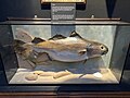 Cod caught in Swansea Bay.jpg 4032 × 3024; 3 ՄԲ
-
 Coffad Brwydr Garn Goch Ionawr y Cyntaf 2013.jpg 3264 × 2448; 3,6 ՄԲ
-
 Colourful bollards - geograph.org.uk - 1619097.jpg 640 × 480; 113 ԿԲ
-
 Colourful, or what - panoramio.jpg 2592 × 1944; 1,1 ՄԲ
-
 Commemorative plaque to Dylan Thomas.jpg 829 × 1031; 355 ԿԲ
-
 Crymlyn Burrows Beach, Swansea 1.jpg 1068 × 712; 945 ԿԲ
-
 Crymlyn Burrows Beach, Swansea 2.jpg 975 × 697; 706 ԿԲ
-
 Crymlyn Burrows Beach, Swansea 3.jpg 990 × 707; 764 ԿԲ
-
 Crymlyn Burrows Beach, Swansea 4.jpg 1000 × 667; 600 ԿԲ
-
 Culver-Hole - geograph.org.uk - 1454563.jpg 640 × 425; 119 ԿԲ
-
 Cwm Stream - geograph.org.uk - 1177261.jpg 480 × 640; 124 ԿԲ
-
 Cwtch Community Group 2.JPG 2592 × 1936; 1,59 ՄԲ
-
 Cwtch Community Group Cafe.JPG 2592 × 1936; 1,76 ՄԲ
-
 Cwtch Community Group petition.jpg 1131 × 805; 280 ԿԲ
-

-
 Davies Coaches, Crofty, Gower Peninsula (17749101302).jpg 2880 × 1623; 1,4 ՄԲ
-
-
 Derelict (3293704862).jpg 2592 × 3872; 4,5 ՄԲ
-
 Derelict rolling mill, Landore - geograph.org.uk - 946514.jpg 640 × 428; 87 ԿԲ
-
 Digwyddiad Gentle Radical yn Abertawe.jpg 4032 × 3024; 635 ԿԲ
-
 Distressing News for the Youngsters - JM Staniforth.png 657 × 538; 371 ԿԲ
-

-
 Dry dock Swansea - panoramio.jpg 2048 × 1536; 693 ԿԲ
-
 Dry stone wall in Cwm Clydach - geograph.org.uk - 846488.jpg 640 × 480; 94 ԿԲ
-
 Dyfatty & Greenhill Community Centre, Swansea (geograph 5744596).jpg 800 × 669; 178 ԿԲ
-
 Ebenezer Gospel Hall, Swansea - geograph.org.uk - 3769763.jpg 800 × 628; 140 ԿԲ
-
 Edward VII pillar box in Swansea, Eaton Terrace.JPG 2115 × 3058; 1,4 ՄԲ
-
 Enjoying the February sun - geograph.org.uk - 1175624.jpg 640 × 335; 48 ԿԲ
-
-
 Entrance to Ynys Mond Forest - geograph.org.uk - 831247.jpg 640 × 480; 246 ԿԲ
-
 Ethnic makeup of Swansea by single year ages.svg 3467 × 2303; 39 ԿԲ
-

-
 Exotic fruit for sale at an Asian supermarket.jpg 2260 × 2138; 1,54 ՄԲ
-
 Fabian Way - Wern Fawr Road level crossing - geograph.org.uk - 2733077.jpg 1600 × 1200; 684 ԿԲ
-
 Fabian Way footbridge, Swansea - geograph.org.uk - 3756965.jpg 800 × 631; 133 ԿԲ
-
 Fabian Way footbridge, Swansea - geograph.org.uk - 3769690.jpg 800 × 610; 196 ԿԲ
-
 Farm Buildings, Birchgrove - geograph.org.uk - 831170.jpg 640 × 480; 304 ԿԲ
-
 Farm track beside Lower Clydach River - geograph.org.uk - 846490.jpg 640 × 480; 94 ԿԲ
-
 Fendrod Lake, Llansamlet, Swansea - geograph.org.uk - 1730706.jpg 640 × 486; 76 ԿԲ
-
 Fish ladder at Tawe Barrage - geograph.org.uk - 1607929.jpg 640 × 480; 76 ԿԲ
-
 Fishing The Mumbles - geograph.org.uk - 847141.jpg 640 × 415; 54 ԿԲ
-
 Flower display in front of restaurant on Brynymor Road, St Helen’s, Swansea.jpg 1536 × 2048; 1,44 ՄԲ
-
 Footbridge over Lower Clydach River - geograph.org.uk - 846486.jpg 640 × 480; 95 ԿԲ
-
 Ford at entrance to former Ilston Quarry - geograph.org.uk - 988464.jpg 640 × 480; 101 ԿԲ
-
 Ford in Decoy Wood - geograph.org.uk - 1261241.jpg 640 × 480; 110 ԿԲ
-
 Forestfachordinancesurvey1860.jpg 450 × 278; 86 ԿԲ
-
 Former Swansea Workhouse administrative block (geograph 4002660).jpg 800 × 606; 195 ԿԲ
-

-

-
 Fortes Ice Cream Parlour, Bracelet Bay, Swansea.jpg 3275 × 1770; 1,42 ՄԲ
-
-
 Gelli Street, Swansea - geograph.org.uk - 3769811.jpg 800 × 652; 137 ԿԲ
-
 Giant TV screen in Castle Plaza - geograph.org.uk - 1056747.jpg 640 × 480; 76 ԿԲ
-
 Glamorgan farmhouse kitchen, recreated at Swansea Museum.jpg 2585 × 3587; 2,4 ՄԲ
-
 Gower Way marker 46A - geograph.org.uk - 534548.jpg 480 × 640; 83 ԿԲ
-
 Grafog Street, Swansea - geograph.org.uk - 3800713.jpg 800 × 599; 121 ԿԲ
-
-
 Harpist.jpg 3259 × 2430; 1,23 ՄԲ
-
 Harvest jug, Swansea, 1841.jpg 3024 × 4032; 2,26 ՄԲ
-
 High Street Swansea the palace.png 1569 × 841; 2,12 ՄԲ
-
 Inflatable Boat by Mumbles Pier - geograph.org.uk - 1479343.jpg 640 × 480; 89 ԿԲ
-
 Invasive Bracken, the Beacon - geograph.org.uk - 1490160.jpg 640 × 427; 107 ԿԲ
-
 Jersey Terrace, Swansea - geograph.org.uk - 3769745.jpg 800 × 674; 136 ԿԲ
-
 Kardomah Cafe, Swansea.jpg 2047 × 1536; 628 ԿԲ
-
 Karnataka TL 2011jpg.jpg 958 × 624; 114 ԿԲ
-
 Laverbread.jpg 2448 × 3264; 1,59 ՄԲ
-
 Leon Atkins, the rebel priest of Swansea (15842039531).jpg 435 × 607; 55 ԿԲ
-
 Limeslade Bay Near Swansea (NBY 444258).jpg 3600 × 2332; 1,81 ՄԲ
-
 Looking east along the prom - geograph.org.uk - 1610861.jpg 480 × 640; 94 ԿԲ
-
 Looking towards Burry Holmes from Rhossili downs - panoramio.jpg 3072 × 2304; 2,96 ՄԲ
-
 Looking up the Tawe - geograph.org.uk - 357908.jpg 640 × 480; 110 ԿԲ
-
 Lower Lliw Reservoir - geograph.org.uk - 740669.jpg 640 × 480; 116 ԿԲ
-
 Madonna and child, Quadrant walkway, Swansea.jpg 3886 × 3400; 4,74 ՄԲ
-
 McDonald's, Dan-y-graig, Swansea - geograph.org.uk - 3133369.jpg 640 × 481; 311 ԿԲ
-
 Metropolitan Bank of England and Wales, Swansea.jpg 3024 × 4032; 3,46 ՄԲ
-
 Mills type milepost near Swansea - geograph.org.uk - 260735.jpg 640 × 480; 64 ԿԲ
-
 Millstones at Penrice - geograph.org.uk - 1318656.jpg 640 × 480; 146 ԿԲ
-
 Mr & Mrs Luigi Cascarini.jpg 810 × 539; 56 ԿԲ
-
 Mumble Bay - panoramio.jpg 2592 × 1944; 864 ԿԲ
-
 Mumbles Pierand Pebble Beach.jpg 5184 × 3456; 6,32 ՄԲ
-
 Musgrave engine house and flywheel, Hafod-Morfa, Swansea.JPG 2000 × 1500; 1,85 ՄԲ
-
 Mynydd Cilfai - Kilvey Hill - geograph.org.uk - 3746833.jpg 690 × 518; 223 ԿԲ
-
 Near Mumbles Pier - geograph.org.uk - 1495886.jpg 640 × 455; 94 ԿԲ
-
 NewcastleTransport BustechZDI450.jpg 6000 × 4000; 7,92 ՄԲ
-
 Newton Cliff - geograph.org.uk - 1480643.jpg 640 × 480; 103 ԿԲ
-
 No unauthorised access.jpg 2788 × 2670; 2,76 ՄԲ
-
 Northern end of Grafog Street, Swansea - geograph.org.uk - 3800732.jpg 800 × 703; 157 ԿԲ
-
 Observatory at former Penllergare Estate - geograph.org.uk - 1764608.jpg 2800 × 2100; 802 ԿԲ
-
 Old Castle Cliffs at Rhossili - geograph.org.uk - 1518416.jpg 480 × 640; 66 ԿԲ
-
 On Cefn Bryn Ridge - geograph.org.uk - 1490088.jpg 640 × 480; 150 ԿԲ
-
 Ordnance Survey Cut Mark - geograph.org.uk - 4725269.jpg 480 × 640; 81 ԿԲ
-
 Ordnance Survey Cut Mark - geograph.org.uk - 4725284.jpg 480 × 640; 87 ԿԲ
-

-
 Ordnance Survey One-Inch Sheet 153 Swansea, Published 1947.jpg 10 928 × 12 766; 16,35 ՄԲ
-
 Ordnance Survey One-Inch Sheet 153 Swansea, Published 1956.jpg 8293 × 9969; 10,57 ՄԲ
-
 Ordnance Survey One-Inch Sheet 153 Swansea, Published 1972.jpg 11 081 × 13 125; 44,93 ՄԲ
-
 Ordnance Survey Pivot - geograph.org.uk - 4725265.jpg 480 × 640; 108 ԿԲ
-
 Ordnance Survey Pivot - geograph.org.uk - 4725277.jpg 480 × 640; 96 ԿԲ
-
 Ordnance Survey Rivet - geograph.org.uk - 3713060.jpg 640 × 480; 142 ԿԲ
-
 Owen Griffiths yn rhoi cylfwyniad ar ei wraith yn Galerie Simpson (cropped).jpg 2864 × 2267; 797 ԿԲ
-
 Oxwich Point - geograph.org.uk - 1511191.jpg 640 × 458; 102 ԿԲ
-
 Oxwich Point - geograph.org.uk - 1512906.jpg 640 × 480; 79 ԿԲ
-
 Painting of Swansea Castle.jpg 3024 × 4032; 3,37 ՄԲ
-
 Pano from a dron.jpg 6216 × 4233; 13,94 ՄԲ
-
 Pant Street Swansea - geograph.org.uk - 3800804.jpg 800 × 611; 126 ԿԲ
-
 Pant Street, Swansea - geograph.org.uk - 3769795.jpg 800 × 604; 109 ԿԲ
-
 Pantygwydr Baptist Church, Uplands, Swansea, Wales.jpg 2448 × 3264; 2,83 ՄԲ
-
 Parallel Road - geograph.org.uk - 1490188.jpg 480 × 640; 107 ԿԲ
-
 Parc le Breos, Gwyr yr ogof cathole.JPG 2448 × 3264; 4,97 ՄԲ
-
 Park View (242876967).jpeg 2048 × 1377; 1,47 ՄԲ
-

-
 Path to Bishop's Wood - geograph.org.uk - 1480357.jpg 640 × 480; 116 ԿԲ
-

-
 Pen Ucha by Morfydd Llwyn Owen.jpg 683 × 607; 274 ԿԲ
-
 Pier & entrance to harbour, Swansea.jpeg 700 × 530; 148 ԿԲ
-

-
 Pony herd in the autumn (Unsplash).jpg 4000 × 2672; 6,77 ՄԲ
-
 Port Tennant Kebab ^ Pizza shop, Swansea - geograph.org.uk - 3769759.jpg 800 × 544; 112 ԿԲ
-
 Portrait of the Artist as a Young Octopus by Pete Fowler.jpg 4000 × 3000; 2,68 ՄԲ
-
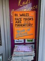 Poster requesting wearing of face masks.jpg 3024 × 4032; 2,51 ՄԲ
-
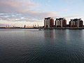
 Prince of Wales Dock.jpg 4320 × 3240; 3,03 ՄԲ
-
 Pwll-Du Bay.jpg 350 × 262; 43 ԿԲ
-
 Quay, Sea and Salt Cottages - Port-Eynon - geograph.org.uk - 1522919.jpg 640 × 640; 114 ԿԲ
-

-
 Re-development of the Ice House - geograph.org.uk - 902870.jpg 640 × 480; 60 ԿԲ
-
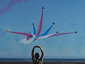 Red Arrows in Swansea (5513125444).jpg 1024 × 768; 257 ԿԲ
-
 Red Pond, the Beacon - geograph.org.uk - 1490155.jpg 640 × 427; 86 ԿԲ
-
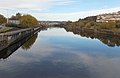 River Tawe from Tawe Bridge, Swansea - geograph.org.uk - 3741320.jpg 800 × 523; 75 ԿԲ
-
 Rocky Cove nr Oxwich Point - geograph.org.uk - 1511170.jpg 640 × 480; 94 ԿԲ
-
 Rocky Feature, nr Oxwich Point - geograph.org.uk - 1511179.jpg 480 × 640; 77 ԿԲ
-
 Ruin beside Lower Clydach River - geograph.org.uk - 846487.jpg 640 × 480; 86 ԿԲ
-
 SA1 Development, Swansea Docks - geograph.org.uk - 3144412.jpg 640 × 480; 57 ԿԲ
-
 Sand Dune @ Oxwich Bay, Wales (3707017962).jpg 3008 × 2000; 3,72 ՄԲ
-
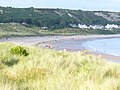 Sand Dunes at Port-Eynon - geograph.org.uk - 1481748.jpg 640 × 480; 91 ԿԲ
-
 Sea on a sunny day.jpg 2448 × 3264; 2,34 ՄԲ
-
 Sea Views at Caswell Bay - geograph.org.uk - 1480368.jpg 640 × 480; 98 ԿԲ
-
 Seaside Development at Caswell Bay - geograph.org.uk - 1480393.jpg 640 × 480; 120 ԿԲ
-
 Seaview, Swansea, Glamorgan.jpg 2109 × 1486; 796 ԿԲ
-

-
 Sidings Bridge - geograph.org.uk - 3139595.jpg 1712 × 2288; 1,19 ՄԲ
-
 Small lake (28990921454).jpg 6000 × 4000; 6,8 ՄԲ
-
 St Helen's.DSC00503.JPG 519 × 308; 19 ԿԲ
-
 Steam engine, Landore Works - geograph.org.uk - 1552985.jpg 640 × 416; 68 ԿԲ
-
 Steep Slope of Colour, Oxwich Point - geograph.org.uk - 1511187.jpg 480 × 640; 152 ԿԲ
-
 Strand Subway (leading to High Street, Swansea) (geograph 2733394).jpg 1280 × 1024; 399 ԿԲ
-
 Surf and Turf, Hillend - geograph.org.uk - 1418943.jpg 640 × 480; 121 ԿԲ
-
 Swans on the river Tawe - geograph.org.uk - 588944.jpg 640 × 480; 97 ԿԲ
-
 Swansea - Welsh speakers' capital city (18605676486).jpg 438 × 599; 69 ԿԲ
-
 Swansea 1.jpg 1280 × 853; 502 ԿԲ
-
 Swansea bay (1130925).jpg 1000 × 731; 162 ԿԲ
-
 Swansea bay barrage.jpg 2896 × 1440; 1,19 ՄԲ
-
 Swansea Bay Meets the West Pier - geograph.org.uk - 1184512.jpg 640 × 480; 62 ԿԲ
-
 Swansea bay.jpeg 700 × 445; 168 ԿԲ
-

-
 Swansea Docks - geograph.org.uk - 3492404.jpg 640 × 480; 71 ԿԲ
-
 SWANSEA FLAG.jpg 360 × 216; 37 ԿԲ
-
 Swansea from The Mumbles - geograph.org.uk - 3213204.jpg 1663 × 1000; 1,07 ՄԲ
-
 Swansea gasworks (8918356332).jpg 4324 × 2859; 5,99 ՄԲ
-
 Swansea market seafood stall - geograph.org.uk - 220160.jpg 640 × 480; 125 ԿԲ
-
 Swansea photo.jpg 400 × 321; 71 ԿԲ
-
 Swansea skyline at dusk - geograph.org.uk - 1606628.jpg 640 × 480; 43 ԿԲ
-

-
 Swansea, south Wales.jpeg 700 × 464; 126 ԿԲ
-
 Swansea, UK - panoramio.jpg 4000 × 3000; 1,89 ՄԲ
-
 Swansea, United Kingdom (Unsplash LLeKNRAPPls).jpg 4896 × 3264; 4,53 ՄԲ
-
 Swansea3.jpg 1278 × 1289; 1,69 ՄԲ
-
 SwanseaBUA.png 800 × 850; 742 ԿԲ
-
 SwanseaMaliphantSidingsMap.png 728 × 614; 749 ԿԲ
-
 Tennant Canal (Fabian Way) - geograph.org.uk - 2733079.jpg 1200 × 900; 759 ԿԲ
-
 Tennant Canal (Wern Fawr Road) - geograph.org.uk - 2733081.jpg 1600 × 1200; 684 ԿԲ
-
 Thatched cottages, Black Pill (3990133492).jpg 603 × 700; 157 ԿԲ
-
 The Birds of Swansea - panoramio.jpg 2048 × 1536; 1,63 ՄԲ
-
 The Groose - geograph.org.uk - 1417284.jpg 640 × 480; 117 ԿԲ
-
 The Hillside Wildlife Corridor, Mayhill, Swansea, UK.jpg 2048 × 1536; 1,34 ՄԲ
.jpg)


.jpg)
.jpg)


.jpg)
_-_geograph.org.uk_-_1511202.jpg)
.jpg)


.jpg)


.jpg)
_-_geograph.org.uk_-_2733080.jpg)


.jpg)


.jpg)
.jpg)


_-_geograph.org.uk_-_4345077.jpg)


.jpg)


.jpeg)


.jpg)


.jpg)


.jpg)


.jpg)


_(geograph_2733394).jpg)


.jpg)

.jpg)


.jpg)


_(14780570474).jpg)


.jpg)


_-_geograph.org.uk_-_2733079.jpg)
_-_geograph.org.uk_-_2733081.jpg)
.jpg)


