Category:Swinefleet
Aller à la navigation
Aller à la recherche
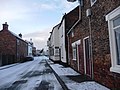
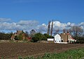
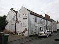
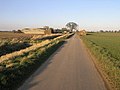
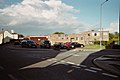
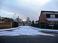
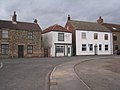
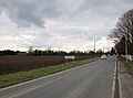
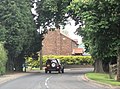
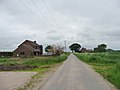
English: Swinefleet is a village and civil parish in the East Riding of Yorkshire, England. It is situated approximately 2 miles (3.2 km) south east of the town of Goole on the A161 road from Goole to Crowle. It lies on the south bank of the River Ouse.
village britannique  | |||||
| Téléverser des médias | |||||
| Nature de l’élément | |||||
|---|---|---|---|---|---|
| Lieu | East Riding of Yorkshire, Yorkshire de l'Est, Yorkshire-et-Humber, Angleterre | ||||
 | |||||
Sous-catégories
Cette catégorie comprend 4 sous-catégories, dont les 4 ci-dessous.
Média dans la catégorie « Swinefleet »
Cette catégorie comprend 331 fichiers, dont les 200 ci-dessous.
(page précédente) (page suivante)-
 "The Ship Inn", Swinefleet - geograph.org.uk - 6085655.jpg 5 184 × 3 888 ; 5,55 Mio
-
 'The Old Mill' - geograph.org.uk - 2210059.jpg 2 000 × 1 245 ; 2,57 Mio
-
 2 metre trig point, Reading Gate - geograph.org.uk - 3814891.jpg 1 024 × 768 ; 143 kio
-
 A bench on New Lane, Reedness - geograph.org.uk - 2337130.jpg 800 × 600 ; 231 kio
-
 A choice of views, west end of Swinefleet - geograph.org.uk - 3496784.jpg 1 024 × 768 ; 117 kio
-
 A drain junction - geograph.org.uk - 5736313.jpg 4 606 × 3 454 ; 7,22 Mio
-
 A farm road towards Moors Farm - geograph.org.uk - 2337061.jpg 800 × 600 ; 175 kio
-
 A sliver of land - geograph.org.uk - 3700884.jpg 1 024 × 768 ; 119 kio
-
 A snowy morning in High Street, near the Ship Inn - geograph.org.uk - 1701580.jpg 1 024 × 768 ; 139 kio
-
 A Tree - geograph.org.uk - 143300.jpg 640 × 480 ; 66 kio
-
 A view of Common Farm - geograph.org.uk - 6085621.jpg 4 950 × 3 849 ; 4,33 Mio
-
 A view of The Old Mill, Swinefleet - geograph.org.uk - 6085668.jpg 4 964 × 3 507 ; 3,62 Mio
-
 A War Memorial - geograph.org.uk - 1992121.jpg 800 × 600 ; 214 kio
-
 Access into garden from Church Lane - geograph.org.uk - 6492238.jpg 2 000 × 1 255 ; 2,61 Mio
-
 Access to the river bank - geograph.org.uk - 2304070.jpg 1 024 × 768 ; 142 kio
-
 Access track off Low Street in Swinefleet - geograph.org.uk - 3804076.jpg 640 × 427 ; 68 kio
-
 After the harvest - geograph.org.uk - 2018214.jpg 1 024 × 768 ; 135 kio
-
 Another "Pub with No Beer" The George Inn Swinefleet - geograph.org.uk - 5736231.jpg 4 586 × 3 426 ; 4,49 Mio
-
 Arable fields separated by a drainage channel - geograph.org.uk - 6345018.jpg 4 000 × 3 000 ; 3,7 Mio
-
 Bankside Farm - geograph.org.uk - 334612.jpg 640 × 480 ; 82 kio
-
 Bankside Farm - geograph.org.uk - 4052829.jpg 640 × 480 ; 57 kio
-
 Bankside Farm - geograph.org.uk - 6085617.jpg 4 971 × 3 768 ; 5,62 Mio
-
 Barns at farm on the outskirts of Swinefleet - geograph.org.uk - 6179702.jpg 1 600 × 978 ; 383 kio
-
 Barns at King's Causeway Farm - geograph.org.uk - 6002772.jpg 1 500 × 995 ; 1,43 Mio
-
 Bench and Lane - geograph.org.uk - 143298.jpg 640 × 480 ; 78 kio
-
 Blossoming heart alongside Reading Gate - geograph.org.uk - 3502119.jpg 1 024 × 768 ; 148 kio
-
 Bog Gate - geograph.org.uk - 3503188.jpg 1 024 × 768 ; 133 kio
-
 Bog Gate between arable fields - geograph.org.uk - 6345036.jpg 4 000 × 3 000 ; 3,17 Mio
-
 Bridge carrying Reading Gate over a drain - geograph.org.uk - 3501660.jpg 1 024 × 768 ; 106 kio
-
 Buildings at Hall Farm, Swinefleet - geograph.org.uk - 3496793.jpg 1 024 × 768 ; 140 kio
-
 Buried Level Crossing - geograph.org.uk - 334617.jpg 640 × 480 ; 98 kio
-
 Caroline Square, Swinefleet - geograph.org.uk - 365017.jpg 640 × 427 ; 47 kio
-
 Cemetery Chapel - geograph.org.uk - 1561958.jpg 640 × 426 ; 118 kio
-
 Cereal field, east of Reading Gate - geograph.org.uk - 3502212.jpg 1 024 × 768 ; 159 kio
-
 Cereal field, east of Reading Gate - geograph.org.uk - 3503184.jpg 1 024 × 768 ; 158 kio
-
 Cereal field, north of Readingate Farm - geograph.org.uk - 3502128.jpg 1 024 × 768 ; 168 kio
-
 Cereal field, west of Reading Gate - geograph.org.uk - 3502061.jpg 1 024 × 768 ; 110 kio
-
 Cereals growing east of Quay Lane - geograph.org.uk - 3496837.jpg 1 024 × 768 ; 198 kio
-
 Cereals growing in Quay Field - geograph.org.uk - 3503181.jpg 1 024 × 768 ; 138 kio
-
 Chapel of rest in graveyard at St. Margaret's Church - geograph.org.uk - 6492246.jpg 2 000 × 1 333 ; 2,49 Mio
-
 Chapel of rest in Swinefleet Cemetery - geograph.org.uk - 6085645.jpg 5 184 × 3 888 ; 6,4 Mio
-
 Cherry Tree Farm - geograph.org.uk - 1224132.jpg 640 × 480 ; 34 kio
-
 Cherry Tree Farm - geograph.org.uk - 6085676.jpg 5 069 × 3 888 ; 4,08 Mio
-
 Cherry Tree Farm on the road into Reedness - geograph.org.uk - 3803605.jpg 640 × 427 ; 44 kio
-
 Cherry Tree Farm, west of Reedness - geograph.org.uk - 3622689.jpg 1 024 × 614 ; 78 kio
-
 Church Acres, off Church Lane, Swinefleet - geograph.org.uk - 1701571.jpg 1 024 × 768 ; 114 kio
-
 Church Lane junction - geograph.org.uk - 3522119.jpg 640 × 480 ; 117 kio
-
 Church Lane junction at Swinefleet - geograph.org.uk - 3523927.jpg 640 × 378 ; 90 kio
-
 Citizenlink Office, Swinefleet - geograph.org.uk - 2304328.jpg 1 024 × 768 ; 171 kio
-
 Clough west of Swinefleet - geograph.org.uk - 397864.jpg 640 × 480 ; 142 kio
-
 Converted windmill from Mill Trod (Track) - geograph.org.uk - 5736125.jpg 5 152 × 3 864 ; 6,57 Mio
-
 Cottages on High Street, Swinefleet - geograph.org.uk - 2304351.jpg 1 024 × 768 ; 159 kio
-
 Course of the Axholme Light Railway (2) - geograph.org.uk - 1965124.jpg 1 024 × 768 ; 205 kio
-
 Crop field east of Quay Lane - geograph.org.uk - 4052850.jpg 640 × 480 ; 67 kio
-
 Crop field, Yokefleet Farm - geograph.org.uk - 4052825.jpg 640 × 480 ; 59 kio
-
 Crossmoor Bank (1) - geograph.org.uk - 3501649.jpg 1 024 × 768 ; 102 kio
-
 Crossmoor Bank (2) - geograph.org.uk - 3501992.jpg 1 024 × 768 ; 135 kio
-
 Crossmoor Bank near to Yokefleet Farm - geograph.org.uk - 6344333.jpg 4 000 × 3 000 ; 3,33 Mio
-
 Crowle Moors - geograph.org.uk - 488012.jpg 640 × 480 ; 97 kio
-
 Development site in Swinefleet - geograph.org.uk - 2304075.jpg 1 024 × 768 ; 198 kio
-
 Disused Peat Extraction Machinery (geograph 1669985).jpg 640 × 480 ; 57 kio
-
 Disused Railway line - geograph.org.uk - 1212973.jpg 640 × 480 ; 89 kio
-
 Ditch and field west of Crow Tree Farm - geograph.org.uk - 5631947.jpg 1 500 × 1 125 ; 1,53 Mio
-
 Ditch between two ploughed fields - geograph.org.uk - 6388952.jpg 2 500 × 1 428 ; 2,71 Mio
-
 Ditch with farm track south of King's Causeway - geograph.org.uk - 2210946.jpg 2 000 × 1 500 ; 2,94 Mio
-
 Double bend, Reading Gate - geograph.org.uk - 3814740.jpg 1 024 × 768 ; 138 kio
-
 Drain heading east from Quay Lane - geograph.org.uk - 6085608.jpg 5 055 × 3 791 ; 4,64 Mio
-
 Drain in Quay Field - geograph.org.uk - 3502193.jpg 1 024 × 768 ; 178 kio
-
 Drain on the east side of Reading Gate - geograph.org.uk - 3502170.jpg 1 024 × 768 ; 195 kio
-
 Drain on the west side of New Lane - geograph.org.uk - 3815643.jpg 1 024 × 768 ; 122 kio
-
 Drain west of Reading Gate - geograph.org.uk - 3502002.jpg 1 024 × 768 ; 174 kio
-
 Drainage ditch beside the A161 - geograph.org.uk - 2549863.jpg 1 600 × 1 200 ; 560 kio
-
 Drainage ditch, west of Quay Lane - geograph.org.uk - 3501586.jpg 1 024 × 615 ; 144 kio
-
 Dunmires Lane (track) - geograph.org.uk - 2942445.jpg 1 024 × 768 ; 185 kio
-
 Dyke and Bridge - geograph.org.uk - 334619.jpg 640 × 480 ; 106 kio
-
 Edge of a field of oil seed rape - geograph.org.uk - 3501620.jpg 1 024 × 768 ; 179 kio
-
 Emerging crop, north of Swinefleet Peat Works - geograph.org.uk - 3814882.jpg 1 024 × 768 ; 152 kio
-
 Entering 30 limit for Swinefleet - geograph.org.uk - 3522054.jpg 640 × 443 ; 92 kio
-
 Entering sunny Swinefleet - geograph.org.uk - 1740761.jpg 640 × 473 ; 62 kio
-
 Entering Swinefleet at Field House Farm - geograph.org.uk - 3522063.jpg 640 × 379 ; 93 kio
-
 Entering Swinefleet from Reedness - geograph.org.uk - 5736185.jpg 3 777 × 2 786 ; 3,24 Mio
-
 Entrance to Mount Pleasant Farm from Quart Lane - geograph.org.uk - 5736346.jpg 4 584 × 3 424 ; 6,09 Mio
-
 Farm buildings in Swinefleet - geograph.org.uk - 6342949.jpg 2 000 × 1 106 ; 2,13 Mio
-
 Farm buildings on Reading Gate, (road) - geograph.org.uk - 2337028.jpg 800 × 600 ; 240 kio
-
 Farm track off Reading Gate - geograph.org.uk - 2533139.jpg 1 024 × 768 ; 168 kio
-
 Farm track west of Quay Lane - geograph.org.uk - 3501637.jpg 1 024 × 768 ; 150 kio
-
 Farm track, Quay Field - geograph.org.uk - 3503177.jpg 1 024 × 768 ; 161 kio
-
 Farmhouse at Cherry Tree over frozen field - geograph.org.uk - 2210156.jpg 2 000 × 1 527 ; 2,9 Mio
-
 Farmhouse, Quayfields Farm - geograph.org.uk - 5631964.jpg 1 500 × 1 125 ; 2,22 Mio
-
 Farmland - geograph.org.uk - 356474.jpg 640 × 480 ; 94 kio
-
 Farmland east of Reading Gate - geograph.org.uk - 3814750.jpg 1 024 × 768 ; 123 kio
-
 Farmland north of Moors Farm - geograph.org.uk - 3814719.jpg 1 024 × 768 ; 150 kio
-
 Farmland north-west of Quay Lane - geograph.org.uk - 3501579.jpg 1 024 × 768 ; 146 kio
-
 Farmland off New Lane - geograph.org.uk - 2549868.jpg 1 600 × 1 200 ; 451 kio
-
 Farmland off the A161 - geograph.org.uk - 2549852.jpg 1 600 × 1 200 ; 456 kio
-
 Farmland off the A161 - geograph.org.uk - 2549859.jpg 1 600 × 1 200 ; 521 kio
-
 Farmland south-west of Quay Lane - geograph.org.uk - 3501590.jpg 1 024 × 768 ; 151 kio
-
 Farmland west of Puddiners Lane - geograph.org.uk - 3814647.jpg 1 024 × 768 ; 147 kio
-
 Farmland west of Reading Gate - geograph.org.uk - 3814681.jpg 1 024 × 768 ; 139 kio
-
 Field adjacent to Swinefleet Warping Drain - geograph.org.uk - 2684098.jpg 1 500 × 966 ; 1,22 Mio
-
 Fields of SE7720 - geograph.org.uk - 1198513.jpg 640 × 480 ; 45 kio
-
 Fields off Quay Lane - geograph.org.uk - 5463084.jpg 1 024 × 576 ; 164 kio
-
 Fields towards Crowle Moors - geograph.org.uk - 488007.jpg 640 × 480 ; 98 kio
-
 Fields with drain south of Swinefleet - geograph.org.uk - 2684059.jpg 1 500 × 1 125 ; 1,28 Mio
-
 Filling station and shop Swinefleet - geograph.org.uk - 5736199.jpg 4 582 × 3 420 ; 5,09 Mio
-

-
 Flat Fields - geograph.org.uk - 143292.jpg 640 × 480 ; 79 kio
-
 Gravestones and chapel in Swinefleet churchyard - geograph.org.uk - 6002720.jpg 1 500 × 1 125 ; 2,33 Mio
-
 Green Farm - geograph.org.uk - 143296.jpg 640 × 480 ; 62 kio
-
 Green roof Garage and Swinefleet church - geograph.org.uk - 1198610.jpg 640 × 480 ; 121 kio
-
 Grossmoor Bank - geograph.org.uk - 3025757.jpg 1 500 × 1 125 ; 1,35 Mio
-
 Hall Farm - geograph.org.uk - 2549835.jpg 1 600 × 1 200 ; 325 kio
-
 Heightened flood defence Swinefleet - geograph.org.uk - 5736243.jpg 4 526 × 3 346 ; 4,75 Mio
-
 High Street at Swinefleet.jpg 640 × 480 ; 85 kio
-
 High Street Swinefleet looking southwest - geograph.org.uk - 5736177.jpg 4 608 × 3 456 ; 5,05 Mio
-
 High Street with a scattering of snow - geograph.org.uk - 1701574.jpg 1 024 × 768 ; 105 kio
-
 High Street, Swinefleet - geograph.org.uk - 3804104.jpg 640 × 427 ; 55 kio
-
 High Street, Swinefleet - geograph.org.uk - 6495816.jpg 2 000 × 1 333 ; 1,95 Mio
-
 High West Moor Field, Moor Fields - geograph.org.uk - 3814656.jpg 1 024 × 768 ; 151 kio
-
 Humber Ranger Survey vessel on River Ouse - geograph.org.uk - 5736147.jpg 5 150 × 3 862 ; 7,65 Mio
-
 Humber Renown, east of Saltmarshe Hall - geograph.org.uk - 3597931.jpg 1 024 × 614 ; 113 kio
-
 Ice and Sunshine - geograph.org.uk - 334611.jpg 640 × 480 ; 97 kio
-
 Junction of roads on Swinefleet and Reedness Moor - geograph.org.uk - 6345013.jpg 4 000 × 3 000 ; 3,01 Mio
-
 King's Causeway Farm , Swinefleet - geograph.org.uk - 1198602.jpg 640 × 487 ; 45 kio
-
 King's Causeway, Swinefleet - geograph.org.uk - 2109737.jpg 800 × 600 ; 209 kio
-
 Land drain at Swinefleet - geograph.org.uk - 397867.jpg 640 × 480 ; 104 kio
-
 Land drain parallel to Quay Lane (1) - geograph.org.uk - 3496807.jpg 1 024 × 768 ; 173 kio
-
 Land drain parallel to Quay Lane (2) - geograph.org.uk - 3496820.jpg 1 024 × 768 ; 160 kio
-
 Land drain running north-east from Quay Lane - geograph.org.uk - 3496822.jpg 1 024 × 768 ; 154 kio
-
 Levee on south side of River Ouse - geograph.org.uk - 5435840.jpg 1 500 × 768 ; 1,06 Mio
-
 Long Shadows - geograph.org.uk - 334615.jpg 640 × 480 ; 93 kio
-
 Long Shores Fields - geograph.org.uk - 1224141.jpg 640 × 480 ; 40 kio
-
 Looking along Upper Sands, near Swinefleet - geograph.org.uk - 2109758.jpg 800 × 600 ; 177 kio
-
 Looking Towards Red House Farm - geograph.org.uk - 644011.jpg 640 × 480 ; 85 kio
-
 Low Street , Swinefleet - geograph.org.uk - 2549839.jpg 1 600 × 1 200 ; 403 kio
-
-
 Margrave Lane, between Low and High West Moor Fields - geograph.org.uk - 3814664.jpg 1 024 × 768 ; 128 kio
-
 Mill Trod (Track) alongside Cherry Tree Farm - geograph.org.uk - 5736603.jpg 4 604 × 3 450 ; 6,67 Mio
-
 Mill Trod (Track) toward Swinefleet - geograph.org.uk - 5736613.jpg 4 594 × 3 438 ; 6,39 Mio
-
 Moor Farm Trig Point - geograph.org.uk - 447440.jpg 640 × 480 ; 71 kio
-
 Moors Farm - geograph.org.uk - 2741732.jpg 1 500 × 949 ; 1,41 Mio
-
 Move on, please. There's nothing to see here - geograph.org.uk - 2692080.jpg 1 024 × 768 ; 174 kio
-
 Navigation beacon 21, east of Bank House - geograph.org.uk - 3585330.jpg 1 024 × 768 ; 182 kio
-
 Navigation beacon at Swinefleet - geograph.org.uk - 6085660.jpg 3 888 × 5 184 ; 4,66 Mio
-
 Navigation beacons at Bank House - geograph.org.uk - 3585323.jpg 1 024 × 615 ; 103 kio
-
 Navigation mark by the Ouse - geograph.org.uk - 1326257.jpg 640 × 480 ; 61 kio
-
 Navigation marker opposite Swinefleet Reach on the River Ouse - geograph.org.uk - 5585871.jpg 5 256 × 2 792 ; 2,08 Mio
-
 New house on the east side of Quay Lane - geograph.org.uk - 3501572.jpg 1 024 × 768 ; 106 kio
-
 New houses on the edge of Swinefleet - geograph.org.uk - 3503176.jpg 1 024 × 768 ; 145 kio
-
 New Lane - geograph.org.uk - 1198596.jpg 640 × 480 ; 69 kio
-
 New Lane heading towards Reedness - geograph.org.uk - 6345040.jpg 4 000 × 3 000 ; 2,82 Mio
-
 New Lane heading towards Reedness - geograph.org.uk - 6345046.jpg 4 000 × 3 000 ; 3,18 Mio
-
 New Lane towards Reedness - geograph.org.uk - 2337124.jpg 800 × 600 ; 209 kio
-
 New Lane towards Reedness - geograph.org.uk - 2549873.jpg 1 600 × 1 200 ; 347 kio
-
 New Lane, near Reedness - geograph.org.uk - 2942443.jpg 1 024 × 697 ; 97 kio
-
 Newly built houses on High Street, Swinefleet - geograph.org.uk - 6285992.jpg 1 200 × 1 600 ; 700 kio
-
 Newly planted potato field off Crossmoor Bank - geograph.org.uk - 2337050.jpg 800 × 600 ; 236 kio
-
 North bank of the Ouse, at Saltmarshe Hall - geograph.org.uk - 3585342.jpg 1 024 × 768 ; 144 kio
-
 North bank of the Ouse, near Bank House - geograph.org.uk - 3570977.jpg 1 024 × 768 ; 68 kio
-
 Nova Scotia Farm - geograph.org.uk - 1198505.jpg 640 × 480 ; 60 kio
-
 Nova Scotia Farm - geograph.org.uk - 1965140.jpg 1 024 × 768 ; 132 kio
-
 Nova Scotia Farm - geograph.org.uk - 5736339.jpg 4 524 × 3 340 ; 4,32 Mio
-
 Oilseed rape crop, Nova Scotia Farm - geograph.org.uk - 4052837.jpg 640 × 480 ; 57 kio
-
 Old High Street at Swinefleet - geograph.org.uk - 397900.jpg 640 × 480 ; 68 kio
-
 On Reading Gate approaching Swinefleet - geograph.org.uk - 6085642.jpg 5 184 × 3 888 ; 5,61 Mio
-
 Passing place on Reading Gate - geograph.org.uk - 3502021.jpg 1 024 × 768 ; 114 kio
-
 Passing places on Reading Gate - geograph.org.uk - 3502224.jpg 1 024 × 768 ; 101 kio
-
 Pilgrim's Rest - geograph.org.uk - 3502087.jpg 1 024 × 768 ; 109 kio
-
 Pipeline marker, Reading Gate - geograph.org.uk - 3814758.jpg 1 024 × 768 ; 131 kio
-
 Plough awaiting its next job - geograph.org.uk - 5463104.jpg 1 024 × 576 ; 144 kio
-
 Ploughed field, Swinefleet ^ Reedness Moor - geograph.org.uk - 3814761.jpg 1 024 × 768 ; 154 kio
-
 Ploughed land at Puddiners - geograph.org.uk - 3814634.jpg 1 024 × 768 ; 115 kio
-
 Potato crop, Bankside Farm - geograph.org.uk - 4052831.jpg 640 × 480 ; 61 kio
-
 Potato field - geograph.org.uk - 3025840.jpg 1 500 × 818 ; 1,11 Mio
-
 Potato field - geograph.org.uk - 4052848.jpg 640 × 480 ; 68 kio
-
 Prospect House - geograph.org.uk - 6385672.jpg 2 499 × 1 813 ; 5,37 Mio
-
 Prospect of Swinefleet - geograph.org.uk - 5586055.jpg 5 320 × 2 922 ; 2,73 Mio
-
 Pub and house on High Street, Swinefleet - geograph.org.uk - 5821048.jpg 1 499 × 1 015 ; 1,41 Mio
-
 Public grassed area on Riverdale Road - geograph.org.uk - 6386439.jpg 2 499 × 1 543 ; 3,56 Mio
-
 Puddiners Lane - geograph.org.uk - 3814638.jpg 1 024 × 768 ; 139 kio
-
 Puddiners Lane at the 1 metre spot height - geograph.org.uk - 3814671.jpg 1 024 × 768 ; 105 kio
-
 Puddiners Lane back toward Readingate Farm - geograph.org.uk - 5736356.jpg 4 592 × 3 434 ; 5,55 Mio
-
 Puddiners Lane near to Readingate Farm - geograph.org.uk - 6345032.jpg 4 000 × 3 000 ; 3,3 Mio
-
 Puddiners Lane, a minor road - geograph.org.uk - 5736367.jpg 4 562 × 3 394 ; 5,39 Mio
-
 Puddiners Lane, off the A161 - geograph.org.uk - 2337015.jpg 800 × 600 ; 175 kio
-
 Quart Lane - geograph.org.uk - 4052840.jpg 640 × 480 ; 58 kio
-
 Quart Lane - geograph.org.uk - 5463090.jpg 1 024 × 576 ; 152 kio
-
 Quart Lane at Mount Pleasant Farm - geograph.org.uk - 6349137.jpg 4 000 × 3 000 ; 3,11 Mio
-
 Quay Lane (1) - geograph.org.uk - 3501599.jpg 1 024 × 768 ; 127 kio
-
 Quay Lane (2) - geograph.org.uk - 3501625.jpg 1 024 × 768 ; 115 kio
-
 Quay lane - geograph.org.uk - 1198510.jpg 640 × 480 ; 50 kio
-
 Quay Lane - geograph.org.uk - 3496834.jpg 1 024 × 768 ; 106 kio
-
 Quay Lane - geograph.org.uk - 4052828.jpg 640 × 480 ; 45 kio
-
 Quay Lane - geograph.org.uk - 4052834.jpg 640 × 480 ; 56 kio
-
 Quay Lane - geograph.org.uk - 4052843.jpg 640 × 480 ; 44 kio
-
 Quay Lane - geograph.org.uk - 4052853.jpg 640 × 480 ; 61 kio
-
 Quay lane and Mount Pleasant farm - geograph.org.uk - 1198517.jpg 640 × 480 ; 62 kio
-
 Quay Lane at Bankside Farm - geograph.org.uk - 6344328.jpg 4 000 × 3 000 ; 3,58 Mio
-
 Quay Lane beside drain and ploughed field near to Field House - geograph.org.uk - 6344326.jpg 4 000 × 3 000 ; 3,51 Mio
-
 Quay Lane joining the A161 near to Swinefleet - geograph.org.uk - 6344322.jpg 4 000 × 3 000 ; 3,62 Mio


_-_geograph.org.uk_-_5736125.jpg)

_-_geograph.org.uk_-_1965124.jpg)


_-_geograph.org.uk_-_3501649.jpg)
_-_geograph.org.uk_-_3501992.jpg)


.jpg)


_-_geograph.org.uk_-_2942445.jpg)


_-_geograph.org.uk_-_2337028.jpg)


_near_Reedness_-_geograph.org.uk_-_1740750.jpg)


_-_geograph.org.uk_-_3496807.jpg)
_-_geograph.org.uk_-_3496820.jpg)


_alongside_Cherry_Tree_Farm_-_geograph.org.uk_-_5736603.jpg)
_toward_Swinefleet_-_geograph.org.uk_-_5736613.jpg)


_-_geograph.org.uk_-_3501599.jpg)
_-_geograph.org.uk_-_3501625.jpg)


