Category:Swinton with Warthermarske
Jump to navigation
Jump to search
civil parish in North Yorkshire, England, UK | |||||
| Upload media | |||||
| Instance of | |||||
|---|---|---|---|---|---|
| Location | Harrogate, North Yorkshire, Yorkshire and the Humber, England | ||||
 | |||||
Subcategories
This category has the following 2 subcategories, out of 2 total.
S
W
- Warthermarske (8 F)
Media in category "Swinton with Warthermarske"
The following 76 files are in this category, out of 76 total.
-
 'Centre ville', Ilton - geograph.org.uk - 5880833.jpg 4,320 × 2,923; 2.89 MB
-
 A distant view of Clifton Castle - geograph.org.uk - 5923065.jpg 4,299 × 2,290; 2.5 MB
-
 Approaching Shaws Farm - geograph.org.uk - 1418926.jpg 640 × 480; 88 KB
-
 Badger Lane Farm - geograph.org.uk - 6164749.jpg 3,204 × 1,329; 1.39 MB
-
 Bench Mark, Warrener Wood - geograph.org.uk - 2544033.jpg 640 × 480; 89 KB
-
 Buildings at Gill Head Farm - geograph.org.uk - 3102939.jpg 800 × 539; 129 KB
-
 Bush Shelter - geograph.org.uk - 4152633.jpg 1,600 × 1,200; 530 KB
-
 Cattle country - geograph.org.uk - 1993858.jpg 3,202 × 1,632; 771 KB
-

-
 Daffodils near Ilton - geograph.org.uk - 2544044.jpg 640 × 480; 81 KB
-
 Den Beck - geograph.org.uk - 3844338.jpg 4,320 × 3,240; 3.35 MB
-
 Den Beck meets the River Burn - geograph.org.uk - 3373923.jpg 4,096 × 2,730; 5.54 MB
-

-
 Farm at Roomer - geograph.org.uk - 2377312.jpg 640 × 480; 90 KB
-
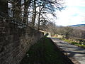
 Following the wall - geograph.org.uk - 5880386.jpg 4,320 × 3,240; 4.16 MB
-
 Georgian Post Box - geograph.org.uk - 1223228.jpg 640 × 480; 98 KB
-
 Grouse butts, Galloper - geograph.org.uk - 5923054.jpg 4,320 × 3,240; 2.87 MB
-
 Hen pheasant, Warrener Wood - geograph.org.uk - 2544039.jpg 640 × 481; 102 KB
-
 Home Lake - geograph.org.uk - 807017.jpg 640 × 427; 65 KB
-
 Horses at High Swinton - geograph.org.uk - 1223225.jpg 640 × 480; 114 KB
-
 Houses at Low Swinton - geograph.org.uk - 3102901.jpg 800 × 600; 82 KB
-
 Ilton Manor farm - geograph.org.uk - 4152641.jpg 1,600 × 1,200; 427 KB
-
 Lambs off Roomer Lane - geograph.org.uk - 2377321.jpg 640 × 480; 108 KB
-
-
 Lane by the Perimeter of Swinton Park - geograph.org.uk - 3117826.jpg 4,320 × 3,240; 4.53 MB
-
 Lane from Swinton to Ilton near to Brock Ridding - geograph.org.uk - 5483128.jpg 4,000 × 3,000; 4.81 MB
-
 Lane near Park House at Wathermarske - geograph.org.uk - 5483120.jpg 4,000 × 3,000; 3.65 MB
-
 Log Pile and forestry track - geograph.org.uk - 1222099.jpg 640 × 480; 121 KB
-
 Looking East towards Masham - geograph.org.uk - 1223222.jpg 640 × 480; 101 KB
-
 Low Burn Bridge - geograph.org.uk - 1221853.jpg 640 × 480; 108 KB
-
 Low Burn bridge near Masham - geograph.org.uk - 436585.jpg 640 × 480; 124 KB
-
 Low Burn Bridge over the River Burn near Masham - geograph.org.uk - 2785218.jpg 1,600 × 1,200; 403 KB
-
 Masham Golf Course - geograph.org.uk - 308455.jpg 640 × 480; 66 KB
-
 Masham Golf Course at dusk - geograph.org.uk - 312717.jpg 640 × 480; 120 KB
-
 Meadow near Oak Bank - geograph.org.uk - 6164760.jpg 4,128 × 1,678; 2 MB
-
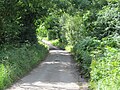
 Minor road near Ilton - geograph.org.uk - 3844023.jpg 4,320 × 3,240; 2.11 MB
-
 Minor road to Nutwith Lane - geograph.org.uk - 5195527.jpg 1,918 × 1,441; 1.19 MB
-
 Mossmire, Ilton - geograph.org.uk - 5880835.jpg 4,320 × 3,240; 1.75 MB
-
 Narcissi, sheep and Shaw's Farm - geograph.org.uk - 1222179.jpg 640 × 480; 121 KB
-
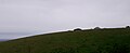
 Nutwith Common - geograph.org.uk - 1160533.jpg 640 × 428; 113 KB
-

-
 Pastures at Warthermarske - geograph.org.uk - 5880836.jpg 4,162 × 2,772; 2.09 MB
-
 Pines on Oak Bank - geograph.org.uk - 2857841.jpg 2,448 × 3,264; 3.17 MB
-
-
 Ponies and barn - geograph.org.uk - 1221859.jpg 640 × 480; 88 KB
-
 Post, Warrener Wood - geograph.org.uk - 2544030.jpg 640 × 480; 74 KB
-
 Quarry Gill Bridge - geograph.org.uk - 4152674.jpg 2,560 × 1,920; 2.79 MB
-
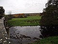
 River Burn, Swinton - geograph.org.uk - 2544013.jpg 640 × 482; 85 KB
-
 Road across the moor at Ilton - geograph.org.uk - 5880829.jpg 3,047 × 3,967; 4.25 MB
-
 Road in Low Swinton - geograph.org.uk - 3117809.jpg 4,320 × 3,240; 6.02 MB
-
 Road junction near Ilton - geograph.org.uk - 2544025.jpg 640 × 480; 74 KB
-
 Road Junction near to Swinton Park - geograph.org.uk - 312215.jpg 640 × 480; 121 KB
-
 Road near Park House at Wathermarske - geograph.org.uk - 5483114.jpg 4,000 × 3,000; 3.67 MB
-
 Road to Roomer - geograph.org.uk - 2377301.jpg 640 × 480; 83 KB
-
 Roomer - geograph.org.uk - 2377316.jpg 640 × 480; 94 KB
-
 Roomer Common - geograph.org.uk - 1734697.jpg 3,264 × 2,448; 1.92 MB
-
 Roomer Common and Farm - geograph.org.uk - 1734710.jpg 2,176 × 1,632; 805 KB
-
 Roomer Lane - geograph.org.uk - 2377402.jpg 480 × 640; 155 KB
-
 Roomer Lane at Den Beck Bridge - geograph.org.uk - 5483103.jpg 4,000 × 3,000; 4.23 MB
-
 Rough grassland near Ilton - geograph.org.uk - 2544049.jpg 640 × 480; 65 KB
-
 Sheep pasture at Ilton - geograph.org.uk - 5923060.jpg 4,320 × 3,240; 2.46 MB
-
 St Mary's Church Sundial, Masham - geograph.org.uk - 4584546.jpg 3,089 × 3,739; 2.12 MB
-
 Swinton Bridge - geograph.org.uk - 2540945.jpg 640 × 480; 73 KB
-
 Swinton Bridge, Masham - geograph.org.uk - 3373952.jpg 3,958 × 2,651; 5.2 MB
-
 Swinton Park - geograph.org.uk - 5880380.jpg 4,320 × 3,240; 3.84 MB
-
 Thank God for a Sat-Nav turn left for Grewelthorpe - geograph.org.uk - 5195526.jpg 2,304 × 1,728; 1.37 MB
-
 The entrance to Highfield House - geograph.org.uk - 3102953.jpg 800 × 600; 144 KB
-
 Top Lake - geograph.org.uk - 807016.jpg 640 × 427; 50 KB
-
 Track at Nutwith Cote - geograph.org.uk - 6164752.jpg 4,128 × 2,006; 3.5 MB
-
 Track to Nook House - geograph.org.uk - 1994059.jpg 2,448 × 3,264; 1.61 MB
-
 Unmade lane at Bramley Grange - geograph.org.uk - 638708.jpg 480 × 640; 101 KB
-
 Well at Gill Head Farm - geograph.org.uk - 1222108.jpg 640 × 480; 89 KB
-
 Windblown pines - geograph.org.uk - 1994076.jpg 2,178 × 2,589; 932 KB
-
 Woodland path, Nutwith Common - geograph.org.uk - 2933724.jpg 2,448 × 3,264; 3.42 MB
-
 Woodland track, Nutwith Common - geograph.org.uk - 2857809.jpg 3,264 × 2,448; 3.62 MB
-
 Yellow Fungus - geograph.org.uk - 811144.jpg 640 × 427; 83 KB


