Category:Tacherting
Vai alla navigazione
Vai alla ricerca
comune tedesco    | |||||
| Carica un file multimediale | |||||
| Istanza di |
| ||||
|---|---|---|---|---|---|
| Parte di |
| ||||
| Luogo | circondario di Traunstein, Alta Baviera, Baviera, Germania | ||||
| Capo del governo |
| ||||
| Popolazione |
| ||||
| Superficie |
| ||||
| Altezza sul mare |
| ||||
| Considerato essere uguale a | Tacherting | ||||
| sito web ufficiale | |||||
 | |||||
Sottocategorie
Questa categoria contiene le 4 sottocategorie indicate di seguito, su un totale di 4.
- Geography of Tacherting (17 F)
File nella categoria "Tacherting"
Questa categoria contiene 17 file, indicati di seguito, su un totale di 17.
-
 BahnhofTacherting.jpg 2 816 × 2 112; 1 002 KB
-
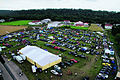 BMWTreffen.jpg 452 × 301; 62 KB
-
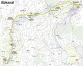 Karte Alzkanal.png 2 004 × 1 601; 1,32 MB
-
 Luftbild Tacherting Pfarrkirche.jpg 2 304 × 1 728; 2,23 MB
-
 ND Lindenallee südöstlich von Neudeck Amtsblatt.jpg 829 × 1 165; 272 KB
-
 Nigthsky (215351957).jpeg 2 048 × 1 365; 792 KB
-
 Tacherting, HP Schalchen v S, 1.jpeg 3 264 × 2 000; 2,43 MB
-
 Tacherting, Linde AG Schalchen, Gleisanschluss, 1.jpeg 3 104 × 2 348; 2,56 MB
-
 TACHERTING ALTENHAM nieder.png 480 × 360; 5 KB
-
 TACHERTING ALTENHAM nieder.svg 512 × 427; 21 KB
-
 Tacherting in TS.svg 652 × 820; 1,35 MB
-
 TACHERTING SPREIT nieder.png 480 × 360; 5 KB
-
 TACHERTING SPREIT nieder.svg 512 × 427; 21 KB
-
 Tacherting Wappen.svg 500 × 482; 20 KB
-
 TachertingOrtsmitte.jpg 2 816 × 2 112; 947 KB
-
 TachertingZentrum.jpg 640 × 480; 236 KB
-
 Wappen Tacherting.png 640 × 625; 165 KB


.jpeg)


