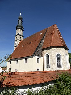
Category:Kirchanschöring
Jump to navigation
Jump to search
municipality of Germany | |||||
| Upload media | |||||
| Instance of |
| ||||
|---|---|---|---|---|---|
| Part of |
| ||||
| Location | Traunstein, Upper Bavaria, Bavaria, Germany | ||||
| Head of government |
| ||||
| Population |
| ||||
| Area |
| ||||
| Elevation above sea level |
| ||||
| official website | |||||
 | |||||
Subcategories
This category has the following 3 subcategories, out of 3 total.
Media in category "Kirchanschöring"
The following 22 files are in this category, out of 22 total.
-
Blick Richtung Wolkersdorf - geo.hlipp.de - 13026.jpg 640 × 480; 112 KB
-
DEU Kirchanschöring COA.svg 512 × 559; 17 KB
-
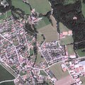
DOP40 - Landkreis Traunstein 32786 5317 (Bayerische Vermessungsverwaltung).tif 2,500 × 2,500; 17.19 MB
-
DOP40 - Landkreis Traunstein 32786 5318 (Bayerische Vermessungsverwaltung).tif 2,500 × 2,500; 17.96 MB
-
Feldkreuz bei Pirach - geo.hlipp.de - 9960.jpg 640 × 480; 109 KB
-
Feldkreuz bei Wolkersdorf - geo.hlipp.de - 13025.jpg 640 × 480; 127 KB
-
Kanal zum Kraftwerk Lebenau - geo.hlipp.de - 12445.jpg 480 × 640; 97 KB
-
Kirchanschöring - Ort - Götzinger Achen - 2022 09 02-1.jpg 6,960 × 4,640; 7.35 MB
-
Kirchanschöring - Ort - Götzinger Achen - 2022 09 02-2.jpg 6,960 × 4,640; 7.25 MB
-
Kirchanschöring 02.JPG 1,728 × 2,304; 2.4 MB
-
Kirchanschöring in TS.svg 652 × 820; 1.35 MB
-
Kirchanschöring und die Alpen im Sommer.JPG 1,600 × 1,200; 1,016 KB
-
Kirchanschöring, Bayern.jpg 2,560 × 1,920; 1.03 MB
-
Landschaft bei Eschelbach - geo.hlipp.de - 12443.jpg 640 × 480; 47 KB
-
ND Bachaue, Röhricht und Quellfluren süd-südwestlich von Herrnöd Amtsblatt.jpg 809 × 1,129; 410 KB
-
Totenbretter - geo.hlipp.de - 12444.jpg 640 × 480; 80 KB
-
Vom Reschberg Richtung Untersberg - geo.hlipp.de - 9961.jpg 640 × 480; 64 KB
-
Von Hausen nach Kothaich - geo.hlipp.de - 12279.jpg 640 × 480; 115 KB
-
Von Kothaich nach Ribing - geo.hlipp.de - 12288.jpg 640 × 480; 114 KB
-
Von Kronwitt Richtung Rehwinkl - geo.hlipp.de - 12284.jpg 640 × 480; 114 KB
-
Wald bei Redl (Richtung Kulbing) - geo.hlipp.de - 12466.jpg 640 × 480; 120 KB
-
Wappen kirchanschöring.jpg 100 × 107; 6 KB


