Category:Thames Ditton
Aller à la navigation
Aller à la recherche
Deutsch: Thames Ditton ist eine Ortschaft im Norden der Grafschaft Surrey, England, die unmittelbar an Groß-London und die Themse angrenzt. Verwaltungstechnisch gehört sie zum Borough Elmbridge und bildet dessen nordöstlichen Abschluss.
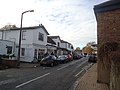
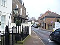
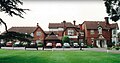
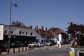
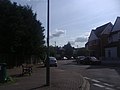
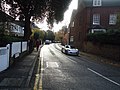
English: Thames Ditton is a village in Surrey, England, bordering Greater London. It is situated 12.2 miles (19.6 km) south-west of Charing Cross between the towns of Kingston upon Thames, Surbiton, Esher and East Molesey. Despite being on the fringe of Greater London's suburbs, Thames Ditton retains the character of a village. It became part of the former Esher Urban District in 1933.
village britannique  | |||||
| Téléverser des médias | |||||
| Nature de l’élément | |||||
|---|---|---|---|---|---|
| Lieu | Elmbridge, Surrey, Angleterre du Sud-Est, Angleterre | ||||
| Baigné par | |||||
| Superficie |
| ||||
| Altitude |
| ||||
| site officiel | |||||
 | |||||
Sous-catégories
Cette catégorie comprend 14 sous-catégories, dont les 14 ci-dessous.
H
N
P
R
S
- Edward Burtenshaw Sugden (2 F)
T
- Thames Ditton Island (17 F)
- Thames Ditton railway station (29 F)
W
°
Média dans la catégorie « Thames Ditton »
Cette catégorie comprend 96 fichiers, dont les 96 ci-dessous.
-
 A riverside garden, Thames Ditton. - panoramio.jpg 2 854 × 1 802 ; 2,01 Mio
-
 A309, Hampton Court Way - geograph.org.uk - 1169917.jpg 640 × 480 ; 72 kio
-
 Aerial view of Thames Ditton.JPG 2 048 × 1 536 ; 632 kio
-
 Alexandra Road, Thames Ditton - geograph.org.uk - 2158221.jpg 4 320 × 3 240 ; 4,52 Mio
-
 Almshouses at Thames Ditton (geograph 3862742).jpg 4 000 × 3 000 ; 4,21 Mio
-
 Basing Way, Thames Ditton - geograph.org.uk - 1924607.jpg 640 × 480 ; 111 kio
-
 Basingfield Road, Thames Ditton - geograph.org.uk - 2158188.jpg 4 320 × 3 240 ; 4,67 Mio
-
 Cesar Picton's house, Thames Ditton.JPG 1 848 × 1 379 ; 456 kio
-
 Church Walk, Thames Ditton - geograph.org.uk - 3856303.jpg 4 000 × 3 000 ; 3,96 Mio
-
 Church Walk, Thames Ditton - geograph.org.uk - 3862759.jpg 4 000 × 3 000 ; 4,36 Mio
-
 Clematis Cottage seen from St Nicholas Churchyard, Thames Ditton - geograph.org.uk - 3862784.jpg 4 000 × 3 000 ; 3,95 Mio
-

-
 Daffodils on Giggs Hill Green (geograph 3893386).jpg 4 000 × 3 000 ; 4,17 Mio
-
 Denleigh Gardens - geograph.org.uk - 3354737.jpg 1 600 × 1 067 ; 1,38 Mio
-
 Derelict house in Thames Ditton - geograph.org.uk - 3862952.jpg 4 000 × 3 000 ; 3,93 Mio
-
 Dittons Library, Mercer Close, Thames Ditton (June 2015).JPG 4 000 × 2 000 ; 1,86 Mio
-
 Drinking Fountain and Roundabout at High Street, Thames Ditton (June 2015).JPG 3 600 × 2 200 ; 1,59 Mio
-
 Ewell Road, Thames Ditton - geograph.org.uk - 3609205.jpg 1 600 × 1 200 ; 581 kio
-
 Ferry Road, Thames Ditton - geograph.org.uk - 4203966.jpg 2 560 × 1 920 ; 2,01 Mio
-
 Footbridge from 'mainland' Thames Ditton to residential Tagg's Island. - panoramio.jpg 4 416 × 3 312 ; 3,78 Mio
-
 Giggs Hill Green - geograph.org.uk - 2724379.jpg 2 560 × 1 920 ; 1,71 Mio
-
 Hampton Court from Ditton Field.jpg 4 000 × 2 668 ; 3,36 Mio
-
 High Street - geograph.org.uk - 4624964.jpg 1 024 × 768 ; 171 kio
-
 High Street - Thames Ditton - geograph.org.uk - 630523.jpg 640 × 480 ; 84 kio
-
 High Street, Thames Ditton - geograph.org.uk - 2158080.jpg 4 320 × 3 240 ; 3,87 Mio
-
 High Street, Thames Ditton - geograph.org.uk - 2158210.jpg 4 320 × 3 240 ; 3,91 Mio
-
 High Street, Thames Ditton - geograph.org.uk - 2227957.jpg 1 600 × 1 200 ; 532 kio
-
 High Street, Thames Ditton - geograph.org.uk - 2724991.jpg 2 560 × 1 920 ; 1,9 Mio
-
 High Street, Thames Ditton - geograph.org.uk - 2725122.jpg 2 560 × 1 920 ; 1,91 Mio
-
 High Street, Thames Ditton - geograph.org.uk - 2757753.jpg 1 600 × 1 200 ; 545 kio
-
 Horse Paddocks - geograph.org.uk - 304730.jpg 640 × 480 ; 88 kio
-
 Houses and pubs on the green, Thames Ditton - geograph.org.uk - 3233245.jpg 1 600 × 1 148 ; 316 kio
-
 Investa, Thames Ditton 01.png 986 × 678 ; 1,14 Mio
-
 Investa, Thames Ditton 02.png 979 × 711 ; 1,26 Mio
-
 King William III Apartments and Gardens at Hampton Court Palace - panoramio.jpg 2 000 × 1 479 ; 1,96 Mio
-
 Kingston Grammar School Boathouse.jpg 4 032 × 3 024 ; 4,86 Mio
-
 Level Crossing near Hampton Court - geograph.org.uk - 1924684.jpg 640 × 480 ; 93 kio
-
 Level Crossing near Hampton Court - geograph.org.uk - 1924693.jpg 640 × 480 ; 123 kio
-
 Living by the River Thames - geograph.org.uk - 620421.jpg 640 × 480 ; 79 kio
-
 Mansion, Thames Ditton - geograph.org.uk - 2725014.jpg 2 560 × 1 920 ; 1,8 Mio
-
 Marina in Seething Wells.jpg 4 032 × 3 024 ; 4,23 Mio
-
 Marina ^ boatyard, Thames at Surbiton. - panoramio.jpg 4 389 × 3 275 ; 4,82 Mio
-
 Mini-roundabout, Thames Ditton - geograph.org.uk - 1338212.jpg 640 × 518 ; 87 kio
-
 Old Cottages, Thames Ditton - geograph.org.uk - 2725020.jpg 2 560 × 1 920 ; 1,79 Mio
-
 Picton House, 56 High Street, Thames Ditton (NHLE Code 1190732) (June 2015).JPG 3 400 × 3 200 ; 2,11 Mio
-
 Portsmouth Road - geograph.org.uk - 1078682.jpg 640 × 480 ; 75 kio
-
 Portsmouth Road - geograph.org.uk - 2725131.jpg 2 560 × 1 920 ; 1,81 Mio
-
 Portsmouth Road in Thames Ditton - geograph.org.uk - 4639175.jpg 800 × 471 ; 101 kio
-
 Portsmouth Road, Weston Green - geograph.org.uk - 3222906.jpg 1 600 × 1 200 ; 601 kio
-
 Professor-Peter-Saville-Management-Centre.jpg 1 000 × 524 ; 321 kio
-
 Railway bridge over A307 near Weston Green - geograph.org.uk - 3678469.jpg 4 320 × 3 240 ; 2,79 Mio
-
 Railway bridge over Portsmouth Road - geograph.org.uk - 3222922.jpg 1 600 × 1 200 ; 749 kio
-
 Riversdale Road, Thames Ditton - geograph.org.uk - 2158014.jpg 4 320 × 3 240 ; 4,13 Mio
-
 Station Road, Thames Ditton - geograph.org.uk - 2158097.jpg 4 320 × 3 240 ; 4,48 Mio
-
 Station Road, Thames Ditton - geograph.org.uk - 2158180.jpg 4 320 × 3 240 ; 4,56 Mio
-
 Station Road, Thames Ditton - geograph.org.uk - 2158206.jpg 4 320 × 3 240 ; 4,06 Mio
-
 Suburban country lane - Thames Ditton - geograph.org.uk - 630522.jpg 640 × 494 ; 113 kio
-
 Summer Road, Thames Ditton - geograph.org.uk - 2158213.jpg 4 320 × 3 240 ; 4,01 Mio
-
 Surbiton boatyard ^ marina. - panoramio.jpg 4 416 × 2 956 ; 3,99 Mio
-
 TD 05-09-170242.JPG 3 008 × 2 000 ; 1,51 Mio
-
 TDLTCparty.JPG 400 × 266 ; 34 kio
-
 Thames Ditton - geograph.org.uk - 5774103.jpg 3 720 × 2 480 ; 7,69 Mio
-
 Thames Ditton - geograph.org.uk - 5774104.jpg 3 120 × 2 080 ; 7,75 Mio
-
 Thames Ditton - geograph.org.uk - 5774315.jpg 4 080 × 2 720 ; 7,59 Mio
-
 Thames Ditton - geograph.org.uk - 5774813.jpg 4 200 × 2 800 ; 7,68 Mio
-
 Thames Ditton - geograph.org.uk - 5774976.jpg 3 420 × 2 280 ; 7,67 Mio
-
 Thames Ditton - geograph.org.uk - 5836142.jpg 3 498 × 2 333 ; 7,59 Mio
-
 Thames Ditton - geograph.org.uk - 5836672.jpg 3 578 × 2 386 ; 7,69 Mio
-

-
 Thames Ditton Cricket Club - geograph.org.uk - 2724973.jpg 2 560 × 1 920 ; 1,83 Mio
-
 Thames Ditton from the air - geograph.org.uk - 5077182.jpg 640 × 480 ; 167 kio
-
 Thames Ditton High Street - geograph.org.uk - 1924621.jpg 640 × 480 ; 74 kio
-
 Thames Ditton High Street - geograph.org.uk - 2725007.jpg 2 560 × 1 920 ; 1,91 Mio
-
 Thames Ditton High Street - geograph.org.uk - 2757702.jpg 1 600 × 1 200 ; 610 kio
-
 Thames Ditton post office - geograph.org.uk - 2158084.jpg 4 320 × 3 240 ; 3,52 Mio
-
 Thames Ditton Railway Bridge, United Kingdom.jpg 2 048 × 1 360 ; 603 kio
-
 Thames Ditton Railway bridges - geograph.org.uk - 33248.jpg 640 × 480 ; 109 kio
-
 Thames Ditton sundown.jpg 4 608 × 3 456 ; 6,11 Mio
-
 Thames Ditton, fountain on roundabout.jpg 3 000 × 1 995 ; 1,75 Mio
-
 The BL King’s Topographical Collection- "THAMES DITTON the Seat of S.R THOMAS HEATHCOTE Bar.t. ".jpg 4 000 × 3 137 ; 2,27 Mio
-
 The Lodge, Thames Ditton 01.png 885 × 723 ; 990 kio
-
 The Lodge, Thames Ditton 02.png 636 × 683 ; 641 kio
-

-
 The river at Thames Ditton 2.JPG 2 048 × 1 536 ; 744 kio
-
 The river at Thames Ditton.JPG 2 048 × 1 536 ; 642 kio
-
 The Roundabout - Thames Ditton - geograph.org.uk - 630521.jpg 640 × 480 ; 56 kio
-
 Thistledene, Thames Ditton - geograph.org.uk - 2236198.jpg 1 600 × 1 200 ; 541 kio
-
 Thorkhill Road, Thames Ditton - geograph.org.uk - 3609201.jpg 1 600 × 1 200 ; 570 kio
-
 Tree in Thames Ditton High Street - geograph.org.uk - 1924634.jpg 640 × 480 ; 93 kio
-
 Vaughan Road, Thames Ditton - geograph.org.uk - 5432957.jpg 2 304 × 1 728 ; 882 kio
-
 Vera Fletcher Hall, 4 Embercourt Road, Thames Ditton (July 2015).JPG 3 200 × 2 600 ; 1,86 Mio
-
 Village centre, Thames Ditton - geograph.org.uk - 2227956.jpg 1 600 × 1 200 ; 644 kio
-
 Village centre, Thames Ditton - geograph.org.uk - 2227959.jpg 1 600 × 1 200 ; 672 kio
-
 Watts Road, Thames Ditton - geograph.org.uk - 2158142.jpg 4 320 × 3 240 ; 4,68 Mio
-
 Weston Green Road, Thames Ditton - geograph.org.uk - 2275931.jpg 1 600 × 1 200 ; 624 kio
-
 Metropolitan Police FC - geograph.org.uk - 591737.jpg 640 × 480 ; 60 kio


.jpg)


.jpg)


.JPG)
.JPG)


_(June_2015).JPG)


,_Home_of_Compassion,_58,_High_Street,_Thames_Ditton_(NHLE_Code_1190713)_(June_2015).JPG)


.JPG)


