Category:Thamesmead
Vai alla navigazione
Vai alla ricerca
area in London, England, UK  | |||||
| Carica un file multimediale | |||||
| Istanza di | |||||
|---|---|---|---|---|---|
| Luogo | |||||
| Situato sul mare / lago / fiume | |||||
 | |||||
English: Category for files related to the suburb of Thamesmead, which forms part of both the London Borough of Bexley and the Royal Borough of Greenwich.
Sottocategorie
Questa categoria contiene le 5 sottocategorie indicate di seguito, su un totale di 5.
B
- Belmarsh Prison (18 F)
R
- Royal Arsenal Canal (6 F)
T
- Thamesmead South (23 F)
W
- Woolwich Crown Court (1 F)
File nella categoria "Thamesmead"
Questa categoria contiene 73 file, indicati di seguito, su un totale di 73.
-
 2015 London-Abbey Wood, Thamesmead South 01.jpg 2 400 × 1 596; 1,36 MB
-
 2015 London-Abbey Wood, Thamesmead South 02.jpg 1 287 × 1 176; 579 KB
-
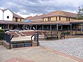
 2015 London-Thamesmead Moorings, shopping centre 1.jpg 2 400 × 976; 735 KB
-
 2015 London-Thamesmead Moorings, shopping centre 2.jpg 2 400 × 1 568; 1,05 MB
-
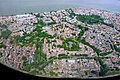
 2015 London-Thamesmead, aerial view 1.jpg 2 400 × 1 800; 1,52 MB
-
 2015 London-Thamesmead, aerial view 2.jpg 2 400 × 1 628; 1,43 MB
-
 2015 London-Thamesmead, aerial view 3.jpg 2 400 × 1 594; 1,49 MB
-
 2015 London-Thamesmead, aerial view 4.jpg 2 400 × 1 637; 1,55 MB
-
 2015 London-Thamesmead, aerial view 5.jpg 2 400 × 1 549; 1,38 MB
-
 2015 London-Thamesmead, aerial view 7.jpg 2 400 × 1 800; 1,41 MB
-
 2017 Thamesmead aerial view 01.jpg 3 563 × 2 754; 2,69 MB
-
 2017 Thamesmead aerial view 01a.jpg 2 632 × 1 772; 1,26 MB
-
 A Creekmouth Jetty - geograph.org.uk - 50921.jpg 640 × 482; 64 KB
-
 Butts Wood, London Borough of Greenwich, SE28 (2738903555).jpg 1 280 × 960; 345 KB
-
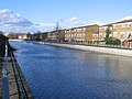
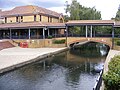
 Canal Thamesmead 27 July 2008.jpg 1 280 × 960; 318 KB
-
 Cannons in Thamesmead.jpg 1 280 × 960; 376 KB
-
 Did you remember the £ for the trolley^ - geograph.org.uk - 5181273.jpg 4 608 × 3 456; 3,53 MB
-
 Eastern Way, Thamesmead.jpg 1 600 × 1 200; 458 KB
-
 Erith Marshes, Southmere Park - geograph.org.uk - 3608709.jpg 640 × 480; 75 KB
-
 Footbridge across Eastern Way, Thamesmead.jpg 960 × 1 280; 348 KB
-
 Gallions Reach WW2 defences - geograph.org.uk - 912467.jpg 640 × 480; 90 KB
-
 Gallions View - geograph.org.uk - 369824.jpg 640 × 480; 46 KB
-
 Graffiti, Southmere, Banksy^ - geograph.org.uk - 3608710.jpg 640 × 480; 92 KB
-
 London, Thamesmead & Abbey Wood, aerial view 01.jpg 3 110 × 2 125; 1,82 MB
-
 London, Thamesmead & Abbey Wood, aerial view 02.jpg 3 264 × 1 771; 1,62 MB
-
 London, Thamesmead, aerial view 01.jpg 3 261 × 2 132; 1,79 MB
-
 London, Thamesmead, aerial view 02.jpg 3 261 × 2 123; 1,5 MB
-
 London, Thamesmead, aerial view 03.jpg 3 262 × 2 118; 1,72 MB
-
 London, Thamesmead, aerial view 04.jpg 3 172 × 2 348; 2,07 MB
-
 Misfits set.jpg 2 626 × 1 989; 1 013 KB
-
 Pilkington Canal, Thamesmead - geograph.org.uk - 369840.jpg 640 × 480; 62 KB
-
 Radiance Signs, Nathan Way - geograph.org.uk - 1849019.jpg 640 × 480; 115 KB
-
 Red gate in Thamesmead.jpg 960 × 1 280; 357 KB
-
 South Mere - geograph.org.uk - 3608714.jpg 640 × 480; 58 KB
-
 South Mere - geograph.org.uk - 3608717.jpg 640 × 480; 53 KB
-
 South Mere - geograph.org.uk - 3608719.jpg 640 × 480; 72 KB
-

-

-

-
 St Paul's Ecumenical Centre, Thamesmead - geograph.org.uk - 2004516.jpg 1 000 × 518; 130 KB
-
 St Paul's Ecumenical Centre, Thamesmead - geograph.org.uk - 2004517.jpg 1 000 × 696; 173 KB
-

-

-
 Sustrans milepost, Tripcock Ness - geograph.org.uk - 753063.jpg 480 × 640; 67 KB
-
 Thames Walk at Thamesmead.jpg 1 280 × 960; 311 KB
-
 2015 London-Thamesmead, aerial view 6.jpg 2 400 × 1 580; 1,34 MB
-

-
 Thamesmead 27 July 2008.jpg 1 280 × 960; 340 KB
-
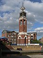
 Thamesmead Clocktower.jpg 1 200 × 1 600; 455 KB
-
 Thamesmead Ecopark, Tor Grove Block A - geograph.org.uk - 383071.jpg 640 × 480; 83 KB
-
 Thamesmead Oct 2016 (2).JPG 3 264 × 2 448; 2,28 MB
-
 Thamesmead Oct 2016 (3).JPG 3 264 × 2 448; 1,73 MB
-
 Thamesmead Oct 2016 (4).JPG 3 264 × 2 448; 1,49 MB
-
 Thamesmead Oct 2016 (5).JPG 3 264 × 2 448; 1,64 MB
-
 Thamesmead Oct 2016.JPG 3 264 × 2 448; 2,11 MB
-
 Thamesmead SE28 - 26177893669.jpg 3 072 × 2 304; 1,42 MB
-
 Thamesmead SE28 - 37953283511.jpg 3 072 × 2 304; 1,43 MB
-
 Thamesmead SE28 - 37953284721.jpg 3 072 × 2 304; 1,47 MB
-
 Thamesmead SE28.jpg 3 072 × 2 304; 1,46 MB
-
 Thamesmead, A2016 Eastern Way - geograph.org.uk - 329587.jpg 640 × 480; 78 KB
-
 Thamesmead, A2016 Eastern Way footbridge - geograph.org.uk - 329430.jpg 640 × 480; 123 KB
-
 Thamesmead, clock tower - geograph.org.uk - 865310.jpg 480 × 640; 62 KB
-
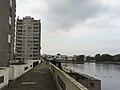
 Thamesmead, Gallions Canal - geograph.org.uk - 383484.jpg 640 × 480; 101 KB
-
 Thamesmead, Gallions Canal bridge - geograph.org.uk - 383701.jpg 640 × 480; 109 KB
-
 Thamesmead, The Harrow Canal - geograph.org.uk - 574883.jpg 640 × 480; 108 KB
-
 Thamesmead, view across the lake - geograph.org.uk - 865307.jpg 640 × 480; 57 KB
-
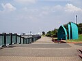
 Thamesmere - geograph.org.uk - 57599.jpg 640 × 482; 81 KB
-
 The fair comes to Thamesmead - geograph.org.uk - 936070.jpg 640 × 480; 68 KB
-
 The Pilkington Canal, drained (2) - geograph.org.uk - 1519903.jpg 640 × 480; 57 KB
-
 Warning to shipping - geograph.org.uk - 1454818.jpg 640 × 480; 110 KB
-
 West Thamesmead - panoramio.jpg 3 200 × 2 368; 1,29 MB
-
 When you have nine cygnets to feed - geograph.org.uk - 6188499.jpg 3 171 × 2 347; 1,26 MB
-
 Where is the shopping list^ - geograph.org.uk - 5181277.jpg 4 608 × 3 456; 3,55 MB


.jpg)


.JPG)
.JPG)
.JPG)
.JPG)


_-_geograph.org.uk_-_1519903.jpg)


