Category:London Borough of Bexley
Jump to navigation
Jump to search
Boroughs of London: City of London · City of Westminster · Barking and Dagenham · Barnet · Bexley · Brent · Bromley · Camden · Croydon · Ealing · Enfield · Greenwich · Hackney · Hammersmith and Fulham · Haringey · Harrow · Havering · Hillingdon · Hounslow · Islington · Kensington and Chelsea · Kingston · Lambeth · Lewisham · Merton · Newham · Redbridge · Richmond · Southwark · Sutton · Tower Hamlets · Waltham Forest · Wandsworth
borough in the London Region in England   | |||||
| Upload media | |||||
| Instance of | |||||
|---|---|---|---|---|---|
| Location | Greater London, London, England | ||||
| Legislative body |
| ||||
| Executive body |
| ||||
| Head of government |
| ||||
| Inception |
| ||||
| Population |
| ||||
| Area |
| ||||
| Different from | |||||
| official website | |||||
 | |||||
Subcategories
This category has the following 17 subcategories, out of 17 total.
A
E
F
G
H
P
S
T
V
Media in category "London Borough of Bexley"
The following 200 files are in this category, out of 1,964 total.
(previous page) (next page)-
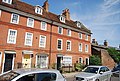
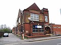
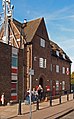
 "Bear and Ragged Staff" public house, Crayford - geograph.org.uk - 5730155.jpg 1,600 × 1,067; 508 KB
-
 "The Belvedere" public house, Belvedere, near Erith - geograph.org.uk - 4752182.jpg 1,488 × 1,175; 1.72 MB
-
 "The Millers Arms", Bexley - geograph.org.uk - 4723035.jpg 1,468 × 1,724; 712 KB
-
 'Orahope' at Erith Oil Works - geograph.org.uk - 4160291.jpg 640 × 480; 85 KB
-
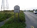 'Welcome to Kent' - geograph.org.uk - 2532843.jpg 4,000 × 3,000; 3.96 MB
-
 143 - 153 Sidcup Hill - geograph.org.uk - 2841629.jpg 640 × 428; 78 KB
-
 180 - 188, Rectory Lane - geograph.org.uk - 3713777.jpg 640 × 430; 107 KB
-
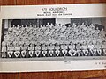 670 Glider Squadron.jpg 2,592 × 1,936; 1.88 MB
-
 A fiery sunset - geograph.org.uk - 5662654.jpg 4,000 × 3,000; 4.48 MB
-
 A footbridge over the A2 - geograph.org.uk - 2982626.jpg 800 × 600; 116 KB
-
 A frosty East Wickham Open Space - geograph.org.uk - 3300942.jpg 4,000 × 3,000; 3.93 MB
-
 A frosty morning at Howbury Manor - geograph.org.uk - 2330268.jpg 1,280 × 960; 613 KB
-
 A line of trees - geograph.org.uk - 3754529.jpg 640 × 430; 71 KB
-
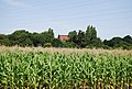 A maize crop - geograph.org.uk - 3732951.jpg 640 × 430; 104 KB
-
 A new Premier Inn - geograph.org.uk - 3901176.jpg 640 × 430; 66 KB
-
 A pylon and new flats - geograph.org.uk - 6256900.jpg 2,578 × 3,436; 1.53 MB
-
 A snowy night in the suburbs - geograph.org.uk - 6053501.jpg 4,000 × 3,000; 4.88 MB
-
 A snowy Station Approach, Welling - geograph.org.uk - 2247163.jpg 1,280 × 960; 655 KB
-
 A summer's morning at Crayford Marsh - geograph.org.uk - 1957240.jpg 1,280 × 960; 616 KB
-
 A way out of Foots Cray Meadows - geograph.org.uk - 2841692.jpg 640 × 480; 131 KB
-
 A2 - East Rochester Way - geograph.org.uk - 4829637.jpg 4,608 × 3,456; 3.48 MB
-
 A2 - East Rochester Way - geograph.org.uk - 4829672.jpg 4,608 × 3,456; 3.39 MB
-
 A2 - geograph.org.uk - 3749663.jpg 640 × 409; 68 KB
-
 A2 at Black Prince - geograph.org.uk - 3827664.jpg 640 × 430; 33 KB
-
 A2 at Falconwood - geograph.org.uk - 3887420.jpg 640 × 360; 52 KB
-
 A2 bridge - geograph.org.uk - 3749658.jpg 640 × 430; 131 KB
-
 A2 Bridge over the A221 - geograph.org.uk - 3827691.jpg 640 × 430; 54 KB
-
 A2 bridge over the railway line - geograph.org.uk - 3749652.jpg 640 × 430; 94 KB
-
 A2 crosses Westwood Lane - geograph.org.uk - 3886597.jpg 640 × 430; 48 KB
-
 A2 East Rochester Way, Falconwood - geograph.org.uk - 3631783.jpg 640 × 480; 256 KB
-
 A2 near Danson Interchange - geograph.org.uk - 3827671.jpg 640 × 430; 47 KB
-
 A2, Arbuthnot Lane Bridge - geograph.org.uk - 3827672.jpg 640 × 430; 39 KB
-
 A2, Danson Interchange - geograph.org.uk - 3827679.jpg 640 × 430; 39 KB
-
 A2, East Rochester Way - geograph.org.uk - 3631754.jpg 640 × 480; 226 KB
-
 A2, westbound - geograph.org.uk - 3827667.jpg 640 × 430; 49 KB
-
 A2, westbound - geograph.org.uk - 3827677.jpg 640 × 430; 53 KB
-
 A2, westbound - geograph.org.uk - 3881118.jpg 640 × 430; 54 KB
-
 A20 Near Frognal Corner - geograph.org.uk - 6027624.jpg 678 × 1,024; 88 KB
-
 A20 Sidcup Bypass - geograph.org.uk - 3634714.jpg 640 × 508; 290 KB
-
 A20, Sidcup Bypass - geograph.org.uk - 3634700.jpg 640 × 480; 294 KB
-
 A20, Sidcup bypass - geograph.org.uk - 3704742.jpg 640 × 430; 77 KB
-
 A207, A221 junction - geograph.org.uk - 3827702.jpg 640 × 430; 61 KB
-
 A209, Upper Wickham Lane - geograph.org.uk - 5290045.jpg 640 × 428; 124 KB
-
 A220 bridge over the A2 - geograph.org.uk - 3749693.jpg 640 × 430; 60 KB
-
 A221 to Bexleyheath - geograph.org.uk - 3827694.jpg 640 × 430; 51 KB
-
 A221, northbound - geograph.org.uk - 3827695.jpg 640 × 430; 75 KB
-
 A224 - A211 junction - geograph.org.uk - 3713767.jpg 640 × 430; 71 KB
-
 A224 - geograph.org.uk - 3713761.jpg 640 × 430; 75 KB
-

-
 Abbey Hill Millennium Wood, Sidcup - geograph.org.uk - 2026348.jpg 1,280 × 960; 591 KB
-
 Abbey Hill Park, Sidcup - geograph.org.uk - 2356299.jpg 1,280 × 960; 626 KB
-
 Abbey Ponds - geograph.org.uk - 2394360.jpg 1,280 × 960; 619 KB
-
 Abbey Ponds - geograph.org.uk - 2394366.jpg 1,280 × 960; 624 KB
-
 Abbey Ponds - geograph.org.uk - 3510087.jpg 4,000 × 3,000; 4.21 MB
-
 Abbey Ponds at Lesnes Abbey - geograph.org.uk - 3510091.jpg 4,000 × 3,000; 4.08 MB
-
 Abbey Road, Abbey Wood - geograph.org.uk - 4395321.jpg 2,272 × 1,704; 673 KB
-
 Abbey Wood Post Office - geograph.org.uk - 4752397.jpg 1,483 × 2,406; 726 KB
-
 Abbey Wood Post Office - geograph.org.uk - 4752414.jpg 2,395 × 1,510; 1.39 MB
-
 Abbey Wood, ancient and modern - geograph.org.uk - 4855382.jpg 640 × 480; 106 KB
-
 Access Lane beside the Manford Industrial Estate - geograph.org.uk - 5173972.jpg 1,600 × 1,067; 482 KB
-
 Access to the eastern end of the Ridgeway - geograph.org.uk - 4451803.jpg 1,024 × 768; 147 KB
-
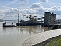 ADM Jetty, Erith II.jpg 4,032 × 3,024; 1.23 MB
-
 ADM Jetty, Erith.jpg 4,032 × 3,024; 959 KB
-
 ADM Ltd from Rainham - geograph.org.uk - 2496764.jpg 1,600 × 753; 128 KB
-
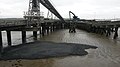 Aggregate jetties, Conway Wharf - geograph.org.uk - 4365416.jpg 640 × 360; 49 KB
-
 Aggregate works near Erith - geograph.org.uk - 2533168.jpg 1,024 × 768; 192 KB
-
 Albany Road bridge over River Shuttle - geograph.org.uk - 2560295.jpg 4,288 × 3,216; 6.67 MB
-
 Alberta Road, Northumberland Heath - geograph.org.uk - 3909551.jpg 3,488 × 2,616; 1.81 MB
-
 Albion Road-Townley Road Roundabout - geograph.org.uk - 2770546.jpg 4,288 × 3,216; 5.43 MB
-
 All Saints Church, Foots Cray - geograph.org.uk - 3713813.jpg 640 × 430; 133 KB
-
 All Saints Rectory - geograph.org.uk - 3840109.jpg 640 × 397; 97 KB
-
 Alley heading North off Manor Road, Erith - geograph.org.uk - 5173980.jpg 1,600 × 1,067; 402 KB
-
 Allotments - geograph.org.uk - 3845338.jpg 640 × 430; 117 KB
-
 Allotments, EWOS - geograph.org.uk - 3860100.jpg 640 × 430; 67 KB
-
 Allotments, Hudson Rd - geograph.org.uk - 3830498.jpg 640 × 430; 48 KB
-
 Allotments, Plumstead Common - geograph.org.uk - 3860128.jpg 640 × 430; 53 KB
-
 Along the bat walk at East Wickham Open Space after snow - geograph.org.uk - 2792278.jpg 4,000 × 3,000; 4.07 MB
-
 Along the Shuttle Riverway in springtime - geograph.org.uk - 3936622.jpg 4,000 × 3,000; 4.17 MB
-
 Along the Thames Path north of Erith - geograph.org.uk - 2387952.jpg 1,280 × 960; 632 KB
-
 Alongside the River Shuttle near the A2 - geograph.org.uk - 5205571.jpg 4,000 × 3,000; 4.79 MB
-
 Amberley Court, Foots Cray - geograph.org.uk - 4734002.jpg 2,272 × 1,704; 790 KB
-
 An entrance to Parish Wood Park - geograph.org.uk - 3872286.jpg 4,000 × 3,000; 3.96 MB
-
 An old infilled quarry - geograph.org.uk - 3766576.jpg 640 × 430; 75 KB
-
 An old sailing boat on the Thames - geograph.org.uk - 5984687.jpg 4,000 × 3,000; 4.58 MB
-
 An old sailing boat on the Thames - geograph.org.uk - 5984703.jpg 4,000 × 3,000; 4.76 MB
-
 Ancient fire exit - geograph.org.uk - 3485552.jpg 768 × 1,024; 388 KB
-
 Apartment block on Perry Street, near Dartford - geograph.org.uk - 6220599.jpg 1,024 × 768; 178 KB
-
 Apartments - geograph.org.uk - 3754591.jpg 640 × 430; 81 KB
-
 Approach to Howbury Farm - geograph.org.uk - 1955501.jpg 1,280 × 960; 611 KB
-
 Approaching Crossness on Belevedere Road - geograph.org.uk - 4451808.jpg 1,024 × 768; 109 KB
-

-
 Arco Dijk Cargo - geograph.org.uk - 5361589.jpg 640 × 424; 69 KB
-
 Army Cadet Force, Belvedere - geograph.org.uk - 2822955.jpg 4,288 × 3,216; 6.45 MB
-
 Art Deco houses on Danson Road - geograph.org.uk - 3444861.jpg 1,024 × 768; 265 KB
-
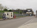
 Asda Recycling Site, Belvedere - geograph.org.uk - 2576949.jpg 3,072 × 2,304; 1.97 MB
-
 Asda Supermarket, Bexleyheath - geograph.org.uk - 2559303.jpg 4,288 × 3,216; 3.86 MB
-
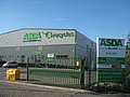
 ASDA, Belvedere - geograph.org.uk - 3777519.jpg 640 × 430; 48 KB
-
 Asda, Bexleyheath - geograph.org.uk - 3910470.jpg 640 × 416; 54 KB
-
 Asda, Crook Log - geograph.org.uk - 3910565.jpg 640 × 430; 45 KB
-
 Aspen Green, Thamesmead - geograph.org.uk - 2318600.jpg 1,280 × 960; 651 KB
-
 Aspen Veterinary Surgery - geograph.org.uk - 3845408.jpg 640 × 430; 55 KB
-
-
 Autumn at Foots Cray Meadows - geograph.org.uk - 5986961.jpg 4,000 × 3,000; 4.71 MB
-
 Autumn at Foots Cray Meadows - geograph.org.uk - 5987029.jpg 4,000 × 3,000; 4.95 MB
-
 Autumn fruits on East Wickham Open Space - geograph.org.uk - 3663538.jpg 4,000 × 3,000; 4.01 MB
-
 Autumn fruits on East Wickham Open Space - geograph.org.uk - 3663541.jpg 4,000 × 3,000; 4 MB
-
 Autumn on East Wickham Open Space - geograph.org.uk - 3756703.jpg 4,000 × 3,000; 4.24 MB
-
 Autumn on East Wickham Open Space - geograph.org.uk - 4222061.jpg 4,000 × 3,000; 4.14 MB
-
 Autumn on East Wickham Open Space - geograph.org.uk - 4222064.jpg 4,000 × 3,000; 4.28 MB
-
 Autumn on East Wickham Open Space - geograph.org.uk - 4712587.jpg 4,608 × 3,456; 3.3 MB
-
 Avenue of trees leading up to the site of Foots Cray Place - geograph.org.uk - 2456462.jpg 4,000 × 3,000; 3.91 MB
-
 Axminster Crescent, East Wickham - geograph.org.uk - 6212006.jpg 1,024 × 768; 173 KB
-
 Badger Holes In Foots Cray Meadows - geograph.org.uk - 2553574.jpg 4,288 × 3,216; 4.19 MB
-
 BAM Nuttal Yard, Dartford - geograph.org.uk - 3204444.jpg 4,288 × 3,216; 6.47 MB
-
-
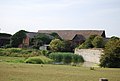 Barn, Howbury Farm - geograph.org.uk - 3772123.jpg 640 × 430; 63 KB
-
 Barnehurst Ambulance Station - geograph.org.uk - 2544330.jpg 3,072 × 2,304; 1.44 MB
-
 Barnehurst Fire Station - geograph.org.uk - 2544326.jpg 3,072 × 2,304; 1.24 MB
-
 Barnes Cray Rd - geograph.org.uk - 3760734.jpg 640 × 430; 66 KB
-
-
 Barnes Cray Road, Barnes Cray - geograph.org.uk - 4838082.jpg 3,264 × 2,448; 1.34 MB
-
 Barnes Cray Road, Barnes Cray - geograph.org.uk - 4838093.jpg 3,264 × 2,448; 1.85 MB
-
 Barrier in Parkside Road - geograph.org.uk - 4365482.jpg 640 × 360; 54 KB
-
 Barriers on the Thames Path at Crossness Sewage Works (2) - geograph.org.uk - 2571310.jpg 4,288 × 3,216; 5.13 MB
-
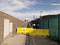 Barriers on the Thames Path at Crossness Sewage Works - geograph.org.uk - 2571277.jpg 4,288 × 3,216; 4.61 MB
-
 Barton Road, Foots Cray - geograph.org.uk - 4734112.jpg 2,272 × 1,704; 667 KB
-
 Basketball Court - geograph.org.uk - 2543230.jpg 3,072 × 2,304; 1.95 MB
-
 Batt Cables, Erith - geograph.org.uk - 2823185.jpg 4,288 × 3,216; 3.45 MB
-
 Baugh Rd - geograph.org.uk - 3713793.jpg 640 × 430; 100 KB
-
 Bayley Walk, Abbey Wood - geograph.org.uk - 3909063.jpg 3,488 × 2,616; 2.25 MB
-
 Bayway in Barnes Cray - geograph.org.uk - 5361404.jpg 640 × 424; 81 KB
-
 Beacon by Dartford Creek - geograph.org.uk - 4534830.jpg 4,000 × 2,404; 1.58 MB
-
 Bear and Ragged Staff - geograph.org.uk - 3754784.jpg 640 × 430; 80 KB
-
 Beech Walk, Barnes Cray - geograph.org.uk - 4838077.jpg 3,264 × 2,448; 2.2 MB
-
 Beechfield Road at the junction of Frinsted Road - geograph.org.uk - 4349490.jpg 2,560 × 1,920; 1.98 MB
-
 Behind the House on Pembroke Road, Erith - geograph.org.uk - 5174701.jpg 1,600 × 1,067; 356 KB
-
-
 Belmont Primary School - geograph.org.uk - 3836119.jpg 640 × 430; 94 KB
-
 Belvedere Incinerator seen across a lake on Erith Marshes - geograph.org.uk - 4438859.jpg 4,000 × 3,000; 4.29 MB
-
 Belvedere Incinerator seen from a dyke on Erith Marshes - geograph.org.uk - 4438878.jpg 4,000 × 3,000; 4.27 MB
-
 Belvedere Industrial Estate - geograph.org.uk - 3160368.jpg 640 × 480; 73 KB
-
 Belvedere Park - geograph.org.uk - 2576972.jpg 3,072 × 2,304; 1.78 MB
-
 Belvedere Police Station - geograph.org.uk - 3840094.jpg 640 × 430; 63 KB
-
 Belvedere Road, Thamesmead - geograph.org.uk - 4560291.jpg 2,272 × 1,704; 906 KB
-
 Belvedere Road, Thamesmead - geograph.org.uk - 4560295.jpg 2,272 × 1,704; 741 KB
-
 Belvedere Road, Thamesmead - geograph.org.uk - 4560296.jpg 2,272 × 1,704; 720 KB
-
 Belvedere Social Club - geograph.org.uk - 3836308.jpg 640 × 430; 53 KB
-
 Belvedere Working Men's Club - geograph.org.uk - 2689623.jpg 640 × 480; 69 KB
-
 Belvedere Working Men's Club - geograph.org.uk - 3909220.jpg 3,488 × 2,616; 2.01 MB
-
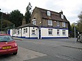 Belvedere, Ye Olde Leather Bottle - geograph.org.uk - 2689637.jpg 640 × 480; 66 KB
-
 Beside the River Cray - geograph.org.uk - 5172959.jpg 1,600 × 1,067; 742 KB
-
 Beult Road, Barnes Cray - geograph.org.uk - 4838073.jpg 3,264 × 2,448; 1.59 MB
-
 Beverley Road, Barnehurst - geograph.org.uk - 6214694.jpg 1,024 × 768; 142 KB
-
 Bexley Allotments - geograph.org.uk - 4426677.jpg 800 × 600; 220 KB
-
 Bexley College, Erith - geograph.org.uk - 4577342.jpg 1,600 × 1,029; 232 KB
-
 Bexley Cricket Club - geograph.org.uk - 3742253.jpg 640 × 430; 61 KB
-
 Bexley Leisure Centre - geograph.org.uk - 3910573.jpg 640 × 430; 60 KB
-
 Bexley Leisure Centre - geograph.org.uk - 3910575.jpg 640 × 430; 67 KB
-
 Bexley Leisure Centre - geograph.org.uk - 3910576.jpg 430 × 640; 53 KB
-

-
 Bexley Road, Northumberland Heath - geograph.org.uk - 3909502.jpg 3,488 × 2,616; 2.43 MB
-
 Bexley side of the Ridgeway - geograph.org.uk - 4451800.jpg 1,024 × 768; 208 KB
-
 Bexley Stop Smoking Service - geograph.org.uk - 2848756.jpg 640 × 480; 120 KB
-
 Bexleyheath Bus Garage - geograph.org.uk - 6213670.jpg 1,024 × 768; 154 KB
-
 Bexleyheath Royal Mail Delivery Office - geograph.org.uk - 4724114.jpg 1,984 × 3,200; 3.85 MB
-
 Bexleyheath Toby Carvery - geograph.org.uk - 2559273.jpg 4,288 × 3,216; 6.48 MB
-
 BHS, Bexley - geograph.org.uk - 3901189.jpg 640 × 430; 58 KB
-
 Bideford Road, East Wickham - geograph.org.uk - 6212008.jpg 1,024 × 768; 138 KB
-
 Binsey Walk, Thamesmead - geograph.org.uk - 4397032.jpg 2,272 × 1,704; 910 KB
-
 Binsey Walk, Thamesmead - geograph.org.uk - 4397037.jpg 2,272 × 1,704; 778 KB
-
 Birch Walk, Erith - geograph.org.uk - 2823196.jpg 4,288 × 3,216; 6.59 MB
-
 Bird College, Sidcup - geograph.org.uk - 2553831.jpg 4,288 × 3,216; 4.79 MB
-
 Birkbeck College, Sidcup - geograph.org.uk - 2553813.jpg 4,065 × 3,096; 4.57 MB
-
 Birling Road, Northumberland Heath - geograph.org.uk - 4349314.jpg 2,560 × 1,920; 1.96 MB
-
 Blossom at Lesnes Abbey - geograph.org.uk - 6078282.jpg 4,000 × 3,000; 4.66 MB
-
 Blossom at Lesnes Abbey - geograph.org.uk - 6078286.jpg 4,000 × 3,000; 4.89 MB
-
 Blossom in St Michael's Churchyard - geograph.org.uk - 4421139.jpg 4,000 × 3,000; 4.25 MB
-
 Blossom in St Michael's Churchyard - geograph.org.uk - 4421142.jpg 4,000 × 3,000; 4.07 MB
-
 Blossom in St Michael's Churchyard - geograph.org.uk - 4914309.jpg 4,608 × 3,456; 3.38 MB
-
 Blossom near Lesnes Abbey - geograph.org.uk - 4449369.jpg 4,000 × 3,000; 4.25 MB
-
 Blossoming bushes - geograph.org.uk - 5283908.jpg 640 × 480; 154 KB
-
 Bluebells in St John the Baptist Churchyard, Erith - geograph.org.uk - 4917749.jpg 4,608 × 3,456; 3.38 MB
-
 Bluebells on the edge of North Cray Wood - geograph.org.uk - 2435410.jpg 1,280 × 960; 653 KB
-
 Boardwalk in East Wickham Open Space - geograph.org.uk - 2546598.jpg 3,072 × 2,304; 3.36 MB
-
 Boat on the Pub Wall - geograph.org.uk - 4521633.jpg 3,312 × 2,436; 1.21 MB
-
 Boiler House roof - geograph.org.uk - 4451815.jpg 1,024 × 768; 83 KB
-
 Bollard by Dartford Creek - geograph.org.uk - 4521137.jpg 4,000 × 2,664; 1.32 MB
-
 Bootscraper, bench and bin - geograph.org.uk - 4416974.jpg 1,024 × 768; 781 KB
-
 Borough boundary on the Ridgeway - geograph.org.uk - 4451799.jpg 1,024 × 768; 108 KB
-
 Bostall Park Avenue, near Bexleyheath - geograph.org.uk - 6212920.jpg 1,024 × 768; 144 KB
-
 Bostall Park Avenue, near Bexleyheath - geograph.org.uk - 6212922.jpg 1,024 × 768; 114 KB
-
 Bostall Woods from East Wickham Open Space in autumn - geograph.org.uk - 3756799.jpg 4,000 × 3,000; 4.31 MB
-
 Bosworth House, Erith - geograph.org.uk - 3908693.jpg 3,488 × 2,616; 1.97 MB
-
 Boundary Stone beside the Thames - geograph.org.uk - 4522337.jpg 3,676 × 2,468; 1.52 MB
-
 Bourne Industrial Estate - geograph.org.uk - 3754598.jpg 640 × 430; 50 KB
-
 Bourne Road Bridge over the A2, Coldblow - geograph.org.uk - 3631682.jpg 640 × 480; 276 KB
-
 BP service station - geograph.org.uk - 5287141.jpg 640 × 428; 97 KB
-
 BP service station and Alsford Timber on Edgington Way - geograph.org.uk - 3284809.jpg 2,048 × 1,536; 1.48 MB
-
 Bramley Place, Barnes Cray - geograph.org.uk - 4838091.jpg 3,264 × 2,448; 1.42 MB
-
 Brampton Primary School - geograph.org.uk - 3830449.jpg 640 × 430; 82 KB


_-_geograph.org.uk_-_2571310.jpg)


